Bathwood Lane, Spurstow, CW6
- Land size
- 1.33 acres
- Bedrooms
- 4
- Bathrooms
- 3
Key Features
- Beautifully situated house in an acre, with two driveways
- Quiet and rural in feel yet just two miles from Bunbury
- Superb comprehensively refurbished house of 2519 square feet
- Outstanding family accommodation with terrific layout
- Four bedrooms, two en suites, family bathroom
- Fabulous open plan kitchen two reception rooms plus study
- Strong eco credentials with ground source heat pump and EC charging point
- Fully insulated floors and walls and well insulated roof
- Residence 9, double glazed windows 1.2W, m2K
- Outbuilding with studio, cloaks, kitchenette double garage and workshop
Description
Comment from Robert Reed of Gascoigne Halman
In the last eight years, this home has been radically transformed and substantially rebuilt. The end result is a first class eco friendly detached house of 2519 square feet, which boasts strong aesthetic appeal, an ideal modern day family layout, a superb plot of circa 1.33 acre and a highly versatile outbuilding of a little under 1000 square feet.
For such a rural house, the eco credentials are notable and impressive, with the house benefitting from a ground source heat pump, Residence 9 double glazed windows, fully insulated floors and walls, a very well insulated roof, ground floor underfloor heating and a modern private drainage system, compliant with the 2020 binding rules. The Renewable Heat Incentive will provide the future owner with circa three years of future income, predicted to be circa £6000 per annum.
Internally the house has been transformed and has been designed to optimise family living. The balance of the accommodation is excellent, with the large open plan kitchen family dining room being the focal point and heart of day to day living. There are two additional reception rooms, each with their own distinct style, character and purpose and both of which can be adapted to suit individual requirements. The living rooms has a HETAS certified 8kw output log burning stove. There is also a small study.
At first floor level there is a elegant principal suite with dressing room and en suite, thee further double bedrooms, one of which has an en suite and the other which is served by a high quality and visually appealing family bathroom.
It should also be noted that this a really tech enabled house with Cat6 wiring throughout, multiple integrated wifi points, some automated lights, and there high amp pre wiring in place for electric gates and a car charging point if either or both are required by a future owner.
Externally the highlight is the outbuilding which is 961 square feet and has a double garage, workshop, art studio, kitchenette and cloakroom. This building is so flexible and subject to planning consent could be converted to become an annexe for ancillary living.
The gardens wrap around the house and have maturity and colour and also provide space for young children playing or family eating together and entertaining outside. The paddock is ideal for those with a horse, pony, donkey or livestock and with two driveways, there is enough parking for even the largest family.
If you seek a fully developed detached country residence in a tranquil yet connected location, there are few if any better buying opportunities out there.
For a personal description of the property or to arrange a viewing, please contact myself or the Gascoigne Halman Tarporley office.
Accommodation and dimensions
As detailed on floorplan
Location
Spurstow is a very attractive semi rural village only fifteen minutes drive from Tarporley village, twenty minutes from the centre of Nantwich and just over five minute from Bunbury and its highly regarded Primary School. Bunbury is a delightful village with the convenience of a refurbished Co-op convenience store, three public houses and a beautiful historic Church which dates back over 1,000 years. There is also a cricket club and modern medical centre. Of particular note is Bunbury Primary School that enjoys an excellent reputation for academic excellence and is aided by the Worshipful Company of Haberdashers. Bunbury Primary School also feeds into Tarporley High School and also many children also go on to Bishop Heber in Malpas. There are a range of independent schools in Chester.
The nearby village of Tarporley provides a wider range of amenities and the whole area is well placed for the business traveller with many commercial centres including Manchester, Liverpool, Crewe, Warrington and Nantwich, all being found within comfortable commuting distance.
Railway Stations can be found at Crewe, Chester and Nantwich, with London readily accessible from Crewe. Manchester and Liverpool Airports are found within a maximum of an hours drive. For those with an interest in historical cities, Chester City centre can be reached in within approximately 30 minutes. For those with leisure pursuits there are many golf clubs in the area whilst the sandstone trail is ideal for those with a love of walking and the outdoors.
Directions
From our office in the centre of Tarporley take a left turn out of the village in the direction of Nantwich and proceed until reaching a junction with the A49. At this point turn left onto the A49 and upon reaching the crossroads with the Rosai Indian Restuarant on your right, take a right turn. Proceed through the village of Beeston and having passed The former Wild Boar Hotel on the left hand side (now a residential development site known as Beeston Park) continue straight on. Before reaching Panama Hatties on the right hand side take a left hand turn onto Long Lane. Proceed along Long Lane for approximately a quarter of a mile, follow the road round to the right having passed the Yew Tree Pub on the left hand side, continue along following the road around until eventually reaching a very sharp left hand bend which should be taken with appropriate caution. Proceed forward for a very short distance and take the right turn onto Cappers Lane. Proceed down Cappers Lane passing Broom Butts, proceed for a short distance taking a right turn into Dobb Lane. Proceed down Dobb Lane which turns into Bathwood Lane and the subject property will be found on the left hand side clearly marked by a Gascoigne Halman for sale board.
Tenure / Services / Viewing
TENURE We believe the property is freehold tenure, this will be confirmed as part of the legal process.
SERVICES We understand that mains electricity and water are connected. Ground source heat pump. Private drainage with system compliant with the 2020 binding rules, details to be confirmed in contract of sale.
VIEWING Viewing by appointment through the Agents Tarporley office.
WANT TO MOVE BUT NEED TO SELL?
If you are interested in this property but need to sell your own home in Cheshire, South Manchester or the Peak District, Gascoigne Halman can provide a free, no obligation market appraisal and valuation of your own home. We are proud to be the leading estate agent in the area, with a network of twenty three offices - full contact details can be located on our website. Robert Reed is the manager of the Tarporley office.
The Tarporley team consists of Robert, Pamela, Oliver, Sally, Tresa, Sam, Clive, Lydia and Yvonne - we pride ourselves on being not just professional and efficient but also warm and welcoming. If you are in the village and fancy a coffee, do come in and say hello. We are located at 62 High Street, Tarporley, six premises to the left of Tarporley Parish Church. Our building is a landmark in the village, having above the shop front a beautiful illuminated fully working heritage clock.
NOTICE
Gascoigne Halman for themselves and for the vendors or lessors of this property whose agents they are give notice that: (i) the particulars are set out as a general outline only for the guidance of intending purchasers or lessees, and do not constitute, nor constitute part of, an offer or contract; (ii) all descriptions, dimensions, references to condition and necessary permissions for use and occupation, and other details are given in good faith and are believed to be correct but any intending purchasers or tenants should not rely on them as statements or representations of fact but must satisfy themselves by inspection or otherwise as to the correctness of each of them; (iii) no person in the employment of Gascoigne Halman has any authority to make or give any representation or warranty whatever in relation to this property.
EPC Rating: D
Map Location
Property details
- Tenure
- Freehold
- Council Tax Band
- G
- Date Posted
- 2026-05-10
Market Value Analysis
Compared with 790 Homes with Land listings in North West England (1+ acres).
Energy Performance Certificate
Energy Efficiency Rating
Based on UK Energy Performance Certificate standards (EU Directive 2002/91/EC)
Running costs are one side. Planning activity, flood history and ground risks for this location are in the full report.
Utilities & Restrictions
Utilities
- Electricity
- Mains
- Water
- Mains
- Heating
- Ground Source Heat Pump, Wood Burner
- Broadband
- Full Fibre (FTTP)
- Sewerage
- Septic Tank / Private
Rights & Restrictions
- Public Rights of Way
- Ask Agent
- Private Rights of Way
- Ask Agent
- Listed Property
- Ask Agent
- Restrictions
- Ask Agent
Listed status, conservation areas and planning constraints for this location are in the full report.
Property Features
- Accessibility
- Ask Agent
- Parking
- Parking Available
- Garden
- Garden
Beyond the particulars: planning activity, flood history, heritage and ground risks, checked for this exact spot.
Connectivity
Broadband
Fastest speed available at this postcode
26 Mbps
Standard (10-30 Mbps)
Suitable for
- Web & social
- Music streaming
- Standard video calls
Mobile signal
Outdoor predictions; indoor signal depends on building materials.
Ofcom Connected Nations postcode-level predictions. Speeds and signal are modelled, not measured, and vary between addresses and providers.
Signal is the easy part. Planning activity, flood history and protected designations here are in the full report.
Nearest Schools
Primary
- Bunbury Aldersey CofE Primary School1.7 milesOfsted: Good
- Ages
- 2 to 11
- Pupils
- 200
- Type
- Academy converter
- Faith
- Church of England
- Calveley Primary Academy3.3 milesOfsted: Outstanding *
- Ages
- 2 to 11
- Pupils
- 118
- Type
- Academy converter
- Bickerton Holy Trinity CofE Primary School3.6 milesOfsted: Good
- Ages
- 4 to 11
- Pupils
- 101
- Type
- Voluntary controlled school
- Faith
- Church of England
- Acton Church of England Primary Academy4.2 milesOfsted: Good
- Ages
- 4 to 11
- Pupils
- 195
- Type
- Academy converter
- Faith
- Church of England
- Tarporley CofE Primary School4.5 milesNo Ofsted rating
- Ages
- 4 to 11
- Pupils
- 259
- Type
- Voluntary controlled school
- Faith
- Church of England
Secondary
- Tarporley High School and Sixth Form College4.2 milesOfsted: Good
- Ages
- 11 to 18
- Pupils
- 1,219
- Type
- Academy converter
- Malbank School and Sixth Form College4.9 milesOfsted: Good
- Ages
- 11 to 18
- Pupils
- 1,289
- Type
- Academy converter
- Brine Leas School6 milesNo Ofsted rating
- Ages
- 11 to 18
- Pupils
- 1,417
- Type
- Academy converter
- Bishop Heber High School6.5 milesOfsted: Good
- Ages
- 11 to 18
- Pupils
- 1,293
- Type
- Foundation school
- St Thomas More Catholic High School7.7 milesOfsted: Good *
- Ages
- 11 to 16
- Pupils
- 642
- Type
- Academy converter
- Faith
- Roman Catholic
* Latest graded judgement covers quality of education only; no overall grade was issued under the 2024-25 inspection framework.
Distances are straight-line from the advertised location. Source: the national school registers (DfE, Welsh Government, Scottish Government) and Ofsted.
Schools are just the start: sold prices nearby, planning activity and any flood history are in the full report.
Amenities
Supermarket
GP surgery
Pharmacy
Hospital
Straight-line distances from the advertised location. Sources: NHS records, Geolytix supermarket locations, OS Open Greenspace and the national trails registers.
The area stacks up? Now check the location itself: planning nearby, protected designations and past flooding.
Getting Around
Nearest station
Nearest bus stop
Typical drive times
Straight-line distances from the advertised location; drive times are typical free-flow times over OpenStreetMap road data, so allow more at peak. Public transport locations from DfT NaPTAN.
Easy to reach matters. So do planning activity, flood history and ground risks: all in the full report.
Flood Risk
From Environment Agency flood map open data, checked around the advertised map pin and allowing for the listed acreage where known. This summary comes from LandSale, the advertising platform, not from the listing agent, and is not part of the agent's particulars. Risk can vary across a single holding, so verify anything critical through your own searches before committing.
Rivers and the sea
Surface water
The detail behind these bandings
The full report pinpoints where this location sits on the flood maps, and runs the deeper checks that usually only surface after an offer.
- Exact flood zones & annual chances (included in the full report)
- Any recorded past flooding (included in the full report)
- Planning activity nearby (included in the full report)
- Heritage & conservation (included in the full report)
- Protected nature designations (included in the full report)
- Ground risks (included in the full report)
- Sold prices nearby (included in the full report)
£14.99 · one-off purchase
By LandSale, the platform. Not provided by the listing agent. Ready in about a minute.
Important notice: Information, maps and tags on this page are drawn from the advertising agent's marketing materials or generated automatically. LandSale has not verified them. Relying on these details is at your own risk, always carry out independent checks before committing to a purchase.
LandSale full disclaimer
Marketing information only - not formal particulars. The details on this website are provided for general guidance and do not constitute an offer or contract. Neither LandSale nor the advertising estate/land agent accepts responsibility for any inaccuracy.
1. Source of information
- Listing content: Core description, asking price, tenure, measurements, photographs and planning history originate from the marketing materials of the advertising estate or land agent. LandSale does not author this content and cannot guarantee its accuracy.
- Automated tags & categorisation: Property type, land-use class, acreage bands and similar labels may be applied by machine-learning models. They are intended as a helpful guide only and may not reflect the property's legal status or permitted use.
- Third-party & enriched data layers: Maps, boundary outlines, planning designations, soil reports, broadband coverage and other environmental or location-based insights are licensed from external suppliers. Such data are supplied “as is", may be incomplete or out of date and are subject to change without notice.
2. Verification required
Prospective purchasers must verify critical matters, including but not limited to planning permission, title boundaries, public rights of way, environmental constraints, acreage, services, access and VAT status, through their own inspections, specialist surveys, legal advisers and the selling agent before relying on the information or entering into any contract.
3. No warranty or liability
LandSale gives no warranty, express or implied, as to the accuracy, completeness or fitness for any particular purpose of the information displayed. LandSale shall not be liable for any loss, damage, cost or expense arising directly or indirectly from any use of or reliance on such information, save where liability may not be excluded by law.
4. Updates & feedback
If you believe any detail on this listing is inaccurate, please let us know. We will investigate and, where appropriate, update the listing or notify the agent.
© LandSale | Version 1.3 - August 2026
Listing agent
Gascoigne Halman, Tarporley
62 High Street, Tarporley, CW6 0AG
Similar properties for sale
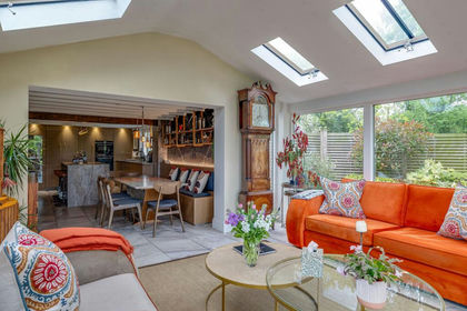
- Price
- £1,200,000
- Size
- 2.5 acres
Whitchurch Road, Spurstow, CW6, Spurstow, Cheshire East CW6 England
Added on 28/05/2026Country Home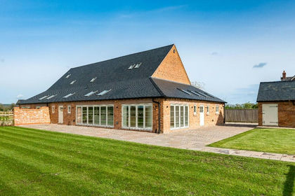
- Price
- Guide Price£1,195,000
Wrexham Road, CW6, Bulkeley and Ridley, Cheshire East CW6 England
Added on 25/04/2026Barn Conversion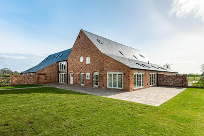
- Price
- Guide Price£1,140,000
Wrexham Road, CW6, Bulkeley and Ridley, Cheshire East CW6 England
Added on 25/04/2026Barn Conversion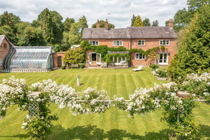
- Price
- Offers Over£1,250,000
- Size
- 9 acres
Windmill Cottage, Wrexham Road, Burland, Burland and Acton, Cheshire East CW5 England
Added on 29/01/2026House with Land
- Price
- Offers Over£1,250,000
- Size
- 9.1 acres
Wrexham Road, Burland, CW5, Burland and Acton, Cheshire East CW5 England
Added on 25/07/2026House with Land
- Price
- Offers in Region of£1,500,000
- Size
- 2.68 acres
Stoke Hall Lane, Poole, Nantwich, Stoke and Hurleston, Cheshire East CW5 England
Added on 29/01/2026Conversion Land
- Price
- £1,350,000
- Size
- 9.6 acres
Cholmondeley Road, Wrenbury, CW5, Wrenbury cum Frith, Cheshire East CW5 England
Added on 01/07/2026Country Home
- Price
- Guide Price£1,500,000
- Size
- 5.84 acres
Added on 15/08/2026House with Land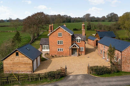
- Price
- Guide Price£1,500,000
- Size
- 6 acres
Common Farmhouse, Nr Cholmondeley, Marbury and District, Cheshire East SY13 England
Added on 15/04/2026Farmhouse
- Price
- Offers in Region of£1,275,000
Henhull, Nantwich, Cheshire, CW5, Nantwich, Cheshire East CW5 England
Added on 05/06/2026Barn Conversion