Cae Sion Mawr, Carmel - 5.3 ac
- Land size
- 5.3 acres
- Bedrooms
- 4
- Bathrooms
- 1
Key Features
- 5.3 Acres in Total
- Well-Appointed Farmhouse
- Panoramic Views
- Pleasant Location and Layout
Description
Tyddyn pum acer sy’n cynnwys t fferm traddodiadol gyda phedair ystafell wely ac ystod o adeiladau cerrig mewn lleoliad gwledig gyda golygfeydd panoramig o’r arfordir a’r cefn gwlad.
Five-acre smallholding featuring a traditional four-bedroom detached farmhouse and a range of stone outbuildings in a rural location with panoramic coastal and countryside views.
Smallholdings like this are rare: a well appointed detached property set away from the public highway within its own land, offering outstanding views.
Mae tyddynnod fel hyn yn brin, yn cynnig cartref taclus mewn cyflwr da, mewn lleoliad braf ar eu tir eu hunain gyda golygfeydd di-ben-draw.
Ty Fferm | Farmhouse
The farmhouse at Cae Sion Mawr was historically extended to the rear and comprises four bedrooms and an attic bedroom. Both the front room and the loft face the principal aspect, with views across the adjoining land toward the coastline.
The side entrance opens into a rear hallway that runs the width of the property. The kitchen occupies its own extension on the left; the utility and bathroom are at the end of the hall. Dining and reception rooms sit at the front, with the main reception room leading to the central hall and original front door, adjacent to the fourth bedroom. Upstairs are three bedrooms: two generous doubles and a smaller single opposite the landing.
Accommodation:
Entrance Hallway
Kitchen - 2.67m x 3.60m
Dining Room - 3.45m x 4.24m | Stairs to Crog Loft
Main Reception Room - 3.47m x 4.42m | Inglenook Fireplace
Central Hallway | Stairs to 1st Floor
Bedroom 4 - 2.27m x 4.42m
Utility Room - 1.89m x 2.17m
Bathroom - 2.91m x 3.01m | Bath, WC, Basin
Landing
Bedroom 1 - 2.99m x 4.29m
Bedroom 2 - 2.22m x 4.41m
Bedroom 3 - 1.92m x 2.18m
Attic Bedroom - 2.71m x 3.60m | Stairs from Dining Room
Buildings | Adeiladau
Next to the farmhouse is a detached range of outbuildings, divided into three individual rooms offering multipurpose space for storage or potential conversion.
Tir | Land
The land extends to permanent pasture and is divided and bounded by traditional stone walls. Vehicular access is via the driveway that runs behind the property from the public highway at Carmel.
Location and Directions
From the A487 in Groeslon, follow Gladstone Terrace towards Carmel and continue along the single-track public road for about 1 mile. On entering Carmel, bear right at the crossroads; after the detached property Tros Yr Enfys on the right, take the gateway on the right. Follow the track to the end — Cae Sion Mawr will be on the right.
Important Information
EPC: E | Council Tax Band: B
Construction: Traditional Construction Under Slate Roof.
Services: Oil Fired Central Heating, Mains Water and Private Drainage.
Method of Sale: Private Treaty
Planning: The property is sold subject to any existing or other statutory notice, or which may come into force in the future. Purchasers should make their own enquiries into any designations.
Easements, Wayleaves and Rights of Way: The land is sold subject to all the benefits of all wayleaves, easements, right of way and third-party rights, whether mentioned or not.
Viewing: By appointment only.
Tenure: Freehold with vacant possession on completion.
Boundaries: Any Purchaser shall be deemed to have full knowledge of all boundaries and neither the Vendor nor Vendors Agents are responsible for defining the boundaries or ownership thereof.
Basic Payment Scheme: No Basic Payment Scheme Entitlements are included with the sale of the property. These may be available by separate negotiation.
PROPERTY MISDESCRIPTIONS ACT 1991: The Agents has not tested any apparatus, equipment, fixtures and fittings, or services, so cannot verify that they are in working order or fit for the purpose. The buyer is advised to obtain verification from his or her Professional Buyer, References to the Tenure of the property are based on information supplied by the Vendor. The agents have not had sight of the title documents. The buyer is advised to obtain verification from their Solicitor. You are advised to check the availability of any property before travelling any distance to view. The plans and drawings provided are for illustrative purposes only. Any areas, measurements or distances are approximate. The text and plans are for guidance only and are not necessarily comprehensive. It should not be assumed that the property has all necessary planning, building regulation or other consents.
Map Location
Property details
- Tenure
- Freehold
- Council Tax Band
- B
- Date Posted
- 2026-04-28
Market Value Analysis
Compared with 443 Homes with Land listings in Wales (5+ acres).
Energy Performance Certificate
View the official EPC certificate for detailed energy efficiency information.
View official EPC certificate ↗
Running costs are one side. Planning activity, flood history and ground risks for this location are in the full report.
Utilities & Restrictions
Utilities
- Electricity
- Ask Agent
- Water
- Ask Agent
- Heating
- Ask Agent
- Broadband
- Ask Agent
- Sewerage
- Ask Agent
Rights & Restrictions
- Public Rights of Way
- Ask Agent
- Private Rights of Way
- Ask Agent
- Listed Property
- Ask Agent
- Restrictions
- Ask Agent
Listed status, conservation areas and planning constraints for this location are in the full report.
Property Features
- Accessibility
- Ask Agent
- Parking
- Parking Available
- Garden
- Ask Agent
Beyond the particulars: planning activity, flood history, heritage and ground risks, checked for this exact spot.
Connectivity
Broadband
Fastest speed available at this postcode
1.8 Gbps
Gigabit full fibre
Suitable for
- 4K streaming on every screen
- Full-time home working
- Online gaming & big downloads
Mobile signal
Outdoor predictions; indoor signal depends on building materials.
Ofcom Connected Nations postcode-level predictions. Speeds and signal are modelled, not measured, and vary between addresses and providers.
Signal is the easy part. Planning activity, flood history and protected designations here are in the full report.
Nearest Schools
Primary
- Ysgol Bro Llifon1 mile
- Pupils
- 150
- Type
- Nursery, Infants & Juniors
- Language
- Welsh medium school / provision (including transitional)
- Ysgol Gynradd Talysarn1.1 miles
- Pupils
- 96
- Type
- Nursery, Infants & Juniors
- Language
- Welsh medium school / provision (including transitional)
- Ysgol Bro Lleu1.5 miles
- Pupils
- 190
- Type
- Nursery, Infants & Juniors
- Language
- Welsh medium school / provision (including transitional)
- Ysgol Gynradd Rhosgadfan1.7 miles
- Pupils
- 39
- Type
- Nursery, Infants & Juniors
- Language
- Welsh medium school / provision (including transitional)
- Ysgol Baladeulyn1.9 miles
- Pupils
- 13
- Type
- Nursery, Infants & Juniors
- Language
- Welsh medium school / provision (including transitional)
Secondary
- Ysgol Dyffryn Nantlle1.6 miles
- Pupils
- 397
- Type
- Secondary (ages 11-19)
- Language
- Welsh medium school / provision (including transitional)
- Ysgol Syr Hugh Owen5.2 miles
- Pupils
- 873
- Type
- Secondary (ages 11-19)
- Language
- Welsh medium school / provision (including transitional)
- Ysgol Brynrefail6.1 miles
- Pupils
- 764
- Type
- Secondary (ages 11-19)
- Language
- Welsh medium school / provision (including transitional)
- Ysgol Eifionydd11 miles
- Pupils
- 373
- Type
- Secondary (ages 11-16)
- Language
- Welsh medium school / provision (including transitional)
- Ysgol Friars11 miles
- Pupils
- 1,383
- Type
- Secondary (ages 11-19)
- Language
- Dual language school / provision (Welsh and English) (including transitional)
Distances are straight-line from the advertised location. Source: the national school registers (DfE, Welsh Government, Scottish Government) and Ofsted.
Schools are just the start: sold prices nearby, planning activity and any flood history are in the full report.
Amenities
Supermarket
GP surgery
Pharmacy
Green space
Straight-line distances from the advertised location. Sources: NHS records, Geolytix supermarket locations, OS Open Greenspace and the national trails registers.
The area stacks up? Now check the location itself: planning nearby, protected designations and past flooding.
Getting Around
Nearest station
Nearest bus stop
Typical drive times
Straight-line distances from the advertised location; drive times are typical free-flow times over OpenStreetMap road data, so allow more at peak. Public transport locations from DfT NaPTAN.
Easy to reach matters. So do planning activity, flood history and ground risks: all in the full report.
Flood Risk
From Natural Resources Wales flood map open data, checked around the advertised map pin and allowing for the listed acreage where known. This summary comes from LandSale, the advertising platform, not from the listing agent, and is not part of the agent's particulars. Risk can vary across a single holding, so verify anything critical through your own searches before committing.
Rivers and the sea
Surface water
Mapped within the area searched, not at the advertised map pin itself.
These bandings are the summary. Where this location sits on the flood maps, plus planning activity, heritage and ground risks, is in the full report.
Important notice: Information, maps and tags on this page are drawn from the advertising agent's marketing materials or generated automatically. LandSale has not verified them. Relying on these details is at your own risk, always carry out independent checks before committing to a purchase.
LandSale full disclaimer
Marketing information only - not formal particulars. The details on this website are provided for general guidance and do not constitute an offer or contract. Neither LandSale nor the advertising estate/land agent accepts responsibility for any inaccuracy.
1. Source of information
- Listing content: Core description, asking price, tenure, measurements, photographs and planning history originate from the marketing materials of the advertising estate or land agent. LandSale does not author this content and cannot guarantee its accuracy.
- Automated tags & categorisation: Property type, land-use class, acreage bands and similar labels may be applied by machine-learning models. They are intended as a helpful guide only and may not reflect the property's legal status or permitted use.
- Third-party & enriched data layers: Maps, boundary outlines, planning designations, soil reports, broadband coverage and other environmental or location-based insights are licensed from external suppliers. Such data are supplied “as is", may be incomplete or out of date and are subject to change without notice.
2. Verification required
Prospective purchasers must verify critical matters, including but not limited to planning permission, title boundaries, public rights of way, environmental constraints, acreage, services, access and VAT status, through their own inspections, specialist surveys, legal advisers and the selling agent before relying on the information or entering into any contract.
3. No warranty or liability
LandSale gives no warranty, express or implied, as to the accuracy, completeness or fitness for any particular purpose of the information displayed. LandSale shall not be liable for any loss, damage, cost or expense arising directly or indirectly from any use of or reliance on such information, save where liability may not be excluded by law.
4. Updates & feedback
If you believe any detail on this listing is inaccurate, please let us know. We will investigate and, where appropriate, update the listing or notify the agent.
© LandSale | Version 1.3 - August 2026
Listing agent
Tir Ac Eiddo LWH Land and Property CYF, Pwllheli
27 Penlan Street, Pwllheli, LL53 5DE
Contact Tir Ac Eiddo LWH Land and Property CYF, Pwllheli
27 Penlan Street, Pwllheli, LL53 5DE
View agent profileSimilar properties for sale
- Price
- £475,000
- Size
- 2.2 acres
Upper Llandwrog, Caernarfon, Gwynedd, LL54, Llandwrog, Gwynedd LL54 Wales
Added on 29/01/2026Cottage
- Price
- Offers in Region of£490,000
- Size
- 7.5 acres
Nasareth, Caernarfon, Gwynedd, LL54, Llanllyfni, Gwynedd LL54 Wales
Added on 07/06/2026House with Land
- Price
- Offers Over£500,000
- Size
- 3 acres
Llanrug, Caernarfon, Gwynedd, LL55, Llanrug, Gwynedd LL55 Wales
Added on 29/01/2026House with Land
- Price
- £395,000
- Size
- 4 acres
Beddgelert, Caernarfon, Gwynedd, LL55, Beddgelert, Gwynedd LL55 Wales
Added on 17/06/2026House with Land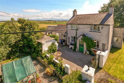
- Price
- £535,000
- Size
- 3.59 acres
Newborough, Llanfairpwll, Sir Ynys Mon, LL61, Rhosyr, Isle of Anglesey LL61 Wales
Added on 29/01/2026House with Land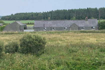
- Price
- Offers in Region of£420,000
- Size
- 3.97 acres
Pen Cob, Malltraeth, Anglesey, LL62, Bodorgan, Isle of Anglesey LL62 Wales
Added on 08/08/2026House with Land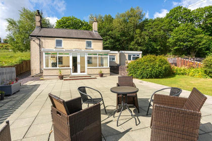
- Price
- £475,000
- Size
- 3.6 acres
Coed Y Parc, Bethesda, Bangor, Gwynedd, LL57, Llandygai, Gwynedd LL57 Wales
Added on 13/08/2026House with Land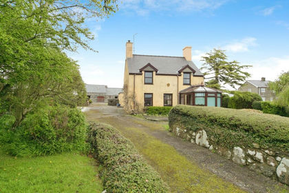
- Price
- £425,000
- Size
- 2 acres
Chwilog, Pwllheli, Gwynedd, LL53, Llanystumdwy, Gwynedd LL53 Wales
Added on 29/01/2026House with Land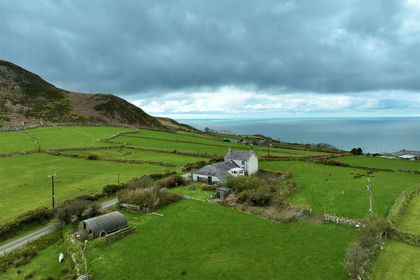
- Price
- Guide Price£459,999
- Size
- 2.15 acres
Added on 28/01/2026House with Land
- Price
- £399,950
- Size
- 3.8 acres
Bodffordd, Llangefni, Anglesey, LL77, Bodffordd, Isle of Anglesey LL77 Wales
Added on 26/08/2026House with Land