Arable Land at Winwick
- Land size
- 26.89 acres
Description
Arable Land at Winwick, Huntingdonshire
FOR SALE AS A WHOLE
Approximately 26.89 ACRES (10.89 hectares) of Commercial Arable Land FOR SALE BY PRIVATE TREATY
SITUATION
The land is situated in one parcel to the north of the village of Winwick, in the District of Huntingdonshire. It is approximately 5 miles north of junction 16 of the A14; 7 miles north east of Thrapston; 9 miles north west of Huntingdon; and 12 miles south west of Peterborough. Lot 1 has direct access from the Gidding Road; while
DESCRIPTION
The land comprises one enclosure extending to approximately 26.89 acres (10.89 hectares) of commercial arable land.
The land is primarily classified as Grade 3 according to the Land Classification Plans. The soils are of the Hanslope and Evesham 3 Soil Associations, according to the Soil Survey of England and Wales.
The land is offered for sale in 2 lots.
Lot 1 - Approximately 26.89 acres (10.89 hectares) of arable land (blue on the plan)
Lot 2 - Approximately 15.81 acres (6.39 hectares) of arable land (red on the plan) SOLD
CROPPING
The land has been cropped with an arable and grass rotation
GENERAL INFORMATION
METHOD OF SALE
The property is offered for sale by Private Treaty as a whole or in 2 Lots.
TENURE AND POSSESSION
The property is offered for sale freehold with vacant possession on completion
ENVIRONMENTAL SCHEMES
The land is not entered into any agri-environmental schemes.
OUTGOINGS
The property is subject to General Drainage Rates as levied by the Environment Agency.
LOCAL AUTHORITY
The Property is located within the administrative boundaries of Huntingdonshire District Council.
SPORTING, TIMBER AND MINERAL RIGHTS
All sporting, timber and mineral rights are included in the sale, insofar as they are owned.
EASEMENTS, WAYLEAVES, COVENANTS AND RIGHTS OF WAY
The property is sold subject to and with the benefit of all existing wayleaves, easements and rights of way, whether public or private, light, sport, drainage, water, electricity supplies and any other rights, obligations, easements and quasi easements, whether specifically mentioned or not.
BOUNDARIES
The Buyer(s) will be deemed to have inspected the property and satisfied themselves as to the ownership of any boundary, hedge, tree or ditch.
INGOING VALUATION
In addition to the purchase price, the Buyer(s) will be required to pay for: any growing crops and all beneficial cultivations and acts of cultivation since the previous harvest at current CAAV rates or contract rates where applicable; seed, manures, fertilisers, chemicals, lime and chalk applied to the growing crops since the last harvest will be recharged at invoice cost; an enhancement will be applied at £20.00 per acre per month from the date of establishment to completion.
PLANS, AREAS AND SCHEDULES
Plans included or attached to these particulars are based upon the Ordnance Survey Maps, copyright reserved. All plans are not to scale.
NEAREST POSTCODE AND WHAT3WORDS
The nearest postcode for the property is PE28 5PN. The property can be found more precisely using the what3words mapping system reference of:
Lot 1 - access from Gidding Road
/// openly.against.gradually
Lot 2 - access off Thurning Road
/// coverings.hopefully.trackers
OVERAGE
The land is sold subject to an overage for 30 years, whereby the Seller will retain a 30% share in any uplift in value if planning permission is obtained for a change of use from agricultural, horticultural or equestrian purposes. The overage payment will be triggered upon the disposal of land with the benefit of planning permission or implementation of a planning permission, whichever is the sooner.
VAT
Should the sale of the property or rights attached to the sale become a chargeable supply for the purpose of VAT, such tax will be paid by the Buyer(s) in addition to the purchase price.
DECLARATION OF PERSONAL INTEREST
Section 21 of the Estate Agents Act 1979 requires an estate agent to disclose a personal interest. A share in the property is currently vested in the Executors of the late Alan Woodward. David Bletsoe is a joint executor and a partner member of the Selling Agent, Henry H Bletsoe and Son LLP.
VIEWINGS
All viewings are strictly by appointment only through the Selling Agent, Henry H Bletsoe and Son LLP; to be undertaken during daylight hours, on foot only, with a set of particulars in hand. Please contact Henry H Bletsoe and Son LLP to arrange a viewing of the Property.
HEALTH AND SAFETY
Given the potential hazards of a working farm, we ask you to be as vigilant as possible when making your inspection, for your own personal safety. It is asked that you observe any specific signage on the property.
MEASUREMENTS AND OTHER INFORMATION
All measurements are approximate. While we endeavour to make our Sales Particulars accurate and reliable, if there is a point which is of particular importance, please do contact the Selling Agent, Henry H Bletsoe and Son LLP, who will be pleased to check the information for you, particularly if you are contemplating travelling some distance to the property.
ANTI-MONEY LAUNDERING REGULATIONS
The Buyer(s) will be required to provide proof of source of funds, identity and address to the Selling Agent following acceptance of an offer (subject to contract) and prior to solicitors being instructed.
IMPORTANT NOTICE
Henry H. Bletsoe and Son LLP for themselves and the Seller whose agents they are give Notice that: 1. These particulars are intended to give a fair and substantially correct overall description for the guidance of intending Buyers and do not constitute part of an offer or Contract. Prospective Buyer(s) ought to seek their own professional advice. 2. All descriptions, dimensions, areas, reference to condition and if necessary permissions for use and occupation and details are given in good faith and are believed to be correct. Any intending Buyer(s) should not rely on them as a statement or representation of fact but must satisfy themselves when inspecting or otherwise as to the correctness of each of them. 3. No person in the employment of Henry H. Bletsoe and Son LLP has any authority either to make or give any representation or warranty whether in relation to this property or these Particulars nor to enter in any contract relating to the property on behalf of the Seller. 4. No responsibility is accepted for any expenses incurred by the intending Buyer(s) inspecting properties that have been sold, let or withdrawn. 5. The property is open to inspection. The Buyer(s) shall be deemed to have full knowledge of the state and condition thereof including the ownership of any tree, boundary or part of the property. 6. Should any dispute arise between the Seller and Buyer(s) upon any point not involving a question of Law arising out of these Particulars, stipulations or plans as to interpretation, the dispute shall be referred to the Selling Agent, Henry H. Bletsoe and Son LLP whose decision shall be final and binding on all parties to the dispute and in every such referral the Selling Agent to decide how the costs of such reference shall be borne. Particulars prepared December 2025 and photograph taken: June 2025.
Map Location
Property details
- Tenure
- Freehold
- Council Tax Band
- Ask Agent
- Date Posted
- 2026-04-25
Market Value Analysis
Compared with 64 Farmland & Pasture listings in East Anglia (25+ acres).
Utilities & Restrictions
Utilities
- Electricity
- Ask Agent
- Water
- Ask Agent
- Heating
- Ask Agent
- Broadband
- Ask Agent
- Sewerage
- Ask Agent
Rights & Restrictions
- Public Rights of Way
- Ask Agent
- Private Rights of Way
- Ask Agent
- Listed Property
- Ask Agent
- Restrictions
- Ask Agent
Listed status, conservation areas and planning constraints for this location are in the full report.
Property Features
- Accessibility
- Ask Agent
- Parking
- Ask Agent
- Garden
- Ask Agent
Beyond the particulars: planning activity, flood history, heritage and ground risks, checked for this exact spot.
Connectivity
Broadband
Fastest speed available at this postcode
80 Mbps
Superfast
Suitable for
- HD streaming
- Video calls
- Web & social
Mobile signal
Outdoor predictions; indoor signal depends on building materials.
Ofcom Connected Nations postcode-level predictions. Speeds and signal are modelled, not measured, and vary between addresses and providers.
Signal is the easy part. Planning activity, flood history and protected designations here are in the full report.
Nearest Schools
Primary
- Brington CofE Primary School3.5 milesNo Ofsted rating
- Ages
- 4 to 11
- Pupils
- 94
- Type
- Voluntary controlled school
- Faith
- Church of England
- Sawtry Infants' School4.1 milesOfsted: Good *
- Ages
- 4 to 7
- Pupils
- 211
- Type
- Community school
- Sawtry Junior Academy4.1 milesOfsted: Good
- Ages
- 7 to 11
- Pupils
- 274
- Type
- Academy converter
- Polebrook Church of England Primary School4.5 milesNo Ofsted rating
- Ages
- 5 to 11
- Pupils
- 70
- Type
- Academy converter
- Faith
- Church of England
- Titchmarsh Church of England Primary School5.2 milesOfsted report card · Jun 2026
- Ages
- 4 to 11
- Pupils
- 101
- Type
- Voluntary controlled school
- Faith
- Church of England
Secondary
- Sawtry Village Academy4.4 milesNo Ofsted rating
- Ages
- 11 to 18
- Pupils
- 1,101
- Type
- Academy converter
- Prince William School5.7 milesOfsted: Good
- Ages
- 11 to 18
- Pupils
- 1,416
- Type
- Academy sponsor led
- Manor School8.2 milesOfsted: Inadequate
- Ages
- 11 to 19
- Pupils
- 851
- Type
- Academy converter
- Hinchingbrooke School9.5 milesOfsted report card · May 2026
- Ages
- 11 to 18
- Pupils
- 2,173
- Type
- Academy converter
- Ormiston Bushfield Academy9.5 milesOfsted: Good *
- Ages
- 11 to 19
- Pupils
- 1,212
- Type
- Academy sponsor led
* Latest graded judgement covers quality of education only; no overall grade was issued under the 2024-25 inspection framework.
Distances are straight-line from the advertised location. Source: the national school registers (DfE, Welsh Government, Scottish Government) and Ofsted.
Schools are just the start: sold prices nearby, planning activity and any flood history are in the full report.
Amenities
Supermarket
GP surgery
Pharmacy
Hospital
Straight-line distances from the advertised location. Sources: NHS records, Geolytix supermarket locations, OS Open Greenspace and the national trails registers.
The area stacks up? Now check the location itself: planning nearby, protected designations and past flooding.
Getting Around
Nearest station
Nearest bus stop
Typical drive times
Straight-line distances from the advertised location; drive times are typical free-flow times over OpenStreetMap road data, so allow more at peak. Public transport locations from DfT NaPTAN.
Easy to reach matters. So do planning activity, flood history and ground risks: all in the full report.
Flood Risk
From Environment Agency flood map open data, checked around the advertised map pin and allowing for the listed acreage where known. This summary comes from LandSale, the advertising platform, not from the listing agent, and is not part of the agent's particulars. Risk can vary across a single holding, so verify anything critical through your own searches before committing.
Rivers and the sea
Surface water
Mapped within the area searched, not at the advertised map pin itself.
The detail behind these bandings
The full report pinpoints where this location sits on the flood maps, and runs the deeper checks that usually only surface after an offer.
- Exact flood zones & annual chances (included in the full report)
- Any recorded past flooding (included in the full report)
- Planning activity nearby (included in the full report)
- Heritage & conservation (included in the full report)
- Protected nature designations (included in the full report)
- Ground risks (included in the full report)
- Sold prices nearby (included in the full report)
£14.99 · one-off purchase
By LandSale, the platform. Not provided by the listing agent. Ready in about a minute.
Important notice: Information, maps and tags on this page are drawn from the advertising agent's marketing materials or generated automatically. LandSale has not verified them. Relying on these details is at your own risk, always carry out independent checks before committing to a purchase.
LandSale full disclaimer
Marketing information only - not formal particulars. The details on this website are provided for general guidance and do not constitute an offer or contract. Neither LandSale nor the advertising estate/land agent accepts responsibility for any inaccuracy.
1. Source of information
- Listing content: Core description, asking price, tenure, measurements, photographs and planning history originate from the marketing materials of the advertising estate or land agent. LandSale does not author this content and cannot guarantee its accuracy.
- Automated tags & categorisation: Property type, land-use class, acreage bands and similar labels may be applied by machine-learning models. They are intended as a helpful guide only and may not reflect the property's legal status or permitted use.
- Third-party & enriched data layers: Maps, boundary outlines, planning designations, soil reports, broadband coverage and other environmental or location-based insights are licensed from external suppliers. Such data are supplied “as is", may be incomplete or out of date and are subject to change without notice.
2. Verification required
Prospective purchasers must verify critical matters, including but not limited to planning permission, title boundaries, public rights of way, environmental constraints, acreage, services, access and VAT status, through their own inspections, specialist surveys, legal advisers and the selling agent before relying on the information or entering into any contract.
3. No warranty or liability
LandSale gives no warranty, express or implied, as to the accuracy, completeness or fitness for any particular purpose of the information displayed. LandSale shall not be liable for any loss, damage, cost or expense arising directly or indirectly from any use of or reliance on such information, save where liability may not be excluded by law.
4. Updates & feedback
If you believe any detail on this listing is inaccurate, please let us know. We will investigate and, where appropriate, update the listing or notify the agent.
© LandSale | Version 1.3 - August 2026
Listing agent
Bletsoes, Thrapston
Oakleigh House, High Street, Thrapston, NN14 4LJ
Similar properties for sale
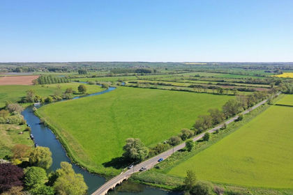
- Price
- £300,000
- Size
- 34.08 acres
Added on 22/07/2026Vacant Land- Price
- Guide Price£300,000
- Size
- 34.08 acres
Land at Fotheringhay Northamptonshire, Fotheringhay, North Northamptonshire PE8 England
Added on 10/06/2026Farmland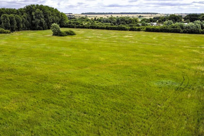
- Price
- Guide Price£210,000
- Size
- 14 acres
Willington, Bedford, Bedfordshire, Cople, Bedford MK44 England
Added on 15/07/2026Arable Land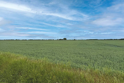
- Price
- Guide Price£210,000
- Size
- 24.43 acres
Land At Haven Drove, Willingham, Cambridgeshire, CB24, Rampton, Cambridgeshire CB24 England
Added on 04/07/2026Arable Land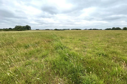
- Price
- From£335,000
- Size
- 40.61 acres
Added on 29/07/2026Agricultural Land
- Price
- Guide Price£235,000
- Size
- 28.46 acres
Added on 29/07/2026Agricultural Land
- Price
- Guide Price£235,000
- Size
- 31.1 acres
Land At Clare Farm, Witcham, Ely, Cambridgeshire, CB6, Witcham, Cambridgeshire CB6 England
Added on 27/03/2026Arable Land
- Price
- Guide Price£245,000
- Size
- 30.7 acres
Added on 16/06/2026Farmland
- Price
- Guide Price£275,000
- Size
- 22.84 acres
Murrow Bank, Parson Drove, Wisbech, Cambridgeshire, PE13, Parson Drove, Cambridgeshire PE13 England
Added on 10/08/2026Arable Land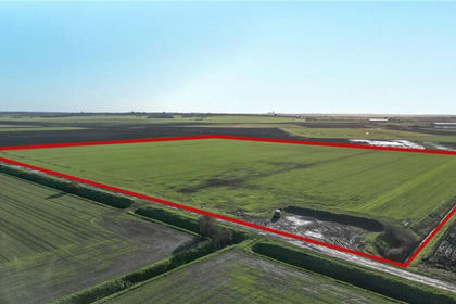
- Price
- Guide Price£228,000
- Size
- 76.97 acres
Added on 05/03/2026Agricultural Land