Chertsey Lane, Chertsey, TW18
- Land size
- 44 acres
Description
In total, the land extends to approximately 40 acres of permanent pasture with 4 acres of mixed deciduous trees split across two fields. The land is bordered mostly with livestock fencing with one strand of wire and timber posts and one galvanised gateway. The fields are split with 4 strands of barbed wire with gateway access between them.
The land has been used for livestock grazing and is to be sold subject to overage based on 10% of any uplift in value in the event of planning consent for development, over 20 years. Further information available on request.
The land falls within the London Metropolitan Green Belt Zone. and There are no Tree Preservation Orders (TPO’s) on the land or within the immediate vicinity.
SITUATION
Located approximately 1 mile south of Staines-Upon-Thames, 3 miles from Junction 13 of the M25, 5 miles west of Littleton and 3 miles to the east of Egham.
What3word location of the land: thank.focus.swing
ACCESS
The land is accessed direct from Chertsey Lane to the east of the land.
WAYLEAVES, EASEMENTS AND RIGHTS OF WAY
The land is sold subject to or with the benefit of all existing wayleaves, easements, rights of way, covenants and restrictions, whether mentioned in these particulars or not.
SERVICES
There is water servicing the land with a network of water troughs throughout. Any purchaser should make their own enquiries with the Local Authority.
BOUNDARIES
The boundaries are based on an Ordnance Survey Plan and are for reference purposes only. Any Purchaser will be deemed to have full knowledge of all boundaries and any error shall not be the responsibility of the Vendor or entitle any party to compensation in respect thereof.
TENURE AND POSSESSION
Freehold with vacant possession.
METHOD OF SALE
For sale by Private Treaty as a whole.
VAT
Any guide price quoted or discussed is exclusive of VAT. In the event that a sale of the land or any part of it or any right attached to it becomes a chargeable supply for the purposes of VAT, such tax will be payable in addition.
ANTI-MONEY LAUNDERING REGULATIONS
In accordance with the Anti-Money Laundering Regulations 2017, once an offer has been accepted the Purchaser will be required to provide proof of identity and address prior to the instruction of a solicitor.
VIEWING
See contact details below for further information.
LOCAL AUTHORITY
Runnymede Borough Council
Surrey County Council
VIEWING
Phone: (Opt. 3)
Postal Address: White & Sons, Reeve House, Parsonage Square, Dorking, Surrey RH4 1UP
E-mail: george.
Map Location
Property details
- Tenure
- Ask Agent
- Council Tax Band
- TBC
- Date Posted
- 2026-04-22
Market Value Analysis
Compared with 36 Farmland & Pasture listings in South East England (25+ acres).
Utilities & Restrictions
Utilities
- Electricity
- Ask Agent
- Water
- Ask Agent
- Heating
- Ask Agent
- Broadband
- Ask Agent
- Sewerage
- Ask Agent
Rights & Restrictions
- Public Rights of Way
- Ask Agent
- Private Rights of Way
- Ask Agent
- Listed Property
- Ask Agent
- Restrictions
- Ask Agent
Property Features
- Accessibility
- Ask Agent
- Parking
- Ask Agent
- Garden
- Ask Agent
Important notice: Information, maps and tags on this page are supplied by the advertising agent or generated automatically. LandSale has not verified them. Relying on these details is at your own risk, always carry out independent checks before committing to a purchase.
LandSale full disclaimer
Marketing information only - not formal particulars. The details on this website are provided for general guidance and do not constitute an offer or contract. Neither LandSale nor the advertising estate/land agent accepts responsibility for any inaccuracy.
1. Source of information
- Agent-supplied content: Core description, asking price, tenure, measurements, photographs and planning history are uploaded by the appointed agent, who remains solely responsible for their accuracy.
- Automated tags & categorisation: Property type, land-use class, acreage bands and similar labels may be applied by machine-learning models. They are intended as a helpful guide only and may not reflect the property's legal status or permitted use.
- Third-party & enriched data layers: Maps, boundary outlines, planning designations, soil reports, broadband coverage and other environmental or location-based insights are licensed from external suppliers. Such data are supplied “as is", may be incomplete or out of date and are subject to change without notice.
2. Verification required
Prospective purchasers must verify critical matters, including but not limited to planning permission, title boundaries, public rights of way, environmental constraints, acreage, services, access and VAT status, through their own inspections, specialist surveys, legal advisers and the selling agent before relying on the information or entering into any contract.
3. No warranty or liability
LandSale gives no warranty, express or implied, as to the accuracy, completeness or fitness for any particular purpose of the information displayed. LandSale shall not be liable for any loss, damage, cost or expense arising directly or indirectly from any use of or reliance on such information, save where liability may not be excluded by law.
4. Updates & feedback
If you believe any detail on this listing is inaccurate, please let us know. We will investigate and, where appropriate, update the listing or notify the agent.
© LandSale | Version 1.2 - January 2026
Listing agent
White & Sons, Oxted
39-41 Station Road East, Oxted, RH8 0BD
Similar properties for sale

- Price
- Guide Price£1,700,000
- Size
- 69.06 acres
Added on 22/04/2026Arable Land
- Price
- Offers in Region of£1,250,000
- Size
- 4.4 acres
Added on 25/06/2026Development Land
- Price
- Guide Price£1,750,000
- Size
- 275.48 acres
Land at East Court Farm, Chalk, Gravesend, Kent, Shorne, Kent DA12 3HS England
Added on 22/04/2026Farmland
- Price
- Guide Price£1,400,000
- Size
- 24 acres
Woodmancote, West Sussex, Westbourne, West Sussex PO10 8RG England
Added on 06/02/2026Building Plot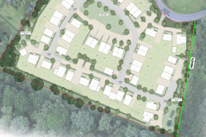
- Price
- Offers in Excess of£2,000,000
Pratling Street, Aylesford, Aylesford, Kent ME20 7DU England
Added on 07/07/2026Development Land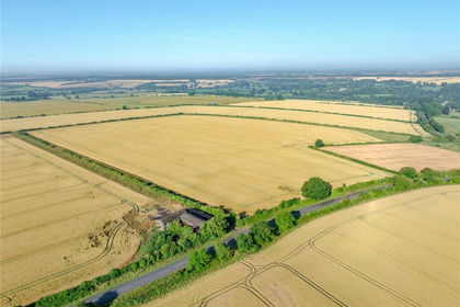
- Price
- Guide Price£2,350,000
- Size
- 228.28 acres
Added on 11/07/2026Farm
- Price
- Guide Price£2,375,000
- Size
- 220 acres
Willington, Bedford, Bedfordshire, Willington, Bedford MK44 3PR England
Added on 15/07/2026Farm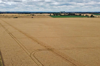
- Price
- Guide Price£1,600,000
- Size
- 152.91 acres
Willington, Bedford, Bedfordshire, Willington, Bedford MK44 3PR England
Added on 15/07/2026Farm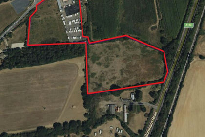
- Price
- Offers in Region of£1,750,000
- Size
- 13.5 acres
Woods Farm, Woodham Road, Wickford, SS11 7QU, Rettendon, Essex SS11 7QU England
Added on 18/06/2026Agricultural Land
- Price
- Guide Price£1,250,000
- Size
- 66.32 acres
Added on 02/05/2026Farmland