Fornham Park, Fornham St. Genevieve, Bury St. Edmunds, Suffolk, IP28
- Land size
- 172.94 acres
Key Features
- 96.32 acres of agricultural land
- 27.82 acres of parkland
- 6.76 acres of scenic lakes
- 12.88 acres of mature mixed woodland
- 29.16 acres of a former brownfield site restored to amenity grassland
Description
96.32 acres of agricultural land
27.82 acres of parkland
6.76 acres of scenic lakes
12.88 acres of mature mixed woodland
INTRODUCTION
Fornham Park represents an exciting opportunity to secure a strategic property comprising a range of land uses located to the north of the market town of Bury St Edmunds. Situated on the northern edge of Fornham St Genevieve, the site provides potential for a purchaser to create a private estate or to diversify into other uses, subject to planning. The Vendors preference is to undertake this transaction as a Share Sale of Fornham Country Park Limited, which owns the subject property that is the Companies only property Assets.
LOCATION & SITUATION
Fornham Park is located approximately 3 miles northwest of Bury St Edmunds and situated on the northern edge of the village of Fornham St Genevieve. The property is adjacent to the B1106 and access to the property can be taken directly from the Public Highway. The B1106 links directly onto the A134 which connects the property to the A14 and surrounding areas.
Bury St Edmunds is a desirable market town for both locals and tourists with a range of shops, restaurants and amenity areas/attractions such as the Abbey Gardens and St Edmundsbury Cathedral.
AGRICULTURAL LAND
The land extends to 96.32 acres divided into four large fields. Currently the land is grassland with the potential to be converted back into arable land suitable for commercial farming. The land gently slopes south westerly towards the River Lark and the Lakes. The soils are mainly of the Newport 4 Association which are described as well drained sandy soils suitable for cereal crops, sugar beet and potatoes. The land has previously been cropped with sugar beet, maize, rye and winter wheat.
PARKLAND
Extending to 27.82 acres in total, the majority of the parkland forms part of the southern land situated adjacent to residential properties and the adjoining Aspen Country Park development. This area of land benefits from a range of mature trees and a separate access directly off the B1106 roundabout. The rest of the parkland extends around the lakes in the centre of the property.
WOODLAND
The main woodland is an attractive block extending to approximately 9.57 acres of mature broad leaf and conifer trees situated adjacent to the agricultural land to the north. The woodland benefits from an access directly off the Public Highway, Mill Road. The remaining areas of woodland are made up of small areas of trees and shelter belts.
LAKES
The scenic lakes are situated to the south west of the property and extend, in total, to 6.76 acres. A boathouse is situated on the northern bank of the eastern most lake.
Constructed of brick plinth with an oak frame under a pantile roof.
BROWNFIELD SITE
Extending to 29.16 acres of former landfill, the land has been restored to amenity grassland with an elevated view of the surrounding property. The land is filled in part with inert soils and part builder's waste and is regularly monitored by the Environment Agency.
BUILDINGS
Agricultural Building - A concrete block building measuring approx. 9.5m x 6m situated in the centre of the property. Church Tower The Church Tower, being the remains of the Fornham St Genevieve Church lies in the centre of the property. A fire destroyed the church in 1782 leaving only the tower which was subsequently used as a folly for the estate. The tower is Grade II* Listed and currently houses a redundant water tank.
ENVIRONMENTAL AND BIODIVERSITY NET GAIN POTENTIAL
Owing to the property's location and local environmental context, the land provides opportunities for the uplift of onsite habitats, mostly agricultural land, for the purposes of generating Biodiversity Net Gain Habitat Units. Such uplift could include the creation of new species-rich grasslands and woodland parcels and the enhancement of existing freshwater ponds and marginal river areas. Generated units can be sold commercially to developers in England and would be of particular value to those seeking to develop within the Bury St Edmunds local planning authority or national character area.
GENERAL REMARKS & STIPULATIONS
METHOD OF SALE
The property is offered for sale by Private Treaty as a whole.
If a purchaser is interested in part of the property, they are invited to discuss their requirements with the selling agents.
The Vendors preference is to sell 100% of the issued share capital of Fornham Country Park Limited.
TENURE AND POSSESSION
The property is offered for sale freehold with vacant possession on completion.
EXCHANGE OF CONTRACTS & COMPLETION
Exchange of contracts to take place 28 days after receipt by the Purchaser's Solicitor of the draft contract and completion will be 28 days after exchange.
A deposit of 10% of the purchase price will be payable on exchange of contracts. If early entry is required then the purchaser/s will be asked to pay an additional 10% at that stage.
WAYLEAVES, EASEMENTS AND RIGHTS OF WAY
The property is sold subject to and with the benefit of all existing rights, including rights of way, whether public or private, light, support, drainage, water and electricity supplies and other rights, easements, quasi-easements, and all wayleaves whether or not referred to in these particulars. There are some third-party rights of way over the driveway adjoining North Lodge for the access to the central dwellings outside of the ownership.
There is a right of way over the driveway as an emergency access to the holiday lodge park adjoining.
There is an easement in place in favour of Eastern Concrete to draw water as shown on the plan marked with an "X".
TIMBER, SPORTING AND MINERALS
All sporting, standing timber and minerals (except as reserved by statute or the crown) are included in the sale of the freehold.
BOUNDARIES
The Buyer shall be deemed to have full knowledge of all boundaries and neither the Seller nor the Selling Agents will be responsible for defining boundaries nor their ownership.
PLANS, AREAS AND SCHEDULES
These have been prepared as carefully as possible and based on Ordnance Survey data. The plans are published for illustrative purposes only and although they are believed to be correct, their accuracy is not guaranteed.
TOWN AND COUNTRY PLANNING
The purchaser(s) will be deemed to have full knowledge and have satisfied themselves as to any planning matters that may affect
the property.
The following properties are Listed:
Church Tower (Church of St Genevieve at Fornham Park) - Grade II*
Icehouse - Grade II
OUTGOINGS
The land is sold subject to any drainage rates or other outgoings that may be relevant.
FIXTURES AND FITTINGS
All fixtures and fittings are excluded within the sale unless specifically referred to in these particulars.
DISPUTES
Should any disputes arise as to the boundaries or any points concerning the particulars, schedules, plans and tenant right issues, or the interpretation of any of them, the question will be referred to an arbitrator appointed by the selling agent.
ANTI MONEY LAUNDERING LEGISLATION
In accordance with the most recent Anti Money Laundering Legislation, Buyers will be required to provide proof of identity and address to the Selling Agent once an offer has been submitted and accepted (subject to contract) prior to Solicitors being instructed.
Photographs
Please note the photographs used within these particulars and some of the website were taken in 2024.
VIEWINGS
Strictly by appointment with Brown & Co.
29.16 acres of a former brownfield site restored to amenity grassland
Map Location
Property details
- Tenure
- Freehold
- Council Tax Band
- Ask Agent
- Date Posted
- 2026-04-15
Price history
| Date | Change | Price |
|---|---|---|
| 14 Aug 2026 | Reduced 14.3% (−£250,000) | £1,500,000 |
| Until 14 Aug 2026 | Asking price | £1,750,000 |
Market Value Analysis
Compared with 3 Development Land listings in East Anglia (75+ acres).
Utilities & Restrictions
Utilities
- Electricity
- Ask Agent
- Water
- Ask Agent
- Heating
- Ask Agent
- Broadband
- Ask Agent
- Sewerage
- Ask Agent
Rights & Restrictions
- Public Rights of Way
- Ask Agent
- Private Rights of Way
- Ask Agent
- Listed Property
- Ask Agent
- Restrictions
- Ask Agent
Listed status, conservation areas and planning constraints for this location are in the full report.
Property Features
- Accessibility
- Ask Agent
- Parking
- Parking Available
- Garden
- Ask Agent
Beyond the particulars: planning activity, flood history, heritage and ground risks, checked for this exact spot.
Connectivity
Broadband
Fastest speed available at this postcode
48 Mbps
Superfast
Suitable for
- HD streaming
- Video calls
- Web & social
Mobile signal
Predicted 4G and 5G signal; indoor signal depends on building materials.
Ofcom Connected Nations postcode-level predictions. Speeds and signal are modelled, not measured, and vary between addresses and providers.
Signal is the easy part. Planning activity, flood history and protected designations here are in the full report.
Nearest Schools
Primary
- Howard Community Academy1.8 milesOfsted: Good *
- Ages
- 3 to 11
- Pupils
- 210
- Type
- Academy sponsor led
- Tollgate Primary School1.9 milesOfsted: Good
- Ages
- 3 to 11
- Pupils
- 437
- Type
- Academy sponsor led
- Sexton's Manor Primary School2.6 milesNo Ofsted rating
- Ages
- 3 to 11
- Pupils
- 165
- Type
- Academy converter
- St Edmundsbury CofE Primary Academy2.6 milesOfsted: Requires improvement
- Ages
- 5 to 11
- Pupils
- 168
- Type
- Academy sponsor led
- Faith
- Church of England
- Risby Church of England Voluntary Controlled Primary School3 milesOfsted: Good
- Ages
- 4 to 11
- Pupils
- 203
- Type
- Voluntary controlled school
- Faith
- Church of England
Secondary
- St Benedict's Catholic School2 milesNo Ofsted rating
- Ages
- 11 to 18
- Pupils
- 968
- Type
- Academy converter
- Faith
- Roman Catholic
- Bury St Edmunds County High School2.1 milesOfsted report card · May 2026
- Ages
- 11 to 16
- Pupils
- 657
- Type
- Academy converter
- King Edward VI CEVC School2.5 milesNo Ofsted rating
- Ages
- 11 to 16
- Pupils
- 1,189
- Type
- Voluntary controlled school
- Faith
- Church of England
- Sybil Andrews Academy4 milesOfsted: Good
- Ages
- 11 to 16
- Pupils
- 657
- Type
- Academy sponsor led
- Thurston Community College5.3 milesNo Ofsted rating
- Ages
- 11 to 18
- Pupils
- 1,512
- Type
- Community school
* Latest graded judgement covers quality of education only; no overall grade was issued under the 2024-25 inspection framework.
Distances are straight-line from the advertised location. Source: the national school registers (DfE, Welsh Government, Scottish Government) and Ofsted.
Schools are just the start: sold prices nearby, planning activity and any flood history are in the full report.
Amenities
Supermarket
GP surgery
Pharmacy
Hospital
Straight-line distances from the advertised location. Sources: NHS records, Geolytix supermarket locations, OS Open Greenspace and the national trails registers.
The area stacks up? Now check the location itself: planning nearby, protected designations and past flooding.
Getting Around
Nearest station
Nearest bus stop
Typical drive times
Straight-line distances from the advertised location; drive times are typical free-flow times over OpenStreetMap road data, so allow more at peak. Public transport locations from DfT NaPTAN.
Easy to reach matters. So do planning activity, flood history and ground risks: all in the full report.
Flood Risk
Environment Agency open data, checked around the advertised map pin for the listed acreage. Long-term risk counts flood defences; the planning map's flood zones do not. The map pin for this listing is approximate, so these readings describe the surrounding area. Provided by LandSale, not the listing agent, and not part of the agent's particulars. Risk varies across a holding, so verify before committing.
Rivers and the sea
Planning map: Flood Zone 1.
Surface water
Not at the pin: mapped about 10 metres away.
These bandings are the summary. Where this location sits on the flood maps, plus planning activity, heritage and ground risks, is in the full report.
Important notice: Information, maps and tags on this page are drawn from the advertising agent's marketing materials or generated automatically. LandSale has not verified them. Relying on these details is at your own risk, always carry out independent checks before committing to a purchase.
LandSale full disclaimer
Marketing information only - not formal particulars. The details on this website are provided for general guidance and do not constitute an offer or contract. Neither LandSale nor the advertising estate/land agent accepts responsibility for any inaccuracy.
1. Source of information
- Listing content: Core description, asking price, tenure, measurements, photographs and planning history originate from the marketing materials of the advertising estate or land agent. LandSale does not author this content and cannot guarantee its accuracy.
- Automated tags & categorisation: Property type, land-use class, acreage bands and similar labels may be applied by machine-learning models. They are intended as a helpful guide only and may not reflect the property's legal status or permitted use.
- Third-party & enriched data layers: Maps, boundary outlines, planning designations, soil reports, broadband coverage and other environmental or location-based insights are licensed from external suppliers. Such data are supplied “as is", may be incomplete or out of date and are subject to change without notice.
2. Verification required
Prospective purchasers must verify critical matters, including but not limited to planning permission, title boundaries, public rights of way, environmental constraints, acreage, services, access and VAT status, through their own inspections, specialist surveys, legal advisers and the selling agent before relying on the information or entering into any contract.
3. No warranty or liability
LandSale gives no warranty, express or implied, as to the accuracy, completeness or fitness for any particular purpose of the information displayed. LandSale shall not be liable for any loss, damage, cost or expense arising directly or indirectly from any use of or reliance on such information, save where liability may not be excluded by law.
4. Updates & feedback
If you believe any detail on this listing is inaccurate, please let us know. We will investigate and, where appropriate, update the listing or notify the agent.
© LandSale | Version 1.3 - August 2026
Listing agent
BROWN & CO-PROPERTY AND BUSINESS CONSULTANTS LLP, Bury St Edmunds
Contact BROWN & CO-PROPERTY AND BUSINESS CONSULTANTS LLP, Bury St Edmunds
View agent profileSimilar properties for sale
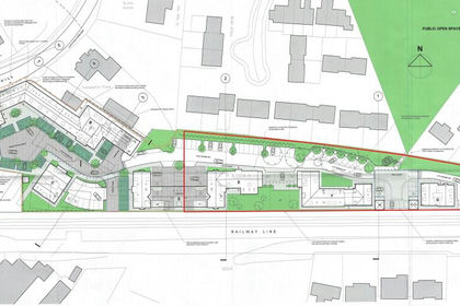
- Price
- Offers in Excess of£1,250,000
- Size
- 1.1 acres
The Old Granary Site, Station Hill, Thurston, IP31, Thurston, Suffolk IP31 England
Added on 18/07/2026Development Land
- Price
- Guide Price£1,000,000
- Size
- 5.08 acres
Added on 24/07/2026Development Land
- Price
- Guide Price£1,670,000
- Size
- 5.4 acres
Thorpe Morieux, Bury St. Edmunds, IP30, Bury St. Edmunds, Suffolk IP30 England
Added on 24/07/2026Development Land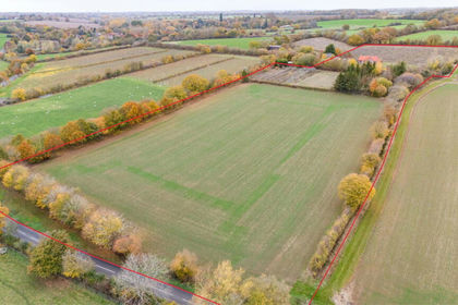
- Price
- Guide Price£950,000
- Size
- 12.6 acres
East Barn & Hedgerows Farm Bungalow, Brent Eleigh, Brent Eleigh, Suffolk CO10 England
Added on 16/09/2026Development Land
- Price
- Guide Price£900,000
Added on 20/05/2026Development Land- Price
- Guide Price£900,000
Added on 03/09/2026Development Land
- Price
- Guide Price£1,250,000
- Size
- 170.64 acres
Added on 25/09/2026Agricultural Land
- Price
- Guide Price£1,500,000
- Size
- 1.95 acres
Great Cornard, Sudbury, Suffolk, Great Cornard, Suffolk CO10 England
Added on 05/09/2026Development Land
- Price
- £1,000,000
- Size
- 2.08 acres
Added on 29/01/2026Undeveloped Land
- Price
- Offers in Region of£1,860,000
- Size
- 2124 acres
Lorry Park, Paper Mill Lane, Claydon, Ipswich, Suffolk, IP6, Claydon, Suffolk IP6 England
Added on 21/08/2026Industrial Land