Dolwyddelan
- Land size
- 9.94 acres
- Bedrooms
- 2
Description
A character smallholding extending to approximately 10 Acres in a secluded setting in the beautiful Lledr Valley within the Snowdonia National Park
INSPECTION HIGHLY RECOMMENDED
Set within approximately 9.94 acres of its own grounds, this delightful smallholding occupies a wonderful secluded setting, lying between Dolwyddelan and Betws y Coed in a hamlet known as Pont y Pant, within easy reach of Pont y Pant railway station.
Surrounded by a mixture of grassland, woodland and mature trees, the property enjoys a truly private and tranquil setting, ideal for those seeking a rural lifestyle yet conveniently placed for local amenities, countryside walks and transport links.
The farmhouse has been sympathetically upgraded in recent years, carefully retaining a wealth of original character features, including exposed stonework, timber beams and a traditional inglenook fireplace. The layout offers flexibility, making the property equally suitable as a permanent residence or lifestyle smallholding.
A range of traditional stone outbuildings offer excellent potential for alternative uses, subject to the necessary planning consents. These buildings complement the character of the property and add further scope for storage, workshops or rural enterprise.
The land extends to approximately 9.94 acres, comprising grazing land, wooded areas and natural features, creating a varied and attractive landscape that enhances the sense of privacy and seclusion.
The accommodation is arranged as follows:
Ground Floor
•Welcoming entrance and rear hall
•Living / dining room featuring a character inglenook fireplace, forming the heart of the home
•Kitchen positioned to the rear, enjoying views over the grounds
•Additional sitting room, which could alternatively serve as a third bedroom if required
•Utility area and shower room, providing practical facilities for country living
First Floor
•Two well-proportioned bedrooms, both enjoying pleasant outlooks
•Family bathroom
The Accommodation Affords: - (Approximate measurements only)
Living & Dining Room - 5.61m x 3.62m (18'4" x 11'10") - Feature inglenook style fireplace surround with slate lintel and hearth, cast iron multi fuel stove, built in cupboard to alcove recess, sealed unit double glazed window overlooking side elevation, sash double glazed window overlooking front enjoying views, double panel radiator, telephone point, stable timber and glazed front door. Turn timber staircase leading off to first floor level, exposed oak beams. Access to rear hallway.
Downstairs Sitting Room / Bedroom 3 - 3.9m x 3.61m (12'9" x 11'10") - Recessed fireplace with slate hearth and lintel, gas operated coal effect cast iron stove, sash double glazed window overlooking front, double panel radiator, timber flooring.
Rear Hallway - 2.46m x 1.52m (8'0" x 4'11") - Timber and glazed rear outer door, vaulted ceiling, overhead storage cupboard, exposed timbers, cloak hooks, double panel radiator.
Kitchen - 3.34m x 2.38m (10'11" x 7'9") - Fitted base and wall units with complimentary worktops, electric cooker point, concealed filter extractor, 1.5 bowl sink, space for fridge/freezer, double panel radiator, beamed ceiling, stable timber and glazed side door and double glazed window overlooking rear.
Rear Utility And Shower Room - 2.78m x 2.48m (9'1" x 8'1") - Plumbing for automatic washing machine, base units with worktop over, wall mounted central heating boiler, low level w.c. beamed ceiling, shower enclosure, double panel radiator.
First Floor Landing - Built in airing cupboard with cylinder, linen storage, integrated lighting.
Bedroom 1 - 3.89m x 3.29m (12'9" x 10'9") - Sash double glazed window overlooking front, double panel radiator, vanity washbasin, views.
Bedroom 2 - 3.0m x 3.59m (9'10" x 11'9") - Double panel radiator into recess, sash double glazed window overlooking front enjoying extensive views, access to roof space.
Bathroom - 2.19m x 1.69m (7'2" x 5'6") - Slipper style roll top bath with mixer tap shower adaptor, pedestal wash handbasin, low level w.c. radiator, Velux double glazed window, tiled splashback.
Outside - A range of traditional stone outbuildings with potential for alternative use, subject to necessary planning consent. Approximately 9.94 acres of grassland, wooded areas and natural features.
Services - Mains electricity and water; septic tank drainage; LPG gas.
Viewing - By appointment through the agents Iwan M Williams, 5 Denbigh Street, Llanrwst, tel , email
Agent's Note - Please note that there are National Trust Covenants relating to the property - awaiting full details.
Proof Of Funds - In order to comply with anti-money laundering regulations, Iwan M Williams Estate Agents require all buyers to provide us with proof of identity and proof of current residential address. The following documents must be presented in all cases: IDENTITY DOCUMENTS: a photographic ID, such as current passport or UK driving licence. EVIDENCE OF ADDRESS: a bank, building society statement, utility bill, credit card bill or any other form of ID, issued within the previous three months, providing evidence of residency as the correspondence address.
Council Tax - Band E.
Directions - From Betws y Coed, follow the A470 towards Dolwyddelan for approximately 3.5 miles, turn left over the bridge at Pont y Pant, signposted towards the Railway Station and bare sharp right with the road towards the Station and take the next left up towards Gelli Pant and the access to the property will be viewed on the left hand side via a galvanised gate showing the name plate.
What3words: - ///absorbing.waitress.meals
The property is conveniently situated for access to local countryside walks, the surrounding Snowdonia landscape and nearby villages. Pont y Pant railway station is within close proximity, providing a valuable transport link, while the village of Dolwyddelan offers local amenities and community facilities.
Map Location
Property details
- Tenure
- Freehold
- Council Tax Band
- Ask Agent
- Date Posted
- 2026-03-25
Price history
| Date | Change | Price |
|---|---|---|
| 24 Sep 2026 | Reduced 8.7% (−£50,000) | £525,000 |
| Until 24 Sep 2026 | Asking price | £575,000 |
Market Value Analysis
Compared with 365 Homes with Land listings in Wales (5+ acres).
Energy Performance Certificate
Energy Efficiency Rating
Based on UK Energy Performance Certificate standards (EU Directive 2002/91/EC)
Running costs are one side. Planning activity, flood history and ground risks for this location are in the full report.
Utilities & Restrictions
Utilities
- Electricity
- Ask Agent
- Water
- Ask Agent
- Heating
- Ask Agent
- Broadband
- Ask Agent
- Sewerage
- Ask Agent
Rights & Restrictions
- Public Rights of Way
- Ask Agent
- Private Rights of Way
- Ask Agent
- Listed Property
- Ask Agent
- Restrictions
- Ask Agent
Listed status, conservation areas and planning constraints for this location are in the full report.
Property Features
- Accessibility
- Ask Agent
- Parking
- Ask Agent
- Garden
- Garden
Beyond the particulars: planning activity, flood history, heritage and ground risks, checked for this exact spot.
Connectivity
Broadband
Fastest speed available at this postcode
1.8 Gbps
Gigabit full fibre · available to 10% of premises
Suitable for
- 4K streaming on every screen
- Full-time home working
- Online gaming & big downloads
Mobile signal
Predicted 4G and 5G signal; indoor signal depends on building materials.
Ofcom Connected Nations postcode-level predictions. Speeds and signal are modelled, not measured, and vary between addresses and providers.
Signal is the easy part. Planning activity, flood history and protected designations here are in the full report.
Nearest Schools
Primary
- Ysgol Dolwyddelan1.3 miles
- Pupils
- 19
- Type
- Nursery, Infants & Juniors
- Language
- Welsh medium school / provision (including transitional)
- Ysgol Betws y Coed2.6 miles
- Pupils
- 14
- Type
- Nursery, Infants & Juniors
- Language
- Welsh medium school / provision (including transitional)
- Ysgol Penmachno3.1 miles
- Pupils
- 38
- Type
- Nursery, Infants & Juniors
- Language
- Welsh medium school / provision (including transitional)
- Ysgol Capel Garmon4.1 miles
- Pupils
- 18
- Type
- Nursery, Infants & Juniors
- Language
- Welsh medium school / provision (including transitional)
- Ysgol Bro Gwydir5.7 miles
- Pupils
- 320
- Type
- Nursery, Infants & Juniors
- Language
- Welsh medium school / provision (including transitional)
Secondary
- Ysgol Dyffryn Conwy5.8 miles
- Pupils
- 649
- Type
- Secondary (ages 11-19)
- Language
- Welsh medium school / provision (including transitional)
- Ysgol Y Moelwyn6 miles
- Pupils
- 355
- Type
- Secondary (ages 11-16)
- Language
- Welsh medium school / provision (including transitional)
- Ysgol Dyffryn Ogwen Bethesda12 miles
- Pupils
- 398
- Type
- Secondary (ages 11-19)
- Language
- Welsh medium school / provision (including transitional)
- Ysgol Eifionydd14 miles
- Pupils
- 373
- Type
- Secondary (ages 11-16)
- Language
- Welsh medium school / provision (including transitional)
- Ysgol Brynrefail15 miles
- Pupils
- 764
- Type
- Secondary (ages 11-19)
- Language
- Welsh medium school / provision (including transitional)
Distances are straight-line from the advertised location. Source: the national school registers (DfE, Welsh Government, Scottish Government) and Ofsted.
Schools are just the start: sold prices nearby, planning activity and any flood history are in the full report.
Amenities
Supermarket
GP surgery
Pharmacy
Green space
Straight-line distances from the advertised location. Sources: NHS records, Geolytix supermarket locations, OS Open Greenspace and the national trails registers.
The area stacks up? Now check the location itself: planning nearby, protected designations and past flooding.
Getting Around
Nearest station
Nearest bus stop
Typical drive times
Straight-line distances from the advertised location; drive times are typical free-flow times over OpenStreetMap road data, so allow more at peak. Public transport locations from DfT NaPTAN.
Easy to reach matters. So do planning activity, flood history and ground risks: all in the full report.
Flood Risk
Natural Resources Wales open data, checked around the advertised map pin for the listed acreage. Long-term risk counts flood defences; the planning map's flood zones do not. Provided by LandSale, not the listing agent, and not part of the agent's particulars. Risk varies across a holding, so verify before committing.
Rivers and the sea
Not at the pin: mapped about 20 metres away.
Planning map: Flood Zone 3, about 20 metres away.
Surface water
Not at the pin: mapped about 10 metres away.
These bandings are the summary. Where this location sits on the flood maps, plus planning activity, heritage and ground risks, is in the full report.
Important notice: Information, maps and tags on this page are drawn from the advertising agent's marketing materials or generated automatically. LandSale has not verified them. Relying on these details is at your own risk, always carry out independent checks before committing to a purchase.
LandSale full disclaimer
Marketing information only - not formal particulars. The details on this website are provided for general guidance and do not constitute an offer or contract. Neither LandSale nor the advertising estate/land agent accepts responsibility for any inaccuracy.
1. Source of information
- Listing content: Core description, asking price, tenure, measurements, photographs and planning history originate from the marketing materials of the advertising estate or land agent. LandSale does not author this content and cannot guarantee its accuracy.
- Automated tags & categorisation: Property type, land-use class, acreage bands and similar labels may be applied by machine-learning models. They are intended as a helpful guide only and may not reflect the property's legal status or permitted use.
- Third-party & enriched data layers: Maps, boundary outlines, planning designations, soil reports, broadband coverage and other environmental or location-based insights are licensed from external suppliers. Such data are supplied “as is", may be incomplete or out of date and are subject to change without notice.
2. Verification required
Prospective purchasers must verify critical matters, including but not limited to planning permission, title boundaries, public rights of way, environmental constraints, acreage, services, access and VAT status, through their own inspections, specialist surveys, legal advisers and the selling agent before relying on the information or entering into any contract.
3. No warranty or liability
LandSale gives no warranty, express or implied, as to the accuracy, completeness or fitness for any particular purpose of the information displayed. LandSale shall not be liable for any loss, damage, cost or expense arising directly or indirectly from any use of or reliance on such information, save where liability may not be excluded by law.
4. Updates & feedback
If you believe any detail on this listing is inaccurate, please let us know. We will investigate and, where appropriate, update the listing or notify the agent.
© LandSale | Version 1.3 - August 2026
Listing agent
Iwan M Williams, Llanrwst
5 Denbigh Street Llanrwst LL26 0LL.
Similar properties for sale
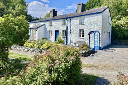
- Price
- £595,000
- Size
- 9.88 acres
Added on 02/09/2026House with Land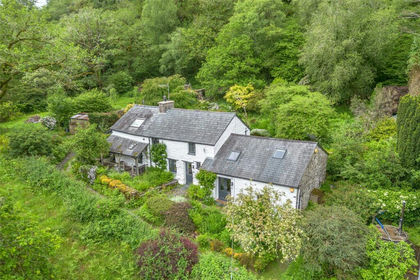
- Price
- £550,000
- Size
- 8.7 acres
Blaenau Ffestiniog, Gwynedd, LL41, Ffestiniog, Gwynedd LL41 Wales
Added on 26/06/2026House with Land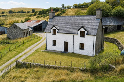
- Price
- Guide Price£500,000
- Size
- 8.54 acres
Added on 19/08/2026House with Land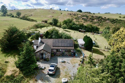
- Price
- £549,950
- Size
- 8 acres
Added on 12/02/2026House with Land
- Price
- Guide Price£600,000
- Size
- 5 acres
Old Mill Farmhouse, Trawsfynydd, Trawsfynydd, Gwynedd LL41 Wales
Added on 29/01/2026Holiday Let Property
- Price
- Offers in Region of£485,000
- Size
- 10.71 acres
Tyddyn Sais House and Buildings, Trawsfynydd (Lot 1), Trawsfynydd, Gwynedd LL41 Wales
Added on 29/01/2026Farmhouse
- Price
- £425,000
- Size
- 6.5 acres
Added on 01/08/2026House with Land
- Price
- £535,000
- Size
- 8.56 acres
Added on 28/07/2026House with Land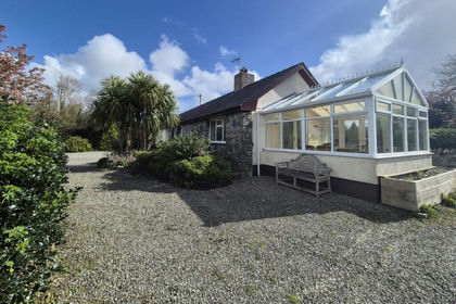
- Price
- Offers in Region of£599,000
- Size
- 5 acres
Lon Cae Metta, Llanrug, Gwynedd, LL55, Llanddeiniolen, Gwynedd LL55 Wales
Added on 19/05/2026House with Land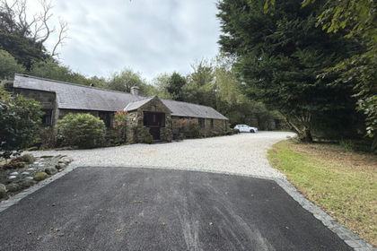
- Price
- £650,000
- Size
- 5 acres
Off B4418 Road, Nantlle, Gwynedd, LL54, Llanllyfni, Gwynedd LL54 Wales
Added on 19/04/2026House with Land