Seal Chart, Sevenoaks, Sevenoaks, TN15
- Land size
- 0.25 acres
- Bedrooms
- 6
- Bathrooms
- 4
Key Features
- VIEWING OF VIRTUAL TOUR HIGHLY RECOMMENDED!
- Detached and substantial barn conversion
- Six bedrooms, four bathrooms
- Extensive living accommodation
- Self-contained flat
- Recently refurbished, including new roof
- Characterful and charming
- Space for garage/car port and ample parking
- Courtyard style garden, but with an adaptable plot approaching 1/4 acre
- Oil central heating
Description
VIEWING OF VIRTUAL TOUR HIGHLY RECOMMENDED! Discover the charm of this exceptional large detached converted barn, nestled in the sought-after semi-rural area on the eastern outskirts of Sevenoaks. This remarkable property, attractively refurbished by its current owners since its conversion in the early 1970s, combines spacious living with rustic character. The total plot size extends to nearly 1/4 acre, and the property boasts five bedrooms, including two en-suites, and offers extensive living accommodation which is perfect for families or those who love to entertain. The standout features include a fabulous galleried landing and a stunning entrance hall. Additionally, the property includes a self-contained studio flat, ideal for guests. With a wealth of exposed timbers, every corner of this barn reflects its rich history and character. Featuring a charming courtyard garden and ample parking on the private driveway.
Entrance Hall
4.42m x 4.1m (14' 6" x 13' 5") Dramatic vaulted ceiling with a wealth of exposed timbers, double glazed windows to front, radiator, built in bar with space for fridge create a warm welcome to guests, turning galleried staircase to first floor, Oak flooring, central heating thermostat.
Living Room
4.83m x 4.1m (15' 10" x 13' 5") Inglenook style fireplace with Oak bressummer and canopy hood, double glazed windows to rear, and radiator, open to dining room.
Dining Room
4.83m x 3.34m (15' 10" x 10' 11") Double glazed windows to rear and French doors to garden, radiator, door to study.
Study
4.32m x 3.34m (14' 2" x 10' 11") Double glazed French doors to side courtyard, arrow slit window to front, exposed painted ragstone wall, radiator, door to dining room.
Kitchen
4.95m x 6.1m (16' 3" x 20' 0") Fitted with Shaker style wall and base units, worktops incorporating double sized stainless steel sink with mixer tap, space and plumbing for dishwasher, space for Range cooker, space for fridge/freezer, pull out larder cupboard, corner display unit, laminate wood floor, door to Annexe and Utility rooms.
Utility Rooms
Range of wall cupboards, Perrymatic oil fired boiler serving central heating and hot water, exposed painted ragstone wall, worktop, space and plumbing for washing machine and tumble dryer, quarry tiled floor, open to Boot Room which is open to Freezer Room and Cloakroom.
Cloakroom
Quarry tiled floor, low level W.C. stainless steel sink unit
Self Contained Annexe / Family Room
3.71m x 6.78m (12' 2" x 22' 3") Painted ragstone walls, exposed beams, radiators, double glazed window to side, fitted kitchen area with wall and base units, worktops, marble splashback, electric hob, integrated oven, space and plumbing for washing machine, wood effect flooring, double glazed French doors leading to rear lobby with door leading to small garden area.
En-suite Shower Room 1
2.64m x 1.53m (8' 8" x 5' 0") Enclosed shower cubicle with Aqualisa shower, vanity unit, low level W.C. redundant door to main house entrance hall, tiled walls and floor.
Galleried Landing
High level eaves storage, radiator, wealth of exposed timbers, doors to bedroom 1.
Principal Bedroom
4.15m x 4.9m (13' 7" x 16' 1") Partly vaulted ceiling, built in double shelved cupboard, exposed timbers, two double gazed windows to rear, built in shoe cupboard, radiator, door to ensuite.
En-suite
3.46m x 2.02m (11' 4" x 6' 8") Jacuzzi panelled bath, vanity unit, low level W.C., shaver point, eaves storage, exposed timbers, radiator, Grohe tower shower with shower head and body jets, splash back tiling, extractor fan.
Inner Landing
Airing cupboard housing hot water tank, access to loft
Bedroom 2
3.42m x 4.01m (11' 3" x 13' 2") Built in wardrobes, exposed timbers, double glazed window to side, radiator, door to ensuite.
En-suite Shower Room 2
1.71m x 1.66m (5' 7" x 5' 5") Large shower cubicle, corner wash hand basin, low level W.C., radiator, shaver point, localised tiling, exposed beams.
Bedroom 5
3.49m x 1.94m (11' 5" x 6' 4") 1.98m x 3.35m (6' 6" x 11' 0") Double glazed window to side, radiator, built in wardrobes.
Bathroom
2.63m x 1.57m (8' 8" x 5' 2") Panelled bath with mixer tap and hand held shower, pedestal wash hand basin, localised tiling, low level W.C., shaver point, extractor fan, radiator, wall mounted mirror.
Further Landing
Doors to bedrooms 3 and 4, storage.
Bedroom 3
3.34m x 3.55m (10' 11" x 11' 8") Double glazed window to side, two built in double wardrobes, exposed timbers.
Bedroom 4
3.46m x 2.96m (11' 4" x 9' 9") Double glazed window to side, partly dormered, radiator, built in double wardrobe.
The Courtyard
There is a courtyard to the side of the barn with outside water tap and lighting and power. The courtyard is enclosed by stables and outbuildings.
Stable 1
2.13m x 3.55m (7' 0" x 11' 8")
The stables make a great, versatile space for use as stables, store rooms, or have ample potential for further uses.
Stable 2
3.51m x 3.21m (11' 6" x 10' 6")
Stable 3
3.04m x 3.21m (10' 0" x 10' 6")
Stable 4
3.04m x 3.21m (10' 0" x 10' 6")
Car Port
Opening to front and opening to yard.
Garden
The garden is mainly to the front with an area also to side, secluded seating areas, array of shrubs and bushes. Long driveway approached via 5bar gate leading to parking and turning area. The total plot extends to close to 1/4 acre and presents the opportunity to adapt to ones needs. The garden is currently courtyard style to the side, but the stables could be demolished and parking area utilised as more garden. The property is set within a farming complex and there are farm buildings to rear.
Council Tax Band G approx. £3,948.77 2025/26
Private drainage system which is shared with neighbouring properties.
Map Location
Property details
- Tenure
- Freehold
- Council Tax Band
- G
- Date Posted
- 2026-02-07
Energy Performance Certificate
Energy Efficiency Rating
Based on UK Energy Performance Certificate standards (EU Directive 2002/91/EC)
Running costs are one side. Planning activity, flood history and ground risks for this location are in the full report.
Utilities & Restrictions
Utilities
- Electricity
- Mains
- Water
- Mains
- Heating
- Oil Heating
- Broadband
- Ask Agent
- Sewerage
- Ask Agent
Rights & Restrictions
- Public Rights of Way
- Ask Agent
- Private Rights of Way
- Ask Agent
- Listed Property
- Ask Agent
- Restrictions
- Ask Agent
Listed status, conservation areas and planning constraints for this location are in the full report.
Property Features
- Accessibility
- Ask Agent
- Parking
- Driveway
- Garden
- Garden
Beyond the particulars: planning activity, flood history, heritage and ground risks, checked for this exact spot.
Connectivity
Broadband
Fastest speed available at this postcode
80 Mbps
Superfast
Suitable for
- HD streaming
- Video calls
- Web & social
Mobile signal
Outdoor predictions; indoor signal depends on building materials.
Ofcom Connected Nations postcode-level predictions. Speeds and signal are modelled, not measured, and vary between addresses and providers.
Signal is the easy part. Planning activity, flood history and protected designations here are in the full report.
Nearest Schools
Primary
- Ightham Primary School0.9 milesOfsted: Outstanding
- Ages
- 4 to 11
- Pupils
- 206
- Type
- Academy converter
- St Lawrence Church of England Primary School1.1 milesOfsted: Good
- Ages
- 5 to 11
- Pupils
- 87
- Type
- Voluntary controlled school
- Faith
- Church of England
- Seal Church of England Primary School1.7 milesNo Ofsted rating
- Ages
- 2 to 11
- Pupils
- 317
- Type
- Academy converter
- Faith
- Church of England
- Kemsing Primary School1.9 milesNo Ofsted rating
- Ages
- 5 to 11
- Pupils
- 194
- Type
- Community school
- Borough Green Primary School2.3 milesOfsted: Good
- Ages
- 4 to 11
- Pupils
- 208
- Type
- Foundation school
Secondary
- Trinity School2.1 milesNo Ofsted rating
- Ages
- 11 to 19
- Pupils
- 1,153
- Type
- Free schools
- Faith
- Christian
- Wrotham School2.5 milesNo Ofsted rating
- Ages
- 11 to 18
- Pupils
- 1,054
- Type
- Academy converter
- Knole Academy3.2 milesNo Ofsted rating
- Ages
- 11 to 19
- Pupils
- 1,410
- Type
- Academy sponsor led
- Leigh Academy Hugh Christie5.2 milesOfsted: Requires improvement
- Ages
- 11 to 18
- Pupils
- 688
- Type
- Academy sponsor led
- Hadlow Rural Community School5.4 milesOfsted: Requires improvement
- Ages
- 11 to 16
- Pupils
- 377
- Type
- Free schools
Distances are straight-line from the advertised location. Source: the national school registers (DfE, Welsh Government, Scottish Government) and Ofsted.
Schools are just the start: sold prices nearby, planning activity and any flood history are in the full report.
Amenities
Supermarket
GP surgery
Pharmacy
Hospital
Straight-line distances from the advertised location. Sources: NHS records, Geolytix supermarket locations, OS Open Greenspace and the national trails registers.
The area stacks up? Now check the location itself: planning nearby, protected designations and past flooding.
Getting Around
Nearest station
Nearest bus stop
Typical drive times
Straight-line distances from the advertised location; drive times are typical free-flow times over OpenStreetMap road data, so allow more at peak. Public transport locations from DfT NaPTAN.
Easy to reach matters. So do planning activity, flood history and ground risks: all in the full report.
Flood Risk
From Environment Agency flood map open data, checked around the advertised map pin and allowing for the listed acreage where known. This summary comes from LandSale, the advertising platform, not from the listing agent, and is not part of the agent's particulars. Risk can vary across a single holding, so verify anything critical through your own searches before committing.
Rivers and the sea
Surface water
These bandings are the summary. Where this location sits on the flood maps, plus planning activity, heritage and ground risks, is in the full report.
Important notice: Information, maps and tags on this page are drawn from the advertising agent's marketing materials or generated automatically. LandSale has not verified them. Relying on these details is at your own risk, always carry out independent checks before committing to a purchase.
LandSale full disclaimer
Marketing information only - not formal particulars. The details on this website are provided for general guidance and do not constitute an offer or contract. Neither LandSale nor the advertising estate/land agent accepts responsibility for any inaccuracy.
1. Source of information
- Listing content: Core description, asking price, tenure, measurements, photographs and planning history originate from the marketing materials of the advertising estate or land agent. LandSale does not author this content and cannot guarantee its accuracy.
- Automated tags & categorisation: Property type, land-use class, acreage bands and similar labels may be applied by machine-learning models. They are intended as a helpful guide only and may not reflect the property's legal status or permitted use.
- Third-party & enriched data layers: Maps, boundary outlines, planning designations, soil reports, broadband coverage and other environmental or location-based insights are licensed from external suppliers. Such data are supplied “as is", may be incomplete or out of date and are subject to change without notice.
2. Verification required
Prospective purchasers must verify critical matters, including but not limited to planning permission, title boundaries, public rights of way, environmental constraints, acreage, services, access and VAT status, through their own inspections, specialist surveys, legal advisers and the selling agent before relying on the information or entering into any contract.
3. No warranty or liability
LandSale gives no warranty, express or implied, as to the accuracy, completeness or fitness for any particular purpose of the information displayed. LandSale shall not be liable for any loss, damage, cost or expense arising directly or indirectly from any use of or reliance on such information, save where liability may not be excluded by law.
4. Updates & feedback
If you believe any detail on this listing is inaccurate, please let us know. We will investigate and, where appropriate, update the listing or notify the agent.
© LandSale | Version 1.3 - August 2026
Listing agent
John Kingston Estate Agents, Sevenoaks
3B Dorset Street, Sevenoaks, TN13 1LL
View agent profileSimilar properties for sale
- Price
- Guide Price£890,000
- Size
- 2.98 acres
Added on 10/09/2026Equestrian property
- Price
- Guide Price£800,000
Added on 27/06/2026Barn Conversion
- Price
- Guide Price£1,195,000
Clenches Farm Road, Sevenoaks, Kent, TN13, Sevenoaks, Kent TN13 England
Added on 28/07/2026Barn Conversion
- Price
- Offers in Excess of£850,000
- Size
- 3.83 acres
Ashen Grove Road, Sevenoaks, TN15, West Kingsdown, Kent TN15 England
Added on 16/07/2026Distressed property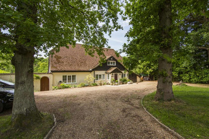
- Price
- £1,200,000
- Size
- 2 acres
Ashen Grove Road, Knatts Valley TN15, West Kingsdown, Kent TN15 England
Added on 04/07/2026House with Land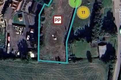
- Price
- Guide Price£1,200,000
Land East of Chirnside House, West Kingsdown, West Kingsdown, Kent TN15 England
Added on 17/07/2026Self Build Plot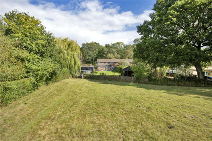
- Price
- Guide Price£985,000
- Size
- 1.6 acres
Grenadier, Riding Lane, Hildenborough, Kent, TN11, Hildenborough, Kent TN11 England
Added on 28/06/2026House with Land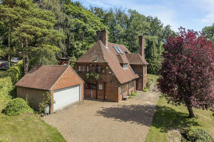
- Price
- Guide Price£1,200,000
- Size
- 1.5 acres
Botsom Lane, West Kingsdown, Sevenoaks, West Kingsdown, Kent TN15 England
Added on 08/07/2026House with Land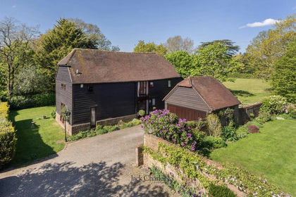
- Price
- Guide Price£1,150,000
Nizels Lane, Hildenborough, Tonbridge, Hildenborough, Kent TN11 England
Added on 01/05/2026Barn Conversion
- Price
- Guide Price£925,000
Swanton Road, West Peckham, Maidstone, Kent, ME18, West Peckham, Kent ME18 England
Added on 10/06/2026Barn Conversion