Wetherby Road, LS14
- Land size
- 70 acres
Description
BAY HORSE LANE & WETHERBY ROAD
SCARCROFT
EXPRESSIONS OF INTEREST INVITED
IN LOTS OR AS A WHOLE
4 BED FARMHOUSE & LODGE HOUSE both for refurbishment
Planning Consent for PROSPECTIVE LIVERY YARD
GRASS LAND - about 70 ACRES in total
Subject to pre-emption rights
COMMERCIAL & OUTBUILDINGS WITH REDEVELOPMENT OPPORTUNITIES
Probably likely of interest to those with equestrian pursuits in mind and or developers.
Viewing by appointment with the Agents
SUMMARY & SCHEDULE OF LOTS
LOT 1 - House & Outbuilding 0.18 acres
LOT 2 - The Lodge & Spinney 0.25 acres MARKETING ON HOLD
LOT 3 - Grass land with amenity features & 24 stable plans. 17.18 acres MARKETING ON HOLD
LOT 4 - Grass Land 51.17 acres
LOT 5 - Grass Paddock 1.74 acres
Total About 70 acres
While lotted to appeal to most parties, the owner welcomes the opportunity to consider various combinations or adjustments to lots to suit individual requirements.
GENERAL INFORMATION
SITUATION:
The property is located to the south and west of the well perceived village of Scarcroft, 7 miles north east of Leeds centre, in the "Golden Triangle". A few amenities are available within the village augmented by comprehensive services in Leeds and within the town of Wetherby.
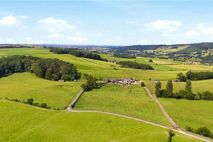
Generally, the location is typical of the countryside to the district with open landscape here having a level aspect interspersed with tree plantations and notably veteran trees adding significant character. Another feature is the well formed footpath east west from Wetherby Road to Bay Horse Lane commensurate for enjoyment of the area and the property for equestrian use.
LOCAL AUTHORITY:
District: Leeds City Council, Planning Functions:
SERVICES:
Generally: mains water, electricity 1 phase are connected to lot 1, oil to the kitchen Aga. Domestic drainage is to the septic tank and surface water to soak-away. Oil fired radiator central heating is provided in the house from a boiler within the outbuilding. No tests have been undertaken. No live service connections are available to the Lodge.
Mains water is connected field trough supply as found within the remaining lots.
EPC:
Full report available from the Agent. Rated E, potential C.
OUTGOINGS:
Main House: Council Tax Band: E. Buildings: nil (benefitting from agricultural relief)
PLANNING:
The property lies within the Leeds District and the area identified as 'Green Belt' and identified within 'Special Landscape Area' designation in saved elements of former Local plan. The successor LDF replacement plan is currently being resubmitted but not expected to make changes here.
The Farmhouse is understood to be subject to an agricultural occupancy condition. The traditional stone built storage buildings alongside may be adapted for residential subject to Planning consent.
The Lodge is anticipated to have a historic and current residential use permitted.
The proposed Stable Block off Bay Horse Lane has a planning consent for such use together with ancillary buildings under Decision No: 13/00371/EXT which has had a start recorded to provide for preserving the consent and for construction.
THE LAND:
The land area is classified as Grade 3 on the former MAFF identification plans and is versatile and has been used for intensive grass formerly being part of a dairy farm in recent times. The soil type is recorded as Dunkeswick, being deep loam.
The historic farm unit has also been mown and further supported sheep production and notably in recent times given over to operations as part of a horse livery enterprise.
TENURE:
Freehold.
FARM SUPPORT BPS: - The BPS entitlements are to be assigned to qualifying parties at the first available opportunity post completion to enable the acquirers to claim BPS in 2022, for an additional consideration of £100/ha or part of, plus VAT. The benefit of the BPS for 2021 is reserved.
RIGHTS & RESERVATIONS:
Access to the house is by way of the private shared access from the adopted Highway to the Wetherby Road. Road frontage is provided at the Bay Horse Lane end through the shared gated access. Rights of access for the grass lots 3 & 4 are to be reserved.
A public footpath extends along the Track bounding Lots 3 & 4.
SPORTING RIGHTS:
The shooting rights are in hand.
QUOTA:
No quotas apply.
VALUATION:
In addition to the consideration for the freehold, the parties shall pay for any growing crops on the land based on the cost of cultivations in accordance with C.A.A.V. costing schedule, and the amount expended in seeds, fertilisers and sprays applied as at the date of completion.
HOLDOVER:
None required.
MODE OF OFFERING:
Proposals will be considered for individual lots or combinations of lots or for the whole and are invited in writing.
VIEWING: By arrangement through the sole agents.
DIRECTIONS:
From the Leeds Outer Ring road in proceed up the A58, Wetherby Road and the house is located by the village entrance of Scarcroft on the left hand side at LS14 3HN. Bay Horse Lane is accessed off Ling Lane from within the village heading towards Shadwell or indeed from Main Street, Shadwell heading north from the village.
LOT 1 - Farm House A family house of sand stone under a stone slate roof in the vernacular, situated in a pleasant and convenient location for access to the city and beyond. In need of significant improvement, repairs and decorating following localized water damage to north aspect.
GROUND FLOOR
ENTRANCE HALL: Staircase to first floor with varnished treads.
KITCHEN: 5.20m. x 3.65m. fitted with an oil fired AGA and set in wood-effect wall and base units having laminated work surfaces, inset stainless steel sink unit with single drainer and monobloc tap. Built-in appliances comprise electric hob with solid hot plates and electric oven all as found (none tested or warranted). Tiled splash-backs. Space for washing machine and fridge freezer (appliances not included).
LOUNGE: 3.55m. x 3.60m having stone fireplace fitted with solid fuel grate.
LIVING ROOM: 2.55m. x 3.60m. having solid fuel grate with stone fireplace. T.V. aerial point.
UTILITY/OFFICE: Tiled floor.
FIRST FLOOR
LANDING: Having large 2-door fitted cupboard.
BEDROOM 1: 3.60m. x 3.55m. with window to the west.
BEDROOM 2: 3.70m. x 2.75m. with window to the south. Large walk-in wardrobe.
BEDROOM 3: 3.60m. x 2.30m. a large single room with window to south and providing through access to Bedroom 4.
BEDROOM 4: 3.30m x 2.10m
BATHROOM: Fitted with contemporary suite comprising panelled bath, washbasin and close-coupled w.c.
CENTRAL HEATING: Radiator central heating and domestic hot water from the oil fired AGA
OUTSIDE: A lawned garden is set out on the south or front of the property and the stoned driveway extends into the yard to the rear of the house with a large parking area giving access to an open front storage out building with annex and at the opposing side of the court yard, a former mistal can provide storage or both could be adapted for residential conversion subject planning approval.
STABLES: The existing stables complex and associated land is not included and is currently the subject of a planning application for residential conversion with details found under 18/05022/FU
SERVICES: Mains services of water and electricity are connected to the property. Foul drainage is to a septic tank. Heating is by the oil-fired Aga with a fuel storage tank.
LOT 2 - The Lodge: MARKETING ON HOLD With frontage to Bay Horse Lane: The stone built lodge house which has become derelict but originally had lounge, kitchen and bathroom with a bedroom and felt could be modestly extended within planning policy. It lies in an attractive tree copse with grand standard specimens but with space for parking and gardens. The lot is subject to pre-emption option.
LOT 3 - MARKETING ON HOLD Grass and amenity Land with access from the public Highway and extending in two enclosures to about 7.14 ha (17.18 acres), registered with the RLR and trees with a hardstanding and bounded by beech shelter belts, 0.12 acres, and with veteran standard trees all subject to tree preservation orders. Water available. It is subject to pre-emption option. This lot has the benefit of the extant planning consent for a replacement stable block (24 boxes) and ancillary accommodation granted originally under 13/00371/EXT and now with conditions discharged. A right of way is reserved along the track for the benefit of Lot 4.
LOT 4 - Grass RLR registered as grass and spinneys in all 22.31 ha (51.17acres) with access from the public Highway by way of the well made internal farm track well bounded and sheltered in parts by well formed amenity hedges. It is sold with the benefit of a right of way from the Wetherby Road to the east and Bay Horse Lane to the west. Water supply pipe and troughs as found to the various enclosures. 6 acres to the east side is subject to pre-emption option as identified on the plan thus netting the parcel to about 48 acres.
LOT 5 - Grass Land About 0.70 ha (1.74 acres) with access from the public Highway or by way of and with access off the farm track in a useful sized enclosure, temporarily subdivided and well bounded with hedge to the south and by a well formed stone wall to the road side. Within, a small area of tree planting has been undertaken and the proposal would be for the trees to be removed. It is sold with a right of way off the farm track to the northern boundary and a visibility splay is reserved and easements for services and a foul drainage for the house.
Map Location
Property details
- Tenure
- Ask Agent
- Council Tax Band
- Ask Agent
- Date Posted
- 2026-01-29
Utilities & Restrictions
Utilities
- Electricity
- Ask Agent
- Water
- Ask Agent
- Heating
- Ask Agent
- Broadband
- Ask Agent
- Sewerage
- Ask Agent
Rights & Restrictions
- Public Rights of Way
- Ask Agent
- Private Rights of Way
- Ask Agent
- Listed Property
- Ask Agent
- Restrictions
- Ask Agent
Listed status, conservation areas and planning constraints for this location are in the full report.
Property Features
- Accessibility
- Ask Agent
- Parking
- Parking Available
- Garden
- Garden
Beyond the particulars: planning activity, flood history, heritage and ground risks, checked for this exact spot.
Connectivity
Broadband
Fastest speed available at this postcode
950 Mbps
Superfast
Suitable for
- 4K streaming on every screen
- Full-time home working
- Online gaming & big downloads
Mobile signal
Predicted 4G and 5G signal; indoor signal depends on building materials.
Ofcom Connected Nations postcode-level predictions. Speeds and signal are modelled, not measured, and vary between addresses and providers.
Signal is the easy part. Planning activity, flood history and protected designations here are in the full report.
Nearest Schools
Primary
- Shadwell Primary School1.2 milesOfsted: Good *
- Ages
- 5 to 11
- Pupils
- 200
- Type
- Community school
- Thorner Church of England Primary School1.3 milesNo Ofsted rating
- Ages
- 4 to 11
- Pupils
- 182
- Type
- Academy converter
- Faith
- Church of England
- Bardsey Primary Academy1.7 milesNo Ofsted rating
- Ages
- 5 to 11
- Pupils
- 208
- Type
- Academy converter
- Fieldhead Carr Primary School1.7 milesNo Ofsted rating
- Ages
- 3 to 11
- Pupils
- 406
- Type
- Community school
- Whinmoor St Paul's Church of England Primary School1.9 milesOfsted: Good
- Ages
- 3 to 11
- Pupils
- 210
- Type
- Voluntary aided school
- Faith
- Church of England
Secondary
- Bishop Young Church of England Academy3.1 milesOfsted: Good
- Ages
- 11 to 16
- Pupils
- 777
- Type
- Academy sponsor led
- Faith
- Church of England
- Allerton Grange School3.3 milesOfsted: Good
- Ages
- 11 to 18
- Pupils
- 1,782
- Type
- Community school
- Leeds East Academy3.3 milesOfsted: Requires improvement *
- Ages
- 11 to 16
- Pupils
- 967
- Type
- Academy sponsor led
- John Smeaton Academy3.3 milesOfsted: Good
- Ages
- 11 to 18
- Pupils
- 677
- Type
- Academy sponsor led
- Roundhay School3.4 milesOfsted: Outstanding
- Ages
- 4 to 18
- Pupils
- 2,554
- Type
- Community school
* Latest graded judgement covers quality of education only; no overall grade was issued under the 2024-25 inspection framework.
Distances are straight-line from the advertised location. Source: the national school registers (DfE, Welsh Government, Scottish Government) and Ofsted.
Schools are just the start: sold prices nearby, planning activity and any flood history are in the full report.
Amenities
Supermarket
GP surgery
Pharmacy
Hospital
Green space
Straight-line distances from the advertised location. Sources: NHS records, Geolytix supermarket locations, OS Open Greenspace and the national trails registers.
The area stacks up? Now check the location itself: planning nearby, protected designations and past flooding.
Getting Around
Nearest station
Nearest bus stop
Typical drive times
Straight-line distances from the advertised location; drive times are typical free-flow times over OpenStreetMap road data, so allow more at peak. Public transport locations from DfT NaPTAN.
Easy to reach matters. So do planning activity, flood history and ground risks: all in the full report.
Flood Risk
Environment Agency open data, checked around the advertised map pin for the listed acreage. Long-term risk counts flood defences; the planning map's flood zones do not. The map pin for this listing marks the postcode area rather than the exact location, so these readings describe the surrounding area. Provided by LandSale, not the listing agent, and not part of the agent's particulars. Risk varies across a holding, so verify before committing.
Rivers and the sea
Planning map: Flood Zone 1.
Surface water
Not at the pin: mapped about 90 metres away.
These bandings are the summary. Where this location sits on the flood maps, plus planning activity, heritage and ground risks, is in the full report.
Important notice: Information, maps and tags on this page are drawn from the advertising agent's marketing materials or generated automatically. LandSale has not verified them. Relying on these details is at your own risk, always carry out independent checks before committing to a purchase.
LandSale full disclaimer
Marketing information only - not formal particulars. The details on this website are provided for general guidance and do not constitute an offer or contract. Neither LandSale nor the advertising estate/land agent accepts responsibility for any inaccuracy.
1. Source of information
- Listing content: Core description, asking price, tenure, measurements, photographs and planning history originate from the marketing materials of the advertising estate or land agent. LandSale does not author this content and cannot guarantee its accuracy.
- Automated tags & categorisation: Property type, land-use class, acreage bands and similar labels may be applied by machine-learning models. They are intended as a helpful guide only and may not reflect the property's legal status or permitted use.
- Third-party & enriched data layers: Maps, boundary outlines, planning designations, soil reports, broadband coverage and other environmental or location-based insights are licensed from external suppliers. Such data are supplied “as is", may be incomplete or out of date and are subject to change without notice.
2. Verification required
Prospective purchasers must verify critical matters, including but not limited to planning permission, title boundaries, public rights of way, environmental constraints, acreage, services, access and VAT status, through their own inspections, specialist surveys, legal advisers and the selling agent before relying on the information or entering into any contract.
3. No warranty or liability
LandSale gives no warranty, express or implied, as to the accuracy, completeness or fitness for any particular purpose of the information displayed. LandSale shall not be liable for any loss, damage, cost or expense arising directly or indirectly from any use of or reliance on such information, save where liability may not be excluded by law.
4. Updates & feedback
If you believe any detail on this listing is inaccurate, please let us know. We will investigate and, where appropriate, update the listing or notify the agent.
© LandSale | Version 1.3 - August 2026
Listing agent
Bartles Ltd, Tadcaster
1 Bridge Street, Tadcaster, LS24 9AW
Similar properties for sale
- Price
- Guide Price£1,395,000
- Size
- 48.92 acres
Farnley Lane, Farnley, Otley, North Yorkshire, LS21, Farnley, North Yorkshire LS21 England
Added on 25/08/2026House with Land
- Price
- Offers in Excess of£6,000,000
- Size
- 535.83 acres
Added on 10/06/2026Farmland
- Price
- Guide Price£1,500,000
- Size
- 96.93 acres
Copt Hewick, Ripon, North Yorkshire, HG4, Hutton Conyers, North Yorkshire YO7 England
Added on 24/08/2026Farm
- Price
- Guide Price£550,000
- Size
- 57.2 acres
Skirpenbeck, York, Skirpenbeck, East Riding of Yorkshire YO41 England
Added on 11/07/2026Farm
- Price
- Guide Price£1,750,000
- Size
- 125.76 acres
Pond Farm, Scawton, Btw Thirsk & Helmsley, Old Byland and Scawton, North Yorkshire YO7 England
Added on 18/09/2026Farm
- Price
- Guide Price£7,000,000
- Size
- 65.56 acres
Kirby Knowle Castle, Thirsk, North Yorkshire, YO7, Kirby Knowle, North Yorkshire YO7 England
Added on 29/01/2026Castle
- Price
- Guide Price£1,500,000
- Size
- 38.3 acres
Bilsdale, Helmsley, York, Hawnby, North Yorkshire YO62 England
Added on 29/01/2026Farm
- Price
- Guide Price£3,700,000
- Size
- 77.83 acres
Whins House, Sabden, Clitheroe, BB7, Sabden, Lancashire BB7 England
Added on 29/01/2026House with Land