Forget Me Not Farm, Earlswood, B94
- Land size
- 3 acres
- Bedrooms
- 5
- Bathrooms
- 4
Key Features
- NO UPWARD CHAIN
- Detached five-bedroom, four-bathroom period farmhouse (approx. 500 years old)
- Approximately three acres of highly productive chemical-free land forming a mature regenerative smallholding developed over 30+ years
- Historically part of a larger rural holding
- Extensive growing infrastructure including three polytunnels, greenhouse and productive kitchen garden
- Orchard with over 15 varieties of apples, pears and plums
- Large modern barn engineered to support a 40 m² solar array
- Potential to apply for rental of adjoining eight acres (separate agreement)
- Beautifully landscaped gardens with Swedish wood-fired hot tub
- Excellent access to Solihull, Birmingham, Warwickshire countryside and the Cotswolds
Description
No upward chain.
Forget Me Not Farm offers a rare opportunity to acquire a charming five-bedroom, 500-year-old farmhouse set within approximately three acres of beautifully established, highly productive land.
Carefully developed over more than three decades without chemicals or sprays, the land now forms a mature and balanced natural system, rich in biodiversity and capable of producing abundant, nutrient-dense food throughout the year.
Importantly, this is not a project or a blank canvas, but a functioning and thriving system already in place. The holding can be engaged with as much or as little as desired, offering both productivity and flexibility depending on lifestyle.
Set in attractive countryside close to the Warwickshire border, yet within easy reach of Solihull, Stratford-upon-Avon, the wider Midlands business centres and the Cotswolds, the property offers a compelling blend of rural tranquillity and accessibility.
**ENQUIRIES**
For all enquiries, viewing requests or to create your own listing please visit the Emoov website. If calling, please quote reference: S5830
A Home with a Heartbeat: The 500-Year-Old Farmhouse
A house that has sheltered families for half a millennium. Thick walls, hand-crafted beams and generous rooms shaped by centuries of living. Solid, warm and welcoming, with a sense of history you feel the moment you arrive.
The Home
Five double bedrooms, four bathrooms, open fires, a wine and root cellar, and wide, flexible living spaces. Well suited to family life, home working and hosting, with rooms that can adapt easily as needs change.
Resilience
Designed with independence in mind, with practical features already in place to support day-to-day living with ease. These include an original well, scope for rainwater harvesting, solar potential, an off-grid gas range, fires and access to free wood.
Soil and Stewardship
Soil like this is rare. Carefully stewarded for over 30 years using regenerative principles, the land supports abundant food production and biodiversity. Fertile, living soil developed without chemicals or sprays.
Growing Infrastructure
Three polytunnels, a greenhouse with established grapevine, raised beds and an orchard with over fifteen fruit varieties provide strong productive capacity and support a self-reliant lifestyle.
A Shared History
Historically the farmhouse and neighbouring converted barn formed part of a single holding before the titles were separated some 33 years ago. The relationship may appeal to buyers considering extended family or multi-generational living.
A Living System
Not a blank canvas, but a mature system already in place and easy to step into. Offering privacy, flexibility and year-round organic food production, the land reflects more than three decades of careful stewardship.
A Place to Live, Create and Carry Forward
Offering privacy, purpose and flexibility, the property suits family living, creative pursuits or retreat-style use. A rare combination of lifestyle and practicality, with the opportunity to carry something meaningful forward.
Setting and Location
Completely private and rural, yet superbly connected. Approximately four miles from Solihull and within easy reach of Birmingham, transport links and the airport. The Warwickshire countryside and Cotswolds are both within comfortable reach.
Viewing
Opportunities of this nature are rarely available, and viewings are by appointment.
Notes
• Freehold
• Council Tax Band G
• Private drainage
• Double glazing throughout
• Viewings by appointment
• Established regenerative land managed without chemicals for over 30 years
Disclaimer
These particulars are provided in good faith as a general guide. Measurements, floor plans, orientation and distances are approximate. They do not form part of any offer or contract and should not be relied upon as statements or representations of fact.
Map Location
Property details
- Tenure
- Freehold
- Council Tax Band
- G
- Date Posted
- 2026-01-29
Market Value Analysis
Compared with 1,032 Homes with Land listings in West Midlands (1+ acres).
Utilities & Restrictions
Utilities
- Electricity
- Ask Agent
- Water
- Ask Agent
- Heating
- Ask Agent
- Broadband
- Ask Agent
- Sewerage
- Ask Agent
Rights & Restrictions
- Public Rights of Way
- Ask Agent
- Private Rights of Way
- Ask Agent
- Listed Property
- Ask Agent
- Restrictions
- Ask Agent
Listed status, conservation areas and planning constraints for this location are in the full report.
Property Features
- Accessibility
- Ask Agent
- Parking
- Ask Agent
- Garden
- Garden
Beyond the particulars: planning activity, flood history, heritage and ground risks, checked for this exact spot.
Connectivity
Broadband
Fastest speed available at this postcode
22 Mbps
Standard (10-30 Mbps)
Suitable for
- Web & social
- Music streaming
- Standard video calls
Mobile signal
Predicted 4G and 5G signal; indoor signal depends on building materials.
Ofcom Connected Nations postcode-level predictions. Speeds and signal are modelled, not measured, and vary between addresses and providers.
Signal is the easy part. Planning activity, flood history and protected designations here are in the full report.
Nearest Schools
Primary
- St Patricks Church of England Primary Academy643 metresNo Ofsted rating
- Ages
- 3 to 11
- Pupils
- 226
- Type
- Academy converter
- Faith
- Church of England
- Cheswick Green Primary School857 metresNo Ofsted rating
- Ages
- 4 to 11
- Pupils
- 259
- Type
- Community school
- Dickens Heath Community Primary School1.1 milesOfsted report card · May 2026
- Ages
- 3 to 11
- Pupils
- 453
- Type
- Community school
- Tidbury Green School1.3 milesOfsted: Good
- Ages
- 2 to 11
- Pupils
- 483
- Type
- Community school
- Our Lady of the Wayside Catholic Primary School1.4 milesNo Ofsted rating
- Ages
- 3 to 11
- Pupils
- 444
- Type
- Academy converter
- Faith
- Roman Catholic
Secondary
- Light Hall School1.6 milesOfsted: Good
- Ages
- 11 to 18
- Pupils
- 1,037
- Type
- Academy converter
- Tudor Grange Academy, Solihull2.2 milesOfsted: Outstanding *
- Ages
- 11 to 18
- Pupils
- 1,730
- Type
- Academy converter
- Alderbrook School2.2 milesNo Ofsted rating
- Ages
- 11 to 18
- Pupils
- 1,701
- Type
- Academy converter
- St Peter's Catholic School2.4 milesOfsted: Outstanding *
- Ages
- 11 to 18
- Pupils
- 1,306
- Type
- Academy converter
- Faith
- Roman Catholic
- Woodrush High School2.6 milesNo Ofsted rating
- Ages
- 11 to 18
- Pupils
- 1,005
- Type
- Academy converter
* Latest graded judgement covers quality of education only; no overall grade was issued under the 2024-25 inspection framework.
Distances are straight-line from the advertised location. Source: the national school registers (DfE, Welsh Government, Scottish Government) and Ofsted.
Schools are just the start: sold prices nearby, planning activity and any flood history are in the full report.
Amenities
Supermarket
GP surgery
Pharmacy
Hospital
Green space
Straight-line distances from the advertised location. Sources: NHS records, Geolytix supermarket locations, OS Open Greenspace and the national trails registers.
The area stacks up? Now check the location itself: planning nearby, protected designations and past flooding.
Getting Around
Nearest station
Nearest bus stop
Typical drive times
Straight-line distances from the advertised location; drive times are typical free-flow times over OpenStreetMap road data, so allow more at peak. Public transport locations from DfT NaPTAN.
Easy to reach matters. So do planning activity, flood history and ground risks: all in the full report.
Flood Risk
Environment Agency open data, checked around the advertised map pin for the listed acreage. Long-term risk counts flood defences; the planning map's flood zones do not. The map pin for this listing marks the postcode area rather than the exact location, so these readings describe the surrounding area. Provided by LandSale, not the listing agent, and not part of the agent's particulars. Risk varies across a holding, so verify before committing.
Rivers and the sea
Not at the pin: mapped about 50 metres away.
Planning map: Flood Zone 3, about 50 metres away.
Surface water
Not at the pin: mapped about 30 metres away.
These bandings are the summary. Where this location sits on the flood maps, plus planning activity, heritage and ground risks, is in the full report.
Important notice: Information, maps and tags on this page are drawn from the advertising agent's marketing materials or generated automatically. LandSale has not verified them. Relying on these details is at your own risk, always carry out independent checks before committing to a purchase.
LandSale full disclaimer
Marketing information only - not formal particulars. The details on this website are provided for general guidance and do not constitute an offer or contract. Neither LandSale nor the advertising estate/land agent accepts responsibility for any inaccuracy.
1. Source of information
- Listing content: Core description, asking price, tenure, measurements, photographs and planning history originate from the marketing materials of the advertising estate or land agent. LandSale does not author this content and cannot guarantee its accuracy.
- Automated tags & categorisation: Property type, land-use class, acreage bands and similar labels may be applied by machine-learning models. They are intended as a helpful guide only and may not reflect the property's legal status or permitted use.
- Third-party & enriched data layers: Maps, boundary outlines, planning designations, soil reports, broadband coverage and other environmental or location-based insights are licensed from external suppliers. Such data are supplied “as is", may be incomplete or out of date and are subject to change without notice.
2. Verification required
Prospective purchasers must verify critical matters, including but not limited to planning permission, title boundaries, public rights of way, environmental constraints, acreage, services, access and VAT status, through their own inspections, specialist surveys, legal advisers and the selling agent before relying on the information or entering into any contract.
3. No warranty or liability
LandSale gives no warranty, express or implied, as to the accuracy, completeness or fitness for any particular purpose of the information displayed. LandSale shall not be liable for any loss, damage, cost or expense arising directly or indirectly from any use of or reliance on such information, save where liability may not be excluded by law.
4. Updates & feedback
If you believe any detail on this listing is inaccurate, please let us know. We will investigate and, where appropriate, update the listing or notify the agent.
© LandSale | Version 1.3 - August 2026
Listing agent
Emoov, Chelmsford
Marsh House Farm, Lower Burnham Road, Latchingdon Chelmsford, Essex CM3 6HQ
Contact Emoov, Chelmsford
Marsh House Farm, Lower Burnham Road, Latchingdon Chelmsford, Essex CM3 6HQ
View agent profileSimilar properties for sale
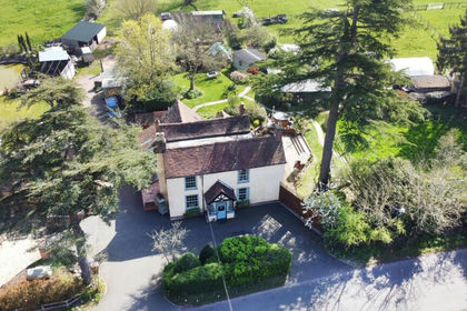
- Price
- £1,850,000
- Size
- 3 acres
Salter Street, Earlswood, Solihull, West Midlands, B94, Cheswick Green, Solihull B94 England
Added on 17/04/2026Farmhouse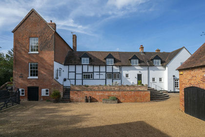
- Price
- Guide Price£1,495,000
- Size
- 4.41 acres
Nr Alcester, Warwickshire, Inkberrow, Worcestershire B49 England
Added on 06/10/2026House with Land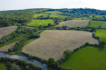
- Price
- Offers in Region of£1,200,000
- Size
- 10 acres
Atherstone Road, Nuneaton CV10, Hartshill, Warwickshire CV10 England
Added on 15/09/2026Smallholding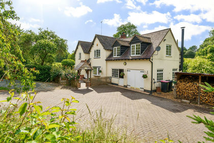
- Price
- Offers in Excess of£1,250,000
- Size
- 11 acres
Added on 08/10/2026Smallholding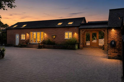
- Price
- Offers Over£1,250,000
- Size
- 3 acres
Hobby Hall Farm, Markfield, Markfield, Leicestershire LE67 England
Added on 05/07/2026Smallholding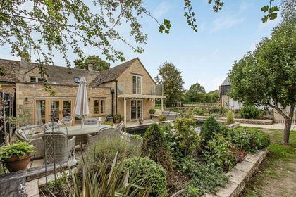
- Price
- £1,650,000
- Size
- 7 acres
Added on 05/10/2026House with Land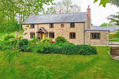
- Price
- £1,500,000
- Size
- 17 acres
Kingsland, Leominster, Herefordshire, HR6, Kingsland, Herefordshire, County of HR6 England
Added on 21/05/2026Farmhouse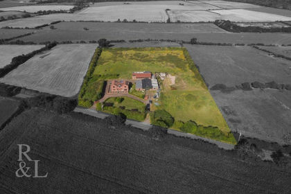
- Price
- £1,995,000
- Size
- 5.4 acres
Wysall Lane, Keyworth, Nottingham, Keyworth, Nottinghamshire NG12 England
Added on 29/01/2026Farmhouse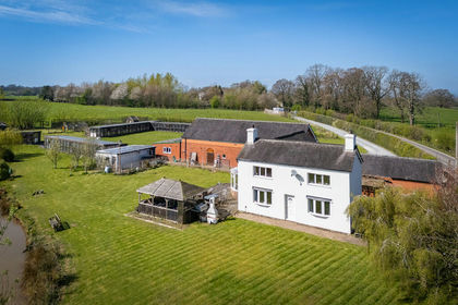
- Price
- Offers in Region of£1,350,000
- Size
- 8.22 acres
Added on 29/04/2026Farmhouse
- Price
- Offers in Region of£1,250,000
- Size
- 4 acres
Leonard Stanley Road, Frocester, Frocester, Gloucestershire GL10 England
Added on 25/05/2026Smallholding