Dunachton Road, Kincraig, Kingussie **REDUCED PRICE**
- Land size
- 1.25 acres
- Bedrooms
- 3
- Bathrooms
- 1
Key Features
- Attractive Three-Bedroom Detached Bungalow
- Peaceful rural location on Dunachton Road, Kincraig
- Generous garden grounds extending to approx. 1¼ acres
- Open-plan kitchen and dining area
- Double-aspect lounge with wood-burning stove
- New double-glazed windows and doors
- New UPVC fascias and soffits
- Private driveway and attached single garage
- Excellent potential for future development
Description
The Cairngorms National Park, known as the outdoor capital of the North, is in one of the most accessible parts of the Highlands having excellent links to both North and South via the A9 trunk road and the main line railway. The airport in Inverness is approximately 50 miles away, giving access to all the main cities and further afield. The surrounding countryside is a haven for wildlife, with red deer, badgers and squirrels amongst some of the abundant inhabitants. There is a wealth of excellent rural sporting facilities, such as stalking and grouse shooting, along with trout and salmon fishing. There are also many outdoor pursuits available within the National Park, such as hill walking, climbing, mountain biking, wind surfing, ski-ing and snowboarding. There are also a number of renowned golf courses in the area - including the championship Spey Valley course in Aviemore - all within stunning countryside settings.
Kincraig is a quiet Highland village, located just off the A9 Inverness to Perth trunk route approximately 6 miles from the busy tourist resort of Aviemore. It is located adjacent to the Insh Marshes National Nature Reserve – one of the most important wetlands in Europe - and the Loch Insh Watersports Centre, a popular holiday and sporting destination. The village itself has an extremely popular Italian café/gallery and a welcoming village pub. The Kincraig community also host a lot of events from its local village hall which can be used for parties and functions.
Sealladh Beann, Dunachton Road, Kincraig
Fixed Price £429,950
Nestled in a peaceful location on the outskirts of Kincraig, Sealladh Beann is an appealing three-bedroom detached bungalow set within generous garden grounds extending to approximately 1¼ acres. This well-proportioned home offers bright, flexible living space and excellent potential for further development, all within easy reach of the village amenities and the natural beauty of the Cairngorms National Park.
The property features an inviting open-plan kitchen and dining area, a double-aspect lounge with a wood-burning stove, and three comfortable double bedrooms. A well-appointed bathroom, additional WC, and a spacious laundry room provide convenience for family living.
Recent improvements include newly fitted double-glazed windows and doors, new UPVC roof fascias and soffits, and modern electric economy heating, ensuring low-maintenance comfort throughout.
OUTSIDE
Externally, the home is approached via a private driveway leading to an attached single garage, with the expansive garden grounds offering space for outdoor recreation, gardening, or potential future development (subject to the necessary consents). The setting combines privacy, outlook, and accessibility—making this an ideal Highland retreat or family home.
This stunning property is in immaculate condition and will be extremely popular due to its idyllic location set amongst the silver birch trees and its private garden grounds which benefit from an abundance of wildlife.
INCLUDED
Fitted floor coverings & light fittings. White goods will be included but no warranties will be given.
SERVICES
Mains electricity water & waste.
COUNCIL TAX
Currently Band F £3597.47 p.a. in (2026/27). Including water rates.
Discounts available for single occupancy.
HOME REPORT
The Home Report is available by using the following link:
- Ref:
- Postcode: PH21 1QE
- EPC rating: Band E
- Home Report Value: £450,000
PRICE
Fixed Price of £429,950. The seller reserves the right to accept or refuse a suitable offer at any time.
OFFERS
Formal offers should be submitted to our office in Aviemore.
VIEWING
Viewing is by appointment only through the Selling Agents.
CONSUMER PROTECTION FROM UNFAIR TRADING REGULATIONS 2008
The above particulars, although believed to be correct, are not guaranteed, and any measurements stated therein are approximate only. Purchasers should note that the Selling Agents have NOT tested any of the electrical items or mechanical equipment (e.g. oven, central heating system etc.) included in the sale. Any photographs used are purely illustrative and may demonstrate only the surrounds. They are NOT therefore to be taken as indicative of the extent of the property, or that the photographs are taken from within the boundaries of the property, or what is included in the sale.
Map Location
Property details
- Tenure
- Freehold
- Council Tax Band
- Ask Agent
- Date Posted
- 2026-01-29
Market Value Analysis
Compared with 432 Homes with Land listings in Scotland (1+ acres).
Energy Performance Certificate
Energy Efficiency Rating
Based on UK Energy Performance Certificate standards (EU Directive 2002/91/EC)
Running costs are one side. Planning activity, flood history and ground risks for this location are in the full report.
Utilities & Restrictions
Utilities
- Electricity
- Ask Agent
- Water
- Ask Agent
- Heating
- Ask Agent
- Broadband
- Ask Agent
- Sewerage
- Ask Agent
Rights & Restrictions
- Public Rights of Way
- Ask Agent
- Private Rights of Way
- Ask Agent
- Listed Property
- Ask Agent
- Restrictions
- Ask Agent
Listed status, conservation areas and planning constraints for this location are in the full report.
Property Features
- Accessibility
- Ask Agent
- Parking
- Parking Available
- Garden
- Garden
Beyond the particulars: planning activity, flood history, heritage and ground risks, checked for this exact spot.
Connectivity
Broadband
Fastest speed available at this postcode
10 Gbps
Gigabit full fibre
Suitable for
- 4K streaming on every screen
- Full-time home working
- Online gaming & big downloads
Mobile signal
Outdoor predictions; indoor signal depends on building materials.
Ofcom Connected Nations postcode-level predictions. Speeds and signal are modelled, not measured, and vary between addresses and providers.
Signal is the easy part. Planning activity, flood history and protected designations here are in the full report.
Nearest Schools
Primary
- Alvie Primary School0.7 miles
- Pupils
- 46
- Type
- Non-denominational
- Kingussie Primary School5.5 miles
- Pupils
- 67
- Type
- Non-denominational
- Aviemore Primary School6.4 miles
- Pupils
- 237
- Type
- Non-denominational
- Newtonmore Primary School8.1 miles
- Pupils
- 115
- Type
- Non-denominational
- Deshar Primary School10 miles
- Pupils
- 39
- Type
- Non-denominational
Secondary
- Kingussie High School5.4 miles
- Pupils
- 417
- Type
- Non-denominational
- Grantown Grammar School19 miles
- Pupils
- 362
- Type
- Non-denominational
- Inverness Royal Academy25 miles
- Pupils
- 1,351
- Type
- Non-denominational
- Glen Urquhart High School25 miles
- Pupils
- 209
- Type
- Non-denominational
- Culloden Academy26 miles
- Pupils
- 1,137
- Type
- Non-denominational
Distances are straight-line from the advertised location. Source: the national school registers (DfE, Welsh Government, Scottish Government) and Ofsted.
Schools are just the start: planning activity, heritage and any flood history here are in the full report.
Amenities
Supermarket
GP surgery
Pharmacy
Green space
Straight-line distances from the advertised location. Sources: NHS records, Geolytix supermarket locations, OS Open Greenspace and the national trails registers.
The area stacks up? Now check the location itself: planning nearby, protected designations and past flooding.
Getting Around
Nearest station
Nearest bus stop
Typical drive times
Straight-line distances from the advertised location; drive times are typical free-flow times over OpenStreetMap road data, so allow more at peak. Public transport locations from DfT NaPTAN.
Easy to reach matters. So do planning activity, flood history and ground risks: all in the full report.
Flood Risk
From SEPA flood map open data, checked around the advertised map pin and allowing for the listed acreage where known. This summary comes from LandSale, the advertising platform, not from the listing agent, and is not part of the agent's particulars. Risk can vary across a single holding, so verify anything critical through your own searches before committing.
Rivers and the sea
Surface water
The detail behind these bandings
The full report pinpoints where this location sits on the flood maps, and runs the deeper checks that usually only surface after an offer.
- Exact flood zones & annual chances (included in the full report)
- Any recorded past flooding (included in the full report)
- Planning activity nearby (included in the full report)
- Heritage & conservation (included in the full report)
- Protected nature designations (included in the full report)
- Ground risks (included in the full report)
£14.99 · one-off purchase
By LandSale, the platform. Not provided by the listing agent. Ready in about a minute.
Important notice: Information, maps and tags on this page are drawn from the advertising agent's marketing materials or generated automatically. LandSale has not verified them. Relying on these details is at your own risk, always carry out independent checks before committing to a purchase.
LandSale full disclaimer
Marketing information only - not formal particulars. The details on this website are provided for general guidance and do not constitute an offer or contract. Neither LandSale nor the advertising estate/land agent accepts responsibility for any inaccuracy.
1. Source of information
- Listing content: Core description, asking price, tenure, measurements, photographs and planning history originate from the marketing materials of the advertising estate or land agent. LandSale does not author this content and cannot guarantee its accuracy.
- Automated tags & categorisation: Property type, land-use class, acreage bands and similar labels may be applied by machine-learning models. They are intended as a helpful guide only and may not reflect the property's legal status or permitted use.
- Third-party & enriched data layers: Maps, boundary outlines, planning designations, soil reports, broadband coverage and other environmental or location-based insights are licensed from external suppliers. Such data are supplied “as is", may be incomplete or out of date and are subject to change without notice.
2. Verification required
Prospective purchasers must verify critical matters, including but not limited to planning permission, title boundaries, public rights of way, environmental constraints, acreage, services, access and VAT status, through their own inspections, specialist surveys, legal advisers and the selling agent before relying on the information or entering into any contract.
3. No warranty or liability
LandSale gives no warranty, express or implied, as to the accuracy, completeness or fitness for any particular purpose of the information displayed. LandSale shall not be liable for any loss, damage, cost or expense arising directly or indirectly from any use of or reliance on such information, save where liability may not be excluded by law.
4. Updates & feedback
If you believe any detail on this listing is inaccurate, please let us know. We will investigate and, where appropriate, update the listing or notify the agent.
© LandSale | Version 1.3 - August 2026
Listing agent
Caledonia Estate Agency, Aviemore
Ghuilbin House Grampian Road, Inverness-shire, Aviemore, PH22 1RH
View agent profileSimilar properties for sale
- Price
- Offers Over£485,000
- Size
- 1 acres
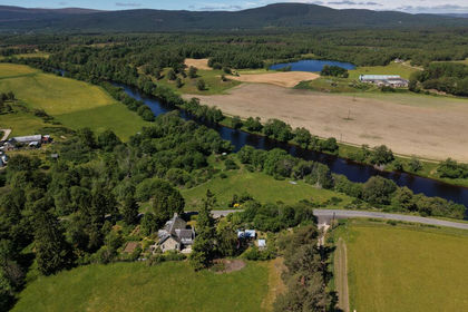
Kincardine, Boat of Garten, Moray West, Nairn and Strathspey, Highland PH24 Scotland
Added on 13/08/2026House with Land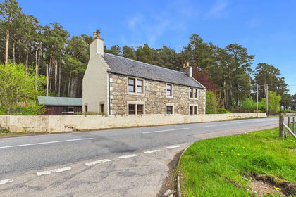
- Price
- Offers Over£350,000
- Size
- 1 acres
Duthil, Carrbridge, Moray West, Nairn and Strathspey, Highland PH23 Scotland
Added on 23/05/2026House with Land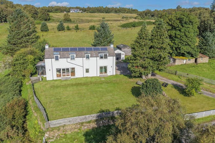
- Price
- Offers Over£475,000
- Size
- 2.5 acres
Added on 28/08/2026House with Land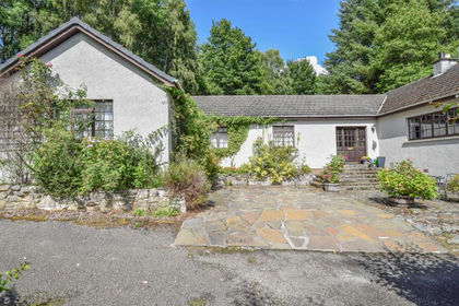
- Price
- Offers Over£395,000
- Size
- 3 acres
Cul-A-Mhuilinn, Milton, Drumnadrochit, Inverness, Skye and West Ross-shire, Highland IV63 Scotland
Added on 29/01/2026House with Land
- Price
- Offers Over£430,000
- Size
- 2.8 acres
Muckle Lyne, Nairn, IV12, Moray West, Nairn and Strathspey, Highland IV12 Scotland
Added on 11/05/2026Homestead
- Price
- Fixed Price£500,000
- Size
- 3 acres
Kiltarlity, Beauly, Caithness, Sutherland and Easter Ross, Highland IV4 Scotland
Added on 01/05/2026House with Land
- Price
- Offers Over£450,000
- Size
- 2.5 acres
Auchterawe, Fort Augustus, PH32, Inverness, Skye and West Ross-shire, Highland PH32 Scotland
Added on 05/07/2026House with Land
- Price
- Fixed Price£499,000
- Size
- 2 acres
Bluebell House, Breakachy, Beauly, IV4, Caithness, Sutherland and Easter Ross, Highland IV4 Scotland
Added on 21/07/2026House with Land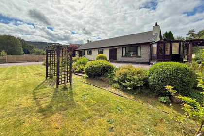
- Price
- Guide Price£420,000
- Size
- 1.3 acres
Lismore House, Invergarry, PH35, Inverness, Skye and West Ross-shire, Highland PH35 Scotland
Added on 29/01/2026House with Land
- Price
- Offers Over£335,000
- Size
- 8.06 acres
Added on 24/08/2026House with Land