Syke Side House, Soulby, Kirkby Stephen, Cumbria
- Land size
- 2.86 acres
- Bedrooms
- 5
- Bathrooms
- 2
Key Features
- Peaceful & Private Setting Surrounded by Farmland
- Driveway & Ample Parking
- Landscaped Grounds with Vegetable Garden, Polytunnel, Orchard & Woodlands
- Views to the Pennines, Stainmore & Mallerstang Edge
- Outbuilding with Potential
- Approximately 2.86 Acres in All
Description
Accommodation in Brief
Lower Ground Floor
Cellar
Ground Floor
Entrance Hallway | Sitting Room | Living Room | Office/Snug | WC | Kitchen/Diner | Utility Room
First Floor
Three Double Bedrooms | Library | Office | Family Bathroom
Second Floor
Double Bedroom with En-Suite | Double Bedroom | Storage Room
Externally
Driveway with Ample Parking | Gardens | Vegetable Garden | Orchard | Approximately 2.86 Acres in All
The Property
Approached along a private lane on the edge of the village of Soulby, Syke Side House is a distinguished early Victorian farmhouse built in 1850, constructed in solid stone with a slate roof and thick walls that provide natural insulation. The house combines original period features with versatile living spaces and is set within a total plot of approximately 2.86 acres comprising gardens, orchard and newly established woodland. From its south-facing frontage to its far-reaching views over the Pennines, Stainmore and Mallerstang Edge, the setting is one of seclusion, privacy and unspoilt rural character.
The entrance hall, laid with original flagstones and framed by a stained-glass window above the front door, sets the tone for the home’s enduring character. Two generous reception rooms sit to either side, both with high ceilings, deep skirting boards and woodburning stoves. One is currently styled as a sitting room but could equally serve as a dining room, while the other is a more formal living room. A snug/office provides a versatile additional reception space, suited to use as a study, work-from-home environment or informal family room. Its adaptable nature adds flexibility to the ground floor layout, providing a quieter retreat alongside the principal reception rooms.
The kitchen diner is a warm and characterful space, fitted with handmade oak cabinetry, a Belfast sink, tiled splashbacks and ceiling beams. At its heart sits a four-oven oil-fired Aga, the unmistakable focal point of this traditional family kitchen. A practical utility room, downstairs WC and access to a cellar with original stone shelving complete the ground floor.
The first floor is arranged around a wide, light-filled landing. Here there are three double bedrooms and a library, the latter offering a peaceful and versatile space that could readily be converted back into a bedroom if required. Two feature original fireplaces, and all enjoy views across the gardens and surrounding farmland. The family bathroom is a generously proportioned space, with a freestanding roll-top bath, separate shower enclosure, timber floorboards and an original fireplace that enhances its period charm. An additional office space offers flexibility for home working or study.
The second floor provides two large bedrooms, one with en-suite bathroom, together with extensive storage and scope for further adaptation. These rooms lend themselves equally well to guest accommodation, independent living for older children or a dedicated leisure space.
Externally
The house sits behind a gated gravelled approach with parking and turning space. A patio terrace at the front provides an inviting spot for al fresco dining, framed by lawns, several trees including an established Bramley apple tree.
To the side lies a productive vegetable garden with raised beds and a polytunnel, while beyond is a separate orchard with apple, pear, plum and damson trees.
The whole plot measures approximately 2.86 acres and has been thoughtfully landscaped to create a remarkable private woodland, with over 3,000 trees and hedges forming avenues, clearings and seating areas that capture sunlight at different times of day. The planting includes oak, chestnut, maple, alder, birch and ornamental cherry, interspersed with fruiting trees and soft fruit bushes. Pathways weave through glades and open to long views of the surrounding fells, reinforcing the sense of privacy. With water and electricity already in place, the woodland also offers potential for business opportunities such as glamping pods, shepherd huts or similar (subject to consents).
A three-bay wooden outbuilding provides useful storage and potential for stabling or workshop use. The whole is bordered by farmland, ensuring uninterrupted views and a high degree of seclusion, while still being only a short distance from the amenities of Kirkby Stephen.
Local Information
Soulby is a peaceful village just outside Kirkby Stephen in Cumbria, set amidst the scenic landscape of the Upper Eden Valley. Surrounded by rolling countryside, it offers easy access to both the Yorkshire Dales and Lake District National Parks, with nearby opportunities for walking, cycling and fishing, as well as a range of historic sites and nature reserves.
Local amenities are available in Kirkby Stephen, approximately two miles from Soulby. This traditional market town provides a good selection of shops, cafés, pubs, a supermarket, healthcare services, and both primary and secondary schools. It also hosts a weekly market and serves as a gateway to walking routes and local heritage attractions.
Soulby falls within the catchment area for Kirkby Stephen Primary School, which serves ages 3–11. Older pupils typically attend Kirkby Stephen Grammar School, a small 11–18 comprehensive academy with sixth form, with both schools rated 'Good'. Additional primary options nearby include Brough Community Primary School and Warcop CofE Primary.
For the commuter, Kirkby Stephen’s railway station is located approximately 1.5 miles to the south-west, on the scenic Settle–Carlisle line. It offers regular Northern services to Leeds and Carlisle. A limited Western Dales community bus connects the station and town, with taxis also available by advance booking.
Approximate Mileages
Soulby 1.1 miles | Kirby Stephen 2.9 miles | Brough 5.7 miles | Appleby-in-Westmorland 8.2 miles | Penrith 21.8 miles | Kendal 25.6 miles | Carlisle 42.1 miles
Services
Syke Side House is connected to mains electricity and water. Heating is provided by an oil-fired central heating system, together with an oil-fired four-oven AGA in the kitchen. Drainage is to a private septic tank.
Tenure
Freehold
Council Tax
Band E
Wayleaves, Easements & Rights of Way
The property is being sold subject to all existing wayleaves, easements and rights of way, whether or not specified within the sales particulars.
Agents Note to Purchasers
We strive to ensure all property details are accurate, however, they are not to be relied upon as statements of representation or fact and do not constitute or form part of an offer or any contract. All measurements and floor plans have been prepared as a guide only. All services, systems and appliances listed in the details have not been tested by us and no guarantee is given to their operating ability or efficiency. Please be advised that some information may be awaiting vendor approval.
Submitting an Offer
Please note that all offers will require financial verification including mortgage agreement in principle, proof of deposit funds, proof of available cash and full chain details including selling agents and solicitors down the chain. To comply with Money Laundering Regulations, we require proof of identification from all buyers before acceptance letters are sent and solicitors can be instructed.
Disclaimer
The information displayed about this property comprises a property advertisement. Finest Properties strives to ensure all details are accurate; however, they do not constitute property particulars and should not be relied upon as statements of fact or representation. All information is provided and maintained by Finest Properties.
EPC Rating: E
Map Location
Property details
- Tenure
- Freehold
- Council Tax Band
- E
- Date Posted
- 2026-01-29
Market Value Analysis
Compared with 779 Homes with Land listings in North West England (1+ acres).
Energy Performance Certificate
Energy Efficiency Rating
Based on UK Energy Performance Certificate standards (EU Directive 2002/91/EC)
Running costs are one side. Planning activity, flood history and ground risks for this location are in the full report.
Utilities & Restrictions
Utilities
- Electricity
- Mains
- Water
- Mains
- Heating
- Oil Heating
- Broadband
- Standard Copper (ADSL)
- Sewerage
- Septic Tank / Private
Rights & Restrictions
- Public Rights of Way
- Yes
- Private Rights of Way
- Yes
- Listed Property
- Ask Agent
- Restrictions
- Ask Agent
Listed status, conservation areas and planning constraints for this location are in the full report.
Property Features
- Accessibility
- Ask Agent
- Parking
- Parking Available
- Garden
- Private Garden
Beyond the particulars: planning activity, flood history, heritage and ground risks, checked for this exact spot.
Connectivity
Broadband
Fastest speed available at this postcode
80 Mbps
Superfast
Suitable for
- HD streaming
- Video calls
- Web & social
Mobile signal
Predicted 4G and 5G signal; indoor signal depends on building materials.
Ofcom Connected Nations postcode-level predictions. Speeds and signal are modelled, not measured, and vary between addresses and providers.
Signal is the easy part. Planning activity, flood history and protected designations here are in the full report.
Nearest Schools
Primary
- Warcop CofE Primary School2.3 milesNo Ofsted rating
- Ages
- 3 to 11
- Pupils
- 85
- Type
- Voluntary aided school
- Faith
- Church of England
- Kirkby Stephen Primary School2.8 milesNo Ofsted rating
- Ages
- 3 to 11
- Pupils
- 189
- Type
- Community school
- Brough Community Primary School3.2 milesOfsted: Good
- Ages
- 4 to 11
- Pupils
- 73
- Type
- Community school
- Asby Endowed School4.2 milesNo Ofsted rating
- Ages
- 4 to 11
- Pupils
- 20
- Type
- Voluntary controlled school
- Appleby Primary School6.6 milesOfsted: Good
- Ages
- 3 to 11
- Pupils
- 163
- Type
- Foundation school
Secondary
- Kirkby Stephen Grammar School2.5 milesOfsted: Good
- Ages
- 11 to 18
- Pupils
- 377
- Type
- Academy converter
- Appleby Grammar School7 milesOfsted report card · May 2026
- Ages
- 11 to 18
- Pupils
- 357
- Type
- Academy converter
- Settlebeck School14 milesOfsted: Good *
- Ages
- 11 to 16
- Pupils
- 203
- Type
- Academy converter
- The Queen Katherine School18 milesOfsted report card · May 2026
- Ages
- 11 to 19
- Pupils
- 910
- Type
- Academy converter
- Ullswater Community College18 milesOfsted: Good
- Ages
- 11 to 18
- Pupils
- 1,520
- Type
- Foundation school
* Latest graded judgement covers quality of education only; no overall grade was issued under the 2024-25 inspection framework.
Distances are straight-line from the advertised location. Source: the national school registers (DfE, Welsh Government, Scottish Government) and Ofsted.
Schools are just the start: sold prices nearby, planning activity and any flood history are in the full report.
Amenities
Supermarket
GP surgery
Pharmacy
Hospital
Green space
Straight-line distances from the advertised location. Sources: NHS records, Geolytix supermarket locations, OS Open Greenspace and the national trails registers.
The area stacks up? Now check the location itself: planning nearby, protected designations and past flooding.
Getting Around
Nearest station
Nearest bus stop
Typical drive times
Straight-line distances from the advertised location; drive times are typical free-flow times over OpenStreetMap road data, so allow more at peak. Public transport locations from DfT NaPTAN.
Easy to reach matters. So do planning activity, flood history and ground risks: all in the full report.
Flood Risk
Environment Agency open data, checked around the advertised map pin for the listed acreage. Long-term risk counts flood defences; the planning map's flood zones do not. Provided by LandSale, not the listing agent, and not part of the agent's particulars. Risk varies across a holding, so verify before committing.
Rivers and the sea
Planning map: Flood Zone 3, about 20 metres away.
Surface water
Not at the pin: mapped about 40 metres away.
These bandings are the summary. Where this location sits on the flood maps, plus planning activity, heritage and ground risks, is in the full report.
Important notice: Information, maps and tags on this page are drawn from the advertising agent's marketing materials or generated automatically. LandSale has not verified them. Relying on these details is at your own risk, always carry out independent checks before committing to a purchase.
LandSale full disclaimer
Marketing information only - not formal particulars. The details on this website are provided for general guidance and do not constitute an offer or contract. Neither LandSale nor the advertising estate/land agent accepts responsibility for any inaccuracy.
1. Source of information
- Listing content: Core description, asking price, tenure, measurements, photographs and planning history originate from the marketing materials of the advertising estate or land agent. LandSale does not author this content and cannot guarantee its accuracy.
- Automated tags & categorisation: Property type, land-use class, acreage bands and similar labels may be applied by machine-learning models. They are intended as a helpful guide only and may not reflect the property's legal status or permitted use.
- Third-party & enriched data layers: Maps, boundary outlines, planning designations, soil reports, broadband coverage and other environmental or location-based insights are licensed from external suppliers. Such data are supplied “as is", may be incomplete or out of date and are subject to change without notice.
2. Verification required
Prospective purchasers must verify critical matters, including but not limited to planning permission, title boundaries, public rights of way, environmental constraints, acreage, services, access and VAT status, through their own inspections, specialist surveys, legal advisers and the selling agent before relying on the information or entering into any contract.
3. No warranty or liability
LandSale gives no warranty, express or implied, as to the accuracy, completeness or fitness for any particular purpose of the information displayed. LandSale shall not be liable for any loss, damage, cost or expense arising directly or indirectly from any use of or reliance on such information, save where liability may not be excluded by law.
4. Updates & feedback
If you believe any detail on this listing is inaccurate, please let us know. We will investigate and, where appropriate, update the listing or notify the agent.
© LandSale | Version 1.3 - August 2026
Similar properties for sale
- Price
- £800,000
- Size
- 6.64 acres
Soulby, Kirkby Stephen, Cumbria, CA17, Soulby, Westmorland and Furness CA17 England
Added on 29/01/2026House with Land
- Price
- £825,000
- Size
- 1 acres
Old Vicarage Kirkby Stephen, Soulby, CA17, Soulby, Westmorland and Furness CA17 England
Added on 19/08/2026House with Land
- Price
- Guide Price£690,000
- Size
- 1.65 acres
Rectory Farm Bungalow, Ormside, Ormside, Westmorland and Furness CA16 England
Added on 23/05/2026House with Land
- Price
- £695,000
- Size
- 1 acres
Ravenstonedale, Kirkby Stephen, Ravenstonedale, Westmorland and Furness CA17 England
Added on 29/09/2026House with Land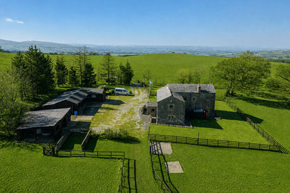
- Price
- Guide Price£695,000
- Size
- 7 acres
Mousegill, Barras, Stainmore, Westmorland and Furness CA17 England
Added on 29/01/2026Barn Conversion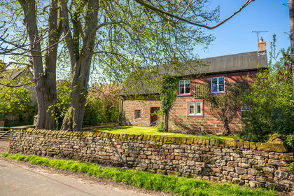
- Price
- £699,999
- Size
- 15 acres
Ivy House, Brampton, Appleby-in-Westmorland, Long Marton, Westmorland and Furness CA16 England
Added on 20/07/2026Equestrian property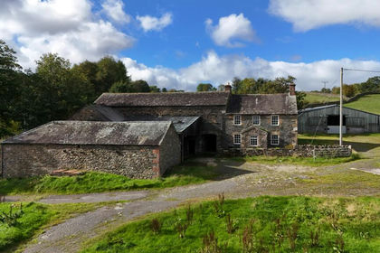
- Price
- £575,000
- Size
- 2.06 acres
Wood Foot, Askham, Westmorland And Furness, Bampton, Westmorland and Furness CA10 England
Added on 14/10/2026Smallholding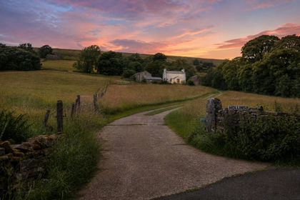
- Price
- £800,000
- Size
- 2 acres
Hollins, Cowgill, Sedbergh, LA10, Dent, Westmorland and Furness LA10 England
Added on 23/07/2026House with Land
- Price
- £850,000
- Size
- 6.59 acres
Combe House - Lot 1, Gawthrop, Sedbergh, Cumbria, Dent, Westmorland and Furness LA10 England
Added on 02/10/2026House with Land
- Price
- Offers in Region of£875,000
- Size
- 14.59 acres
Dent, Sedbergh, Cumbria, Dent, Westmorland and Furness LA10 England
Added on 28/07/2026Agricultural Land