Far Bank Farm, Waberthwaite, LA19
- Land size
- 87.77 acres
- Bedrooms
- 3
Description
A rare opportunity has arisen to purchase Far Bank Farm, located between the Corney Fells and the Irish Sea, in the Lake District National Park with stunning views. The farm is ring-fenced and extends to a total of 87.77 Acres (35.52ha).
The farmhouse is traditional in style and has four bedrooms, three reception rooms, attached barns and Agricultural buildings.
For Sale by Private Treaty as a Whole
Guide Price: £800,000
Farmhouse and steading 0.45ha (1.11 Acres)
Far bank farmhouse is a traditional stone-built property with rendered elevations under a slate roof, the accommodation is over two floors and extends to approx. 1,551 Ft2 (144m2).
Fixtures and Fittings in the Farmhouse:
The farmhouse has been partially renovated, including re-wring, UPVC double glazing, oil fired central heating system with some re-plastered walls. The property is ready to complete to individual taste.
Services
BT telephone line connected. Water and electricity are via a mains supply. Central heating and hot water are via an oil-based system. Septic Tank Drainage.
Council Tax
Far Bank Farmhouse has been placed in band ‘D’ by Cumberland Council.
Energy Performance Certificate (EPC):
The farmhouse EPC ratings TBC, full copies of the EPC are available from the agent on request.
Farm buildings
The farm buildings at Far Bank Farm are a mixture of traditional and modern, comprising:
- Attached traditional lofted ‘L’ shaped barn with side extension, constructed from solid stone under a twin pitched slated roof. GEA approx. 241m2
- Attached traditional byre of similar construction, GEA approx. 24m2
- Former milking parlour, constructed of concrete block with pitched cement fibre roof, with tank room extension. GEA approx. 110m2.
- Former cubicle shed, with livestock accommodation and feed passage, constructed of timber frame and timber clad under a large span box profile pitched roof. GEA approx. 334m2.
- Dutch barn, metal framed construction with further concrete block extensions with box profile roof. GEA approx. 95m2.
- Mono pitched shed of steel portal frame with concrete block walls. GEA approx. 103m2.
- Steel portal framed livestock/general storage shed with dwarf block walls with timber space boarding under a twin pitched box profile roof. GEA approx. 121m2.
Development Potential
The farmhouse is connected to a range of traditional stone barns, with a GEA of 265m2, these buildings provide an opportunity to develop the property for additional accommodation or a separate annex/dwelling, subject to necessary permissions.
35.52ha (87.77 Acres) of agricultural land
The land extends in total to Approx. 87.77 Acres (35.52ha) and comprises a ring-fenced block of permanent pasture which is all mainly suitable for grazing and mowing. The land is gently undulating around the steading and in a westerly aspect and range in height above sea level from 50m to 120m. rising to the southeast the land then levels out into interlinking fields of good grazing and mowing land.
The land is serviced by a mains and natural water supplies. The boundaries are predominantly of post and wire netting fencing and drystone walls with some hedgerows and stone-faced banks.
Tenure and Title:
The property has freehold title, and vacant possession will be given on completion.
The following affect the property:
There is a public footpath through the farm in a north to south direction.
The property is sold subject to all existing burdens (covenants, wayleaves, rights of way, easements, quasi-easements, rights of access, ancient monuments, etc.) whether public or private and whether constituted in the title deeds or not. The purchasers and are advised to contact the Vendor’s solicitor in order to do so.
Water Supply:
The land is served by Mains water troughs and natural water.
Basic Payment Scheme:
Entitlements are retained by the vendor. There are no entitlements for sale either with the land or separately.
Boundaries:
Responsibility for the maintenance of boundaries is indicated by inward facing ‘T’ marks on the Sale Plan. Where no mark is shown no further information is available.
Method of Sale
The property is offered for sale by Private Treaty as a whole. The Vendor reserves the right to amend these particulars, not to accept any offer received or to withdraw the property from sale at any time.
Offers should be submitted to: Mitchells Land Agency, Lakeland Business Centre, Cockermouth, Cumbria CA13 0QQ. A closing date for offers may be fixed, and prospective purchasers are advised to register their interest with the selling Agents following an inspection
Environment:
In so far as the Vendor is aware, the property is not affected by any environmental, historical, archaeological or other statutory designation. The farm is located in the Lake District National Park. In so far as the Vendor is aware, the property is not affected by any other, historical, archaeological or other statutory designation.
The land is not subject to any Agri-environment scheme obligations or restrictions which could affect agricultural operations or future land use. Therefore, providing the purchaser with flexibility for the future management of the land or agricultural enterprise. If you wish to discuss Agri-environment scheme or grant options available for this land, please contact a member of our Farm & Environmental Advisory team.
Our Farm & Environmental Advisory team can transfer and register land through the Rural Payments Agency for you, please contact them to discuss this request further. Sandy Brown | | or Kirsten Evans | |
Money Laundering Regulations:
As part of the Money Laundering Regulations relating to the sale of property, we, as selling agents are obliged to carry out ‘Customer Due Diligence’ checks on potential purchasers prior to a transaction being completed. We are therefore bound by law to ensure we have appropriate identification of purchasers. Please be aware that we will require the purchaser(s) to provide suitable identification to us prior to completion.
Value Added Tax (VAT):
VAT will not be charged on the sale.
Ingoings/Outgoings:
There are no ingoings or outgoings.
Date of Preparation:
December 2025.
Location
What3Words: hindered.seagulls.save
Viewing
Strictly by appointment with the selling agent: Mitchells Land Agency | Telephone |
Vendors Solicitor
TBC
Sporting and Mineral Rights
Insofar as they are owned the mineral rights and the sporting rights to the property are included in the sale.
Roof type: Slate tiles.
Flooded in the last 5 years: No.
Construction materials used: Brick and block.
Water source: Direct mains water.
Electricity source: National Grid.
Sewerage arrangements: Septic Tank.
Heating Supply: Oil central heating.
Does the property have required access (easements, servitudes, or wayleaves)?
Yes.
Do any public rights of way affect your your property or its grounds?
Yes.
Parking Availability: Yes.
Map Location
Property details
- Tenure
- Freehold
- Council Tax Band
- D
- Date Posted
- 2026-01-29
Market Value Analysis
Compared with 26 Farms & Smallholdings listings in North West England (75+ acres).
Energy Performance Certificate
Energy Efficiency Rating
Based on UK Energy Performance Certificate standards (EU Directive 2002/91/EC)
Running costs are one side. Planning activity, flood history and ground risks for this location are in the full report.
Utilities & Restrictions
Utilities
- Electricity
- Mains
- Water
- Mains
- Heating
- Ask Agent
- Broadband
- No Internet Connection
- Sewerage
- Septic Tank / Private
Rights & Restrictions
- Public Rights of Way
- Yes
- Private Rights of Way
- Yes
- Listed Property
- Ask Agent
- Restrictions
- Ask Agent
Listed status, conservation areas and planning constraints for this location are in the full report.
Property Features
- Accessibility
- Ask Agent
- Parking
- Parking Available
- Garden
- Garden
Beyond the particulars: planning activity, flood history, heritage and ground risks, checked for this exact spot.
Connectivity
Broadband
Fastest speed available at this postcode
80 Mbps
Superfast · available to 86% of premises
Suitable for
- HD streaming
- Video calls
- Web & social
Mobile signal
Predicted 4G and 5G signal; indoor signal depends on building materials.
Ofcom Connected Nations postcode-level predictions. Speeds and signal are modelled, not measured, and vary between addresses and providers.
Signal is the easy part. Planning activity, flood history and protected designations here are in the full report.
Nearest Schools
Primary
- Waberthwaite CofE School667 metresNo Ofsted rating
- Ages
- 3 to 11
- Pupils
- 56
- Type
- Voluntary aided school
- Faith
- Church of England
- Captain Shaw's CofE School2.8 milesOfsted: Good
- Ages
- 4 to 11
- Pupils
- 24
- Type
- Voluntary controlled school
- Faith
- Church of England
- St Bega's CofE Primary School5.3 milesOfsted: Requires improvement *
- Ages
- 4 to 11
- Pupils
- 16
- Type
- Voluntary aided school
- Faith
- Church of England
- Thwaites School6.3 milesOfsted: Good *
- Ages
- 3 to 11
- Pupils
- 28
- Type
- Community school
- Seascale Primary School6.9 milesOfsted: Good
- Ages
- 4 to 11
- Pupils
- 97
- Type
- Community school
Secondary
- Millom School8.6 milesOfsted: Good
- Ages
- 11 to 18
- Pupils
- 476
- Type
- Community school
- John Ruskin School13 milesOfsted: Good
- Ages
- 11 to 16
- Pupils
- 247
- Type
- Community school
- West Lakes Academy13 milesOfsted: Inadequate *
- Ages
- 11 to 18
- Pupils
- 1,017
- Type
- Academy sponsor led
- Dowdales School14 milesNo Ofsted rating
- Ages
- 11 to 16
- Pupils
- 877
- Type
- Community school
- Ulverston Victoria High School15 milesOfsted: Good *
- Ages
- 11 to 18
- Pupils
- 1,319
- Type
- Community school
* Latest graded judgement covers quality of education only; no overall grade was issued under the 2024-25 inspection framework.
Distances are straight-line from the advertised location. Source: the national school registers (DfE, Welsh Government, Scottish Government) and Ofsted.
Schools are just the start: sold prices nearby, planning activity and any flood history are in the full report.
Amenities
Supermarket
GP surgery
Pharmacy
Hospital
Straight-line distances from the advertised location. Sources: NHS records, Geolytix supermarket locations, OS Open Greenspace and the national trails registers.
The area stacks up? Now check the location itself: planning nearby, protected designations and past flooding.
Getting Around
Nearest station
Nearest bus stop
Typical drive times
Straight-line distances from the advertised location; drive times are typical free-flow times over OpenStreetMap road data, so allow more at peak. Public transport locations from DfT NaPTAN.
Easy to reach matters. So do planning activity, flood history and ground risks: all in the full report.
Flood Risk
Environment Agency open data, checked around the advertised map pin for the listed acreage. Long-term risk counts flood defences; the planning map's flood zones do not. Provided by LandSale, not the listing agent, and not part of the agent's particulars. Risk varies across a holding, so verify before committing.
Rivers and the sea
Planning map: Flood Zone 1.
Surface water
Not at the pin: mapped about 170 metres away.
These bandings are the summary. Where this location sits on the flood maps, plus planning activity, heritage and ground risks, is in the full report.
Important notice: Information, maps and tags on this page are drawn from the advertising agent's marketing materials or generated automatically. LandSale has not verified them. Relying on these details is at your own risk, always carry out independent checks before committing to a purchase.
LandSale full disclaimer
Marketing information only - not formal particulars. The details on this website are provided for general guidance and do not constitute an offer or contract. Neither LandSale nor the advertising estate/land agent accepts responsibility for any inaccuracy.
1. Source of information
- Listing content: Core description, asking price, tenure, measurements, photographs and planning history originate from the marketing materials of the advertising estate or land agent. LandSale does not author this content and cannot guarantee its accuracy.
- Automated tags & categorisation: Property type, land-use class, acreage bands and similar labels may be applied by machine-learning models. They are intended as a helpful guide only and may not reflect the property's legal status or permitted use.
- Third-party & enriched data layers: Maps, boundary outlines, planning designations, soil reports, broadband coverage and other environmental or location-based insights are licensed from external suppliers. Such data are supplied “as is", may be incomplete or out of date and are subject to change without notice.
2. Verification required
Prospective purchasers must verify critical matters, including but not limited to planning permission, title boundaries, public rights of way, environmental constraints, acreage, services, access and VAT status, through their own inspections, specialist surveys, legal advisers and the selling agent before relying on the information or entering into any contract.
3. No warranty or liability
LandSale gives no warranty, express or implied, as to the accuracy, completeness or fitness for any particular purpose of the information displayed. LandSale shall not be liable for any loss, damage, cost or expense arising directly or indirectly from any use of or reliance on such information, save where liability may not be excluded by law.
4. Updates & feedback
If you believe any detail on this listing is inaccurate, please let us know. We will investigate and, where appropriate, update the listing or notify the agent.
© LandSale | Version 1.3 - August 2026
Listing agent
Mitchells Land & Property, CockermouthLakeland Agricultural Centre, Cockermouth, CA13 0QQ
View agent profileSimilar properties for sale
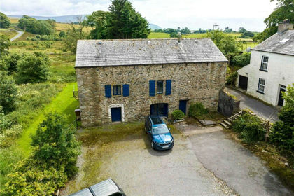
- Price
- Guide Price£585,000
Added on 21/07/2026Barn Conversion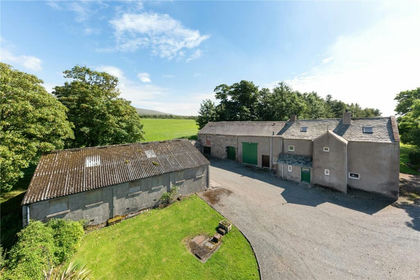
- Price
- Guide Price£575,000
- Size
- 2.31 acres
Woodside House, Waberthwaite, Millom, Cumbria, LA19, Waberthwaite, Cumberland CA18 England
Added on 29/01/2026Farmhouse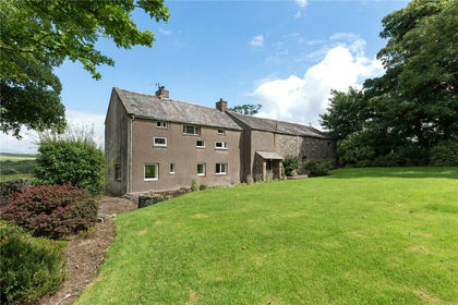
- Price
- Guide Price£950,000
- Size
- 2.31 acres
Woodside House & Land, Waberthwaite, Millom, Cumbria, LA19, Waberthwaite, Cumberland CA18 England
Added on 29/01/2026Farmhouse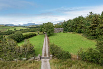
- Price
- Guide Price£595,000
- Size
- 2 acres
Woodside House, Near Ravenglass, Cumbria, Waberthwaite, Cumberland LA19 England
Added on 29/01/2026Farmhouse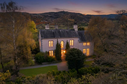
- Price
- Guide Price£650,000
- Size
- 2 acres
Glenwood, Ravenglass, CA18, Muncaster, Cumberland CA18 England
Added on 19/02/2026House with Land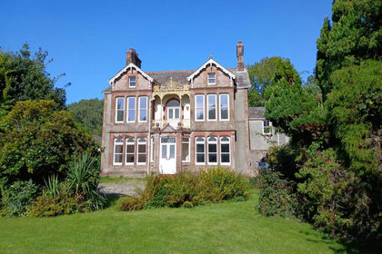
- Price
- Offers in Region of£975,000
- Size
- 2 acres
Mill Holme House, Bootle, Millom, Bootle, Cumberland LA19 England
Added on 01/09/2026House with Land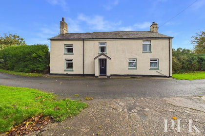
- Price
- Guide Price£495,000
- Size
- 4 acres
Carleton, Holmrook, CA19, Drigg and Carleton, Cumberland CA19 England
Added on 13/10/2026House with Land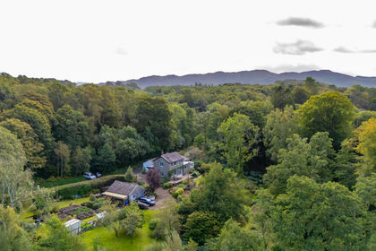 Added on 16/09/2026Cottage
- Price
- £775,000
- Size
- 1.27 acres
Ruskin Mount, The Hill, Millom, Millom Without, Cumberland LA18 England
Added on 28/04/2026House with Land
- Price
- £599,000
- Size
- 1 acres
Bolton Head Farmhouse Seascale, Gosforth, CA20, Gosforth, Cumberland CA20 England
Added on 19/08/2026Farmhouse