Portloe, The Roseland Peninsula
- Land size
- 0.2 acres
- Bedrooms
- 4
- Bathrooms
- 3
Key Features
- Unique opportunity to build your dream home
- Building Plot with Planning Permission for detached House
- Picturesque location between Portloe and Portholland
- Foundations already laid.
- South facing boasting spectacular views
- Attached garage and parking
- Three / Four bedroom accommodation
Description
Cruggan Building Plot
A unique opportunity to purchase an individual building plot with planning permission for a farmhouse style three-bedroom detached house, with attached garage, driveway parking and garden, with fabulous sea, coastal and countryside views.
Description
Nestled in the picturesque landscape between Portholland and Portloe, this 'one of a kind' building plot of approximately 0.2 acres presents a unique opportunity to create your dream home in a truly enchanting location. With planning permission already granted, under application number C1/PA36/1262/05/R, for a stunning 3 / 4 bedroom farmhouse style property, the possibilities are endless. The foundations have already been laid, so planning is granted in perpetuity, and the site benefits from mains electricity already connected, a private water supply and a private septic tank in situ.
Proposed Property
The proposed property will sit facing South and boasts spectacular sea views overlooking the sparkling waters of Veryan Bay and extending further over neighbouring fields towards Dodman Point, offering the perfect blend of natural beauty and rural tranquility.
In addition to the stunning vistas, this proposed property benefits from provisions for driveway parking, attached single garage and a garden, and offers ample space for outdoor activities and relaxation.
Location
With village amenities just a short distance away in the nearby villages of Veryan and Tregony, you can enjoy the convenience of nearby shops, pubs, and services while still relishing in the peaceful seclusion of this idyllic location.
With building plots of this nature rarely available on the Roseland Peninsula, viewing is unhesitatingly recommended.
Location Summary
(Distances and times are approximate)
Veryan Post Office and Stores: 2.1 miles. Roseland Garage & Petrol Station: 2.3 miles. Portloe Harbour: 1.3 miles. Carne Beach: 3.4 miles. Tregony: 4 miles. Truro: 11.3 miles. Cornwall Airport Newquay: 20 miles (flights to London, other UK Regional Airports and European Destinations). St Austell: 11.5 miles (London Paddington 4.5 hours by direct train).
Portloe
Portloe is a very attractive, protected and unspoilt fishing village, located on the Roseland Peninsula, an Area of Outstanding Natural Beauty with safe sailing waters. It has a fine hotel, a public house, bus service and Fibre Broadband. The village of Veryan is approximately 1.5 miles, and provides a primary school, Church, mini-market / post office and public house. St Mawes and Tregony have more comprehensive facilities and are approximately 10 miles and 5 miles away respectively. Carne Beach, owned by the National Trust, offers a wide expanse of clean sand and safe bathing and is about 2.3 miles away. The market town of St Austell and Cathedral City of Truro are about 10 miles away, Truro being the commercial and judicial centre for Cornwall. It also has a main line inter-city railway link, with branch services to the port of Falmouth.
Cornwall
The Duchy of Cornwall offers a range of accessible attractions such as the Eden Project, the National Maritime Museum, the Lost Gardens of Heligan, and the Tate Gallery. The Cathedral City of Truro has a fine range of stores, private schools, college and the main hospital in the county (RCH Treliske). Both Falmouth University, Truro College and Cornwall Airport at Newquay are rapidly expanding.
Fine Dining Restaurants
Fine dining Michelin star and celebrity chef restaurants are in abundance, including Rick Stein (Padstow), Nathan Outlaw (Port Isaac), Paul Ainsworth (Padstow and Rock). Rising stars on The Roseland Peninsula include Simon Stallard at The Hidden Hut on Porthcurnick Beach and The Standard Inn in Gerrans, Paul Wadham at Hotel Tresanton, St Mawes, Stuart Shaw at the Idle Rocks, St Mawes and Michael Golez at The Lugger Hotel in Portloe.
General Information
Services: Mains electricity nearby for connection, private drainage. Private water supply from Cruggan Farm.
Community Infrastructure Levy: Depending on individual circumstances, this is a charge levied under Cornwall's CIL Charging Schedule, collected upon commencement of the build. Enquiries should be made by applicants with the planning authority.
Relevant Planning Permission: PA36/1262/05/R.
Currently EPC and Council Tax exempt.
FTTC Broadband available: Openreach predicted max download speeds: Superfast 46 Mbps; Standard 24 Mbps.
Ofcom Mobile Area Coverage Rating: Good.
Land Registry Title Number: CL212768.
Tenure: Freehold.
Long-Term-Flood-Risks: River/Sea: Very Low Risk. Surface Water: Medium Risk
Viewing: Strictly by appointment with H Tiddy.
Important Notice
Every effort has been made with these details but accuracy is not guaranteed and they are not to form part of a contract. Representation or warranty is not given in relation to this property. All negotiations must be with H Tiddy. Before proceeding to purchase, buyers should consider an independent check of all aspects of the property. Further information on mobile coverage and broadband availability is found on ofcom and openreach 'checker' websites. Visit the Gov.uk website for further information and to 'check long term flood risks'.
General Data Protection Regulations: We treat all data confidentially and with the utmost care and respect. If you do not wish your personal details to be used by us for any specific purpose, then you can unsubscribe or change your communication preferences and contact methods at any time by informing us either by email or in writing at our office in St Mawes
Map Location
Property details
- Tenure
- Freehold
- Council Tax Band
- Ask Agent
- Date Posted
- 2026-01-29
Utilities & Restrictions
Utilities
- Electricity
- Mains
- Water
- Ask Agent
- Heating
- Ask Agent
- Broadband
- Ask Agent
- Sewerage
- Septic Tank / Private
Rights & Restrictions
- Public Rights of Way
- Ask Agent
- Private Rights of Way
- Ask Agent
- Listed Property
- Ask Agent
- Restrictions
- Ask Agent
Listed status, conservation areas and planning constraints for this location are in the full report.
Property Features
- Accessibility
- Ask Agent
- Parking
- Garage
- Garden
- Enclosed Garden
Beyond the particulars: planning activity, flood history, heritage and ground risks, checked for this exact spot.
Connectivity
Broadband
Fastest speed available at this postcode
1 Gbps
Gigabit full fibre
Suitable for
- 4K streaming on every screen
- Full-time home working
- Online gaming & big downloads
Fixed wireless access may also be an option here.
Mobile signal
Outdoor predictions; indoor signal depends on building materials.
Ofcom Connected Nations postcode-level predictions. Speeds and signal are modelled, not measured, and vary between addresses and providers.
Signal is the easy part. Planning activity, flood history and protected designations here are in the full report.
Nearest Schools
Primary
- Veryan CofE School1.8 milesOfsted report card · Mar 2026
- Ages
- 2 to 11
- Pupils
- 42
- Type
- Academy converter
- Faith
- Church of England
- Tregony Community Primary School3.1 milesNo Ofsted rating
- Ages
- 2 to 11
- Pupils
- 171
- Type
- Academy converter
- Gorran School3.6 milesOfsted: Good
- Ages
- 4 to 11
- Pupils
- 91
- Type
- Community school
- Grampound-With-Creed CofE Primary School4.9 milesOfsted report card · Apr 2026
- Ages
- 2 to 11
- Pupils
- 41
- Type
- Academy converter
- Faith
- Church of England
- Probus Primary School5.4 milesNo Ofsted rating
- Ages
- 2 to 11
- Pupils
- 216
- Type
- Academy converter
Secondary
- The Roseland Academy3.1 milesNo Ofsted rating
- Ages
- 11 to 16
- Pupils
- 665
- Type
- Academy converter
- Penair School7 milesNo Ofsted rating
- Ages
- 11 to 16
- Pupils
- 1,223
- Type
- Academy converter
- Brannel School7.6 milesOfsted: Good
- Ages
- 11 to 16
- Pupils
- 888
- Type
- Academy sponsor led
- Poltair School9.1 milesOfsted: Good
- Ages
- 11 to 16
- Pupils
- 882
- Type
- Academy sponsor led
- Penrice Academy9.1 milesOfsted: Outstanding *
- Ages
- 11 to 16
- Pupils
- 1,405
- Type
- Academy converter
* Latest graded judgement covers quality of education only; no overall grade was issued under the 2024-25 inspection framework.
Distances are straight-line from the advertised location. Source: the national school registers (DfE, Welsh Government, Scottish Government) and Ofsted.
Schools are just the start: sold prices nearby, planning activity and any flood history are in the full report.
Amenities
Supermarket
GP surgery
Pharmacy
Hospital
Walking trail
Straight-line distances from the advertised location. Sources: NHS records, Geolytix supermarket locations, OS Open Greenspace and the national trails registers.
The area stacks up? Now check the location itself: planning nearby, protected designations and past flooding.
Getting Around
Nearest station
Nearest bus stop
Typical drive times
Straight-line distances from the advertised location; drive times are typical free-flow times over OpenStreetMap road data, so allow more at peak. Public transport locations from DfT NaPTAN.
Easy to reach matters. So do planning activity, flood history and ground risks: all in the full report.
Flood Risk
From Environment Agency flood map open data, checked around the advertised map pin and allowing for the listed acreage where known. This summary comes from LandSale, the advertising platform, not from the listing agent, and is not part of the agent's particulars. Risk can vary across a single holding, so verify anything critical through your own searches before committing.
Rivers and the sea
Surface water
The detail behind these bandings
The full report pinpoints where this location sits on the flood maps, and runs the deeper checks that usually only surface after an offer.
- Exact flood zones & annual chances (included in the full report)
- Any recorded past flooding (included in the full report)
- Planning activity nearby (included in the full report)
- Heritage & conservation (included in the full report)
- Protected nature designations (included in the full report)
- Ground risks (included in the full report)
- Sold prices nearby (included in the full report)
£14.99 · one-off purchase
By LandSale, the platform. Not provided by the listing agent. Ready in about a minute.
Important notice: Information, maps and tags on this page are drawn from the advertising agent's marketing materials or generated automatically. LandSale has not verified them. Relying on these details is at your own risk, always carry out independent checks before committing to a purchase.
LandSale full disclaimer
Marketing information only - not formal particulars. The details on this website are provided for general guidance and do not constitute an offer or contract. Neither LandSale nor the advertising estate/land agent accepts responsibility for any inaccuracy.
1. Source of information
- Listing content: Core description, asking price, tenure, measurements, photographs and planning history originate from the marketing materials of the advertising estate or land agent. LandSale does not author this content and cannot guarantee its accuracy.
- Automated tags & categorisation: Property type, land-use class, acreage bands and similar labels may be applied by machine-learning models. They are intended as a helpful guide only and may not reflect the property's legal status or permitted use.
- Third-party & enriched data layers: Maps, boundary outlines, planning designations, soil reports, broadband coverage and other environmental or location-based insights are licensed from external suppliers. Such data are supplied “as is", may be incomplete or out of date and are subject to change without notice.
2. Verification required
Prospective purchasers must verify critical matters, including but not limited to planning permission, title boundaries, public rights of way, environmental constraints, acreage, services, access and VAT status, through their own inspections, specialist surveys, legal advisers and the selling agent before relying on the information or entering into any contract.
3. No warranty or liability
LandSale gives no warranty, express or implied, as to the accuracy, completeness or fitness for any particular purpose of the information displayed. LandSale shall not be liable for any loss, damage, cost or expense arising directly or indirectly from any use of or reliance on such information, save where liability may not be excluded by law.
4. Updates & feedback
If you believe any detail on this listing is inaccurate, please let us know. We will investigate and, where appropriate, update the listing or notify the agent.
© LandSale | Version 1.3 - August 2026
Listing agent
H Tiddy, St Mawes
The Square, St. Mawes, TR2 5AG
Similar properties for sale
- Price
- Guide Price£450,000
Trevarrick, Gorran, St. Austell, St. Goran, Cornwall PL26 England
Added on 08/08/2026Building Plot Added on 01/07/2026Building Plot
- Price
- Guide Price£350,000
- Size
- 2.61 acres
Added on 29/01/2026Building Plot
- Price
- Guide Price£500,000
Added on 03/07/2026Building Plot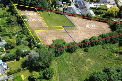
- Price
- £425,000
- Size
- 0.4 acres
Comfort Road, Mylor Bridge, Falmouth, Cornwall, TR11, Mylor, Cornwall TR11 England
Added on 29/01/2026Development Land
- Price
- Guide Price£350,000
- Size
- 0.08 acres
Development Opportunity, Marine Crescent, Falmouth, Falmouth, Cornwall TR11 England
Added on 28/05/2026Development Land
- Price
- £500,000
- Size
- 0.37 acres
Charlestown Joinery, Drinnick Road, St Austell, St. Stephen-in-Brannel, Cornwall PL26 England
Added on 31/03/2026Commercial Land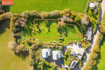 Added on 17/03/2026Building Plot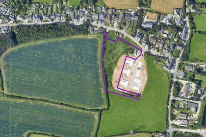
- Price
- £375,000
- Size
- 1.57 acres
Higher Fraddon, St Columb, St Columb., TR9, St. Enoder, Cornwall TR9 England
Added on 14/05/2026Development Land
- Price
- Offers in Region of£315,000
Fore Street, St. Blazey, Par, Cornwall, PL24, St. Blaise, Cornwall PL24 England
Added on 16/04/2026Development Land