Westleigh, Harberton, Totnes
- Bedrooms
- 3
- Bathrooms
- 2
Key Features
- Detached Barn Conversion
- Three Bedrooms
- Modern Kitchen with Granite Top & Larder Cupboard
- Master Bedroom With Ensuite
- Driveway Parking
- Character Features Throughout
- Secure South Facing Garden
- Oak Balcony
- Countryside Views
Description
Luscombe Maye are delighted to bring The Round House to market, an extraordinary barn conversion that beautifully blends heritage architecture with spacious modern living.
Thoughtfully designed to preserve its original character, the home showcases an abundance of exposed beams, trusses, and traditional features, all enhanced by a wonderful sense of openness and natural light. Alongside its aesthetic appeal, the property boasts impressive off grid credentials, including solar panels, a private borehole supplying fresh water, and multiple wood burners that contribute both warmth and rustic charm.
Accessed from the rear, the property opens into a dramatic double height entrance hall that immediately sets the tone for the scale and individuality of the home. This welcoming space includes a practical utility room and a well placed guest WC. From here, the layout flows naturally into the heart of the house: a beautifully designed kitchen complete with a central island topped with elegant marble work surfaces. Its generous proportions and considered layout make this a superb culinary and social hub. The adjoining dining room connects effortlessly with the kitchen, creating an expansive entertaining space ideal for gatherings, family meals, and special occasions. A separate study sits just off the dining area, offering an adaptable room perfect for home working, reading, or quiet retreat.
One of the most striking parts of the home is the original Round House itself, now transformed into a spectacular sitting room. Here, exposed historic elements and a cosy wood burner take centre stage, creating a warm and characterful atmosphere. Large openings frame views of the garden, ensuring this versatile space feels intimately connected with its natural surroundings.
Towards the front of the property, a substantial double height storage area offers exceptional potential. With its own independent access, this space presents exciting possibilities for conversion (STPP), whether as additional accommodation, a workshop, a studio, or a creative project tailored to the new owner’s needs.
The first floor is approached via a spacious landing, which adds to the sense of scale and elegance throughout the home. The principal bedroom suite enjoys a refined, peaceful ambience and benefits from a walk through dressing room leading to a stylish en suite shower room. Two further bedrooms offer comfortable accommodation for family or guests, each enjoying lovely outlooks across the surrounding countryside. A well appointed family bathroom completes the upper level.
Altogether, The Round House is a truly special home—rich in history, generous in scale, thoughtfully improved, and beautifully presented. It offers the perfect blend of rural charm, modern comfort, and sustainable living.
HARBERTON
Harberton is one of the South Hams' most sought after villages, being close to Totnes and having its own strong community centring around St Andrew's Church, the popular Church House Inn and the parish hall. With an outstanding village pub and farm shop selling local produce (both within walking distance), it offers a superb lifestyle in an idyllic location. Totnes, within about 2 miles, is known as an Elizabethan town but has much earlier origins with a castle, a wonderful position on the River Dart and a main line railway station. It has a well regarded community college, full range of shops, a weekly market and a wide choice of cultural facilities.
FURTHER INFORMATION
To ensure legal compliance, we require our sellers to complete a Property Information Questionnaire or provide a Material Information Guide along with the title document. If available, please scan the QR code or access the additional online material information ( you can contact our team for this information.
Verified Material Information
Council Tax band: F
Tenure: Freehold
Property type: House
Property construction: Standard brick and block construction
Energy Performance rating: B
Number and types of room: 3 bedrooms, 2 bathrooms, 3 receptions
Electricity supply: Mains electricity
Solar Panels: Yes - owned outright
Other electricity sources: Battery storage via Solar power 15kwh
Water supply: Borehole
Sewerage: Septic tank
Heating: Oil-powered central heating is installed. The system was installed at an unknown date.
Heating features: Double glazing, Wood burner, and Aga/Rayburn
Broadband: FTTC (Fibre to the Cabinet)
Parking: Gated, Driveway, Off Street, and Private
Building safety issues: No
Restrictions - Listed Building: No
Restrictions - Conservation Area: No
Restrictions - Tree Preservation Orders: None
Public right of way: No
Long-term area flood risk: No
Historical flooding: No
Flood defences: No
Coastal erosion risk: No
Planning permission issues: No
Accessibility and adaptations: None
Coal mining area: No
Non-coal mining area: No
Loft access: Yes - insulated and boarded, accessed by: Through hatch in rear lobby with ladder access
All information is provided without warranty. Contains HM Land Registry data © Crown copyright and database right 2021. This data is licensed under the Open Government Licence v3.0.
The information contained is intended to help you decide whether the property is suitable for you. You should verify any answers which are important to you with your property lawyer or surveyor or ask for quotes from the appropriate trade experts: builder, plumber, electrician, damp, and timber expert.
DIRECTIONS
What3Words - earmarked.panoramic.bakers
Map Location
Property details
- Tenure
- Freehold
- Council Tax Band
- F
- Date Posted
- 2026-01-29
Energy Performance Certificate
Energy Efficiency Rating
Based on UK Energy Performance Certificate standards (EU Directive 2002/91/EC)
Running costs are one side. Planning activity, flood history and ground risks for this location are in the full report.
Utilities & Restrictions
Utilities
- Electricity
- Mains, Solar Panels
- Water
- Private Supply
- Heating
- Double Glazing, Oil Heating, Central Heating, Wood Burner
- Broadband
- Fibre (FTTC)
- Sewerage
- Septic Tank / Private
Rights & Restrictions
- Public Rights of Way
- Ask Agent
- Private Rights of Way
- Ask Agent
- Listed Property
- Ask Agent
- Restrictions
- Ask Agent
Listed status, conservation areas and planning constraints for this location are in the full report.
Property Features
- Accessibility
- Ask Agent
- Parking
- Driveway
- Garden
- Private Garden
Beyond the particulars: planning activity, flood history, heritage and ground risks, checked for this exact spot.
Connectivity
Broadband
Fastest speed available at this postcode
1.8 Gbps
Gigabit full fibre · available to 20% of premises
Suitable for
- 4K streaming on every screen
- Full-time home working
- Online gaming & big downloads
Fixed wireless access may also be an option here.
Mobile signal
Outdoor predictions; indoor signal depends on building materials.
Ofcom Connected Nations postcode-level predictions. Speeds and signal are modelled, not measured, and vary between addresses and providers.
Signal is the easy part. Planning activity, flood history and protected designations here are in the full report.
Nearest Schools
Primary
- Diptford Parochial Church of England Primary School1.9 milesOfsted: Good *
- Ages
- 3 to 11
- Pupils
- 54
- Type
- Academy converter
- Faith
- Church of England
- Harbertonford Church of England Primary School2 milesNo Ofsted rating
- Ages
- 2 to 11
- Pupils
- 101
- Type
- Academy converter
- Faith
- Church of England
- The Grove School3.3 milesOfsted: Good
- Ages
- 3 to 11
- Pupils
- 342
- Type
- Community school
- Dartington Church of England Academy3.4 milesNo Ofsted rating
- Ages
- 2 to 11
- Pupils
- 286
- Type
- Academy converter
- Faith
- Church of England
- Totnes St John's Church of England Primary School3.7 milesOfsted: Good
- Ages
- 4 to 11
- Pupils
- 163
- Type
- Academy sponsor led
- Faith
- Church of England
Secondary
- King Edward VI Community College3.3 milesNo Ofsted rating
- Ages
- 11 to 18
- Pupils
- 940
- Type
- Academy converter
- Ivybridge Community College7.3 milesOfsted: Good
- Ages
- 11 to 18
- Pupils
- 2,262
- Type
- Academy converter
- Paignton Academy7.5 milesOfsted: Requires improvement *
- Ages
- 11 to 16
- Pupils
- 1,568
- Type
- Academy converter
- Dartmouth Academy8.1 milesOfsted: Good
- Ages
- 3 to 19
- Pupils
- 435
- Type
- Academy sponsor led
- South Dartmoor Community College8.1 milesOfsted: Good *
- Ages
- 11 to 18
- Pupils
- 801
- Type
- Academy converter
* Latest graded judgement covers quality of education only; no overall grade was issued under the 2024-25 inspection framework.
Distances are straight-line from the advertised location. Source: the national school registers (DfE, Welsh Government, Scottish Government) and Ofsted.
Schools are just the start: sold prices nearby, planning activity and any flood history are in the full report.
Amenities
Supermarket
GP surgery
Pharmacy
Hospital
Straight-line distances from the advertised location. Sources: NHS records, Geolytix supermarket locations, OS Open Greenspace and the national trails registers.
The area stacks up? Now check the location itself: planning nearby, protected designations and past flooding.
Getting Around
Nearest station
Nearest bus stop
Typical drive times
Straight-line distances from the advertised location; drive times are typical free-flow times over OpenStreetMap road data, so allow more at peak. Public transport locations from DfT NaPTAN.
Easy to reach matters. So do planning activity, flood history and ground risks: all in the full report.
Flood Risk
From Environment Agency flood map open data, checked around the advertised map pin and allowing for the listed acreage where known. This summary comes from LandSale, the advertising platform, not from the listing agent, and is not part of the agent's particulars. Risk can vary across a single holding, so verify anything critical through your own searches before committing.
Rivers and the sea
Surface water
The detail behind these bandings
The full report pinpoints where this location sits on the flood maps, and runs the deeper checks that usually only surface after an offer.
- Exact flood zones & annual chances (included in the full report)
- Any recorded past flooding (included in the full report)
- Planning activity nearby (included in the full report)
- Heritage & conservation (included in the full report)
- Protected nature designations (included in the full report)
- Ground risks (included in the full report)
- Sold prices nearby (included in the full report)
£14.99 · one-off purchase
By LandSale, the platform. Not provided by the listing agent. Ready in about a minute.
Important notice: Information, maps and tags on this page are drawn from the advertising agent's marketing materials or generated automatically. LandSale has not verified them. Relying on these details is at your own risk, always carry out independent checks before committing to a purchase.
LandSale full disclaimer
Marketing information only - not formal particulars. The details on this website are provided for general guidance and do not constitute an offer or contract. Neither LandSale nor the advertising estate/land agent accepts responsibility for any inaccuracy.
1. Source of information
- Listing content: Core description, asking price, tenure, measurements, photographs and planning history originate from the marketing materials of the advertising estate or land agent. LandSale does not author this content and cannot guarantee its accuracy.
- Automated tags & categorisation: Property type, land-use class, acreage bands and similar labels may be applied by machine-learning models. They are intended as a helpful guide only and may not reflect the property's legal status or permitted use.
- Third-party & enriched data layers: Maps, boundary outlines, planning designations, soil reports, broadband coverage and other environmental or location-based insights are licensed from external suppliers. Such data are supplied “as is", may be incomplete or out of date and are subject to change without notice.
2. Verification required
Prospective purchasers must verify critical matters, including but not limited to planning permission, title boundaries, public rights of way, environmental constraints, acreage, services, access and VAT status, through their own inspections, specialist surveys, legal advisers and the selling agent before relying on the information or entering into any contract.
3. No warranty or liability
LandSale gives no warranty, express or implied, as to the accuracy, completeness or fitness for any particular purpose of the information displayed. LandSale shall not be liable for any loss, damage, cost or expense arising directly or indirectly from any use of or reliance on such information, save where liability may not be excluded by law.
4. Updates & feedback
If you believe any detail on this listing is inaccurate, please let us know. We will investigate and, where appropriate, update the listing or notify the agent.
© LandSale | Version 1.3 - August 2026
Listing agent
Luscombe Maye, Totnes
59 Fore Street, Totnes, TQ9 5NJ
Similar properties for sale
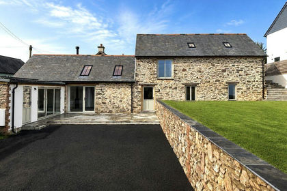
- Price
- Guide Price£750,000
Added on 05/06/2026Barn Conversion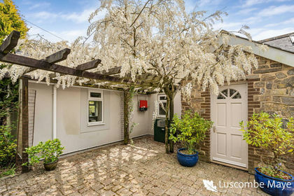
- Price
- Guide Price£595,000
Added on 13/05/2026Barn Conversion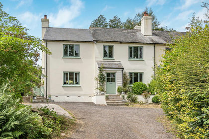
- Price
- Guide Price£795,000
- Size
- 1 acres
Added on 11/07/2026House with Land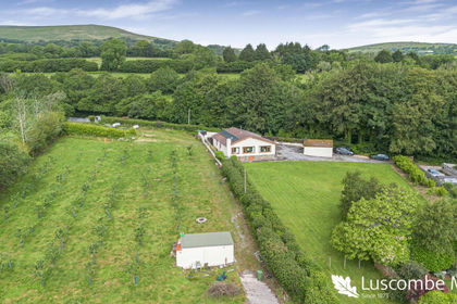
- Price
- Guide Price£735,000
- Size
- 2.08 acres
Added on 13/06/2026House with Land
- Price
- Guide Price£595,000
- Size
- 1.17 acres
Added on 29/01/2026Cottage
- Price
- Guide Price£775,000
Added on 23/03/2026Barn Conversion
- Price
- Guide Price£675,000
Added on 16/06/2026Barn Conversion
- Price
- Guide Price£660,000
Added on 17/06/2026Barn Conversion
- Price
- Offers in Excess of£795,000
- Size
- 3.13 acres
Added on 18/06/2026Cottage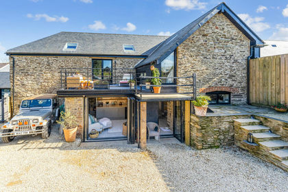
- Price
- Guide Price£795,000
Added on 25/03/2026Barn Conversion