Ninfield Road, Bexhill-On-Sea, East Sussex, TN39
- Land size
- 1.91 acres
Description
GUIDE PRICE: £1,500,000 - £1,900,000
• Prime commercial land with existing large 6990 square feet (649 square meter) impressive detached storage building with internal office accommodation, all of which could possibly be doubled to13,980 subject to planning.
• Water and electricity connected to site
• PLEASE NOTE: This land is located within in an identified strategic land development zone for housing, as is the case with the adjoining land, which we understand has also been recognised for high density potential residential building land for up to circa 250 houses.
• Comes with associated land of 1.9 acres already with extensive areas for parking and manoeuvring of large vehicles
• Excellent further potential for additional commercial buildings to possibly be built, especially as the previous tenants had permission granted for numerous container storage units apparently up to 20 units.
• Planning potential for the existing storage building to have a complete second floor level incorporated in addition to its existing internal corner offices, which would then double the storage capacity of just this single building to approximately 13,980 square feet.
• Located near the main road networks for London and the south east, with the A21 literally almost adjoining its main entrance.
• Previously used for a removal’s storage warehouse and with all sorts of potential other uses due to its setting ideal for logistic business supplies etc
• Valuable commercial land that could also be changed to residential potentially due to its location of being a possible identified infrastructure council site for residential housing.
• Includes a small parcel of woodland planted under a government grant previously
DESCRIPTION: A very valuable and large commercial land site of circa 2 acres, which is perfectly located strategically near the London road network and the new bypasses leading to the south east coastal towns, that also has planning potential for future residential development, due to the fact that it is located within / next to the council’s current land identified for suitable high-density housing.
Currently there exists a large high level 6990 square feet storage commercial building with internal corner offices, that could also with planning adjustments have a second-floor level over the total area, which would allow for the floor area to increase to circa 13,980 square feet within this one single building.
Furthermore, not only is there an excellent amount of unutilized space within the circa 2-acre site (1.91) for planning to be granted for further commercial buildings, there could be additional planning again granted for a large number of container storage units, as previously obtained by the previous tenants, who we understand were a removal and storage company.
There is already a large hard standing area to the lower level near the site’s main entrance for several vehicles of varying sizes to be conveniently parked and manoeuvred, making this site suitable for numerous staff to work on site.
The land arrangement also allows for the existing building to have further wings added to either side subject to planning, as well as the present building having potential to double its floor space should planning be granted for a second floor within the existing building. All of which makes this commercial land site very valuable currently and with its various future enhancements for additional floor areas and further potential commercial buildings subject to planning.
Not forgetting, the potential for this site to have residential planning permission maybe granted due to its location within or next to existing identified high density residential development land.
This existing land could provide valuable biodiversity set aside and be also seen as a more viable access route into the adjoining residential development land identified for circa 250 houses.
LOCATION: Situated off the new bypass to London and connecting directly onto the A21 for London / Bexhill on Sea. This commercial land of circa 2 acres, is perfectly strategically located for supplies and all types of business logistics, whether for London or the South East and its coastal towns etc. You could not wish for a more well-located business hub to operate from.
In addition, the land around this commercial site has been identified as prime residential development land for up to 250 houses and in fact adjoins its own boundaries. Therefore, making this land very important and valuable for both commercial enhancement and even change of use to residential subject to planning.
EXISTING SITE LAYOUT: There is a wide commercial sized double width gated front access to the lower level of the circa 2 acre site leading off from the A21 Ninfield Road to Bexhill on Sea. Here there is a large area for vehicles to park and turn, as well as potential for this area to accommodate further commercial buildings subject to planning.
There is an attractive planted wooded area to the left side of the land, which continues up the hill a little further onto the second level.
The second level of the site is approached by the hard surfaced driveway to the right side of the 2 acre plot, that leads off from the car park and turning area below.
The large second level of this circa 2 acre plot has an impressive existing very large rectangular high level commercial storage building with internal offices within one corner, all of which is in good condition.
FRONT ENTRANCE TO THE STORAGE BUILDING: This substantial sized commercial building is accessed via a large electrically operated retractable door.
SIZE OF EXISTING BUILDING: ground floor area including a corner office set up is 6,950 square feet. PLEASE NOTE: The height of the building easily allows for a second floor to cover the same area (subject to planning), which would increase the buildings square footage to circa 13,900 square feet.
INTERNAL OFFICES: Located in the front right corner of the property and arranged and comprising of an initial open space office area of 15 feet. 9 inches x 13 feet. 7 inches.
Door to adjoining kitchen / cloakroom and shower room.
SECOND LEVEL OFFICE SPACE IN CORNER: Approached by external staircase and measuring 15 feet 9 inches x 19 feet 8 inches.
EXTERIOR GROUNDS TO SECOND LEVEL: Either side of the existing large commercial building are generous sized areas for further wing extensions that could be built subject to planning, or as previously used for, these areas can have numerous container storage units located subject to planning.
VIEWING: We would recommend any business looking for a strategic location near good road networks for London and the South East contact us quickly to avoid disappointment.
AGENTS NOTE: Please note that these details have been prepared as a general guide and do not form part of a contract. We have not carried out a detailed survey, nor tested the services, appliances and specific fittings. Room sizes are approximate and should not be relied upon. Any verbal statements or information given about this property, again, should not be relied on and should not form part of a contract or agreement to purchase.
Map Location
Property details
- Tenure
- Freehold
- Council Tax Band
- TBC
- Date Posted
- 2026-01-29
Utilities & Restrictions
Utilities
- Electricity
- Ask Agent
- Water
- Ask Agent
- Heating
- Ask Agent
- Broadband
- Ask Agent
- Sewerage
- Ask Agent
Rights & Restrictions
- Public Rights of Way
- Ask Agent
- Private Rights of Way
- Ask Agent
- Listed Property
- Ask Agent
- Restrictions
- Ask Agent
Listed status, conservation areas and planning constraints for this location are in the full report.
Property Features
- Accessibility
- Ask Agent
- Parking
- Parking Available
- Garden
- Garden
Beyond the particulars: planning activity, flood history, heritage and ground risks, checked for this exact spot.
Connectivity
Broadband
Fastest speed available at this postcode
1.8 Gbps
Gigabit full fibre
Suitable for
- 4K streaming on every screen
- Full-time home working
- Online gaming & big downloads
Mobile signal
Outdoor predictions; indoor signal depends on building materials.
Ofcom Connected Nations postcode-level predictions. Speeds and signal are modelled, not measured, and vary between addresses and providers.
Signal is the easy part. Planning activity, flood history and protected designations here are in the full report.
Nearest Schools
Primary
- Glenleigh Park Primary Academy845 metresOfsted: Good
- Ages
- 2 to 11
- Pupils
- 334
- Type
- Academy sponsor led
- All Saints Church of England Primary School, Bexhill0.7 milesNo Ofsted rating
- Ages
- 2 to 11
- Pupils
- 282
- Type
- Voluntary controlled school
- Faith
- Church of England
- King Offa Primary Academy1.3 milesOfsted: Good
- Ages
- 2 to 11
- Pupils
- 402
- Type
- Academy sponsor led
- Chantry Community Primary School1.4 milesNo Ofsted rating
- Ages
- 4 to 11
- Pupils
- 195
- Type
- Academy converter
- Little Common School1.5 milesOfsted: Outstanding
- Ages
- 2 to 11
- Pupils
- 670
- Type
- Academy converter
Secondary
- Bexhill High Academy919 metresOfsted: Good *
- Ages
- 11 to 16
- Pupils
- 1,441
- Type
- Academy converter
- St Richard's Catholic College2 milesOfsted: Good
- Ages
- 11 to 16
- Pupils
- 1,029
- Type
- Academy converter
- Faith
- Roman Catholic
- Mulberry Academy St Leonards3.5 milesOfsted: Inadequate *
- Ages
- 11 to 16
- Type
- Academy sponsor led
- Claverham Community College3.7 milesNo Ofsted rating
- Ages
- 11 to 16
- Pupils
- 1,147
- Type
- Community school
- Ark Alexandra Academy5.1 milesOfsted report card · Jun 2026
- Ages
- 11 to 16
- Pupils
- 1,315
- Type
- Academy sponsor led
- Faith
- Church of England
* Latest graded judgement covers quality of education only; no overall grade was issued under the 2024-25 inspection framework.
Distances are straight-line from the advertised location. Source: the national school registers (DfE, Welsh Government, Scottish Government) and Ofsted.
Schools are just the start: sold prices nearby, planning activity and any flood history are in the full report.
Amenities
Supermarket
GP surgery
Pharmacy
Hospital
Green space
Straight-line distances from the advertised location. Sources: NHS records, Geolytix supermarket locations, OS Open Greenspace and the national trails registers.
The area stacks up? Now check the location itself: planning nearby, protected designations and past flooding.
Getting Around
Nearest station
Nearest bus stop
Typical drive times
Straight-line distances from the advertised location; drive times are typical free-flow times over OpenStreetMap road data, so allow more at peak. Public transport locations from DfT NaPTAN.
Easy to reach matters. So do planning activity, flood history and ground risks: all in the full report.
Flood Risk
From Environment Agency flood map open data, checked around the advertised map pin and allowing for the listed acreage where known. This summary comes from LandSale, the advertising platform, not from the listing agent, and is not part of the agent's particulars. Risk can vary across a single holding, so verify anything critical through your own searches before committing.
Rivers and the sea
Surface water
The detail behind these bandings
The full report pinpoints where this location sits on the flood maps, and runs the deeper checks that usually only surface after an offer.
- Exact flood zones & annual chances (included in the full report)
- Any recorded past flooding (included in the full report)
- Planning activity nearby (included in the full report)
- Heritage & conservation (included in the full report)
- Protected nature designations (included in the full report)
- Ground risks (included in the full report)
- Sold prices nearby (included in the full report)
£14.99 · one-off purchase
By LandSale, the platform. Not provided by the listing agent. Ready in about a minute.
Important notice: Information, maps and tags on this page are drawn from the advertising agent's marketing materials or generated automatically. LandSale has not verified them. Relying on these details is at your own risk, always carry out independent checks before committing to a purchase.
LandSale full disclaimer
Marketing information only - not formal particulars. The details on this website are provided for general guidance and do not constitute an offer or contract. Neither LandSale nor the advertising estate/land agent accepts responsibility for any inaccuracy.
1. Source of information
- Listing content: Core description, asking price, tenure, measurements, photographs and planning history originate from the marketing materials of the advertising estate or land agent. LandSale does not author this content and cannot guarantee its accuracy.
- Automated tags & categorisation: Property type, land-use class, acreage bands and similar labels may be applied by machine-learning models. They are intended as a helpful guide only and may not reflect the property's legal status or permitted use.
- Third-party & enriched data layers: Maps, boundary outlines, planning designations, soil reports, broadband coverage and other environmental or location-based insights are licensed from external suppliers. Such data are supplied “as is", may be incomplete or out of date and are subject to change without notice.
2. Verification required
Prospective purchasers must verify critical matters, including but not limited to planning permission, title boundaries, public rights of way, environmental constraints, acreage, services, access and VAT status, through their own inspections, specialist surveys, legal advisers and the selling agent before relying on the information or entering into any contract.
3. No warranty or liability
LandSale gives no warranty, express or implied, as to the accuracy, completeness or fitness for any particular purpose of the information displayed. LandSale shall not be liable for any loss, damage, cost or expense arising directly or indirectly from any use of or reliance on such information, save where liability may not be excluded by law.
4. Updates & feedback
If you believe any detail on this listing is inaccurate, please let us know. We will investigate and, where appropriate, update the listing or notify the agent.
© LandSale | Version 1.3 - August 2026
Listing agent
Neville & Neville Estate Agents, Cowbeech
Forge Meadow Hammer Lane, Cowbeech, BN27 4JL
View agent profileSimilar properties for sale
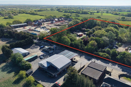
- Price
- Guide Price£1,750,000
- Size
- 9.5 acres
Clayhill, Uckfield Road, East Sussex, BN8, East Sussex, East Sussex BN8 England
Added on 26/08/2026Commercial Land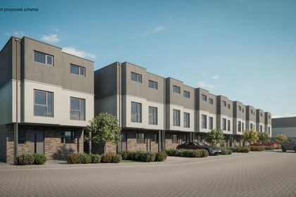
- Price
- Guide Price£1,700,000
- Size
- 1.45 acres
Transit Road, Newhaven, East Sussex, BN9, Newhaven, East Sussex BN9 England
Added on 29/01/2026Development Land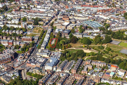
- Price
- £1,700,000
- Size
- 0.46 acres
Added on 29/01/2026Redevelopment Land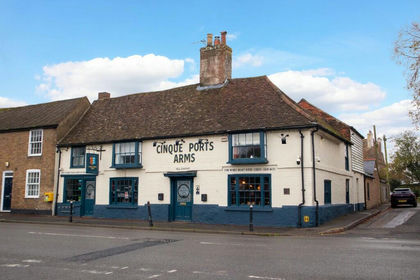
- Price
- Guide Price£1,250,000
KENT - PROFITABLE HIGH BARRELAGE WET-LET PUB, New Romney, Kent TN28 England
Added on 17/07/2026Pub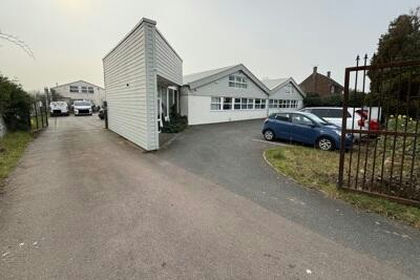
- Price
- £1,200,000
- Size
- 0.38 acres
Anglo House, Wotton Road, Ashford, Kent, TN23, Ashford, Kent TN23 England
Added on 31/03/2026Warehouse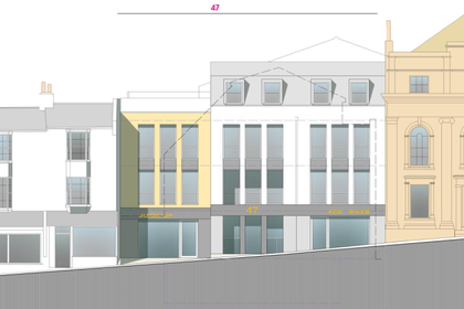 Added on 17/02/2026Development Land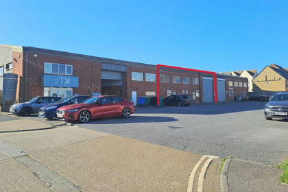
- Price
- £1,200,000
- Size
- 0.2 acres
Added on 25/03/2026Warehouse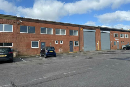
- Price
- £1,200,000
- Size
- 0.2 acres
Added on 20/03/2026Warehouse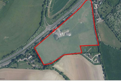
- Price
- Offers in Excess of£1,750,000
- Size
- 13 acres
Hillside Farm, Stockbury Valley, Stockbury, Sittingbourne, Kent, ME9, Stockbury, Kent ME9 England
Added on 10/06/2026Warehouse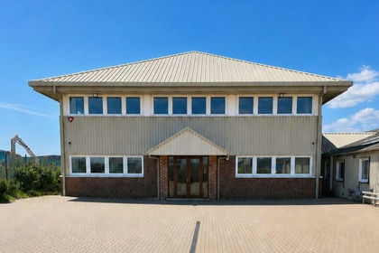
- Price
- From£1,125,000
- Size
- 0.31 acres
Added on 27/05/2026Industrial Land