High Street, Strathmiglo, Fife, KY14
- Bedrooms
- 4
- Bathrooms
- 2
Description
Plot 1, The Stackyard, Strathmiglo, North East Fife
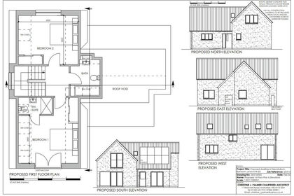
Plot 1 is a generously sized, fully serviced plot on the edge of Strathmiglo—a traditional Fife village nestled beneath the Lomond Hills and surrounded by stunning countryside. With full planning permission already secured for a substantial four-bedroom villa, the opportunity to build your ideal home is ready to begin.
Part of an exclusive release of just two plots, this peaceful and private setting offers the best of both worlds—rural tranquillity with excellent road links via the A91 to Milnathort, Cupar, St Andrews and beyond.
The approved design has been carefully considered for modern family life, with well-proportioned interiors and a strong connection to the outdoors. Connections for water, electricity and drainage are already in place—saving you time and making the build process smoother from the start.
Why Build Here?
- Serviced plot with utilities in place
- Planning permission granted for 4-bed villa
- Plot size approx. 1050 m2
- Views towards the Lomond Hills Regional Park
- Beautiful walking routes and outdoor pursuits on the doorstep
- Excellent local schooling—including nursery, primary and Bell Baxter High School (15 mins)
- Close to the popular village of Falkland and major commuter links
Build with Confidence
To support your self-build journey, the developer has partnered with Thomson Project Management—a highly regarded local firm offering end-to-end project support. Their experienced team can handle everything from sourcing materials and managing contractors to timelines and budgets—ensuring your home is delivered to the highest standard, with as little stress as possible.
A New Chapter Starts Here
This is more than a plot—it’s the beginning of a different way of living. A peaceful setting, a beautifully designed home, and the professional support to help make it all happen. Plot 1 at Strathmiglo offers you the space, freedom, and setting to create something truly lasting.
Contact Gill at Home Sales and Lettings to find out more.
IMPORTANT NOTE TO PURCHASERS: Please note that all images and text are for information/illustrative purposes only. They do not constitute any form of guarantee or contract. We endeavour to make our accurate andbrochure reliable, however, they do not constitute or form part of an offer or any contract and none is to be relied upon as statements of representation or fact. Please be advised that some of the details may be awaiting vendor approval. If you require clarification or further information on any points, please contact us, especially if you are travelling some distance to view the plot.
Tenure: Freehold,Map Location
Property details
- Tenure
- Freehold
- Council Tax Band
- Ask Agent
- Date Posted
- 2026-01-29
Utilities & Restrictions
Utilities
- Electricity
- Ask Agent
- Water
- Ask Agent
- Heating
- Ask Agent
- Broadband
- Ask Agent
- Sewerage
- Ask Agent
Rights & Restrictions
- Public Rights of Way
- Ask Agent
- Private Rights of Way
- Ask Agent
- Listed Property
- Ask Agent
- Restrictions
- Ask Agent
Listed status, conservation areas and planning constraints for this location are in the full report.
Property Features
- Accessibility
- Ask Agent
- Parking
- Driveway
- Garden
- Private Garden
Beyond the particulars: planning activity, flood history, heritage and ground risks, checked for this exact spot.
Connectivity
Broadband
Fastest speed available at this postcode
76 Mbps
Superfast
Suitable for
- HD streaming
- Video calls
- Web & social
Mobile signal
Outdoor predictions; indoor signal depends on building materials.
Ofcom Connected Nations postcode-level predictions. Speeds and signal are modelled, not measured, and vary between addresses and providers.
Signal is the easy part. Planning activity, flood history and protected designations here are in the full report.
Nearest Schools
Primary
- Strathmiglo Primary School85 metres
- Pupils
- 64
- Type
- Non-denominational
- Auchtermuchty Primary School2 miles
- Pupils
- 139
- Type
- Non-denominational
- Falkland Primary School3.3 miles
- Pupils
- 106
- Type
- Non-denominational
- Abernethy Primary School4.2 miles
- Pupils
- 129
- Type
- Non-denominational
- Arngask Primary School4.8 miles
- Pupils
- 74
- Type
- Non-denominational
Secondary
- Glenwood High School6.1 miles
- Pupils
- 876
- Type
- Non-denominational
- Glenrothes High School6.3 miles
- Pupils
- 830
- Type
- Non-denominational
- Kinross High School7.1 miles
- Pupils
- 912
- Type
- Non-denominational
- Auchmuty High School7.2 miles
- Pupils
- 1,302
- Type
- Non-denominational
- Lochgelly High School9.7 miles
- Pupils
- 798
- Type
- Non-denominational
Distances are straight-line from the advertised location. Source: the national school registers (DfE, Welsh Government, Scottish Government) and Ofsted.
Schools are just the start: planning activity, heritage and any flood history here are in the full report.
Amenities
Supermarket
GP surgery
Pharmacy
Green space
Walking trail
Straight-line distances from the advertised location. Sources: NHS records, Geolytix supermarket locations, OS Open Greenspace and the national trails registers.
The area stacks up? Now check the location itself: planning nearby, protected designations and past flooding.
Getting Around
Nearest station
Nearest bus stop
Typical drive times
Straight-line distances from the advertised location; drive times are typical free-flow times over OpenStreetMap road data, so allow more at peak. Public transport locations from DfT NaPTAN.
Easy to reach matters. So do planning activity, flood history and ground risks: all in the full report.
Flood Risk
From SEPA flood map open data, checked around the advertised map pin and allowing for the listed acreage where known. This summary comes from LandSale, the advertising platform, not from the listing agent, and is not part of the agent's particulars. Risk can vary across a single holding, so verify anything critical through your own searches before committing.
Rivers and the sea
Surface water
These bandings are the summary. Where this location sits on the flood maps, plus planning activity, heritage and ground risks, is in the full report.
Important notice: Information, maps and tags on this page are drawn from the advertising agent's marketing materials or generated automatically. LandSale has not verified them. Relying on these details is at your own risk, always carry out independent checks before committing to a purchase.
LandSale full disclaimer
Marketing information only - not formal particulars. The details on this website are provided for general guidance and do not constitute an offer or contract. Neither LandSale nor the advertising estate/land agent accepts responsibility for any inaccuracy.
1. Source of information
- Listing content: Core description, asking price, tenure, measurements, photographs and planning history originate from the marketing materials of the advertising estate or land agent. LandSale does not author this content and cannot guarantee its accuracy.
- Automated tags & categorisation: Property type, land-use class, acreage bands and similar labels may be applied by machine-learning models. They are intended as a helpful guide only and may not reflect the property's legal status or permitted use.
- Third-party & enriched data layers: Maps, boundary outlines, planning designations, soil reports, broadband coverage and other environmental or location-based insights are licensed from external suppliers. Such data are supplied “as is", may be incomplete or out of date and are subject to change without notice.
2. Verification required
Prospective purchasers must verify critical matters, including but not limited to planning permission, title boundaries, public rights of way, environmental constraints, acreage, services, access and VAT status, through their own inspections, specialist surveys, legal advisers and the selling agent before relying on the information or entering into any contract.
3. No warranty or liability
LandSale gives no warranty, express or implied, as to the accuracy, completeness or fitness for any particular purpose of the information displayed. LandSale shall not be liable for any loss, damage, cost or expense arising directly or indirectly from any use of or reliance on such information, save where liability may not be excluded by law.
4. Updates & feedback
If you believe any detail on this listing is inaccurate, please let us know. We will investigate and, where appropriate, update the listing or notify the agent.
© LandSale | Version 1.3 - August 2026
Similar properties for sale
- Price
- Offers Over£129,000
Added on 29/07/2026Building Plot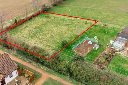
- Price
- Offers Over£150,000
- Size
- 0.21 acres
Burnside, Balmullo, St. Andrews, North East Fife, Fife KY16 Scotland
Added on 29/01/2026Building Plot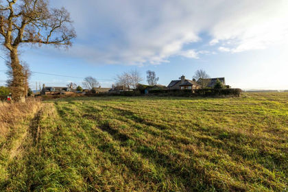
- Price
- Guide Price£120,000
- Size
- 0.36 acres
Added on 04/06/2026Building Plot
- Price
- Offers Over£135,000
- Size
- 0.22 acres
Plot at 117-119 New Row, Dunfermline, KY12, Dunfermline and Dollar, Fife KY12 Scotland
Added on 03/02/2026Development Land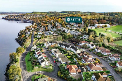
- Price
- Offers Over£155,000
West Park Road, Newport-on-Tay, Fife, North East Fife, Fife DD6 Scotland
Added on 31/03/2026Building Plot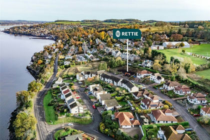
- Price
- Offers Over£140,000
West Park Road, Newport-on-Tay, Fife, North East Fife, Fife DD6 Scotland
Added on 31/03/2026Building Plot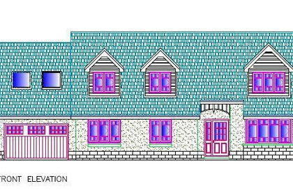
- Price
- Offers in Excess of£120,000
- Size
- 0.17 acres
Added on 29/01/2026Undeveloped Land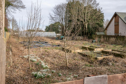
- Price
- Offers Over£120,000
Added on 18/04/2026Building Plot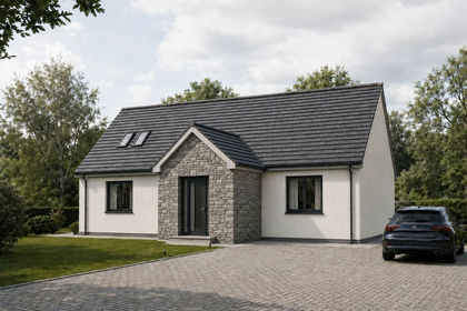
- Price
- Fixed Price£165,000
- Size
- 0.23 acres
Strathern Road, Dundee, DD5, Dundee Central, Dundee City DD4 Scotland
Added on 18/08/2026Building Plot
- Price
- Offers Over£150,000
High Street, Pittenweem, Anstruther, Fife, North East Fife, Fife KY10 Scotland
Added on 28/01/2026Redevelopment Land