Old Hall Street, Malpas, Cheshire, SY14
- Land size
- 5.64 acres
- Bedrooms
- 4
- Bathrooms
- 3
Description
A charming former farmhouse with cottage annexe, stabling & paddock land adjoining open countryside yet convenient for the village.
Accommodation
• Porch
• Reception Hall
• Sitting Room
• W.C/Shower Room
• Boot Room
• Utility Room
• Lounge
• Open Plan Kitchen with Sitting Area
• Dining & Living Areas
• Master Bedroom with en-suite Shower Room
• 3 further Bedrooms (1 en-suite)
• Family Bathroom
Outside
• Traditional Barn with Log Store, Store Room, W.C. and 1 Bedroom Cottage Annexe
• Stable Yard with 3 Loose Boxes
• Tack Room & Feed Store
• Party/Garden Room
• Landscaped Gardens
• Formal Lawns
• Orchard
• Paddock Land
• In all about 5.64 acres (2.28 hectares)
Distances
• Whitchurch 5 miles
• Wrexham 13 miles
• Chester 17 miles
• Crewe Station 20 miles
• Liverpool 34 miles
• Manchester 54 miles
(distances approximate)
Description
Moss House is conveniently situated just a short distance to the south of Malpas. It comprises a charming former farmhouse which is believed to date in part from the early 19th century with later additions. It has a particularly attractive façade with bay windows and there are climbing roses & a mature wisteria trained across the front elevation. Constructed principally of brick beneath a slate roof incorporating dormer windows with finials to the rear it has a combination of single & double-glazed wooden windows and the benefit of gas central heating. Internally the house offers extremely generous accommodation with formal reception rooms and an open plan kitchen connecting to dining & living areas. At first floor level there are four double bedrooms with two having en-suite facilities and the remaining bedrooms are served by a family bathroom. In addition to the main house there is a traditional two storey brick barn which incorporates domestic storage and a one bedroom cottage/annexe being suitable for staff or dependent relatives. Likewise, there is scope to extend the cottage or to create a further unit subject to the availability of planning permission which could generate a useful source of income. Other uses may include a home office or leisure facilities again subject to the availability of planning permission. Moss House is also ideal for those with equestrian interests owing to the existence of the stable yard with four loose boxes, tack room & feed store which complement the surrounding paddock land.
Location
Moss House occupies a slightly elevated, rural setting overlooking open countryside and yet it is convenient for the village with its attractive High Street lined by a collection of period houses and commercial properties. The property is within walking distance of Malpas which is a fully serviced village with a selection of shops, Co-op, doctor’s surgery, Fire Station café, several pubs including The Lion which has been refurbished and an impressive church. For more comprehensive services the former market town of Whitchurch and county town of Chester are 5 miles and 17 miles respectively offering supermarkets and out of town retail parks. Schooling is well provided for with a state primary school in the village and the well-regarded secondary school, Bishop Heber High School, on the edge of Malpas. For those seeking private education there is a good selection of schools locally including Abbeygate College at Saighton, Ellesmere College and the King’s & Queen’s Schools in Chester. On the recreational front there is a sports club in the village offering football, cricket, tennis, and bowls along with golf courses locally at Carden Park and Hill Valley. For the equestrian enthusiasts there is racing at Chester & Bangor-On Dee and hunting is with the Wynnstay.
Communications
Despite its rural location Moss House enjoys excellent road links being approximately 2 miles from the A41 permitting daily travel to all areas of commerce throughout the North West. To the north beyond Chester the A41 connects to the M53 and M56 motorways serving Liverpool and Manchester. To the south the A41 connects with the M54 motorway allowing for ease of access to The Potteries, Telford, Wolverhampton and Birmingham. Liverpool and Manchester International Airports are 37 and 42 miles respectively and travel to London is available via Crewe Station which is 18 miles providing a 1 hr 35 mins service to Euston.
Outside
Moss House is accessed via a splayed entrance with sandstone walls and electrically operated solid wooden gates which open onto a tarmacadam courtyard formed by the house and traditional brick barn providing a generous parking & turning area. Against the drive are a series of mature trees including Maple & Sycamore and beyond which is an herbaceous border together with a selection of ornamental trees comprising Monkey Puzzle & Acer. To the side of the house against the south west elevation is a wide paved terrace which is an ideal seating & dining area taking advantage of the afternoon & evening sun. Beyond the terrace is a lawned garden with orchard containing a selection of fruit trees. To the front of the house is a cobbled path extending across the front elevation and against which is a narrow lawn framed by a wrought iron railing fence and below which is a small mown paddock which is ideal as a children’s play area. To the front of the house are Cedar and Holly trees and to the side against the north east elevation a further lawned garden with mature hedge against the lane and timber & felt garden shed on a brick plinth.
Outbuildings Cottage Annexe & Land
The courtyard barn is a traditional two storey L-shaped range constructed of brick beneath a slate roof and against the south east gable end is a lean-to log store. Within the main barn is a store room with ceramic sink, hot & cold water and power supply. Within the store room stairs lead to an extensive first floor storage area with roof lights. Beyond the store room is an internal corridor which provides access to the stables in the adjoining equestrian range and a cloakroom with low flus w.c., hand basin and gas boiler. The cottage which is accessed via a front door against the north east gable end has the benefit of double-glazed windows and gas central heating. The front door opens into a sitting room with boarded ceiling incorporating downlighters whilst a turned staircase leads up to a mezzanine bedroom with exposed beams and roof light. Beyond the sitting room is the kitchen with fitted wall & base units under work surfaces incorporating a stainless steel sink unit with drainer & mixer tap, Indesit electric oven and hob. Off the kitchen is a wet room which is fully tiled with shower, low flush w.c., pedestal handbasin, mirror, heated towel rail, downlighters and extractor fan.
From the courtyard there is vehicular access to the side of the traditional barn into the stable yard which comprises a brick & concrete lean-to range beneath a plastic coated steel profile sheet roof with covered overhang to the front. The building contains 3 loose boxes, tack room and open fronted feed store. All the loose boxes have stable doors & solid floors and there is an external water tap and power to the building. The tack room has fitted wall & base units under worksurfaces, ceramic sink, plumbing for washing machine and radiator. The stable yard has a concrete surface and is enclosed by a brick retaining wall above which is a lawned garden with paved seating area with beech hedging, lavender and a row of Silver Birch trees. At the end of the stable yard within the field is a cedar clad garden/party room with built in bar, fridge, speakers and bench seating. From the stable yard there are a series of field gates accessing the land which is gently undulating. It forms an attractive block of land which is stockproof and laid to grass enclosed by established hedges and mature trees. Through the fields are a series of mown walks and there is also a field gate onto the lane. The whole extends to 5.64 acres (2.28 hectares).
Property Information
Address: Moss House, Old Hall Street, Malpas, Cheshire, SY14 7JJ
Tenure: The property is freehold with vacant possession.
Services: Mains water, electricity and gas. Private Drainage. Central heating is courtesy of a gas boiler. Telephone line & Broadband connection. Burglar Alarm.
Local Authority: Cheshire West & Chester Council - Tel:
Council Tax: Band G - £3,968.72 payable 2025/2026.
Map Location
Property details
- Tenure
- Freehold
- Council Tax Band
- TBC
- Date Posted
- 2026-01-29
Market Value Analysis
Compared with 254 Homes with Land listings in North West England (5+ acres).
Energy Performance Certificate
Energy Efficiency Rating
Based on UK Energy Performance Certificate standards (EU Directive 2002/91/EC)
Running costs are one side. Planning activity, flood history and ground risks for this location are in the full report.
Utilities & Restrictions
Utilities
- Electricity
- Ask Agent
- Water
- Ask Agent
- Heating
- Ask Agent
- Broadband
- Ask Agent
- Sewerage
- Ask Agent
Rights & Restrictions
- Public Rights of Way
- Ask Agent
- Private Rights of Way
- Ask Agent
- Listed Property
- Ask Agent
- Restrictions
- Ask Agent
Listed status, conservation areas and planning constraints for this location are in the full report.
Property Features
- Accessibility
- Ask Agent
- Parking
- Parking Available
- Garden
- Garden
Beyond the particulars: planning activity, flood history, heritage and ground risks, checked for this exact spot.
Connectivity
Broadband
Fastest speed available at this postcode
1.8 Gbps
Gigabit full fibre
Suitable for
- 4K streaming on every screen
- Full-time home working
- Online gaming & big downloads
Mobile signal
Outdoor predictions; indoor signal depends on building materials.
Ofcom Connected Nations postcode-level predictions. Speeds and signal are modelled, not measured, and vary between addresses and providers.
Signal is the easy part. Planning activity, flood history and protected designations here are in the full report.
Nearest Schools
Primary
- Malpas Alport Endowed Primary School0.8 milesOfsted report card · Nov 2025
- Ages
- 2 to 11
- Pupils
- 261
- Type
- Community school
- Tushingham With Grindley CofE Primary School1.8 milesOfsted: Good *
- Ages
- 3 to 11
- Pupils
- 113
- Type
- Voluntary controlled school
- Faith
- Church of England
- Tilston Parochial CofE Primary Academy3.7 milesNo Ofsted rating
- Ages
- 3 to 11
- Type
- Academy converter
- Faith
- Church of England
- Shocklach Oviatt CofE Primary School3.8 milesNo Ofsted rating
- Ages
- 3 to 11
- Pupils
- 83
- Type
- Voluntary controlled school
- Faith
- Church of England
- Bickerton Holy Trinity CofE Primary School4.3 milesOfsted: Good
- Ages
- 4 to 11
- Pupils
- 101
- Type
- Voluntary controlled school
- Faith
- Church of England
Secondary
- Bishop Heber High School1.2 milesOfsted: Good
- Ages
- 11 to 18
- Pupils
- 1,293
- Type
- Foundation school
- Sir John Talbot's School5 milesOfsted: Good
- Ages
- 11 to 19
- Pupils
- 861
- Type
- Academy sponsor led
- Lakelands Academy9.6 milesOfsted report card · Jun 2026
- Ages
- 11 to 16
- Pupils
- 590
- Type
- Academy converter
- Malbank School and Sixth Form College10 milesOfsted: Good
- Ages
- 11 to 18
- Pupils
- 1,289
- Type
- Academy converter
- Tarporley High School and Sixth Form College10 milesOfsted: Good
- Ages
- 11 to 18
- Pupils
- 1,219
- Type
- Academy converter
* Latest graded judgement covers quality of education only; no overall grade was issued under the 2024-25 inspection framework.
Distances are straight-line from the advertised location. Source: the national school registers (DfE, Welsh Government, Scottish Government) and Ofsted.
Schools are just the start: sold prices nearby, planning activity and any flood history are in the full report.
Amenities
Supermarket
GP surgery
Pharmacy
Hospital
Green space
Straight-line distances from the advertised location. Sources: NHS records, Geolytix supermarket locations, OS Open Greenspace and the national trails registers.
The area stacks up? Now check the location itself: planning nearby, protected designations and past flooding.
Getting Around
Nearest station
Nearest bus stop
Typical drive times
Straight-line distances from the advertised location; drive times are typical free-flow times over OpenStreetMap road data, so allow more at peak. Public transport locations from DfT NaPTAN.
Easy to reach matters. So do planning activity, flood history and ground risks: all in the full report.
Flood Risk
From Environment Agency flood map open data, checked around the advertised map pin and allowing for the listed acreage where known. This summary comes from LandSale, the advertising platform, not from the listing agent, and is not part of the agent's particulars. Risk can vary across a single holding, so verify anything critical through your own searches before committing.
Rivers and the sea
Surface water
Mapped within the area searched, not at the advertised map pin itself.
These bandings are the summary. Where this location sits on the flood maps, plus planning activity, heritage and ground risks, is in the full report.
Important notice: Information, maps and tags on this page are drawn from the advertising agent's marketing materials or generated automatically. LandSale has not verified them. Relying on these details is at your own risk, always carry out independent checks before committing to a purchase.
LandSale full disclaimer
Marketing information only - not formal particulars. The details on this website are provided for general guidance and do not constitute an offer or contract. Neither LandSale nor the advertising estate/land agent accepts responsibility for any inaccuracy.
1. Source of information
- Listing content: Core description, asking price, tenure, measurements, photographs and planning history originate from the marketing materials of the advertising estate or land agent. LandSale does not author this content and cannot guarantee its accuracy.
- Automated tags & categorisation: Property type, land-use class, acreage bands and similar labels may be applied by machine-learning models. They are intended as a helpful guide only and may not reflect the property's legal status or permitted use.
- Third-party & enriched data layers: Maps, boundary outlines, planning designations, soil reports, broadband coverage and other environmental or location-based insights are licensed from external suppliers. Such data are supplied “as is", may be incomplete or out of date and are subject to change without notice.
2. Verification required
Prospective purchasers must verify critical matters, including but not limited to planning permission, title boundaries, public rights of way, environmental constraints, acreage, services, access and VAT status, through their own inspections, specialist surveys, legal advisers and the selling agent before relying on the information or entering into any contract.
3. No warranty or liability
LandSale gives no warranty, express or implied, as to the accuracy, completeness or fitness for any particular purpose of the information displayed. LandSale shall not be liable for any loss, damage, cost or expense arising directly or indirectly from any use of or reliance on such information, save where liability may not be excluded by law.
4. Updates & feedback
If you believe any detail on this listing is inaccurate, please let us know. We will investigate and, where appropriate, update the listing or notify the agent.
© LandSale | Version 1.3 - August 2026
Similar properties for sale
- Price
- £1,000,000
- Size
- 4 acres
Highbrooke House, Higher Wych, Malpas, Bronington, Wrexham SY14 Wales
Added on 15/04/2026House with Land
- Price
- Guide Price£899,000
- Size
- 3.5 acres
Added on 29/01/2026Barn Conversion
- Price
- £1,100,000
- Size
- 3.19 acres
Added on 10/09/2026Development Land
- Price
- £1,150,000
- Size
- 19 acres
Tilston, Cheshire, Tilston, Cheshire West and Chester SY14 England
Added on 14/04/2026House with Land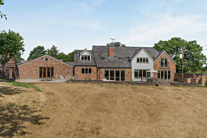
- Price
- £1,250,000
- Size
- 4.3 acres
Lowcross, Tilston, Tilston, Cheshire West and Chester SY14 England
Added on 08/08/2026House with Land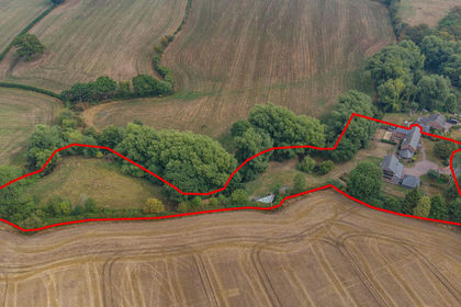
- Price
- £925,000
- Size
- 2 acres
Added on 29/01/2026House with Land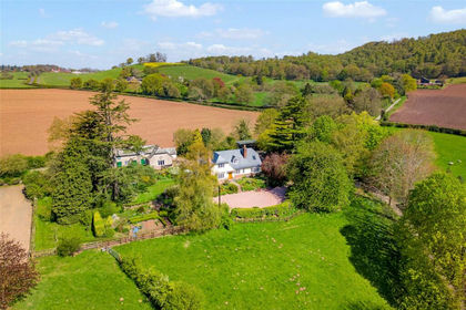
- Price
- Offers Over£1,100,000
- Size
- 4.08 acres
Malpas, Cheshire, Duckington, Cheshire West and Chester SY14 England
Added on 30/04/2026House with Land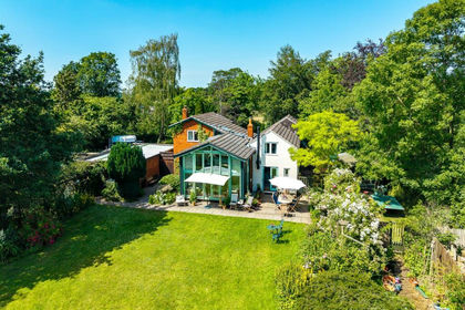
- Price
- Fixed Price£750,000
- Size
- 2.6 acres
Hobb Hill, Tilston, Malpas., Tilston, Cheshire West and Chester SY14 England
Added on 27/08/2026House with Land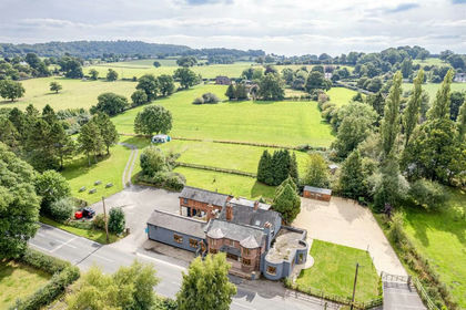
- Price
- Offers Over£795,000
- Size
- 2.5 acres
***Lifestyle Opportunity*** Broxton, Chester, Broxton, Cheshire West and Chester CH3 England
Added on 29/01/2026Camping Land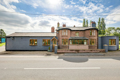
- Price
- £795,000
- Size
- 2.5 acres
Added on 29/01/2026House with Land