Manea Road, Wimblington, March
- Land size
- 71.98 acres
Description
71.98 acres (29.12 hectares) (more or less) land known as Latches Fen Farm, Manea Road, Wimblington, March, Cambridgeshire PE15 0PA.
Compact Block of Arable Land.
Grade 2 / 3.
Vacant possession on Completion.
For Sale by Private Treaty
Guide Price £900,000
DESCRIPTION
A compact block of arable land, comprising 3 adjoining fields of regular shape, abutting Manea Road (B1093), Wimblington, March, Cambridgeshire. The land is registered under Title Number CB459019.
There is a mains water supply, with a meter, in the north east corner of the block.
The land has been underdrained and plans are available.
SCHEDULE
FIELD NUMBER TOTAL AREA
HECTARES ACRES
TL 4291 - 7652 11.76 29.07
TL 4391 - 0142 8.63 21.33
TL 4391 - 1637 8.73 21.58
TOTAL 29.12 71.98
The field numbers are taken from the Rural Payments Agency system and the areas of each field are from the National Grid Ordnance Survey map and from original Sale Particulars, when the land was purchased in 1994.
LAND AND SOIL CLASSIFICATION
The land is classified as Grade 2 and 3 on the Agricultural Land Classification map of England and Wales. The soil is of the Ireton, Peacock and Adventurers series, comprising some peat and some coarse loam soil, described as being suitable for a range of cropping, including cereals and root crops.
PREVIOUS CROPPING
LATCHES 1 - WESTERN BLOCK
2023 Wheat
2022 Pt Millet Pt (7a east) Potatoes
2021 Millet
2020 Leeks
2019 Wheat
LATCHES 2 - CENTRAL FIELD
2023 Wheat
2022 Potatoes
2021 Millet
2020 Leeks
2019 Wheat
LATCHES 3 - EASTERN FIELD
2023 Wheat
2022 Potatoes
2021 Millet
2020 Leeks
2019 Wheat
The owners have practiced traditional farming methods using a long rotation period. Daffodils have been grown in the past.
ENVIRONMENTAL STEWARDSHIP
Each field has had 0.5 hectare AC58 (mixed arable crop) at the southern end. This is a rotational option under the Vendor's Higher Level Stewardship Scheme. There are also 3 metre grass margins along several boundaries. The purchaser will NOT be required to take on the obligations of the Scheme, at the Vendor will relocate these to other land.
POSSESSION
Vacant possession will be given upon completion of the purchase.
BASIC PAYMENT SCHEME
The land is registered with the Rural Payments Agency and claims have been submitted. All monies from the 2023 claim belong to the Vendor and the Purchaser will be required to indemnify against any breaches until the end of the claim year.
All delinked payments belong to the Vendor.
Further details are available from the Agents.
OUTGOINGS
Drainage Rates are payable to the Middle Level Commissioners and Curf and Wimblington Combined Internal Drainage Board.
The amounts for the year ending 31st March 2024 are set out below, for guidance only:
Middle Level Commissioners - £1,239.52
Curf and Wimblington Combined Internal Drainage Board - £1,223.26
IRRIGATION
The Vendor has a water abstraction licence and irrigation has been provided from a reservoir. The Vendor may be prepared to transfer a proportion of the licence, subject to separate negotiation.
Further details are available from the Agent.
SPORTING RIGHTS
These are included in the sale as far as they are owned.
MINERAL RIGHTS
These are included in the sale as far as they are owned.
OVERAGE
The land is sold subject to an Overage Clause retaining 35% of any increased value due to the granting of Planning Permission, for residential or commercial use, for a period of 30 years from the date of Completion.
RIGHTS AND EASEMENTS
The land is offered subject to all existing rights, including rights of way, whether private or public, light, support, drainage, water, and electricity supply and other rights, easements, quasi easements and all wayleaves, whether referred to or not in these Particulars.
There is a main drain running along the southern boundary, with a 9 metre bylaw width under the Land Drainage Act 1991.
There are telegraph poles along the northern boundary.
VIEWINGS
Interested parties may view at their own risk, during daylight hours, with a set of these Particulars in hand.
FOR FURTHER INFORMATION
If you have any queries, please call our March Professional Office on and ask for Shirley Pollard.
PARTICULARS PREPARED
November 2023.
Photographs taken October 2023.
Map Location
Property details
- Tenure
- Freehold
- Council Tax Band
- Ask Agent
- Date Posted
- 2026-01-29
Market Value Analysis
Compared with 49 Farmland & Pasture listings in East Anglia (50+ acres).
Utilities & Restrictions
Utilities
- Electricity
- Ask Agent
- Water
- Ask Agent
- Heating
- Ask Agent
- Broadband
- Ask Agent
- Sewerage
- Ask Agent
Rights & Restrictions
- Public Rights of Way
- Ask Agent
- Private Rights of Way
- Ask Agent
- Listed Property
- Ask Agent
- Restrictions
- Ask Agent
Listed status, conservation areas and planning constraints for this location are in the full report.
Property Features
- Accessibility
- Ask Agent
- Parking
- Ask Agent
- Garden
- Ask Agent
Beyond the particulars: planning activity, flood history, heritage and ground risks, checked for this exact spot.
Connectivity
Broadband
Fastest speed available at this postcode
1.8 Gbps
Gigabit full fibre · available to 53% of premises
Suitable for
- 4K streaming on every screen
- Full-time home working
- Online gaming & big downloads
Mobile signal
Predicted 4G and 5G signal; indoor signal depends on building materials.
Ofcom Connected Nations postcode-level predictions. Speeds and signal are modelled, not measured, and vary between addresses and providers.
Signal is the easy part. Planning activity, flood history and protected designations here are in the full report.
Nearest Schools
Primary
- Thomas Eaton Primary Academy1.4 milesOfsted: Good
- Ages
- 2 to 11
- Pupils
- 126
- Type
- Academy sponsor led
- Lionel Walden Primary School2.2 milesNo Ofsted rating
- Ages
- 4 to 11
- Pupils
- 205
- Type
- Community school
- Manea Community Primary School2.8 milesOfsted: Good
- Ages
- 4 to 11
- Pupils
- 194
- Type
- Community school
- Cavalry Primary School2.9 milesOfsted: Good
- Ages
- 3 to 11
- Pupils
- 407
- Type
- Academy converter
- Burrowmoor Primary Academy3.4 milesOfsted: Inadequate
- Ages
- 2 to 11
- Pupils
- 326
- Type
- Academy converter
Secondary
- Neale-Wade Academy2.7 milesOfsted report card · Jan 2026
- Ages
- 11 to 18
- Pupils
- 1,130
- Type
- Academy sponsor led
- Cromwell Community College4.5 milesOfsted: Good
- Ages
- 4 to 18
- Pupils
- 1,539
- Type
- Academy converter
- Vista Academy Littleport8 milesOfsted report card · Nov 2025
- Ages
- 11 to 16
- Pupils
- 547
- Type
- Academy sponsor led
- Witchford Village College8.7 milesNo Ofsted rating
- Ages
- 11 to 16
- Pupils
- 804
- Type
- Academy converter
- Ely College8.9 milesNo Ofsted rating
- Ages
- 11 to 18
- Pupils
- 1,635
- Type
- Academy converter
Distances are straight-line from the advertised location. Source: the national school registers (DfE, Welsh Government, Scottish Government) and Ofsted.
Schools are just the start: sold prices nearby, planning activity and any flood history are in the full report.
Amenities
Supermarket
GP surgery
Pharmacy
Hospital
Straight-line distances from the advertised location. Sources: NHS records, Geolytix supermarket locations, OS Open Greenspace and the national trails registers.
The area stacks up? Now check the location itself: planning nearby, protected designations and past flooding.
Getting Around
Nearest station
Nearest bus stop
Typical drive times
Straight-line distances from the advertised location; drive times are typical free-flow times over OpenStreetMap road data, so allow more at peak. Public transport locations from DfT NaPTAN.
Easy to reach matters. So do planning activity, flood history and ground risks: all in the full report.
Flood Risk
Environment Agency open data, checked around the advertised map pin for the listed acreage. Long-term risk counts flood defences; the planning map's flood zones do not. Provided by LandSale, not the listing agent, and not part of the agent's particulars. Risk varies across a holding, so verify before committing.
Rivers and the sea
Planning map: Flood Zone 3.
Surface water
Not at the pin: mapped about 20 metres away.
These bandings are the summary. Where this location sits on the flood maps, plus planning activity, heritage and ground risks, is in the full report.
Important notice: Information, maps and tags on this page are drawn from the advertising agent's marketing materials or generated automatically. LandSale has not verified them. Relying on these details is at your own risk, always carry out independent checks before committing to a purchase.
LandSale full disclaimer
Marketing information only - not formal particulars. The details on this website are provided for general guidance and do not constitute an offer or contract. Neither LandSale nor the advertising estate/land agent accepts responsibility for any inaccuracy.
1. Source of information
- Listing content: Core description, asking price, tenure, measurements, photographs and planning history originate from the marketing materials of the advertising estate or land agent. LandSale does not author this content and cannot guarantee its accuracy.
- Automated tags & categorisation: Property type, land-use class, acreage bands and similar labels may be applied by machine-learning models. They are intended as a helpful guide only and may not reflect the property's legal status or permitted use.
- Third-party & enriched data layers: Maps, boundary outlines, planning designations, soil reports, broadband coverage and other environmental or location-based insights are licensed from external suppliers. Such data are supplied “as is", may be incomplete or out of date and are subject to change without notice.
2. Verification required
Prospective purchasers must verify critical matters, including but not limited to planning permission, title boundaries, public rights of way, environmental constraints, acreage, services, access and VAT status, through their own inspections, specialist surveys, legal advisers and the selling agent before relying on the information or entering into any contract.
3. No warranty or liability
LandSale gives no warranty, express or implied, as to the accuracy, completeness or fitness for any particular purpose of the information displayed. LandSale shall not be liable for any loss, damage, cost or expense arising directly or indirectly from any use of or reliance on such information, save where liability may not be excluded by law.
4. Updates & feedback
If you believe any detail on this listing is inaccurate, please let us know. We will investigate and, where appropriate, update the listing or notify the agent.
© LandSale | Version 1.3 - August 2026
Listing agent
Maxey Grounds - Commercial, March
22-24 Market Place, March, PE15 9JH
Similar properties for sale
- Price
- Guide Price£930,000
- Size
- 101.58 acres
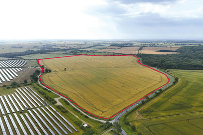
Land At, Woodwalton, Huntingdon, Cambridgeshire, PE28, Wood Walton, Cambridgeshire PE28 England
Added on 02/08/2026Arable Land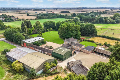
- Price
- Guide Price£745,000
- Size
- 49.62 acres
Lot 2 - West End Farm, Fenstanton, Huntingdon, Fenstanton, Cambridgeshire PE28 England
Added on 09/09/2026Agricultural Land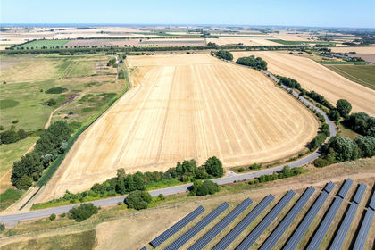
- Price
- £875,000
- Size
- 79.74 acres
Gibbons Farm - Lot 2, Sutton Bridge, PE12, Sutton Bridge, Lincolnshire PE12 England
Added on 05/10/2026Arable Land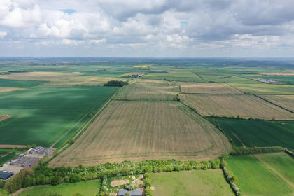
- Price
- Guide Price£770,000
- Size
- 82.65 acres
Added on 31/05/2026Farmland
- Price
- Guide Price£850,000
- Size
- 59.55 acres
Added on 09/09/2026Agricultural Land
- Price
- Guide Price£800,000
- Size
- 89.35 acres
Lot 7 - Land Nr Kirtling And Ashley, Kirtling, Cambridgeshire CB8 England
Added on 01/09/2026Farmland
- Price
- Guide Price£950,000
- Size
- 89.35 acres
Lot 4 - Land Nr Kirtling And Ashley, Kirtling, Cambridgeshire CB8 England
Added on 01/09/2026Farmland
- Price
- Guide Price£700,000
- Size
- 84.83 acres
Lot 2 Homefield Farm, Sturmer, Haverhill, Essex, Sturmer, Essex CB9 England
Added on 13/10/2026Arable Land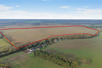
- Price
- £725,000
- Size
- 88.87 acres
Land At Wixoe, Stoke By Clare, Sudbury, Suffolk, CO10, Stoke-by-Clare, Suffolk CO10 England
Added on 18/06/2026Farmland
- Price
- Guide Price£1,040,000
- Size
- 159.93 acres
Added on 25/09/2026Farmland