Castle Lodge, Murtry
- Land size
- 2 acres
- Bedrooms
- 3
- Bathrooms
- 1
Key Features
- Stunning period features
- Wrap around garden
- Driveway parking for several cars
- Woodland paddock
- Approx 2 acres
- Grade II listed
Description
Castle Lodge is a gem of a property on the edge of the Orchardleigh estate. The detached house is Gothic in style with parts of the property dating back to the 17th century. It stands today as a three-bedroom retreat set in c.2 acres of garden and woodland. The current vendors have undergone a sensitive renovation of the property and empathetically restored it to a rare and elegant country home.
The entrance is via a hallway with quarry tiles and a double-height ceiling which show off the Crittall window above the front door. A handy w/c is located just off the hall. To the left of the hallway lies a charming kitchen finished with traditional shaker-style tulip wood units, complemented by a Belfast sink set within the wooden worktop. A electric range oven and hob and integrated dishwasher have also been newly installed. The wood burner is nestled in the exposed stone fireplace, while a spacious pantry cupboard offers ample extra storage space. The elegant sitting room is located on the south side of the property, inviting light in from the dual aspect traditional leadlight windows. A central open fire is surrounded by a wooden carved mantle.
The staircase ascends from the sitting room to a landing, where a mullion leadlight window offers expansive rural views of the estate. The primary bedroom is beautifully proportioned, mirroring the living room below. Two additional bedrooms are located at the back of the house, featuring the same characteristic throughout. The family bathroom has been fitted with a traditional white suite and finished with a modern metro tile.
The gardens of Castle Lodge have a charming and enchanting ambience, featuring a wide variety of mature shrubs and trees, herbaceous borders, and meticulously maintained lawns. A delightful gravel path leads from the driveway, leading visitors around the garden. A captivating pergola, complete with an outdoor fireplace, forms a picturesque garden room. The walled garden offers numerous secluded spots to appreciate the delightful view of the tree canopy. Additionally, there is a peaceful woodland area that opens up to a paddock.
'It's high down and far horizon, its deep woods, and the stillness of its shimmering lake' - William Duckworth 1854 on Orchardleigh estate and grounds.
Castle Lodge is approx 1 mile from Frome, a historic market town, just under 13 miles from Bath and surrounded by beautiful countryside. The town has many amenities, including good schools, two theatres, a cinema and a station with rail links to Bath, Bristol and London Paddington. On the doorstep are many other exciting venues; the exclusive Babington House is located 6 miles from Frome. Hauser and Wirth – garden and gallery and Roth Bar restaurant is 10 miles away, with Bruton High Street to wander around too. Lastly, the internationally known Newt is 13 miles away from Frome, which is an awarding winning hotel with gardens with restaurants.
Grade II listed
Freehold
Private water, private drainage and electrics. LPG gas serves the gas central heating.
Council Tax Band E
Note from Hunter French – These particulars do not form part of any offer or contract and must not be relied upon as a statement or representation of fact. Please note that the material information is provided by third parties and is provided as a guide only. Whilst Hunter French have taken steps to verify the information, you are advised to do your own due diligence and research where necessary prior to exchanging contracts. Areas, measurements, and distances given are approximate only. Any reference to alterations to, or use of, any part of the property does not mean that any necessary planning, building regulations or other consent has been obtained. No testing of services, appliances, or fixtures have been carried out nor have we conducted any surveys or specialist reports. A list of fixtures and fittings will be provided by solicitors during the conveyancing process, any items listed in the description are not assumed to be included in the sale. If we are informed of any changes to the material information we will endeavours to update the materials as soon as possible. We advised clients to obtain legal advice where necessary, and before exchange of contracts.
Map Location
Property details
- Tenure
- Freehold
- Council Tax Band
- E
- Date Posted
- 2026-01-29
Market Value Analysis
Compared with 1,737 Homes with Land listings in South West England (1+ acres).
Utilities & Restrictions
Utilities
- Electricity
- Mains
- Water
- Mains
- Heating
- Gas Central Heating
- Broadband
- Ask Agent
- Sewerage
- Mains
Rights & Restrictions
- Public Rights of Way
- Ask Agent
- Private Rights of Way
- Ask Agent
- Listed Property
- Yes
- Restrictions
- Ask Agent
Listed status, conservation areas and planning constraints for this location are in the full report.
Property Features
- Accessibility
- Ask Agent
- Parking
- Driveway
- Garden
- Private Garden
Beyond the particulars: planning activity, flood history, heritage and ground risks, checked for this exact spot.
Connectivity
Broadband
Fastest speed available at this postcode
950 Mbps
Gigabit full fibre · available to 75% of premises
Suitable for
- 4K streaming on every screen
- Full-time home working
- Online gaming & big downloads
Mobile signal
Outdoor predictions; indoor signal depends on building materials.
Ofcom Connected Nations postcode-level predictions. Speeds and signal are modelled, not measured, and vary between addresses and providers.
Signal is the easy part. Planning activity, flood history and protected designations here are in the full report.
Nearest Schools
Primary
- St Louis Catholic Primary School, Frome1.2 milesOfsted: Good *
- Ages
- 4 to 11
- Pupils
- 178
- Type
- Academy converter
- Faith
- Roman Catholic
- Vallis First School1.2 milesOfsted: Good *
- Ages
- 4 to 9
- Pupils
- 185
- Type
- Community school
- Trinity Church of England First School1.4 milesNo Ofsted rating
- Ages
- 5 to 9
- Pupils
- 297
- Type
- Academy converter
- Faith
- Church of England
- Avanti Park School1.5 milesOfsted: Good
- Ages
- 4 to 13
- Pupils
- 503
- Type
- Free schools
- St John's Church of England Voluntary Aided First School, Frome1.6 milesOfsted: Requires improvement
- Ages
- 4 to 9
- Pupils
- 185
- Type
- Voluntary aided school
- Faith
- Church of England
Secondary
- Frome Community College1.3 milesNo Ofsted rating
- Ages
- 13 to 18
- Pupils
- 1,298
- Type
- Academy converter
- Oakfield Academy1.3 milesOfsted: Requires improvement
- Ages
- 9 to 13
- Pupils
- 490
- Type
- Academy converter
- Selwood Academy1.7 milesOfsted: Good
- Ages
- 9 to 13
- Pupils
- 658
- Type
- Academy converter
- Faith
- Church of England/Methodist
- Somerset Studio School4.8 milesNo Ofsted rating
- Ages
- 14 to 19
- Pupils
- 152
- Type
- Studio schools
- Writhlington School4.8 milesOfsted: Good
- Ages
- 11 to 18
- Pupils
- 894
- Type
- Academy converter
* Latest graded judgement covers quality of education only; no overall grade was issued under the 2024-25 inspection framework.
Distances are straight-line from the advertised location. Source: the national school registers (DfE, Welsh Government, Scottish Government) and Ofsted.
Schools are just the start: sold prices nearby, planning activity and any flood history are in the full report.
Amenities
Supermarket
GP surgery
Pharmacy
Hospital
Straight-line distances from the advertised location. Sources: NHS records, Geolytix supermarket locations, OS Open Greenspace and the national trails registers.
The area stacks up? Now check the location itself: planning nearby, protected designations and past flooding.
Getting Around
Nearest station
Nearest bus stop
Typical drive times
Straight-line distances from the advertised location; drive times are typical free-flow times over OpenStreetMap road data, so allow more at peak. Public transport locations from DfT NaPTAN.
Easy to reach matters. So do planning activity, flood history and ground risks: all in the full report.
Flood Risk
From Environment Agency flood map open data, checked around the advertised map pin and allowing for the listed acreage where known. This summary comes from LandSale, the advertising platform, not from the listing agent, and is not part of the agent's particulars. Risk can vary across a single holding, so verify anything critical through your own searches before committing.
Rivers and the sea
Surface water
The detail behind these bandings
The full report pinpoints where this location sits on the flood maps, and runs the deeper checks that usually only surface after an offer.
- Exact flood zones & annual chances (included in the full report)
- Any recorded past flooding (included in the full report)
- Planning activity nearby (included in the full report)
- Heritage & conservation (included in the full report)
- Protected nature designations (included in the full report)
- Ground risks (included in the full report)
- Sold prices nearby (included in the full report)
£14.99 · one-off purchase
By LandSale, the platform. Not provided by the listing agent. Ready in about a minute.
Important notice: Information, maps and tags on this page are drawn from the advertising agent's marketing materials or generated automatically. LandSale has not verified them. Relying on these details is at your own risk, always carry out independent checks before committing to a purchase.
LandSale full disclaimer
Marketing information only - not formal particulars. The details on this website are provided for general guidance and do not constitute an offer or contract. Neither LandSale nor the advertising estate/land agent accepts responsibility for any inaccuracy.
1. Source of information
- Listing content: Core description, asking price, tenure, measurements, photographs and planning history originate from the marketing materials of the advertising estate or land agent. LandSale does not author this content and cannot guarantee its accuracy.
- Automated tags & categorisation: Property type, land-use class, acreage bands and similar labels may be applied by machine-learning models. They are intended as a helpful guide only and may not reflect the property's legal status or permitted use.
- Third-party & enriched data layers: Maps, boundary outlines, planning designations, soil reports, broadband coverage and other environmental or location-based insights are licensed from external suppliers. Such data are supplied “as is", may be incomplete or out of date and are subject to change without notice.
2. Verification required
Prospective purchasers must verify critical matters, including but not limited to planning permission, title boundaries, public rights of way, environmental constraints, acreage, services, access and VAT status, through their own inspections, specialist surveys, legal advisers and the selling agent before relying on the information or entering into any contract.
3. No warranty or liability
LandSale gives no warranty, express or implied, as to the accuracy, completeness or fitness for any particular purpose of the information displayed. LandSale shall not be liable for any loss, damage, cost or expense arising directly or indirectly from any use of or reliance on such information, save where liability may not be excluded by law.
4. Updates & feedback
If you believe any detail on this listing is inaccurate, please let us know. We will investigate and, where appropriate, update the listing or notify the agent.
© LandSale | Version 1.3 - August 2026
Listing agent
Hunter French, Frome
19 Paul Street, Frome BA11 1DT
Similar properties for sale
- Price
- Offers Over£800,000
- Size
- 2 acres
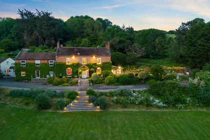
Character Home, Hill Lane, Brent Knoll, Highbridge, Somerset TA9 England
Added on 22/06/2026Country Home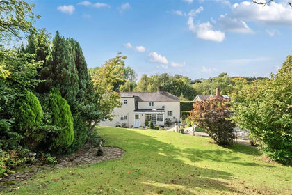
- Price
- Guide Price£695,000
- Size
- 1.2 acres
Lyons Gate, Dorchester, Dorset, Minterne Magna, Dorset DT2 England
Added on 15/05/2026Cottage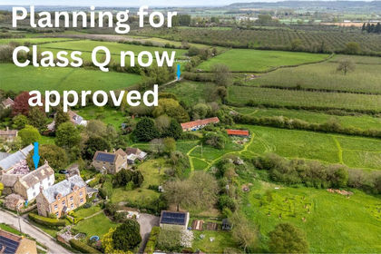
- Price
- Guide Price£650,000
- Size
- 5.28 acres
Church Street, Lopen, South Petherton, Somerset, Lopen, Somerset TA13 England
Added on 31/07/2026House with Land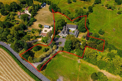
- Price
- Guide Price£650,000
- Size
- 2 acres
Development / Family Home | GL13, Hamfallow, Gloucestershire GL13 England
Added on 29/07/2026Development Land
- Price
- Guide Price£600,000
- Size
- 7.11 acres
Chalmington, Dorchester, Dorset, Cattistock, Dorset DT2 England
Added on 14/05/2026Cottage
- Price
- Guide Price£799,000
- Size
- 2.17 acres
Sleight Lane, Corfe Mullen, Wimborne, Corfe Mullen, Dorset BH21 England
Added on 18/06/2026House with Land
- Price
- Guide Price£795,000
- Size
- 1 acres
Usk Road, Caerleon, NP18, Llangybi, Monmouthshire NP18 Wales
Added on 11/07/2026Country Home
- Price
- Guide Price£795,000
- Size
- 1 acres
Llwynarthen House, Cardiff, CF3, Marshfield, Newport CF3 Wales
Added on 04/09/2026House with Land