Swindon Bank Farm, Pannal, Nr Harrogate
- Land size
- 3 acres
Key Features
- Existing 4 bed stone farmhouse to modernise/extend
- Two stone barns with extant planning for 3400 sq ft dwelling
- Further buildings with conversion potential
- Planning for impressive new country house of 7300 sq ft
- Convenient location south of Harrogate
- Wonderful views over Lower Wharfedale
- Set in around 3 acres
- For sale as a whole
Description
DEVELOPMENT OPPORTUNITY - A substantial range of farm buildings including a 4-bedroom house to modernise/rebuild plus two stone barns with historic permission to convert, plus further buildings with potential, in an enviable 3 acre rural setting south of Harrogate with a lovely southerly outlook and views over Lower Wharfedale. For sale as a whole.
Introduction - At Swindon Bank Farm, there is the opportunity to retain the existing dwelling and modernise/extend to personal choice. and creating a fabulous individual home. Alternatively there is a comprehensive planning approval for the construction of a new country house of exceptional design, stature and presence that would be best in class. When coupled with the potential of the adjacent stone barns as separate dwelling, or ancillary accommodation, one can soon appreciate why this is such a unique opportunity with the existing buildings having an external footprint of some 9800 sq ft.
Development Potential - Swindon Bank Farm offers a number of development options, either as conversion/modernisation or new build. The present stone farmhouse comprises 4 bedrooms and 2 reception rooms having attached outbuildings with potential to enhance the living accommodation either single or two storey. The adjacent range of stone barns are L shaped and naturally lend themselves for conversion to two separate dwellings, albeit there is an extant consent as a single larger dwelling of around 3400 sq ft. In terms of new build, the approved dwelling is arranged over four floors extending to some 7340 sq ft (682 m2) and currently shown on plan as three first floor bedroom suites with second attic floor options, plus a grand ground floor entrance hall and three reception rooms incorporating a large open plan living area that forms of the centrepiece of what could be one of the most impressive private houses in the area.
Situation And Location - The rural nature of the location belies its convenience with excellent facilities in Pannal village itself, as well as South Harrogate and indeed the town centre. There are a number of schooling options within a 10 -15 minute drive, train stations at Weeton and Pannal, with a regular LNER service from Harrogate to Kings Cross. The commercial centres of Leeds, Bradford and York are commutable and the airport at Yeadon offers an increasing number of international flight options. The A1(M) motorway at Wetherby also offers good road access further afield. The existing farmstead sits comfortably within a 3 acre holding with wonderful views over the surrounding countryside, particularly to the south west towards Otley Chevin and Ilkley Moor, as well as offering delightful sunsets over Almscliffe Crag outside North Rigton.
Planning - Planning Permission was granted on 22 August 2023. Reference: ZC23/02378/FUL | Erection of a net zero/ carbon negative replacement farmhouse with solar panels, ground source heat pump, mechanical ventilation with heat recovery and battery storage; Demolition of 2 no. barns; Conversion of 1 no. Barn to domestic accommodation; Installation of new orchard; Landscaping and habitat creation. | Swindon Bank Farm Swindon Lane Pannal Harrogate North Yorkshire HG3 1JD.
There is also extant/historic planning permission to convert the two stone barns into one substantial dwelling, with potential to develop as two separate dwellings as an alternative (subject to appropriate consents).
Further information and opinion on the current, past and future planning potential is available from the selling agents.
Tenure - Swindon Bank Farm is offered freehold with vacant possession on completion. There is a bridleway and right of way to the farmland to the west that runs along the northern boundary of the subject property.
Services And Epc - Mains water and electricity are understood to be in the vicinity. Drainage is historically to a septic tank that needs replacement. Mains gas is not available. Current EPC rating: G
Local Authority And Council Tax - North Yorkshire Council. Band - G
What3words - move.presides.awoken
Directions - From the roundabout/junction at the southern end of the Harrogate bypass (junction of A61/A658) proceed south on the A61 towards Harewood. The entrance to the property is then on the right hand side after 0.3 miles.
Viewing Arrangements - Strictly by appointment through the Boroughbridge office of GSC Grays ). Any parties viewing, do so at their own risk.
Disclaimer - GSC Grays gives notice that:
1. These particulars are a general guide only and do not form any part of any offer or contract.
2. All descriptions, including photographs, dimensions and other details are given in good faith but no warranty is provided. Statements made should not be relied upon as facts and anyone interested must satisfy themselves as to their accuracy by inspection or otherwise.
3. Neither GSC Grays nor the vendors accept responsibility for any error that these particulars may contain however caused.
4. Any plan is for guidance only and is not drawn to scale. All dimensions, shapes, and compass bearings are approximate and should not be relied upon without checking them first.
5. Nothing in these particulars shall be deemed to be a statement that the property is in good condition, repair or otherwise nor that any services or facilities are in good working order.
6. Please discuss with us any aspects that are important to you prior to travelling to the property.
Map Location
Property details
- Tenure
- Freehold
- Council Tax Band
- G
- Date Posted
- 2026-01-29
Market Value Analysis
Compared with 124 Development Land listings in Yorkshire and The Humber (1+ acres).
Energy Performance Certificate
Energy Efficiency Rating
Based on UK Energy Performance Certificate standards (EU Directive 2002/91/EC)
Running costs are one side. Planning activity, flood history and ground risks for this location are in the full report.
Utilities & Restrictions
Utilities
- Electricity
- Mains
- Water
- Mains
- Heating
- Ask Agent
- Broadband
- Ask Agent
- Sewerage
- Septic Tank / Private
Rights & Restrictions
- Public Rights of Way
- Ask Agent
- Private Rights of Way
- Ask Agent
- Listed Property
- Ask Agent
- Restrictions
- Ask Agent
Listed status, conservation areas and planning constraints for this location are in the full report.
Property Features
- Accessibility
- Ask Agent
- Parking
- Ask Agent
- Garden
- Garden
Beyond the particulars: planning activity, flood history, heritage and ground risks, checked for this exact spot.
Connectivity
Broadband
Fastest speed available at this postcode
5 Mbps
Under 10 Mbps here
Suitable for
- Basic browsing & email
Fixed wireless access may also be an option here.
Mobile signal
Predicted 4G and 5G signal; indoor signal depends on building materials.
Ofcom Connected Nations postcode-level predictions. Speeds and signal are modelled, not measured, and vary between addresses and providers.
Signal is the easy part. Planning activity, flood history and protected designations here are in the full report.
Nearest Schools
Primary
- All Saints Church of England School1.3 milesNo Ofsted rating
- Ages
- 4 to 11
- Pupils
- 96
- Type
- Academy converter
- Faith
- Church of England
- North Rigton Church of England Primary School1.5 milesNo Ofsted rating
- Ages
- 4 to 11
- Pupils
- 91
- Type
- Academy converter
- Faith
- Church of England
- Pannal Primary School1.7 milesOfsted: Good
- Ages
- 4 to 11
- Pupils
- 452
- Type
- Academy converter
- Harewood Church of England Voluntary Controlled Primary School2.7 milesOfsted: Good
- Ages
- 5 to 11
- Pupils
- 106
- Type
- Voluntary controlled school
- Faith
- Church of England
- Oatlands Community Junior School2.8 milesOfsted: Good *
- Ages
- 7 to 11
- Pupils
- 356
- Type
- Academy converter
Secondary
- Rossett School2.8 milesOfsted: Good *
- Ages
- 11 to 18
- Pupils
- 785
- Type
- Academy converter
- Harrogate Grammar School3.2 milesOfsted report card · Apr 2026
- Ages
- 11 to 18
- Pupils
- 2,081
- Type
- Academy converter
- St John Fisher Catholic Academy3.3 milesOfsted: Good
- Ages
- 11 to 18
- Pupils
- 1,250
- Type
- Academy converter
- Faith
- Roman Catholic
- St Aidan's Church of England High School3.5 milesOfsted: Good
- Ages
- 11 to 18
- Pupils
- 1,966
- Type
- Academy converter
- Faith
- Church of England
- Harrogate High School4.3 milesOfsted report card · Feb 2026
- Ages
- 11 to 16
- Pupils
- 579
- Type
- Academy converter
* Latest graded judgement covers quality of education only; no overall grade was issued under the 2024-25 inspection framework.
Distances are straight-line from the advertised location. Source: the national school registers (DfE, Welsh Government, Scottish Government) and Ofsted.
Schools are just the start: sold prices nearby, planning activity and any flood history are in the full report.
Amenities
Supermarket
GP surgery
Pharmacy
Hospital
Straight-line distances from the advertised location. Sources: NHS records, Geolytix supermarket locations, OS Open Greenspace and the national trails registers.
The area stacks up? Now check the location itself: planning nearby, protected designations and past flooding.
Getting Around
Nearest station
Nearest bus stop
Typical drive times
Straight-line distances from the advertised location; drive times are typical free-flow times over OpenStreetMap road data, so allow more at peak. Public transport locations from DfT NaPTAN.
Easy to reach matters. So do planning activity, flood history and ground risks: all in the full report.
Flood Risk
Environment Agency open data, checked around the advertised map pin for the listed acreage. Long-term risk counts flood defences; the planning map's flood zones do not. The map pin for this listing is approximate, so these readings describe the surrounding area. Provided by LandSale, not the listing agent, and not part of the agent's particulars. Risk varies across a holding, so verify before committing.
Rivers and the sea
Planning map: Flood Zone 1.
Surface water
These bandings are the summary. Where this location sits on the flood maps, plus planning activity, heritage and ground risks, is in the full report.
Important notice: Information, maps and tags on this page are drawn from the advertising agent's marketing materials or generated automatically. LandSale has not verified them. Relying on these details is at your own risk, always carry out independent checks before committing to a purchase.
LandSale full disclaimer
Marketing information only - not formal particulars. The details on this website are provided for general guidance and do not constitute an offer or contract. Neither LandSale nor the advertising estate/land agent accepts responsibility for any inaccuracy.
1. Source of information
- Listing content: Core description, asking price, tenure, measurements, photographs and planning history originate from the marketing materials of the advertising estate or land agent. LandSale does not author this content and cannot guarantee its accuracy.
- Automated tags & categorisation: Property type, land-use class, acreage bands and similar labels may be applied by machine-learning models. They are intended as a helpful guide only and may not reflect the property's legal status or permitted use.
- Third-party & enriched data layers: Maps, boundary outlines, planning designations, soil reports, broadband coverage and other environmental or location-based insights are licensed from external suppliers. Such data are supplied “as is", may be incomplete or out of date and are subject to change without notice.
2. Verification required
Prospective purchasers must verify critical matters, including but not limited to planning permission, title boundaries, public rights of way, environmental constraints, acreage, services, access and VAT status, through their own inspections, specialist surveys, legal advisers and the selling agent before relying on the information or entering into any contract.
3. No warranty or liability
LandSale gives no warranty, express or implied, as to the accuracy, completeness or fitness for any particular purpose of the information displayed. LandSale shall not be liable for any loss, damage, cost or expense arising directly or indirectly from any use of or reliance on such information, save where liability may not be excluded by law.
4. Updates & feedback
If you believe any detail on this listing is inaccurate, please let us know. We will investigate and, where appropriate, update the listing or notify the agent.
© LandSale | Version 1.3 - August 2026
Listing agent
GSC Grays, Boroughbridge
15-17 High Street, Boroughbridge, YO51 9AW
Nearby properties for sale
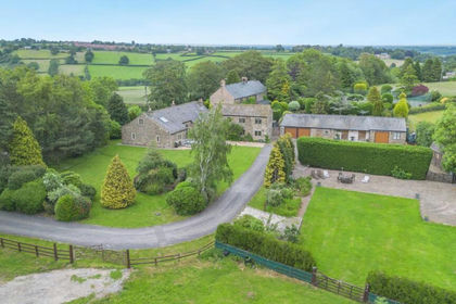
- Price
- Guide Price£2,250,000
- Size
- 2 acres
Brackenthwaite Lane, Pannal, Harrogate, North Rigton, North Yorkshire HG3 England
Added on 28/06/2026House with Land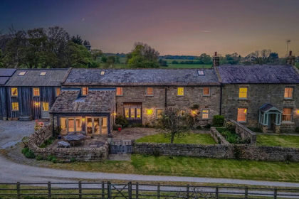
- Price
- £2,375,000
- Size
- 2 acres
Beckside Farm, Beckwithshaw, Harrogate, HG3, Beckwithshaw, North Yorkshire HG3 England
Added on 20/08/2026House with Land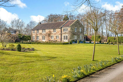
- Price
- Guide Price£2,495,950
- Size
- 2 acres
Spofforth Lane, Follifoot, HG3, Follifoot, North Yorkshire HG3 England
Added on 14/10/2026Country Home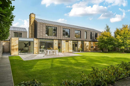
- Price
- Guide Price£1,685,000
Moor Park, Beckwithshaw, HG3, Beckwithshaw, North Yorkshire HG3 England
Added on 28/01/2026Barn Conversion
- Price
- Offers Over£1,500,000
- Size
- 5 acres
Church Lane, Bardsey, Leeds, Bardsey cum Rigton, Leeds LS17 England
Added on 02/09/2026House with Land
- Price
- £1,500,000
- Size
- 15 acres
Rock Hall, Nidd, Harrogate, Nidd, North Yorkshire HG3 England
Added on 17/09/2026Country Home
- Price
- £3,750,000
- Size
- 17 acres
Elm Tree Manor, West Lane, Askwith, Ilkley, LS21, Askwith, North Yorkshire LS21 England
Added on 25/09/2026Country Estate
- Price
- £1,795,000
- Size
- 10 acres
Ripley, Nr Harrogate, Clint cum Hamlets, North Yorkshire HG3 England
Added on 25/07/2026Equestrian property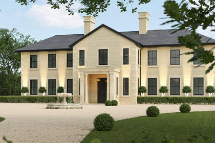
- Price
- £3,600,000
- Size
- 5 acres
Added on 29/01/2026Development Land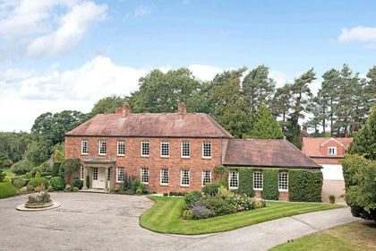
- Price
- £3,600,000
- Size
- 5 acres
Added on 29/01/2026Country Home