Ty Mawr, Llanddona
- Land size
- 1.95 acres
- Bedrooms
- 5
- Bathrooms
- 4
Description
UNDER OFFER
An outstanding grade 2 listed country farmhouse situated within 1.95 acres of landscaped grounds and enjoying truly panoramic coastal views, northwards from Point Lynas headland, towards Puffin Island, The Great Orme and southwards towards the Snowdonia mountain ranges. Having been extended and modernised to a standard befitting this quality dwelling, the viewing of Ty Mawr is considered essential to appreciate not only the enviable coastal location, but also the private well tended grounds together with spacious and flexible accommodation which provides for a 29 foot farmhouse kitchen, two reception rooms, five bedrooms and four bathrooms.
Seldom does a property of this quality become available in such a private coastal location, and viewing is highly recommended for a discerning buyer looking for a Country farmhouse in a rural coastal location.
The Accommodation Affords:- -
Entrance Hall - With UPVC double glazed entrance door and large side panel leading to the entrance hall with slate and stone flagged floor with underfloor heating, and being split level with stairs down to the kitchen and also up to the main bedroom.
This area is large enough to be presently used as a small study area.
Shower Room/Cloak Room Off - 4.00 x 1.77 (13'1" x 5'9") - Recently refitted with a wide walk in shower enclosure with twin head shower control. Wash basin, WC, chrome towel radiator, and underfloor heating. Spacious enough to be also used as an utility area with cupboards and space for the washing machine and dryer.
Farmhouse Kitchen - 8.90 x 4.90 (29'2" x 16'0") - A delightful kitchen, dining and living area, being a naturally light room with windows to both sides to give outstanding sea and rural views.
The kitchen area includes a quality range of painted timber base and wall units with quartz worktop surfaces and to include a matching island which serves also serves as a breakfast bar and incorporates a Neff ceramic hob with spotlights over. Ample kitchen storage space with features such as a pull out larder unit. Feature pale blue electric Aga stove with mosaic tiling behind and recess for a dishwasher. Belfast sink under a side aspect window overlooking open farmland. The dining area is situated adjacent to glazed double opening doors and which leads onto the adjoining patio area and gives fine sea and coastal views. Radiator, natural stone tiled floor with underfloor heating.
Living Room - 7.24 x 4.36 max (23'9" x 14'3" max) - Having a near full length glazed window with integral door overlooking the garden and giving panoramic sea views over Puffin Island towards the Great Orme. Natural local stone surround fireplace surround and hearth and housing a woodburning stove and with wall TV mountings over. Part vaulted ceiling with high level electrically operated velux windows and further windows making this a naturally light room. Ceiling downlights, two radiators.
Ground Floor Bedroom 2 - 7.25 x 3.81 (23'9" x 12'5") - A large bedroom area, also suitable as an additional living area if required, having a 3 panel nearly full length glazed opening with a central door giving outstanding sea views and access to a large extended stone patio area. Two vertical radiators, cupboards housing a Worcester boiler and associated hot water tanks. Door to:-
En Suite Wet Room - Having a twin head thermostatic shower control, wash basin in a vanity cupboard with a large mirror/light over, WC, chrome towel radiator. Fully tiled floor and pvc panelled walls,
Lounge - 4.65 x 4.55 (15'3" x 14'11") - Being in the older section of the house and having a superb "walk in" inglenook fireplace with a natural stone hearth, being part raised to house a "clearview" woodburning stove, and having the original timber lintol over and shelving. Staircase to the first floor with cupboard under
Bathroom - 2.59m x 1.69m - With white suite comprising of pine panelled spa bath with thermostatic shower over, wash hand basin inset in pine vanity unit with light over, WC, tiled floor and half tiled walls, radiator.
Bedroom 5/Study - 2.58 x 2.48 (8'5" x 8'1") - With front aspect window overlooking the gardens, radiator, wall shelving.
First Floor - Accessed via stairs off the entrance hall
Main Bedroom 1 - 4.83 x 3.95 (15'10" x 12'11") - With three windows two of which offer panoramic views of the Anglesey coastline and sea as well as St Michael's Church. 2 radiators, towel radiator.
This bedroom is not only en-suite but has a large dressing room adjoining.
Ensuite Shower Room - With fully tiled shower cubicle with Aqualisa shower control,, wash hand basin inset in cupboards and large wall mirror over, WC, towel radiator, shaver point.
Dressing Room - 4.38m x 2.61m - Being a former bedroom with separate access, spacious fitted wardrobes with shelving. Radiator under side elevation window.
Second Landing - Accessed via the staircase in the lounge
Bedroom 3 - 4.61m x 3.25m - Incorporating the extended stepped stone of the inglenook fireplace in the lounge. Part exposed A frame, fitted mirror fronted wardrobes, wash hand basin inset in vanity unit, shaver point, two radiators.
Bedroom 4 - 4.58m x 2.81m - With front and rear aspect windows, low ceiling with exposed roof beams. Wardrobe, shelving, radiator.
Outside - An adopted road leads to the property which extends to the rear of the house and offers a spacious gravelled parking for several cars and turning area. The drive continues along the side giving access to the main garden and front.
The Grounds - The grounds are a particular feature of this historic property and are estimated at just under two acres (1.95 acres) They have been significantly upgraded and altered by the present owners, with the more formal gardens to the side off the kitchen, with a large and recently extended stone patio with access off the kitchen, living room and bedroom 2. This patio opens onto a large level lawned garden which has a stainless steel boundary surround, and further extends to the front of the house where there is an additional garden, mostly lawn with a wealth of shrubbery to the boundaries., as well as access to the front paddock which has a soft fruit garden and also a Summer House. There is a more traditional style quarry tile patio to the front of the house.
Of particular note is a recently built Summer House (4.86m x 2.86m) off the main side garden, being at a slightly lower level, being sheltered and enjoying a good amount of privacy as well as far reaching coastal/sea views. With electricity and water provided and double opening doors, it opens onto a recently laid stone patio, and adjoins a small herb and soft fruit garden.
For the keen gardener, there is a spacious area dedicated to a vegetable garden to include a recent 9 panel poly tunnel with water supply. Close by are two large metal sheds to house garden equipment and tractor. There is also a large log store provided.
A footpath crosses over part of the garden.
Stable - 5.50m x 4.00 - Having been renovated in the past to include re-roofing and considered ideal as Studio/Office, having a timber floor, belfast sink with drainer, stairs to a gallery store with velux roof light. This building has in the past had planning consent for conversion into a dwelling, but now lapsed
Services - Mains water & electric.
Private drainage.
Oil fired central heating.
Tenure - The property is understood to be freehold and this will be confirmed by the Vendors' conveyancer.
The property is a Grade 2 building.
A footpath crosses part of the garden.
Epc Rating - Band D
Council Tax - Band F
Directions - From our office in Castle Street turn right and proceed up Church Street out of the town for approximately 0.5 mile. At the top of the hill turn right signposted Llanddona. Continuing through the village and proceed on this road towards Glanrafon/Llangoed, Pass the TV mast and after about half a mile turn left signposted St Michael's Church. Ty Mawr will be seen a short distance on the right hand side just after the Church.
Map Location
Property details
- Tenure
- Freehold
- Council Tax Band
- F
- Date Posted
- 2026-01-29
Price history
| Date | Change | Price |
|---|---|---|
| 5 Aug 2026 | Reduced 3.6% (−£30,000) | £795,000 |
| Until 5 Aug 2026 | Asking price | £825,000 |
Market Value Analysis
Compared with 1,032 Homes with Land listings in Wales (1+ acres).
Energy Performance Certificate
Energy Efficiency Rating
Based on UK Energy Performance Certificate standards (EU Directive 2002/91/EC)
Running costs are one side. Planning activity, flood history and ground risks for this location are in the full report.
Utilities & Restrictions
Utilities
- Electricity
- Mains
- Water
- Mains
- Heating
- Oil Heating
- Broadband
- Ask Agent
- Sewerage
- Septic Tank / Private
Rights & Restrictions
- Public Rights of Way
- Yes
- Private Rights of Way
- Ask Agent
- Listed Property
- Yes
- Restrictions
- Yes
Listed status, conservation areas and planning constraints for this location are in the full report.
Property Features
- Accessibility
- Ask Agent
- Parking
- Parking Available
- Garden
- Garden
Beyond the particulars: planning activity, flood history, heritage and ground risks, checked for this exact spot.
Connectivity
Broadband
Fastest speed available at this postcode
1.8 Gbps
Gigabit full fibre · available to 75% of premises
Suitable for
- 4K streaming on every screen
- Full-time home working
- Online gaming & big downloads
Mobile signal
Predicted 4G and 5G signal; indoor signal depends on building materials.
Ofcom Connected Nations postcode-level predictions. Speeds and signal are modelled, not measured, and vary between addresses and providers.
Signal is the easy part. Planning activity, flood history and protected designations here are in the full report.
Nearest Schools
Primary
- Ysgol Gynradd Llangoed1.8 miles
- Pupils
- 85
- Type
- Nursery, Infants & Juniors
- Language
- Welsh medium school / provision (including transitional)
- Ysgol Gynradd Beaumaris3.3 miles
- Pupils
- 32
- Type
- Nursery, Infants & Juniors
- Language
- Welsh medium school / provision (including transitional)
- Ysgol Goronwy Owen4.6 miles
- Pupils
- 138
- Type
- Infants & Juniors
- Language
- Welsh medium school / provision (including transitional)
- Ysgol Gymuned Pentraeth4.7 miles
- Pupils
- 77
- Type
- Nursery, Infants & Juniors
- Language
- Welsh medium school / provision (including transitional)
- Ysgol Gynradd Llanbedrgoch4.7 miles
- Pupils
- 22
- Type
- Nursery, Infants & Juniors
- Language
- Welsh medium school / provision (including transitional)
Secondary
- Ysgol David Hughes6.3 miles
- Pupils
- 1,123
- Type
- Secondary (ages 11-19)
- Language
- Welsh medium school / provision (including transitional)
- Ysgol Tryfan6.5 miles
- Pupils
- 513
- Type
- Secondary (ages 11-19)
- Language
- Welsh medium school / provision (including transitional)
- Ysgol Friars6.7 miles
- Pupils
- 1,383
- Type
- Secondary (ages 11-19)
- Language
- Dual language school / provision (Welsh and English) (including transitional)
- Ysgol Gyfun Llangefni9.2 miles
- Pupils
- 761
- Type
- Secondary (ages 11-19)
- Language
- Welsh medium school / provision (including transitional)
- Ysgol Dyffryn Ogwen Bethesda9.2 miles
- Pupils
- 398
- Type
- Secondary (ages 11-19)
- Language
- Welsh medium school / provision (including transitional)
Distances are straight-line from the advertised location. Source: the national school registers (DfE, Welsh Government, Scottish Government) and Ofsted.
Schools are just the start: sold prices nearby, planning activity and any flood history are in the full report.
Amenities
Supermarket
GP surgery
Pharmacy
Straight-line distances from the advertised location. Sources: NHS records, Geolytix supermarket locations, OS Open Greenspace and the national trails registers.
The area stacks up? Now check the location itself: planning nearby, protected designations and past flooding.
Getting Around
Nearest station
Nearest bus stop
Typical drive times
Straight-line distances from the advertised location; drive times are typical free-flow times over OpenStreetMap road data, so allow more at peak. Public transport locations from DfT NaPTAN.
Easy to reach matters. So do planning activity, flood history and ground risks: all in the full report.
Flood Risk
Natural Resources Wales open data, checked around the advertised map pin for the listed acreage. Long-term risk counts flood defences; the planning map's flood zones do not. The map pin for this listing is approximate, so these readings describe the surrounding area. Provided by LandSale, not the listing agent, and not part of the agent's particulars. Risk varies across a holding, so verify before committing.
Rivers and the sea
Planning map: Flood Zone 1.
Surface water
These bandings are the summary. Where this location sits on the flood maps, plus planning activity, heritage and ground risks, is in the full report.
Important notice: Information, maps and tags on this page are drawn from the advertising agent's marketing materials or generated automatically. LandSale has not verified them. Relying on these details is at your own risk, always carry out independent checks before committing to a purchase.
LandSale full disclaimer
Marketing information only - not formal particulars. The details on this website are provided for general guidance and do not constitute an offer or contract. Neither LandSale nor the advertising estate/land agent accepts responsibility for any inaccuracy.
1. Source of information
- Listing content: Core description, asking price, tenure, measurements, photographs and planning history originate from the marketing materials of the advertising estate or land agent. LandSale does not author this content and cannot guarantee its accuracy.
- Automated tags & categorisation: Property type, land-use class, acreage bands and similar labels may be applied by machine-learning models. They are intended as a helpful guide only and may not reflect the property's legal status or permitted use.
- Third-party & enriched data layers: Maps, boundary outlines, planning designations, soil reports, broadband coverage and other environmental or location-based insights are licensed from external suppliers. Such data are supplied “as is", may be incomplete or out of date and are subject to change without notice.
2. Verification required
Prospective purchasers must verify critical matters, including but not limited to planning permission, title boundaries, public rights of way, environmental constraints, acreage, services, access and VAT status, through their own inspections, specialist surveys, legal advisers and the selling agent before relying on the information or entering into any contract.
3. No warranty or liability
LandSale gives no warranty, express or implied, as to the accuracy, completeness or fitness for any particular purpose of the information displayed. LandSale shall not be liable for any loss, damage, cost or expense arising directly or indirectly from any use of or reliance on such information, save where liability may not be excluded by law.
4. Updates & feedback
If you believe any detail on this listing is inaccurate, please let us know. We will investigate and, where appropriate, update the listing or notify the agent.
© LandSale | Version 1.3 - August 2026
Similar properties for sale
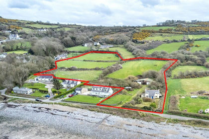
- Price
- Offers Over£695,000
- Size
- 5 acres
Llanddona, Beaumaris, Isle of Anglesey, LL58, Llanddona, Isle of Anglesey LL58 Wales
Added on 03/04/2026House with Land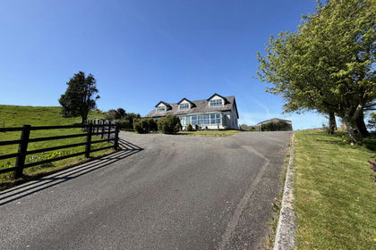
- Price
- £975,000
- Size
- 6.67 acres
Off Allt Bron Philip, Llanddona, Anglesey, LL58, Llanddona, Isle of Anglesey LL58 Wales
Added on 30/04/2026House with Land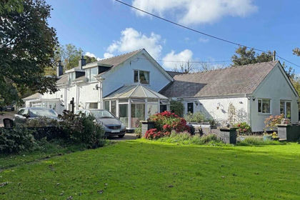
- Price
- £650,000
- Size
- 2 acres
Llanddona, Beaumaris, Isle of Anglesey, LL58, Llanddona, Isle of Anglesey LL58 Wales
Added on 14/10/2026House with Land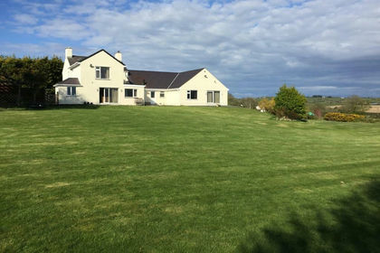
- Price
- £725,000
- Size
- 1.66 acres
Ysgubor Ddegwm, Pentraeth Road, Pentraeth, Isle of Anglesey LL75 Wales
Added on 21/05/2026House with Land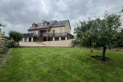
- Price
- £795,000
- Size
- 6.93 acres
B5110, Brynteg, Anglesey, LL78, Llanfair-Mathafarn-Eithaf, Isle of Anglesey LL78 Wales
Added on 29/01/2026House with Land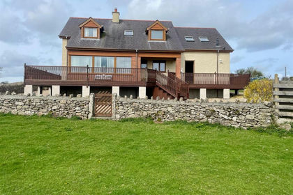
- Price
- Offers in Region of£795,000
- Size
- 6.9 acres
Brynteg, Llanfair-Mathafarn-Eithaf, Isle of Anglesey LL78 Wales
Added on 22/04/2026House with Land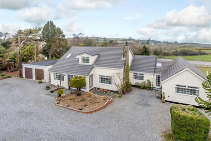
- Price
- Offers in Region of£775,000
- Size
- 4.2 acres
Added on 12/02/2026House with Land- Price
- Offers in Region of£775,000
- Size
- 4.2 acres
Added on 03/06/2026House with Land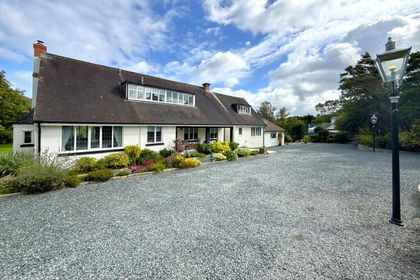
- Price
- £779,995
- Size
- 1.16 acres
Brynrefail, Dulas, Anglesey, LL70, Moelfre, Isle of Anglesey LL70 Wales
Added on 27/09/2026House with Land
- Price
- Guide Price£800,000
- Size
- 82 acres
LOT 2 - Tregaian, Llangefni, Ynys Mon, LL77, Llanddyfnan, Isle of Anglesey LL77 Wales
Added on 29/01/2026Farm