Newmore House, Scotsburn, Ross-Shire, IV18
- Land size
- 4 acres
- Bedrooms
- 12
- Bathrooms
- 6
Description
Newmore House is a substantial period property located in the quiet hamlet of Scotsburn in the County of Ross-shire.
Newmore House is a substantial period property located in the quiet hamlet of Scotsburn in the County of Ross-shire. The property which was built circa 1875 was designed by Alexander Ross who also designed Ardross Castle, currently home to the Traitor television series. The property, which is in need of some renovation, still retains its original character, including a unique hand carved Oak fire surround, cornices and stunning staircase, offers generous versatile living space and enjoys stunning views across unspoiled countryside towards the Cromarty Firth. Set in approximately 4 acres of garden ground the property could be utilised in a variety of ways including a country retreat, hotel, large home for the extended family or could be converted into apartments, given the necessary planning consents. The property also comes with three letting units, currently unfinished, which could provide an almost immediate income stream.
Newmore House is an ideal base for someone looking for a quiet countryside lifestyle with the nearby City conveniences, as Inverness City Centre, UHI University Campus and the airport are all within easy commuting distance. The property is also ideally situated to take full advantage of the excellent range of outdoor recreational activities available on your doorstep, including sailing, fishing and hill walking, while the surrounding garden ground is also a haven for wildlife and birds.
The property is piped for gas fired central heating, currently disconnected, while the top floor benefits from electric heating complimented by wood burning stoves. Viewing is highly recommended for anyone with vision who can fully appreciate the potential this property has to offer and the truly enviable location.
The accommodation on the ground floor consists of:- entrance vestibule with original floor tiles; hallway with the impressive staircase leading to the upper floor; two bright public rooms, both with open fires set in stunning ornamental surrounds; family room with shower room, rear hall with utility area, commercial kitchen with pantry, two bedrooms and shower room; on the first floor, the landing with decorative archways gives access to eight bedrooms, three with en-suite facilities, office, lounge with wood burning stove, WC and bathroom.
On the second floor are two bedrooms, two public rooms, both with wood burning stoves and a small preparation kitchen, study with stairway leading to the tower room, an ideal space for quiet contemplation as it takes full advantage of the stunning views on offer.
The property sits within a generous four acre garden, mainly laid to lawn and well populated with mature trees, shrubs and fruit bushes. A paved courtyard provides an ideal venue for al fresco dining and entertaining and comes with an outside kitchen. There are also various sitting areas around the garden where you can sit and enjoy the sunshine in your tranquil surroundings. There are three letting units with a covered veranda, all with lounge/kitchen and shower room, a double garage with light and power, poly tunnel and the remains of an outbuilding. A sweeping driveway leads to the parking/turning area.
Facilities closest to the property can be found in the town of Alness, previous winner of the Britain in Bloom competition, which include supermarkets, banks, Post Office, cafes, hotels, restaurants and thriving High Street offering a good selection of retail outlets. Education is provided at Obsdale Primary School while secondary pupils attend Alness Academy, to which bus transportation is provided daily.
Inverness, the main business and commercial centre in the Highlands, is approx a 30 minute drive away and offers extensive shopping, leisure and entertainment facilities along with excellent road, rail and air links to the South and beyond.
Map Location
Property details
- Tenure
- Freehold
- Council Tax Band
- H
- Date Posted
- 2026-01-29
Market Value Analysis
Compared with 458 Homes with Land listings in Scotland (1+ acres).
Energy Performance Certificate
Energy Efficiency Rating
Based on UK Energy Performance Certificate standards (EU Directive 2002/91/EC)
Running costs are one side. Planning activity, flood history and ground risks for this location are in the full report.
Utilities & Restrictions
Utilities
- Electricity
- Ask Agent
- Water
- Ask Agent
- Heating
- Ask Agent
- Broadband
- Ask Agent
- Sewerage
- Ask Agent
Rights & Restrictions
- Public Rights of Way
- Ask Agent
- Private Rights of Way
- Ask Agent
- Listed Property
- Ask Agent
- Restrictions
- Ask Agent
Listed status, conservation areas and planning constraints for this location are in the full report.
Property Features
- Accessibility
- Ask Agent
- Parking
- Parking Available
- Garden
- Garden
Beyond the particulars: planning activity, flood history, heritage and ground risks, checked for this exact spot.
Connectivity
Broadband
Fastest speed available at this postcode
52 Mbps
Superfast · available to 29% of premises
Suitable for
- HD streaming
- Video calls
- Web & social
Fixed wireless access may also be an option here.
Mobile signal
Predicted 4G and 5G signal; indoor signal depends on building materials.
Ofcom Connected Nations postcode-level predictions. Speeds and signal are modelled, not measured, and vary between addresses and providers.
Signal is the easy part. Planning activity, flood history and protected designations here are in the full report.
Nearest Schools
Primary
- Newmore Primary School0.8 miles
- Pupils
- 36
- Type
- Non-denominational
- Obsdale Primary School1.6 miles
- Pupils
- 115
- Type
- Non-denominational
- Bridgend Primary School2.4 miles
- Pupils
- 278
- Type
- Non-denominational
- South Lodge Primary School2.4 miles
- Pupils
- 149
- Type
- Non-denominational
- Ardross Primary School2.7 miles
- Pupils
- 27
- Type
- Non-denominational
Secondary
- Alness Academy2.5 miles
- Pupils
- 505
- Type
- Non-denominational
- Invergordon Academy2.6 miles
- Pupils
- 343
- Type
- Non-denominational
- Tain Royal Academy8.2 miles
- Pupils
- 516
- Type
- Non-denominational
- Fortrose Academy10 miles
- Pupils
- 646
- Type
- Non-denominational
- Dingwall Academy12 miles
- Pupils
- 1,062
- Type
- Non-denominational
Distances are straight-line from the advertised location. Source: the national school registers (DfE, Welsh Government, Scottish Government) and Ofsted.
Schools are just the start: planning activity, heritage and any flood history here are in the full report.
Amenities
Supermarket
GP surgery
Pharmacy
Walking trail
Straight-line distances from the advertised location. Sources: NHS records, Geolytix supermarket locations, OS Open Greenspace and the national trails registers.
The area stacks up? Now check the location itself: planning nearby, protected designations and past flooding.
Getting Around
Nearest station
Nearest bus stop
Typical drive times
Straight-line distances from the advertised location; drive times are typical free-flow times over OpenStreetMap road data, so allow more at peak. Public transport locations from DfT NaPTAN.
Easy to reach matters. So do planning activity, flood history and ground risks: all in the full report.
Flood Risk
SEPA open data, checked around the advertised map pin for the listed acreage. Provided by LandSale, not the listing agent, and not part of the agent's particulars. Risk varies across a holding, so verify before committing.
Rivers and the sea
Surface water
These bandings are the summary. Where this location sits on the flood maps, plus planning activity, heritage and ground risks, is in the full report.
Important notice: Information, maps and tags on this page are drawn from the advertising agent's marketing materials or generated automatically. LandSale has not verified them. Relying on these details is at your own risk, always carry out independent checks before committing to a purchase.
LandSale full disclaimer
Marketing information only - not formal particulars. The details on this website are provided for general guidance and do not constitute an offer or contract. Neither LandSale nor the advertising estate/land agent accepts responsibility for any inaccuracy.
1. Source of information
- Listing content: Core description, asking price, tenure, measurements, photographs and planning history originate from the marketing materials of the advertising estate or land agent. LandSale does not author this content and cannot guarantee its accuracy.
- Automated tags & categorisation: Property type, land-use class, acreage bands and similar labels may be applied by machine-learning models. They are intended as a helpful guide only and may not reflect the property's legal status or permitted use.
- Third-party & enriched data layers: Maps, boundary outlines, planning designations, soil reports, broadband coverage and other environmental or location-based insights are licensed from external suppliers. Such data are supplied “as is", may be incomplete or out of date and are subject to change without notice.
2. Verification required
Prospective purchasers must verify critical matters, including but not limited to planning permission, title boundaries, public rights of way, environmental constraints, acreage, services, access and VAT status, through their own inspections, specialist surveys, legal advisers and the selling agent before relying on the information or entering into any contract.
3. No warranty or liability
LandSale gives no warranty, express or implied, as to the accuracy, completeness or fitness for any particular purpose of the information displayed. LandSale shall not be liable for any loss, damage, cost or expense arising directly or indirectly from any use of or reliance on such information, save where liability may not be excluded by law.
4. Updates & feedback
If you believe any detail on this listing is inaccurate, please let us know. We will investigate and, where appropriate, update the listing or notify the agent.
© LandSale | Version 1.3 - August 2026
Listing agent
Macleod & MacCallum, Inverness
28 Queensgate Inverness, IV1 1DJ
Similar properties for sale
- Price
- Offers Over£870,000
- Size
- 9 acres
Delny, Invergordon, IV18, Caithness, Sutherland and Easter Ross, Highland IV18 Scotland
Added on 29/01/2026Equestrian property
- Price
- Offers Over£725,000
- Size
- 4.75 acres
Evanton, Dingwall, Highland, Caithness, Sutherland and Easter Ross, Highland IV16 Scotland
Added on 29/04/2026Multiple Dwelling Property
- Price
- Offers Over£620,000
- Size
- 2.3 acres
The Old Manse, Edderton, Highland, Caithness, Sutherland and Easter Ross, Highland IV19 Scotland
Added on 15/09/2026House with Land
- Price
- Offers Over£650,000
- Size
- 2.5 acres
Westcroft, Lentran, Inverness, IV3, Caithness, Sutherland and Easter Ross, Highland IV3 Scotland
Added on 29/09/2026House with Land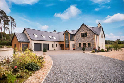
- Price
- Offers Over£950,000
- Size
- 2.9 acres
Thistle House, Forres, IV36, Moray West, Nairn and Strathspey, Moray IV36 Scotland
Added on 29/01/2026House with Land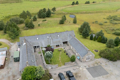
- Price
- Offers Over£600,000
- Size
- 3 acres
Flichity by Farr, Farr, IV2, Inverness, Skye and West Ross-shire, Highland IV2 Scotland
Added on 29/01/2026Barn Conversion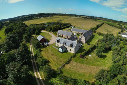
- Price
- Offers in Region of£625,000
- Size
- 3 acres
Briach Farmhouse, Rafford IV36, Moray West, Nairn and Strathspey, Moray IV36 Scotland
Added on 18/08/2026Smallholding