Laws House, Duns, Berwickshire
- Land size
- 3.27 acres
- Bedrooms
- 10
- Bathrooms
- 5
Description
Laws House is a striking Tudor Jacobean country house of circa 8,428 sq. ft occupying an enviable south facing position in the Berwickshire countryside. Built in the late 1870s by Alexander Low, this stunning country house boasts elevated views over the rolling countryside and sits in circa 1.4 acres of beautifully landscaped gardens. The current owners have taken great care to restore, preserve and maintain the ornate period features of the house, blending them effortlessly with modern fixtures and fitting to create an individual and impressive country house suitable for modern living.
In all 3.27 Acres (1.3 Hectares)
Accommodation Comprises:
Ground Floor: Entrance Hall, Dining Room, Drawing Room, Library, Snug, Dining Kitchen, Office, Laundry, Utility, Boot Room, WC.
First Floor: Landing, Four Bedrooms (One En-Suite), Two Bathrooms, Study.
Second Floor: Landing, Six Bedrooms, Bathroom, Storeroom
Basement: Wine Cellar, Storeroom.
Distances: Duns 5 miles, Berwick upon Tweed 13 miles, Kelso 15 miles, Edinburgh 46 miles, Newcastle upon Tweed 73 miles.
Description:
Laws House is a wonderful C listed Tudor Jacobean style country house with outstanding views over rolling borders countryside.
The house is rich with history, being described in the 1885 Ordnance Gazetteer of Scotland as “the only mansion house” in the parish of Whitsome. From its commanding, elevated position, the property truly must be viewed to be appreciated. Its discreet and private location allows a sense of true country living in a wonderful setting with farmland views.
Key Features:
• Striking C-Listed country house made of polished sandstone in the Tudor Jacobean style.
• Four stunning principal reception rooms and an impressive reception hall and grand staircase, with ornate barley sugar balusters.
• Intricate period detailing throughout including feature fireplaces, cornicing, panelled ceilings, finial gables and sash & case windows.
• 1.4 acres of landscaped mature gardens, with a further 1.87 acres of land that adjoin the driveway.
• Principal bedroom suite with garden views, en-suite bathroom/dressing room.
• Sun terrace accessed from the kitchen, perfect for al-fresco dining.
• The property has been meticulously looked after with extensive roof works conducted by the present owners.
Situation:
The property sits in a truly idyllic rural yet accessible location, circa five miles from the busy town of Duns and 13 miles from Berwick-Upon-Tweed. The house is ideally placed for those looking to have an easy commute to wider amenities whilst enjoying a peaceful rural position. Mainline train stations are available at Berwick (13 miles) or Reston (8.5 miles) which offer services to Edinburgh, Newcastle (circa 45 minutes) and London (circa 3 hours 45 minutes). Both Edinburgh and Newcastle offer international airports.
Directions:
From Edinburgh take the A68 south through Dalkeith and Pathhead. Turn left at the Carfraemill Hotel onto the A697 signposted for Coldstream and continue for 15 miles to Greenlaw. One mile beyond Greenlaw turn left onto the B6460. Continue for 8 miles and the entrance to the driveway of Laws House is on the right-hand side, just over 2 miles beyond the crossroads with the A6112. Continue up the shared private drive and the entrance to Laws House is on the right-hand side at the top of the hill. Continue through the private gates to a gravel sweep at the front of the house.
General Remarks:
Services – Mains water and electricity. Private drainage.
Oil fired central heating.
EPC: G (19)
Council Tax: Assessed to band H.
Tenure: Freehold
Viewings strictly by appointment with Rettie.
EPC Rating: G
Council Tax Band: H
Map Location
Property details
- Tenure
- Freehold
- Council Tax Band
- H
- Date Posted
- 2026-01-29
Market Value Analysis
Compared with 449 Homes with Land listings in Scotland (1+ acres).
Energy Performance Certificate
Energy Efficiency Rating
Based on UK Energy Performance Certificate standards (EU Directive 2002/91/EC)
Running costs are one side. Planning activity, flood history and ground risks for this location are in the full report.
Utilities & Restrictions
Utilities
- Electricity
- Ask Agent
- Water
- Ask Agent
- Heating
- Ask Agent
- Broadband
- Ask Agent
- Sewerage
- Ask Agent
Rights & Restrictions
- Public Rights of Way
- Ask Agent
- Private Rights of Way
- Ask Agent
- Listed Property
- Ask Agent
- Restrictions
- Ask Agent
Listed status, conservation areas and planning constraints for this location are in the full report.
Property Features
- Accessibility
- Ask Agent
- Parking
- Parking Available
- Garden
- Garden
Beyond the particulars: planning activity, flood history, heritage and ground risks, checked for this exact spot.
Connectivity
Broadband
Fastest speed available at this postcode
1.8 Gbps
Gigabit full fibre · available to 76% of premises
Suitable for
- 4K streaming on every screen
- Full-time home working
- Online gaming & big downloads
Fixed wireless access may also be an option here.
Mobile signal
Outdoor predictions; indoor signal depends on building materials.
Ofcom Connected Nations postcode-level predictions. Speeds and signal are modelled, not measured, and vary between addresses and providers.
Signal is the easy part. Planning activity, flood history and protected designations here are in the full report.
Nearest Schools
Primary
- Swinton Primary School2.1 miles
- Pupils
- 64
- Type
- Non-denominational
- Duns Primary School3.6 miles
- Pupils
- 347
- Type
- Non-denominational
- Chirnside Primary School4.2 miles
- Pupils
- 168
- Type
- Non-denominational
- Coldstream Primary School6.6 miles
- Pupils
- 94
- Type
- Non-denominational
- Reston Primary School7.6 miles
- Pupils
- 37
- Type
- Non-denominational
Secondary
- Berwickshire High School3.7 miles
- Pupils
- 574
- Type
- Non-denominational
- Eyemouth High School11 miles
- Pupils
- 495
- Type
- Non-denominational
- Kelso High School12 miles
- Pupils
- 592
- Type
- Non-denominational
- Earlston High School17 miles
- Pupils
- 1,090
- Type
- Non-denominational
- Dunbar Grammar School20 miles
- Pupils
- 1,120
- Type
- Non-denominational
Distances are straight-line from the advertised location. Source: the national school registers (DfE, Welsh Government, Scottish Government) and Ofsted.
Schools are just the start: planning activity, heritage and any flood history here are in the full report.
Amenities
Supermarket
GP surgery
Pharmacy
Straight-line distances from the advertised location. Sources: NHS records, Geolytix supermarket locations, OS Open Greenspace and the national trails registers.
The area stacks up? Now check the location itself: planning nearby, protected designations and past flooding.
Getting Around
Nearest station
Nearest bus stop
Typical drive times
Straight-line distances from the advertised location; drive times are typical free-flow times over OpenStreetMap road data, so allow more at peak. Public transport locations from DfT NaPTAN.
Easy to reach matters. So do planning activity, flood history and ground risks: all in the full report.
Flood Risk
From SEPA flood map open data, checked around the advertised map pin and allowing for the listed acreage where known. This summary comes from LandSale, the advertising platform, not from the listing agent, and is not part of the agent's particulars. Risk can vary across a single holding, so verify anything critical through your own searches before committing.
Rivers and the sea
Surface water
These bandings are the summary. Where this location sits on the flood maps, plus planning activity, heritage and ground risks, is in the full report.
Important notice: Information, maps and tags on this page are drawn from the advertising agent's marketing materials or generated automatically. LandSale has not verified them. Relying on these details is at your own risk, always carry out independent checks before committing to a purchase.
LandSale full disclaimer
Marketing information only - not formal particulars. The details on this website are provided for general guidance and do not constitute an offer or contract. Neither LandSale nor the advertising estate/land agent accepts responsibility for any inaccuracy.
1. Source of information
- Listing content: Core description, asking price, tenure, measurements, photographs and planning history originate from the marketing materials of the advertising estate or land agent. LandSale does not author this content and cannot guarantee its accuracy.
- Automated tags & categorisation: Property type, land-use class, acreage bands and similar labels may be applied by machine-learning models. They are intended as a helpful guide only and may not reflect the property's legal status or permitted use.
- Third-party & enriched data layers: Maps, boundary outlines, planning designations, soil reports, broadband coverage and other environmental or location-based insights are licensed from external suppliers. Such data are supplied “as is", may be incomplete or out of date and are subject to change without notice.
2. Verification required
Prospective purchasers must verify critical matters, including but not limited to planning permission, title boundaries, public rights of way, environmental constraints, acreage, services, access and VAT status, through their own inspections, specialist surveys, legal advisers and the selling agent before relying on the information or entering into any contract.
3. No warranty or liability
LandSale gives no warranty, express or implied, as to the accuracy, completeness or fitness for any particular purpose of the information displayed. LandSale shall not be liable for any loss, damage, cost or expense arising directly or indirectly from any use of or reliance on such information, save where liability may not be excluded by law.
4. Updates & feedback
If you believe any detail on this listing is inaccurate, please let us know. We will investigate and, where appropriate, update the listing or notify the agent.
© LandSale | Version 1.3 - August 2026
Listing agent
Rettie, Berwick upon Tweed
50 Hide Hill, Berwick-Upon-Tweed, TD15 1AB
Similar properties for sale
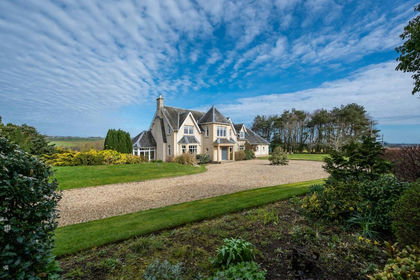
- Price
- Offers Over£895,000
- Size
- 11 acres
Goshielaw, Belmont, Kelso, TD5, Berwickshire, Roxburgh and Selkirk, Scottish Borders TD5 Scotland
Added on 18/04/2026Equestrian property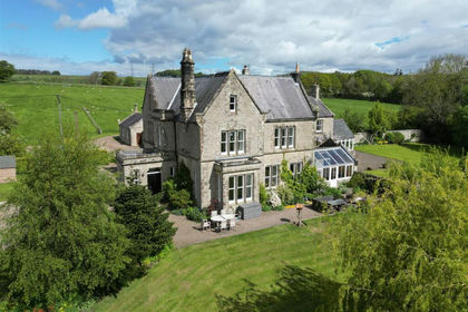
- Price
- Offers in Excess of£925,000
- Size
- 2.02 acres
The Grange, Whittingham, Alnwick, Whittingham, Northumberland NE66 England
Added on 24/06/2026Country Home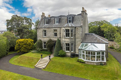
- Price
- Offers Over£899,000
- Size
- 1.5 acres
Loanstone House, Loanstone, Penicuik, EH26, Midlothian, Midlothian EH26 Scotland
Added on 25/03/2026Country Home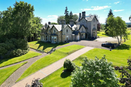
- Price
- Offers Over£935,000
- Size
- 6.4 acres
Milton Bridge, Penicuik, Midlothian, Midlothian, Midlothian EH26 Scotland
Added on 04/07/2026House with Land
- Price
- Offers Over£985,000
- Size
- 10 acres
Middleton, Morpeth, NE61, Wallington Demesne, Northumberland NE61 England
Added on 10/05/2026Country Home
- Price
- Guide Price£1,500,000
- Size
- 2.53 acres
Blindburn Hall, Wark, Hexham, Northumberland, Birtley, Northumberland NE48 England
Added on 17/06/2026Country Home
- Price
- Guide Price£1,500,000
- Size
- 17.06 acres
Added on 22/07/2026House with Land
- Price
- Guide Price£1,750,000
- Size
- 2 acres
Beltingham House, Beltingham, Hexham, Northumberland, Bardon Mill, Northumberland NE47 England
Added on 21/05/2026Country Home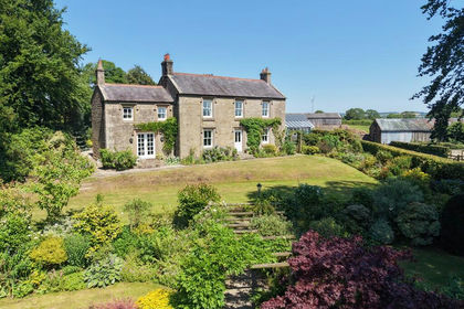
- Price
- Guide Price£975,000
- Size
- 5.69 acres
Stonecross Rigg, Near Walton, Kingwater, Cumberland CA8 England
Added on 16/07/2026Country Home
- Price
- Offers Over£1,500,000
Tillyrie House, Milnathort KY13, Perth and Kinross-shire, Perth and Kinross KY13 Scotland
Added on 22/04/2026Country Home