Parc, Cwrtnewydd, Ceredigion
- Land size
- 13.05 acres
- Bedrooms
- 1
Key Features
- 13 ACRE SMALLHOLDING
- DETACHED STONE COTTAGE
- 1 BEDROOM
- COMPLETE RENOVATION
- CASH BUYERS ONLY
- DELIGHTFUL RURAL LOCATION
Description
:
The property is a run down traditional Welsh Smallholding, and was up to recent years occupied on a lifetime tenancy by the former deceased tenant and his parents previously and lived a very simple life. The opportunity now arises to dispose of the property, together with the adjoining land, which again had previously been let out on a long term tenancy but now vacant. The stone cottage, together with adjoining stone and brick cowshed range under a corrugated iron roof provides the opportunity (subject to necessary consents) for the successful buyer to renovate and adapt into a larger dwelling, if so desired. There are other various semi-derelict outbuildings on the Homestead, with access thereon to the land, which is in need of improvement works to bring it back into a more productive condition.
Gateway off the road, leading into a grassed driveway, with small stream crossing it further on before arriving at the grassed yard, with the stone range 48’ x 18’ overall lying to one side, with the cowshed range firstly and the cottage at the far end, with a further small corrugated iron clad store shed adjoining beyond.
The Cottage provides the following character ACCOMMODATION (all measurements approximate).
Timber Front Door into:
Hallway with quarry tiled floor, electric fuse box and meter, timber partition walls, store cupboard with hatch to first floor attic area (full width and depth of cottage), (no stairs), iron window to rear, door off to:
Bedroom (left hand side) 13’11 x 7’8 with window to fore, quarry tiled floor, single power point.
Living Room 14’ x 11’4 with window to fore, small window to right, quarry tiled floor, open beamed ceiling, brick surround open fireplace and separate integral bread oven, power point.
Externally
Grassed Yard Area. On the approach is a 7’ x’ 6’ brick Dairy with the only cold water tap supplying the property.
Set opposite the stone range is a timber pole and corrugated iron clad 2 section car port. The two cowshed ranges are a total of 6 ties with feed alley to fore and one section with door to rear. Pathway on bottom side of cowshed to rear grassed yard area with aged timber Poultry Shed and 2 bay timber pole Dutch Barn with lean-to on one side. Grassed paddock to rear.
Access from the front yard area to a small handling area with small semi-derelict isolation box and leading out to:
The Land which comprises of two sizable grassed fields due East of the Homestead, being mainly level to gently sloping, but sloping off on the Southern roadside aspects. The leys are mature and would benefit of rejuvenation works to increase productivity. The other two lie North and West of the Homestead, and are more naturally wettish and suited more for rough grazing. Boundary fencing is mainly of barbwire and in need of attention. Water supplies would need to be sourced from the Homestead, although a stream crosses the Rough Grazing area.
IACS – The land has previously been registered. Prospective purchasers to satisfy themselves for future eligibility.
Rights of Way: No public rights of way cross the property, according to the local Ordnance Survey Map.
Situation: Grid Ref: SN477 – 484
The property is located along a minor district road, running up a rural valley from the centre of the village of Cwrtnewydd (0.8 miles) and going ‘around the block’ and heading back out towards the rural community of Cwmsychbant (1½ miles). The market village of Llanybydder is some 5 miles distant via the B4338 district road and has a varied array of everyday facilities. The former University amd Market Town of Lampeter is some 7 miles away.
EPC: Exempt.
TENURE: Advised Freehold.
SERVICES: Advised Mains electricity previously connected. Mains Water. No Drainage system. Timber and iron style glazed windows. Open fireplace.
Council Tax: Band ‘B’ (last recorded).
DIRECTIONS: On reaching the village, you’ll turn off the B4338 Drefach – Cwrtnewydd – Gorsgoch road on the village square onto a minor un-classifed road, climbing slightly up out of the village and then along a straight stretch up through the valley towards the hamlet of Aber (see copy OS Map). The property is set slightly back from the road just before a right hand bend with former telephone kiosk in situ. Our ‘For Sale ‘ board will be on site.
Schedule of Acreage
(Figures taken from previous Welsh Govt. Field Data and converted from Hectares to Acres).
OS No. ACREAGE
7540 0.69 Rough Grazing
7947 1.58 Rough Grazing
8539 4.60
9741 5.93
Homestead 0.25 est.
13.05
Map Location
Property details
- Tenure
- Freehold
- Council Tax Band
- B
- Date Posted
- 2026-11-16
Market Value Analysis
Compared with 236 Farms & Smallholdings listings in Wales (10+ acres).
Utilities & Restrictions
Utilities
- Electricity
- Mains
- Water
- Mains
- Heating
- Ask Agent
- Broadband
- Ask Agent
- Sewerage
- Ask Agent
Rights & Restrictions
- Public Rights of Way
- Ask Agent
- Private Rights of Way
- Ask Agent
- Listed Property
- Ask Agent
- Restrictions
- Ask Agent
Listed status, conservation areas and planning constraints for this location are in the full report.
Property Features
- Accessibility
- Ask Agent
- Parking
- Parking Available
- Garden
- Garden
Beyond the particulars: planning activity, flood history, heritage and ground risks, checked for this exact spot.
Connectivity
Broadband
Fastest speed available at this postcode
8 Mbps
Under 10 Mbps here
Suitable for
- Basic browsing & email
Mobile signal
Predicted 4G and 5G signal; indoor signal depends on building materials.
Ofcom Connected Nations postcode-level predictions. Speeds and signal are modelled, not measured, and vary between addresses and providers.
Signal is the easy part. Planning activity, flood history and protected designations here are in the full report.
Nearest Schools
Primary
- Ysgol Gynradd Dyffryn Cledlyn2.2 miles
- Pupils
- 107
- Type
- Nursery, Infants & Juniors
- Language
- Welsh medium school / provision (including transitional)
- Ysgol Gymunedol Talgarreg3.6 miles
- Pupils
- 36
- Type
- Infants & Juniors
- Language
- Welsh medium school / provision (including transitional)
- Llanybydder4.3 miles
- Pupils
- 58
- Type
- Nursery, Infants & Juniors
- Language
- Welsh medium school / provision (including transitional)
- Ysgol Dyffryn Aeron5.6 miles
- Pupils
- 180
- Type
- Nursery, Infants & Juniors
- Language
- Welsh medium school / provision (including transitional)
- Llanllwni5.7 miles
- Pupils
- 37
- Type
- Infants & Juniors
- Language
- Welsh medium school / provision (including transitional)
Secondary
- Ysgol Bro Teifi5.9 miles
- Pupils
- 861
- Type
- Middle (ages 3-19)
- Language
- Welsh medium school / provision (including transitional)
- Ysgol Bro Pedr6 miles
- Pupils
- 967
- Type
- Middle (ages 3-19)
- Language
- Dual language school / provision (Welsh and English) (including transitional)
- Gyfun Aberaeron Comprehensive8.9 miles
- Pupils
- 573
- Type
- Secondary (ages 11-19)
- Language
- Welsh medium school / provision (including transitional)
- Ysgol Gyfun Emlyn12 miles
- Pupils
- 502
- Type
- Secondary (ages 11-19)
- Language
- Dual language school / provision (Welsh and English) (including transitional)
- Ysgol Henry Richard14 miles
- Pupils
- 387
- Type
- Middle (ages 3-16)
- Language
- Welsh medium school / provision (including transitional)
Distances are straight-line from the advertised location. Source: the national school registers (DfE, Welsh Government, Scottish Government) and Ofsted.
Schools are just the start: sold prices nearby, planning activity and any flood history are in the full report.
Amenities
Supermarket
GP surgery
Pharmacy
Green space
Straight-line distances from the advertised location. Sources: NHS records, Geolytix supermarket locations, OS Open Greenspace and the national trails registers.
The area stacks up? Now check the location itself: planning nearby, protected designations and past flooding.
Getting Around
Nearest station
Nearest bus stop
Typical drive times
Straight-line distances from the advertised location; drive times are typical free-flow times over OpenStreetMap road data, so allow more at peak. Public transport locations from DfT NaPTAN.
Easy to reach matters. So do planning activity, flood history and ground risks: all in the full report.
Flood Risk
Natural Resources Wales open data, checked around the advertised map pin for the listed acreage. Long-term risk counts flood defences; the planning map's flood zones do not. Provided by LandSale, not the listing agent, and not part of the agent's particulars. Risk varies across a holding, so verify before committing.
Rivers and the sea
Not at the pin: mapped about 70 metres away.
Planning map: Flood Zone 3, about 60 metres away.
Surface water
Not at the pin: mapped about 50 metres away.
These bandings are the summary. Where this location sits on the flood maps, plus planning activity, heritage and ground risks, is in the full report.
Also in: West Wales
Important notice: Information, maps and tags on this page are drawn from the advertising agent's marketing materials or generated automatically. LandSale has not verified them. Relying on these details is at your own risk, always carry out independent checks before committing to a purchase.
LandSale full disclaimer
Marketing information only - not formal particulars. The details on this website are provided for general guidance and do not constitute an offer or contract. Neither LandSale nor the advertising estate/land agent accepts responsibility for any inaccuracy.
1. Source of information
- Listing content: Core description, asking price, tenure, measurements, photographs and planning history originate from the marketing materials of the advertising estate or land agent. LandSale does not author this content and cannot guarantee its accuracy.
- Automated tags & categorisation: Property type, land-use class, acreage bands and similar labels may be applied by machine-learning models. They are intended as a helpful guide only and may not reflect the property's legal status or permitted use.
- Third-party & enriched data layers: Maps, boundary outlines, planning designations, soil reports, broadband coverage and other environmental or location-based insights are licensed from external suppliers. Such data are supplied “as is", may be incomplete or out of date and are subject to change without notice.
2. Verification required
Prospective purchasers must verify critical matters, including but not limited to planning permission, title boundaries, public rights of way, environmental constraints, acreage, services, access and VAT status, through their own inspections, specialist surveys, legal advisers and the selling agent before relying on the information or entering into any contract.
3. No warranty or liability
LandSale gives no warranty, express or implied, as to the accuracy, completeness or fitness for any particular purpose of the information displayed. LandSale shall not be liable for any loss, damage, cost or expense arising directly or indirectly from any use of or reliance on such information, save where liability may not be excluded by law.
4. Updates & feedback
If you believe any detail on this listing is inaccurate, please let us know. We will investigate and, where appropriate, update the listing or notify the agent.
© LandSale | Version 1.3 - August 2026
Contact Dai Lewis, Newcastle Emlyn
Newcastle Emlyn Sycamore Street, Newcastle Emlyn, SA38 9AJ
View agent profileSimilar properties for sale
- Price
- Offers in Region of£180,000
- Size
- 19.17 acres
Llysnewydd, Cilycwm, Llandovery, Carmarthenshire, Cilycwm, Carmarthenshire SA20 Wales
Added on 08/08/2026Farmland
- Price
- Guide Price£180,000
- Size
- 19.17 acres
Cilycwm, Llandovery, SA20, Llandovery, Carmarthenshire SA20 Wales
Added on 28/07/2026Smallholding
- Price
- Guide Price£275,000
- Size
- 85.62 acres
Trap, Llandeilo, SA18, Llandeilo, Carmarthenshire SA18 Wales
Added on 07/08/2026Smallholding
- Price
- Guide Price£165,000
- Size
- 31.28 acres
Land at Glyn Mawr, Ynyswen, Penycae, SA9, Penycae, Powys SA9 Wales
Added on 08/06/2026Grazing Land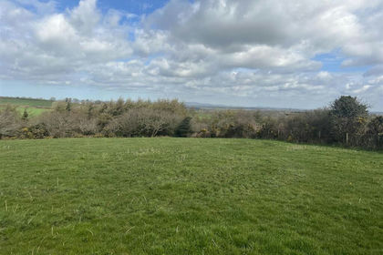
- Price
- £250,000
- Size
- 18 acres
Sardis, Pembrokeshire, SA62, Burton, Pembrokeshire SA62 Wales
Added on 28/08/2026Development Land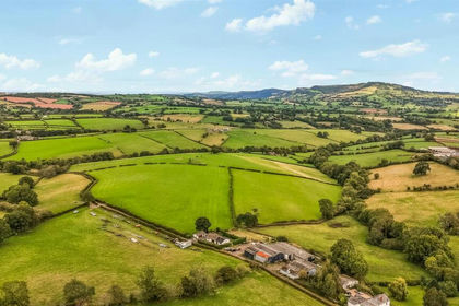
- Price
- £250,000
- Size
- 31.54 acres
Court Llaca Farm, Llanvihangel Crucorney, Crucorney, Monmouthshire NP7 Wales
Added on 16/10/2026Pasture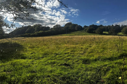
- Price
- Offers Over£190,000
- Size
- 31.92 acres
Added on 18/06/2026Agricultural Land