Off Redhills Road, Arnside, LA5
Key Features
- Land for sale with planning permission granted
- Potential to create a 1 or 2 bedroom, 2 bathroom detached home
- Full pack and cost summary available
- Close proximity to amenities
- Located in a quiet and idyllic woodland location
- Dedicated project website
- Offered with no onward chain
Description
Land for sale with full planning permission to build.
- Planning approved coastal plot - a rare and exciting opportunity to acquire a prime building plot in one of Cumbria’s most picturesque coastal locations - Arnside. Full planning permission has been secured for the development with legal and regulatory groundwork already completed ensuring a smooth and straightforward continuation of the build.
- The site represents a flexible investment opportunity. Buyers can step in at any stage of the build, with transparent costing for each phase once completed.
- Whether you're looking for a turn-key project or wish to oversee the entire development, this site offers both freedom and potential. A dedicated website, Coast Guard Cottage Cumbria, provides further details on this stunning location—described by Wordsworth himself as “the loveliest spot that man hath ever found.”
Additional Information
Water - Mains
Drainage - (to be completed)
Local Authority - Westmorland & Furness Council.
What3Words location - ///pricier.limo.scrapped
Anti-Money Laundering Regulations
In accordance with current Government legislation and the Anti-Money Laundering Regulations, all purchasers are required to complete identification and verification checks once an offer on a property has been accepted. These checks are mandatory, and the transaction cannot progress until they have been successfully completed. Failure to complete the required checks will prevent the sale from proceeding. These checks will be carried out by our specialist third-party compliance partner.
Costs
• £42.00 (including VAT) for a sole purchaser.
• £36.00 per person (including VAT) for joint purchasers, group purchases, and any individuals contributing gifted funds, provided all payments are made as a single transaction.
• £120.00 (including VAT) for purchases being made through a limited company or other corporate entity.
The fee is non-refundable and must be paid prior to the issue of the Memorandum of Sale. This charge covers the cost of obtaining and verifying relevant information, undertaking any manual compliance checks required, and ongoing monitoring where necessary.
Map Location
Property details
- Tenure
- Freehold
- Council Tax Band
- Ask Agent
- Date Posted
- 2026-11-16
Utilities & Restrictions
Utilities
- Electricity
- Ask Agent
- Water
- Ask Agent
- Heating
- Ask Agent
- Broadband
- Ask Agent
- Sewerage
- Ask Agent
Rights & Restrictions
- Public Rights of Way
- Ask Agent
- Private Rights of Way
- Ask Agent
- Listed Property
- Ask Agent
- Restrictions
- Ask Agent
Listed status, conservation areas and planning constraints for this location are in the full report.
Property Features
- Accessibility
- Ask Agent
- Parking
- Ask Agent
- Garden
- Ask Agent
Beyond the particulars: planning activity, flood history, heritage and ground risks, checked for this exact spot.
Connectivity
Broadband
No premises records for this postcode, which is common for bare land and rural plots. A new connection would be quoted by the provider.
Mobile signal
No address-level signal records for this postcode, which is common for bare land.
Ofcom Connected Nations postcode-level predictions. Speeds and signal are modelled, not measured, and vary between addresses and providers.
Signal is the easy part. Planning activity, flood history and protected designations here are in the full report.
Nearest Schools
Primary
- Arnside National CofE School640 metresOfsted: Good
- Ages
- 3 to 11
- Pupils
- 95
- Type
- Academy converter
- Faith
- Church of England
- Storth CofE School1.8 milesOfsted report card · Jun 2026
- Ages
- 2 to 11
- Pupils
- 88
- Type
- Voluntary controlled school
- Faith
- Church of England
- Silverdale St John's Church of England Voluntary Aided Primary School2 milesOfsted: Good
- Ages
- 3 to 11
- Pupils
- 55
- Type
- Voluntary aided school
- Faith
- Church of England
- Lindale CofE Primary School2.6 milesOfsted: Good
- Ages
- 3 to 11
- Pupils
- 47
- Type
- Voluntary controlled school
- Faith
- Church of England
- Beetham CofE Primary School2.9 milesNo Ofsted rating
- Ages
- 2 to 11
- Pupils
- 51
- Type
- Voluntary aided school
- Faith
- Church of England
Secondary
- Dallam School3.6 milesOfsted report card · Apr 2026
- Ages
- 11 to 18
- Pupils
- 761
- Type
- Academy converter
- Cartmel Priory CofE School4.4 milesOfsted report card · May 2026
- Ages
- 11 to 16
- Pupils
- 371
- Type
- Academy converter
- Faith
- Church of England
- Carnforth High School6 milesOfsted report card · Apr 2026
- Ages
- 11 to 16
- Pupils
- 657
- Type
- Academy converter
- Morecambe Bay Academy8.5 milesOfsted: Good
- Ages
- 11 to 18
- Pupils
- 1,045
- Type
- Academy sponsor led
- Kirkbie Kendal School9.1 milesNo Ofsted rating
- Ages
- 11 to 18
- Pupils
- 1,029
- Type
- Academy converter
Distances are straight-line from the advertised location. Source: the national school registers (DfE, Welsh Government, Scottish Government) and Ofsted.
Schools are just the start: sold prices nearby, planning activity and any flood history are in the full report.
Amenities
Supermarket
GP surgery
Pharmacy
Hospital
Green space
Straight-line distances from the advertised location. Sources: NHS records, Geolytix supermarket locations, OS Open Greenspace and the national trails registers.
The area stacks up? Now check the location itself: planning nearby, protected designations and past flooding.
Getting Around
Nearest station
Nearest bus stop
Typical drive times
Straight-line distances from the advertised location; drive times are typical free-flow times over OpenStreetMap road data, so allow more at peak. Public transport locations from DfT NaPTAN.
Easy to reach matters. So do planning activity, flood history and ground risks: all in the full report.
Flood Risk
Environment Agency open data, checked around the advertised map pin for the listed acreage. Long-term risk counts flood defences; the planning map's flood zones do not. Provided by LandSale, not the listing agent, and not part of the agent's particulars. Risk varies across a holding, so verify before committing.
Rivers and the sea
Planning map: Flood Zone 1.
Surface water
These bandings are the summary. Where this location sits on the flood maps, plus planning activity, heritage and ground risks, is in the full report.
Important notice: Information, maps and tags on this page are drawn from the advertising agent's marketing materials or generated automatically. LandSale has not verified them. Relying on these details is at your own risk, always carry out independent checks before committing to a purchase.
LandSale full disclaimer
Marketing information only - not formal particulars. The details on this website are provided for general guidance and do not constitute an offer or contract. Neither LandSale nor the advertising estate/land agent accepts responsibility for any inaccuracy.
1. Source of information
- Listing content: Core description, asking price, tenure, measurements, photographs and planning history originate from the marketing materials of the advertising estate or land agent. LandSale does not author this content and cannot guarantee its accuracy.
- Automated tags & categorisation: Property type, land-use class, acreage bands and similar labels may be applied by machine-learning models. They are intended as a helpful guide only and may not reflect the property's legal status or permitted use.
- Third-party & enriched data layers: Maps, boundary outlines, planning designations, soil reports, broadband coverage and other environmental or location-based insights are licensed from external suppliers. Such data are supplied “as is", may be incomplete or out of date and are subject to change without notice.
2. Verification required
Prospective purchasers must verify critical matters, including but not limited to planning permission, title boundaries, public rights of way, environmental constraints, acreage, services, access and VAT status, through their own inspections, specialist surveys, legal advisers and the selling agent before relying on the information or entering into any contract.
3. No warranty or liability
LandSale gives no warranty, express or implied, as to the accuracy, completeness or fitness for any particular purpose of the information displayed. LandSale shall not be liable for any loss, damage, cost or expense arising directly or indirectly from any use of or reliance on such information, save where liability may not be excluded by law.
4. Updates & feedback
If you believe any detail on this listing is inaccurate, please let us know. We will investigate and, where appropriate, update the listing or notify the agent.
© LandSale | Version 1.3 - August 2026
Similar properties for sale
 Added on 29/01/2026Development Land
- Price
- £132,500
Land Off, Village Road, Cockerham, Lancaster, Lancashire, LA2, Cockerham, Lancashire LA2 England
Added on 19/05/2026Building Plot Added on 25/07/2026Building Plot
- Price
- Offers in Region of£150,000
Cowgill, Dent, Sedbergh, LA10, Sedbergh, Westmorland and Furness LA10 England
Added on 27/10/2026Conversion Land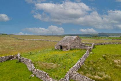
- Price
- Guide Price£130,000
Greenside Barn, Ravenstonedale, Ravenstonedale, Westmorland and Furness CA17 England
Added on 24/06/2026Conversion Land- Price
- Guide Price£130,000
Greenside Barn, Ravenstonedale, Ravenstonedale, Westmorland and Furness CA17 England
Added on 24/06/2026Conversion Land Added on 29/01/2026Development Land
- Price
- Guide Price£135,000
Added on 24/03/2026Building Plot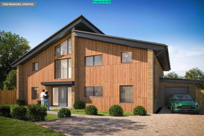
- Price
- Fixed Price£150,000
- Size
- 0.6 acres
Gill Lane, Longton, Preston, PR4, Longton, Lancashire PR4 England
Added on 30/09/2026Self Build Plot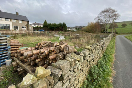
- Price
- £160,000
- Size
- 0.35 acres
Land to the South of Barnwood Road, Earby, Barnoldswick, BB18, Earby, Lancashire BB18 England
Added on 10/11/2026Building Plot