Gill Lane, Longton, Preston, PR4
- Land size
- 0.6 acres
- Bedrooms
- 5
- Bathrooms
- 3
Key Features
- Garden
- Parking
- Utilities included
Description
Property number 54138.
Sale price on custom-build style purchase: Purchase the land and create your dream home alongside Hodson Homes architects and we will build your own designed home for you. The total cost, including land and construction, ranges from £700,000 for a 2,555 sq ft home (including garage and balcony) to £1,050,000 for a 3,805 sq ft home (including double garage and balcony), depending on your preferred design and size. Our architect will assist you in designing your dream home.
Mortgage: Should you require a self-build mortgage, Hodson Homes will help with this process.
Property details: 5 Bedroom, Zero Carbon, Self-Sustainable Healthy Homes.
Property address: Pine Meadows, off Gill Lane, Longton, PR4 4SS.
Land area: Plot 1: 0.18 acres / Plot 2: 0.42 acres
Planning reference: South Ribble Borough Council planning ref: 07/2025/00323/FUL
EPC rating: A.
Local primary schools: New Longton All Saints (0.3miles) / Howick (0.9miles) / Whitefield (1.1miles)
Local high school: All Hallows (0.9miles) / Penwortham Priory (2miles) / Hutton Church of England (2miles)
Broadband: Superfast broadband is expected in the area (your own checks are required).
Expected completion: May - July 2028.
Tenure: Freehold.
Maintenance plan: £200 per year.
About Property: This beautiful property combines the use of natural external materials with luxury internal finishes, alongside super energy efficient zero carbon credentials for energy self-sufficiency. Our stunning homes are unique; including increased air quality inside the home. The upper floors have vaulted ceilings giving an open feel, the hall & gallery have a ceiling heights over 7m with added natural light coming in from rooflights above. The property comes with an enclosed balcony spanning the full length of the rear of the property. The overhanging canopy is designed to shelter the property during the summer months whilst the sun is at it's highest, keeping the house cool and allowing sunlight in the winter months whilst the sun is at it's lowest, heating up the property. The property features a large array of solar panels, air source heat pump, underfloor heating, triple glazing, increased insulation throughout & mechanical ventilation.
Property room details: Ability to design your own home, also see floor plans example contained within the brochure.
Property position: Situated in Longton, the properties are accessed off Gill Lane, secluded, between open fields in all directions.
About Location: Longton is a highly sought-after village on the outskirts of Preston, offering an excellent blend of semi-rural living and everyday convenience. Renowned for its strong sense of community, well-regarded local schools, independent shops, cafés and traditional pubs, Longton provides an attractive setting for families and professionals alike. The village enjoys easy access to Preston City Centre, the motorway network and the beautiful Lancashire countryside, making it an ideal location for those seeking a peaceful yet well-connected lifestyle
Location features: Great access to Preston City Centre. Spectacular views in secluded location
Specification features: High end specifications, full specification of external and internal finishes available on request.
About Developer & Zero Carbon Homes
Zero Carbon Homes – The Future of Sustainable Living
Why choose Hodson Homes?
• Experience true self-sustainability – power your EV
• Save money with lower energy bills
• Enjoy clearer air and healthier living spaces
• Reduce your carbon footprint and tackle climate change
Curious? Keep reading below and see how our homes combine eco responsibility with modern comfort.
Welcome to the future of sustainable living. At Hodson Homes, we are proud to be one of the FIRST house builders in the United Kingdom to offer ‘Zero Carbon’ homes for private sale.
We welcome you to view our Zero Carbon eco self-sustainable homes, where environmental responsibility meets modern living. These homes offer a host of key benefits that not only support homeowners but also contribute to a sustainable future for our planet.
One of the most significant advantages of these homes is their positive impact on the environment. By adopting eco-friendly practices and technologies, they play a crucial role in addressing the climate crisis we face today. They effectively reduce carbon emissions and greenhouse gas emissions, making a tangible difference in the fight against climate change.
These homes also ease pressure on the national grid, reducing reliance on traditional energy infrastructure and minimising costly upgrades. Homeowners benefit directly with lower energy bills and a more sustainable lifestyle.
Moreover, these homes prioritise the health and well-being of their occupants. With advanced ventilation and dust control, our homes create healthier living environments and cleaner air, supporting wellbeing every day. Residents can breathe easy, knowing that their home supports their well-being.
By reducing pollution and striving for lower carbon emissions, these homes contribute to a cleaner and healthier environment for everyone.
One of the most exciting features of these homes is their self-sufficiency. By minimising reliance on non-renewable resources and fossil fuels, they provide a sustainable solution for the future. Imagine charging your electric vehicle using energy generated by your own home, or growing fresh fruit and vegetables in your garden – our homes make sustainable living practical and rewarding.
Our homes are designed to meet the highest standards of sustainability. They blend seamlessly with their surroundings, incorporating natural materials and preserving the beauty of the environment.
Our zero carbon eco-self-sustainable homes are the epitome of responsible and forward-thinking living. They offer a multitude of benefits, from reducing carbon emissions and energy consumption to improving health and promoting a sustainable lifestyle.
Choosing a Hodson Home means choosing a brighter, greener future – for you, your family, and generations to come.
Please note that self-sustainability depends on individual home usages.
Map Location
Property details
- Tenure
- Freehold
- Council Tax Band
- Ask Agent
- Date Posted
- 2026-09-30
Utilities & Restrictions
Utilities
- Electricity
- Ask Agent
- Water
- Ask Agent
- Heating
- Ask Agent
- Broadband
- Ask Agent
- Sewerage
- Ask Agent
Rights & Restrictions
- Public Rights of Way
- Ask Agent
- Private Rights of Way
- Ask Agent
- Listed Property
- Ask Agent
- Restrictions
- Ask Agent
Listed status, conservation areas and planning constraints for this location are in the full report.
Property Features
- Accessibility
- Ask Agent
- Parking
- Parking Available
- Garden
- Garden
Beyond the particulars: planning activity, flood history, heritage and ground risks, checked for this exact spot.
Connectivity
Broadband
Fastest speed available at this postcode
48 Mbps
Superfast · available to 59% of premises
Suitable for
- HD streaming
- Video calls
- Web & social
Mobile signal
Predicted 4G and 5G signal; indoor signal depends on building materials.
Ofcom Connected Nations postcode-level predictions. Speeds and signal are modelled, not measured, and vary between addresses and providers.
Signal is the easy part. Planning activity, flood history and protected designations here are in the full report.
Nearest Schools
Primary
- Little Hoole Primary School789 metresNo Ofsted rating
- Ages
- 5 to 11
- Pupils
- 186
- Type
- Community school
- St Oswald's Catholic Primary School, Longton0.9 milesNo Ofsted rating
- Ages
- 4 to 11
- Pupils
- 246
- Type
- Voluntary aided school
- Faith
- Roman Catholic
- Longton Primary School1 mileOfsted: Good *
- Ages
- 4 to 11
- Pupils
- 213
- Type
- Foundation school
- New Longton All Saints CofE Primary School1.4 milesNo Ofsted rating
- Ages
- 4 to 11
- Pupils
- 217
- Type
- Voluntary aided school
- Faith
- Church of England
- Hoole St Michael CofE Primary School2 milesOfsted report card · Jan 2026
- Ages
- 3 to 11
- Pupils
- 81
- Type
- Voluntary aided school
- Faith
- Church of England
Secondary
- Hutton Church of England Grammar School1.5 milesOfsted report card · May 2026
- Ages
- 11 to 18
- Pupils
- 807
- Type
- Voluntary aided school
- Faith
- Church of England
- Gender
- Boys
- All Hallows Catholic High School2.3 milesOfsted: Outstanding
- Ages
- 11 to 16
- Pupils
- 911
- Type
- Voluntary aided school
- Faith
- Roman Catholic
- Academy@Worden2.9 milesOfsted: Good *
- Ages
- 11 to 16
- Pupils
- 660
- Type
- Academy converter
- Penwortham Priory Academy2.9 milesOfsted: Good
- Ages
- 11 to 16
- Pupils
- 745
- Type
- Academy converter
- Tarleton Academy2.9 milesNo Ofsted rating
- Ages
- 11 to 16
- Pupils
- 674
- Type
- Academy converter
* Latest graded judgement covers quality of education only; no overall grade was issued under the 2024-25 inspection framework.
Distances are straight-line from the advertised location. Source: the national school registers (DfE, Welsh Government, Scottish Government) and Ofsted.
Schools are just the start: sold prices nearby, planning activity and any flood history are in the full report.
Amenities
Supermarket
GP surgery
Pharmacy
Hospital
Green space
Straight-line distances from the advertised location. Sources: NHS records, Geolytix supermarket locations, OS Open Greenspace and the national trails registers.
The area stacks up? Now check the location itself: planning nearby, protected designations and past flooding.
Getting Around
Nearest station
Nearest bus stop
Typical drive times
Straight-line distances from the advertised location; drive times are typical free-flow times over OpenStreetMap road data, so allow more at peak. Public transport locations from DfT NaPTAN.
Easy to reach matters. So do planning activity, flood history and ground risks: all in the full report.
Flood Risk
Environment Agency open data, checked around the advertised map pin for the listed acreage. Long-term risk counts flood defences; the planning map's flood zones do not. The map pin for this listing marks the postcode area rather than the exact location, so these readings describe the surrounding area. Provided by LandSale, not the listing agent, and not part of the agent's particulars. Risk varies across a holding, so verify before committing.
Rivers and the sea
Planning map: Flood Zone 1.
Surface water
Not at the pin: mapped about 20 metres away.
These bandings are the summary. Where this location sits on the flood maps, plus planning activity, heritage and ground risks, is in the full report.
Important notice: Information, maps and tags on this page are drawn from the advertising agent's marketing materials or generated automatically. LandSale has not verified them. Relying on these details is at your own risk, always carry out independent checks before committing to a purchase.
LandSale full disclaimer
Marketing information only - not formal particulars. The details on this website are provided for general guidance and do not constitute an offer or contract. Neither LandSale nor the advertising estate/land agent accepts responsibility for any inaccuracy.
1. Source of information
- Listing content: Core description, asking price, tenure, measurements, photographs and planning history originate from the marketing materials of the advertising estate or land agent. LandSale does not author this content and cannot guarantee its accuracy.
- Automated tags & categorisation: Property type, land-use class, acreage bands and similar labels may be applied by machine-learning models. They are intended as a helpful guide only and may not reflect the property's legal status or permitted use.
- Third-party & enriched data layers: Maps, boundary outlines, planning designations, soil reports, broadband coverage and other environmental or location-based insights are licensed from external suppliers. Such data are supplied “as is", may be incomplete or out of date and are subject to change without notice.
2. Verification required
Prospective purchasers must verify critical matters, including but not limited to planning permission, title boundaries, public rights of way, environmental constraints, acreage, services, access and VAT status, through their own inspections, specialist surveys, legal advisers and the selling agent before relying on the information or entering into any contract.
3. No warranty or liability
LandSale gives no warranty, express or implied, as to the accuracy, completeness or fitness for any particular purpose of the information displayed. LandSale shall not be liable for any loss, damage, cost or expense arising directly or indirectly from any use of or reliance on such information, save where liability may not be excluded by law.
4. Updates & feedback
If you believe any detail on this listing is inaccurate, please let us know. We will investigate and, where appropriate, update the listing or notify the agent.
© LandSale | Version 1.3 - August 2026
Listing agent
Visum, Nationwide
Web based Estate Agent
Similar properties for sale
- Price
- Guide Price£135,000
Added on 24/03/2026Building Plot Added on 29/01/2026Building Plot
- Price
- Offers Over£180,000
Higher Walton Road, Walton-Le-Dale, Preston, Ribble Valley, Lancashire PR5 England
Added on 11/07/2026Building Plot
- Price
- Fixed Price£150,000
Whins Lane, Wheelton, Chorley, PR6, Wheelton, Lancashire PR6 England
Added on 30/09/2026Self Build Plot
- Price
- £175,000
- Size
- 0.3 acres
Added on 10/08/2026Development Land
- Price
- Guide Price£140,000
Added on 25/08/2026Building Plot
- Price
- Guide Price£120,000
- Size
- 0.05 acres
Longhirst Close, Bolton, BL1, Bolton West, Bolton BL1 England
Added on 25/08/2026Building Plot
- Price
- £132,500
Land Off, Village Road, Cockerham, Lancaster, Lancashire, LA2, Cockerham, Lancashire LA2 England
Added on 19/05/2026Building Plot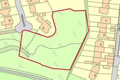
- Price
- Guide Price£185,000
- Size
- 0.8 acres
Land Adjacent to 27 Highgate, Nelson, Lancashire, BB9, Nelson, Lancashire BB9 England
Added on 14/09/2026Building Plot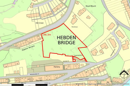
- Price
- Guide Price£155,000
- Size
- 1.09 acres
Land On Heptonstall Road, Hebden Bridge, West Yorkshire HX7, Hebden Royd, Calderdale HX7 England
Added on 15/09/2026Building Plot