Little Chart, Ashford, Kent, TN27
- Land size
- 0.5 acres
- Bedrooms
- 3
- Bathrooms
- 2
Key Features
- 3 Bedrooms
- Breakfast Room
- Kitchen
- Utility Room
- Sitting Room
- Dining Room
- Bathroom
- Bathroom
- Garage
- Cart Lodge
Description
** GUIDE PRICE £700,000 - £750,000 **
Exceptional Grade II Listed Medieval Cottage with Extensive Grounds & Far-Reaching Countryside Views
Key Features
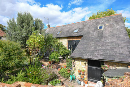
Beautiful three-bedroom Grade II listed cottage
Historic former medieval hall house, believed to date from the 15th century
Idyllic rural setting with far-reaching countryside views
Gated private grounds with solar-powered security gates
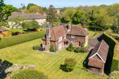
Private grounds of around half an acre
Small paddock with two stables with electric ideal for goats, dogs or small ponies
Private driveway with parking for approximately six cars
Double garage with power, lighting and remote-controlled door
Additional parking to the side, in an attached cart barn.
Period features including exposed beams and original brickwork
Two impressive inglenook fireplaces
Peaceful and secluded country setting
Rare opportunity to own a property of significant architectural character
Description
A truly exceptional opportunity to acquire a Grade II listed three-bedroom cottage, occupying a wonderful private position surrounded by open countryside and enjoying far-reaching rural views.
Believed to date back to the late medieval period, around the 15th century, the property is understood to have originally served as the farmhouse to the surrounding land. Originally constructed as a traditional hall house, it was later altered during the 17th century. Its rich history and architectural heritage are evident throughout, with a wealth of original features and period charm creating a truly characterful and individual home.
Inside, the property retains an impressive collection of period features, including exposed timber beams, traditional brickwork and two striking inglenook fireplaces, providing wonderful focal points and a strong sense of history.
The property is approached via a private gated entrance, with solar-powered security gates and camera providing both privacy and peace of mind. A generous driveway offers parking for approximately six vehicles in a car park, while further parking to the side provides space for a larger vehicle.
The double garage is equipped with power, lighting and a remote-controlled door, providing secure parking, storage and useful additional space.
One of the property's most appealing features is the amount of private land surrounding the home. The grounds provide an exceptional level of privacy and offer considerable flexibility for those seeking a more rural lifestyle. A small paddock adds further appeal and could be suitable for keeping goats, dogs or small ponies, subject to the buyer's requirements and any necessary permissions.
The combination of historic architecture, extensive grounds, secure gated access and uninterrupted countryside views makes this a particularly rare property that is difficult to compare with a conventional modern home.
Local Area & Amenities
The property is situated in a rural location between the picturesque villages of Little Chart and Pluckley, surrounded by the beautiful Kent countryside. Both Charing and Pluckley are approximately a five-minute drive away, offering convenient access to a range of local amenities.
Little Chart is a peaceful village with a rich history, featuring a number of historic buildings, a village church and the popular Swan Inn, which provides a traditional local setting for food and drink.
The surrounding countryside is ideal for those who enjoy walking and exploring the outdoors, with both the Stour Valley Walk and Greensand Way passing through or close to Little Chart, offering access to a variety of scenic footpaths and rural walks.
The neighbouring villages of Charing and Pluckley provide a range of local amenities, including shops, pubs, services and primary schools. Charing also benefits from a local GP surgery. For commuters, Pluckley railway station offers mainline services to London Charing Cross, while Charing railway station provides services towards London Victoria.
For a wider choice of shopping, dining, schooling and leisure facilities, the nearby town of Ashford is easily accessible. Ashford International provides high-speed rail services to London St Pancras, while the A20 and M20 offer convenient road links towards London, the Kent coast and the wider motorway network.
Viewing is highly recommended to fully appreciate the size and potential of this property.
Buyer Process: Our customers use British Homebuyers to either purchase or assist in selling properties quickly and reliably. Therefore any new applicants to purchase are subject to vetting to ensure they meet strict criteria.
Exclusivity Fee:
You can secure the purchase by paying an exclusivity fee of £2,000. This grants the buyer exclusive rights to proceed with the purchase for the duration of the conveyancing process, during which time the seller agrees to remove the property from the market and not negotiate with other parties.
The exclusivity fee is returned to the buyer upon successful completion of the purchase.
A processing fee of £250 is required in order to draw up an exclusive legally binding contract between the buyer and seller. This fee also covers the buyer identity verification checks required under UK Anti-Money Laundering Regulations, which are carried out by our independent third-party provider. The agreement sets out the terms of exclusivity and seller commitment but does not constitute an exchange of contracts.
This arrangement provides buyers with reassurance that the property is secured exclusively for them, reducing the risk of gazumping and unnecessary aborted costs.
Disclaimer
The particulars are set out as a general outline only for the guidance of intended purchasers and do not constitute, any part of a contract. Nothing in these particulars shall be deemed to be a statement that the property is in good structural condition or otherwise nor that any of the services, appliances, equipment or facilities are in good working order. Purchasers should satisfy themselves of this prior to purchasing. The photograph(s) depict only certain parts of the property. It should not be assumed that any contents/furniture etc. photographed are included in the sale. It should not be assumed that the property remains as displayed in the photograph(s). No assumption should be made with regard to parts of the property that have not been photographed. Any areas, measurements, aspects or distances referred to are given as a GUIDE ONLY and are NOT precise. If such details are fundamental to a purchase, purchasers must rely on their own enquiries. Descriptions of the property are subjective and are used in good faith as an opinion and NOT as a statement of fact. Please make further inquiries to ensure that our descriptions are likely to match any expectations you may have.
Breakfast Room
Kitchen
Utility Room
Sitting Room
Dining Room
Bathroom
Bedroom
Bathroom
Bedroom
Bedroom
Garage
Cart Lodge
Map Location
Property details
- Tenure
- Freehold
- Council Tax Band
- TBC
- Date Posted
- 2026-11-16
Utilities & Restrictions
Utilities
- Electricity
- Ask Agent
- Water
- Ask Agent
- Heating
- Ask Agent
- Broadband
- Ask Agent
- Sewerage
- Ask Agent
Rights & Restrictions
- Public Rights of Way
- Ask Agent
- Private Rights of Way
- Ask Agent
- Listed Property
- Ask Agent
- Restrictions
- Ask Agent
Listed status, conservation areas and planning constraints for this location are in the full report.
Property Features
- Accessibility
- Ask Agent
- Parking
- Driveway
- Garden
- Garden
Beyond the particulars: planning activity, flood history, heritage and ground risks, checked for this exact spot.
Connectivity
Broadband
Fastest speed available at this postcode
29 Mbps
Standard (10-30 Mbps)
Suitable for
- Web & social
- Music streaming
- Standard video calls
Fixed wireless access may also be an option here.
Mobile signal
Predicted 4G and 5G signal; indoor signal depends on building materials.
Ofcom Connected Nations postcode-level predictions. Speeds and signal are modelled, not measured, and vary between addresses and providers.
Signal is the easy part. Planning activity, flood history and protected designations here are in the full report.
Nearest Schools
Primary
- Pluckley Church of England Primary School1.5 milesNo Ofsted rating
- Ages
- 3 to 11
- Pupils
- 82
- Type
- Academy converter
- Faith
- Church of England
- Charing Church of England Primary School1.6 milesOfsted report card · Feb 2026
- Ages
- 2 to 11
- Pupils
- 199
- Type
- Academy converter
- Faith
- Church of England
- Egerton Church of England Primary School1.9 milesOfsted: Good
- Ages
- 4 to 11
- Pupils
- 197
- Type
- Voluntary controlled school
- Faith
- Church of England
- Lenham Primary School3.9 milesOfsted: Good
- Ages
- 4 to 11
- Pupils
- 204
- Type
- Community school
- Platts Heath Primary School4.1 milesOfsted: Good
- Ages
- 4 to 11
- Pupils
- 61
- Type
- Community school
Secondary
- The Lenham School4 milesOfsted: Good
- Ages
- 11 to 18
- Pupils
- 820
- Type
- Academy sponsor led
- Chilmington Green School4.8 milesOfsted report card · May 2026
- Ages
- 11 to 19
- Pupils
- 449
- Type
- Free schools
- Highworth Grammar School4.9 milesOfsted: Outstanding *
- Ages
- 11 to 18
- Pupils
- 1,553
- Type
- Academy converter
- Gender
- Girls
- Towers School and Sixth Form Centre5.2 milesOfsted: Good *
- Ages
- 11 to 19
- Pupils
- 1,538
- Type
- Academy converter
- The John Wallis Church of England Academy5.9 milesOfsted: Good
- Ages
- 0 to 19
- Pupils
- 1,650
- Type
- Academy sponsor led
- Faith
- Church of England
* Latest graded judgement covers quality of education only; no overall grade was issued under the 2024-25 inspection framework.
Distances are straight-line from the advertised location. Source: the national school registers (DfE, Welsh Government, Scottish Government) and Ofsted.
Schools are just the start: sold prices nearby, planning activity and any flood history are in the full report.
Amenities
Supermarket
GP surgery
Pharmacy
Hospital
Straight-line distances from the advertised location. Sources: NHS records, Geolytix supermarket locations, OS Open Greenspace and the national trails registers.
The area stacks up? Now check the location itself: planning nearby, protected designations and past flooding.
Getting Around
Nearest station
Nearest bus stop
Typical drive times
Straight-line distances from the advertised location; drive times are typical free-flow times over OpenStreetMap road data, so allow more at peak. Public transport locations from DfT NaPTAN.
Easy to reach matters. So do planning activity, flood history and ground risks: all in the full report.
Flood Risk
Environment Agency open data, checked around the advertised map pin for the listed acreage. Long-term risk counts flood defences; the planning map's flood zones do not. Provided by LandSale, not the listing agent, and not part of the agent's particulars. Risk varies across a holding, so verify before committing.
Rivers and the sea
Not at the pin: mapped about 20 metres away.
Planning map: Flood Zone 1.
Surface water
Not at the pin: mapped about 10 metres away.
These bandings are the summary. Where this location sits on the flood maps, plus planning activity, heritage and ground risks, is in the full report.
Important notice: Information, maps and tags on this page are drawn from the advertising agent's marketing materials or generated automatically. LandSale has not verified them. Relying on these details is at your own risk, always carry out independent checks before committing to a purchase.
LandSale full disclaimer
Marketing information only - not formal particulars. The details on this website are provided for general guidance and do not constitute an offer or contract. Neither LandSale nor the advertising estate/land agent accepts responsibility for any inaccuracy.
1. Source of information
- Listing content: Core description, asking price, tenure, measurements, photographs and planning history originate from the marketing materials of the advertising estate or land agent. LandSale does not author this content and cannot guarantee its accuracy.
- Automated tags & categorisation: Property type, land-use class, acreage bands and similar labels may be applied by machine-learning models. They are intended as a helpful guide only and may not reflect the property's legal status or permitted use.
- Third-party & enriched data layers: Maps, boundary outlines, planning designations, soil reports, broadband coverage and other environmental or location-based insights are licensed from external suppliers. Such data are supplied “as is", may be incomplete or out of date and are subject to change without notice.
2. Verification required
Prospective purchasers must verify critical matters, including but not limited to planning permission, title boundaries, public rights of way, environmental constraints, acreage, services, access and VAT status, through their own inspections, specialist surveys, legal advisers and the selling agent before relying on the information or entering into any contract.
3. No warranty or liability
LandSale gives no warranty, express or implied, as to the accuracy, completeness or fitness for any particular purpose of the information displayed. LandSale shall not be liable for any loss, damage, cost or expense arising directly or indirectly from any use of or reliance on such information, save where liability may not be excluded by law.
4. Updates & feedback
If you believe any detail on this listing is inaccurate, please let us know. We will investigate and, where appropriate, update the listing or notify the agent.
© LandSale | Version 1.3 - August 2026
Listing agent
British Homesellers, NationalThird Floor St. Peters House, 45 Victoria Street, St. Albans, Hertfordshire, AL1 3HZ
Contact British Homesellers, National
Third Floor St. Peters House, 45 Victoria Street, St. Albans, Hertfordshire, AL1 3HZ
View agent profileSimilar properties for sale
 Added on 08/09/2026Barn Conversion
- Price
- £749,995
- Size
- 1.05 acres
Added on 29/01/2026House with Land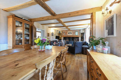
- Price
- £875,000
- Size
- 3.17 acres
Added on 28/01/2026House with Land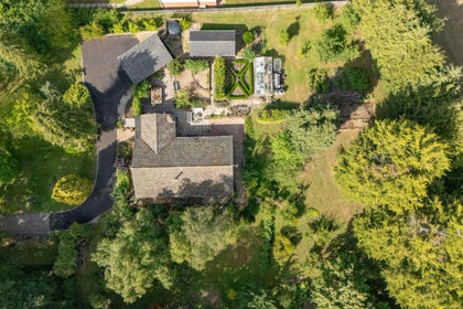
- Price
- £635,000
- Size
- 1.05 acres
Added on 18/06/2026House with Land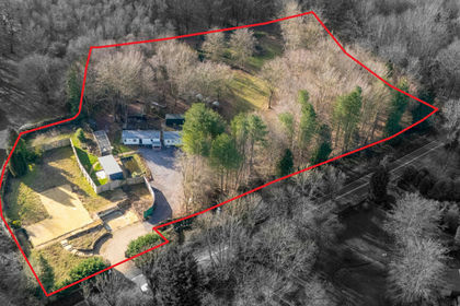
- Price
- Offers in Region of£650,000
- Size
- 2.62 acres
Added on 05/03/2026Building Plot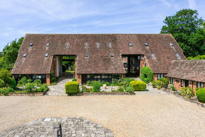 Added on 18/09/2026Barn Conversion
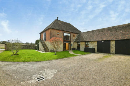
- Price
- Offers Over£800,000
Old Ham Lane, Lenham, Maidstone, ME17, Lenham, Kent ME17 England
Added on 02/10/2026Barn Conversion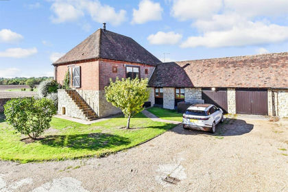
- Price
- Guide Price£591,000
Old Ham Lane, Lenham, Maidstone, Kent, Lenham, Kent ME17 England
Added on 06/11/2026Barn Conversion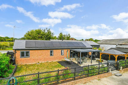
- Price
- Guide Price£575,000
- Size
- 1 acres
Southernden Road, Headcorn, Ashford, Kent, TN27, Boughton Malherbe, Kent TN27 England
Added on 29/01/2026House with Land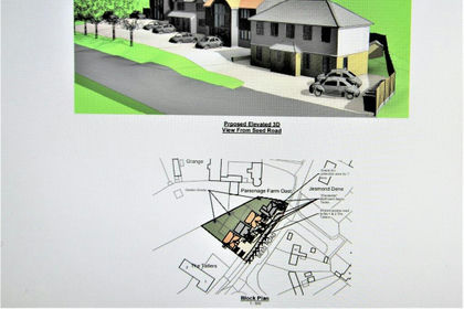
- Price
- Offers in Region of£800,000
Seed Road, Newnham, Sittingbourne, Doddington, Kent ME9 England
Added on 29/01/2026Development Land