Davenport Lane, Mobberley, WA16
- Land size
- 16.5 acres
- Bedrooms
- 4
- Bathrooms
- 3
Key Features
- Over 16 acres of gardens and pasture
- Barn Conversion
- Detached double garage
- Four double bedrooms
- Superb equestrian opportunity
Description
Occupying a delightful rural setting along one of Mobberley's most sought-after country lanes, Brooklands is an impressive semi-detached barn conversion extending to approximately 3,109 sq.ft., complemented by a detached double garage, stable block and approximately 16.5 acres of gardens and paddocks. Blending the character of a traditional Cheshire barn with beautifully presented accommodation and excellent equestrian facilities, the property offers a wonderful opportunity to enjoy country living in one of Cheshire's most desirable locations.
At the heart of the home is a magnificent vaulted reception hall with exposed timber trusses and a beautifully crafted oak staircase. Arranged around this impressive space are three generous reception rooms, including an elegant sitting room extending to over 25ft, a welcoming living room with feature fireplace and a well-appointed kitchen/breakfast room overlooking the courtyard. A utility room and contemporary shower room complete the ground floor.
The first floor is thoughtfully arranged over two separate staircases, creating an excellent degree of privacy. The principal bedroom features exposed beams and a luxurious en-suite bathroom, whilst a second bedroom also benefits from en-suite facilities. Two further double bedrooms are served by a well-appointed family bathroom.
Outside, Brooklands is approached via an extensive gravel driveway providing ample parking and access to the detached double garage. Beautifully maintained formal gardens surround the house, whilst the adjoining pasture and stable block with tack room provide excellent equestrian facilities and the perfect setting for those seeking a true rural lifestyle.
This unique property is offered for sale with no onward chain.
Important Information
What3Words - ///pushing.secure.installs
Parking - Garage and Driveway
Tenure - Freehold
Heating - Oil Central Heating
Services: Mains Electric & Water, Drainage via Septic Tank (non compliant with current regulations)
EPC rating - E (53/65)
Council Tax band - G (Cheshire East).
**Flood Risk - There is a very low flood risk for this property.
*Broadband - Superfast broadband available at the property
*Mobile - Likely coverage by EE, O2, Three and Vodafone.
Information provided by Ofcom checker and isn't guaranteed. Andrew J Nowell take no responsibility for inaccuracies and advise potential tenants to do their own checks before committing to renting the property. * Information provided by GOV.UK
Parking - Double garage
Parking - Driveway
Disclaimer
These particulars are prepared with care to provide a fair overview of the property but do not constitute an offer or contract. All descriptions, dimensions, floor plans and images are given in good faith and believed correct at publication, though accuracy is not guaranteed. Purchasers should rely on their own inspections, surveys and professional advice. Measurements are approximate and floor plans are not to scale. Photography may include wide-angle lenses or digital enhancement. Services, systems, appliances and planning or building regulation matters have not been tested or verified. Fixtures and fittings are excluded unless specifically agreed in writing. We comply with the Consumer Protection from Unfair Trading Regulations 2008 and the Business Protection from Misleading Marketing Regulations 2008, and advise all parties to satisfy themselves as to all aspects before proceeding.
Map Location
Property details
- Tenure
- Freehold
- Council Tax Band
- G
- Date Posted
- 2026-11-11
Market Value Analysis
Compared with 75 Homes with Land listings in North West England (10+ acres).
Utilities & Restrictions
Utilities
- Electricity
- Mains
- Water
- Mains
- Heating
- Oil Heating
- Broadband
- Cable Internet
- Sewerage
- Septic Tank / Private
Rights & Restrictions
- Public Rights of Way
- Ask Agent
- Private Rights of Way
- Yes
- Listed Property
- Ask Agent
- Restrictions
- Ask Agent
Listed status, conservation areas and planning constraints for this location are in the full report.
Property Features
- Accessibility
- Ask Agent
- Parking
- Garage, Driveway
- Garden
- Garden
Beyond the particulars: planning activity, flood history, heritage and ground risks, checked for this exact spot.
Connectivity
Broadband
Fastest speed available at this postcode
1.8 Gbps
Gigabit full fibre · available to 22% of premises
Suitable for
- 4K streaming on every screen
- Full-time home working
- Online gaming & big downloads
Mobile signal
Predicted 4G and 5G signal; indoor signal depends on building materials.
Ofcom Connected Nations postcode-level predictions. Speeds and signal are modelled, not measured, and vary between addresses and providers.
Signal is the easy part. Planning activity, flood history and protected designations here are in the full report.
Nearest Schools
Primary
- Mobberley CofE Primary School0.6 milesOfsted: Good *
- Ages
- 4 to 11
- Pupils
- 193
- Type
- Voluntary controlled school
- Faith
- Church of England
- Lindow Community Primary School2.1 milesNo Ofsted rating
- Ages
- 4 to 11
- Pupils
- 152
- Type
- Community school
- Gorsey Bank Primary School2.3 milesOfsted: Outstanding
- Ages
- 4 to 11
- Pupils
- 422
- Type
- Academy converter
- Ashdene Primary School2.4 milesNo Ofsted rating
- Ages
- 4 to 11
- Pupils
- 422
- Type
- Community school
- St Anne's Fulshaw C of E Primary School2.5 milesOfsted: Good
- Ages
- 4 to 11
- Pupils
- 72
- Type
- Voluntary controlled school
- Faith
- Church of England
Secondary
- Wilmslow High School3 milesNo Ofsted rating
- Ages
- 11 to 18
- Pupils
- 2,227
- Type
- Community school
- Saint Ambrose College3.2 milesOfsted report card · Nov 2025
- Ages
- 11 to 18
- Pupils
- 1,096
- Type
- Academy converter
- Faith
- Roman Catholic
- Gender
- Boys
- Knutsford Academy3.6 milesOfsted report card · Mar 2026
- Ages
- 11 to 18
- Pupils
- 1,429
- Type
- Academy converter
- Altrincham Grammar School for Boys4.1 milesOfsted: Outstanding
- Ages
- 11 to 18
- Pupils
- 1,432
- Type
- Academy converter
- Gender
- Boys
- Manchester Enterprise Academy4.1 milesOfsted report card · Jan 2026
- Ages
- 11 to 16
- Pupils
- 1,145
- Type
- Academy sponsor led
* Latest graded judgement covers quality of education only; no overall grade was issued under the 2024-25 inspection framework.
Distances are straight-line from the advertised location. Source: the national school registers (DfE, Welsh Government, Scottish Government) and Ofsted.
Schools are just the start: sold prices nearby, planning activity and any flood history are in the full report.
Amenities
Supermarket
GP surgery
Pharmacy
Hospital
Straight-line distances from the advertised location. Sources: NHS records, Geolytix supermarket locations, OS Open Greenspace and the national trails registers.
The area stacks up? Now check the location itself: planning nearby, protected designations and past flooding.
Getting Around
Nearest station
Nearest bus stop
Typical drive times
Straight-line distances from the advertised location; drive times are typical free-flow times over OpenStreetMap road data, so allow more at peak. Public transport locations from DfT NaPTAN.
Easy to reach matters. So do planning activity, flood history and ground risks: all in the full report.
Flood Risk
Environment Agency open data, checked around the advertised map pin for the listed acreage. Long-term risk counts flood defences; the planning map's flood zones do not. Provided by LandSale, not the listing agent, and not part of the agent's particulars. Risk varies across a holding, so verify before committing.
Rivers and the sea
Planning map: Flood Zone 3, about 30 metres away.
Surface water
Not at the pin: mapped about 50 metres away.
These bandings are the summary. Where this location sits on the flood maps, plus planning activity, heritage and ground risks, is in the full report.
Important notice: Information, maps and tags on this page are drawn from the advertising agent's marketing materials or generated automatically. LandSale has not verified them. Relying on these details is at your own risk, always carry out independent checks before committing to a purchase.
LandSale full disclaimer
Marketing information only - not formal particulars. The details on this website are provided for general guidance and do not constitute an offer or contract. Neither LandSale nor the advertising estate/land agent accepts responsibility for any inaccuracy.
1. Source of information
- Listing content: Core description, asking price, tenure, measurements, photographs and planning history originate from the marketing materials of the advertising estate or land agent. LandSale does not author this content and cannot guarantee its accuracy.
- Automated tags & categorisation: Property type, land-use class, acreage bands and similar labels may be applied by machine-learning models. They are intended as a helpful guide only and may not reflect the property's legal status or permitted use.
- Third-party & enriched data layers: Maps, boundary outlines, planning designations, soil reports, broadband coverage and other environmental or location-based insights are licensed from external suppliers. Such data are supplied “as is", may be incomplete or out of date and are subject to change without notice.
2. Verification required
Prospective purchasers must verify critical matters, including but not limited to planning permission, title boundaries, public rights of way, environmental constraints, acreage, services, access and VAT status, through their own inspections, specialist surveys, legal advisers and the selling agent before relying on the information or entering into any contract.
3. No warranty or liability
LandSale gives no warranty, express or implied, as to the accuracy, completeness or fitness for any particular purpose of the information displayed. LandSale shall not be liable for any loss, damage, cost or expense arising directly or indirectly from any use of or reliance on such information, save where liability may not be excluded by law.
4. Updates & feedback
If you believe any detail on this listing is inaccurate, please let us know. We will investigate and, where appropriate, update the listing or notify the agent.
© LandSale | Version 1.3 - August 2026
Similar properties for sale
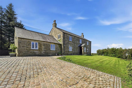
- Price
- Guide Price£1,075,000
- Size
- 8 acres
Bakestonedale Road, Pott Shrigley, Macclesfield, Pott Shrigley, Cheshire East SK10 England
Added on 14/08/2026House with Land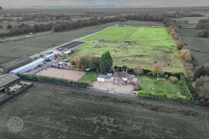
- Price
- £1,100,000
- Size
- 15 acres
Moss Road, Cadishead, M44, Worsley and Eccles, Salford M44 England
Added on 22/10/2026Equestrian property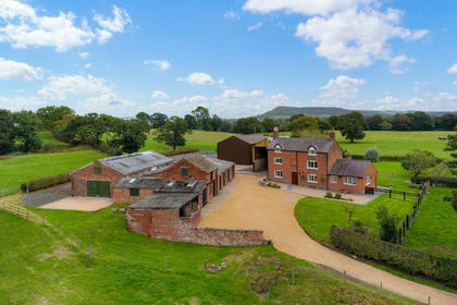
- Price
- Guide Price£1,250,000
- Size
- 8.9 acres
Added on 23/09/2026Farmhouse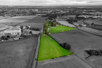
- Price
- Guide Price£1,250,000
- Size
- 9.22 acres
Northwich Road, Lower Stretton, Warrington, Stretton, Warrington WA4 England
Added on 22/09/2026House with Land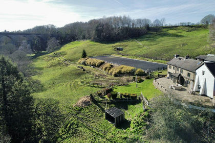
- Price
- Offers in Excess of£1,100,000
- Size
- 10 acres
Watermeetings Lane, Romiley, Hazel Grove, Stockport SK6 England
Added on 22/05/2026Farmhouse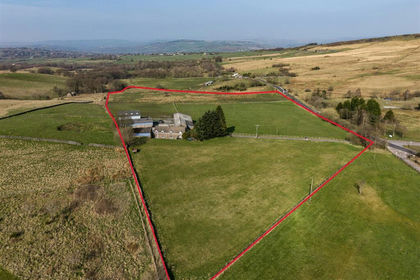
- Price
- Offers in Region of£1,150,000
- Size
- 18.32 acres
Cock Knoll Farm, Mudhurst Lane, Disley, Disley, Cheshire East SK12 England
Added on 29/03/2026Farm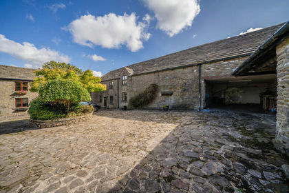
- Price
- Offers in Excess of£1,000,000
- Size
- 17.87 acres
Added on 02/09/2026Equestrian property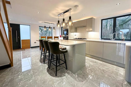
- Price
- £800,000
- Size
- 8.17 acres
Lamberts Lane, Congleton, Congleton, Cheshire East CW12 England
Added on 29/01/2026House with Land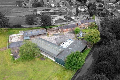
- Price
- Offers in Region of£925,000
- Size
- 8.99 acres
Edge Hill Farm, Congleton Edge Road, Congleton, CW12, Congleton, Cheshire East CW12 England
Added on 17/06/2026Smallholding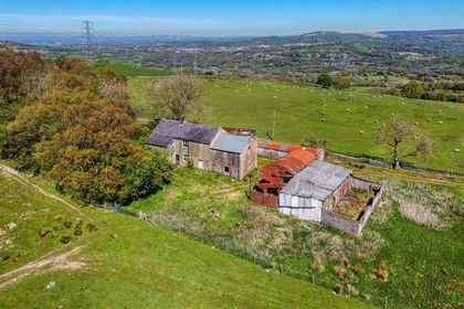
- Price
- Offers in Excess of£950,000
- Size
- 84.82 acres
Higher Chisworth, Chisworth, Glossop, SK13, Glossop, Derbyshire SK13 England
Added on 08/07/2026Agricultural Land