Auction: Thursday 17 December 2026 at 6pm
Bridge Street, Swindon
Key Features
- 17 December 2026 LIVE ONLINE AUCTION
- Fire-damaged commercial building
- Planning permission granted
- Six-storey mixed-use building
- Commercial unit and 23 apartments
- GDV £4,740,000 | Rental income £330,000PA
Description
PRIME DEVELOPMENT SITE IN SWINDON TOWN CENTRE
A substantial fire-damaged commercial building in the heart of Swindon town centre, benefiting from outline planning permission for a six-storey mixed-use development - providing ground-floor commercial space and 23 residential apartments.
The proposed development offers an attractive investment opportunity, with an anticipated GDV of approximately £4,740,000 and estimated annual rental income of £330,000.
A superb opportunity for developers to create a landmark building in central Swindon.
For Sale By Auction - This property is due to feature in our LIVE Online Auction on 17 December 2026 at 6.00pm. Bidding is via proxy, telephone or online remote bidding.
Viewings - External viewings only. Internal viewings are not possible due to the fire damage.
Summary - DEVELOPMENT OPPORTUNITY | PLANNING PERMISSION FOR DEMOLITION AND ERECTION OF A 6-STOREY BUILDING | COMMERCIAL UNIT AND 23 APARTMENTS
Description - An exciting development opportunity comprising a substantial fire-damaged commercial building occupying a prominent position in the heart of Swindon town centre. The property benefits from outline planning permission for an impressive six-storey mixed-use development, incorporating a ground-floor commercial unit and 23 residential apartments.
The proposed scheme offers significant potential for developers and investors, with an anticipated Gross Development Value (GDV) of approximately £4,740,000 and an estimated annual rental income in the region of £330,000.
A rare opportunity to acquire a centrally located development site and create a landmark mixed-use building in the heart of Swindon.
Location - Situated in the heart of Swindon town centre, 32–34 Bridge Street benefits from a highly accessible central location, within walking distance of the town's principal shopping, leisure and commercial amenities. Swindon railway station is approximately 0.3 miles away, with convenient connections to London and the wider regional transport network. The surrounding area offers a mix of established commercial uses, residential developments and local amenities, making it an attractive location for town-centre living.
Planning Permission - Local Authority: Swindon Borough Council
Application Number: S/OUT/24/1135/AMMY
Date Granted: 31st March 2025
Application: Outline Planning Permission for the demolition of the existing building and erection of a 6 storey, mixed use building containing ground floor commercial use and 23 no. self-contained residential units from 1st to 5th floor.
Proposed Schedule Of Accommodation - Proposed GIA (Gross Internal Area)
Commercial Space: 254.81m²
Unit 01: 1-Bed | 50.05 m²
Unit 02: 2-Bed| 70.35 m²
Unit 03: 1-Bed | 67.81 m²
Unit 04: 2-Bed | 63.59 m²
Unit 05: 1-Bed | 50.61 m²
Unit 06: 1-Bed | 50.19 m²
Unit 07: 2-Bed | 74.22 m²
Unit 08: 1-Bed | 61.09 m²
Unit 09: 2-Bed | 65.60 m²
Unit 10: 1-Bed | 50.85 m²
Unit 11: 1-Bed | 52.40 m²
Unit 12: 2-Bed | 73.84 m²
Unit 13: 1-Bed | 53.00 m²
Unit 14: 2-Bed | 65.78 m²
Unit 15: 1-Bed | 50.28 m²
Unit 16: 1-Bed | 50.91 m²
Unit 17: 2-Bed | 61.22 m²
Unit 18: 1-Bed | 53.00 m²
Unit 19: 1-Bed | 53.15 m²
Unit 20: 1-Bed | 50.62 m²
Unit 21: 3-Bed | 91.38 m²
Unit 22: 1-Bed | 52.05 m²
Unit 23: 2-Bed | 61.05 m²
Total Proposed GIA: 1,627.88 m²
Completion - Completion for this lot will be 8 weeks from exchange of contracts or sooner by mutual agreement.
Energy Performance Certificate (Epc) - Rating: B
Tenure - Please refer to the auction legal pack
Site Plan & Aerial Images - The site plan and aerial images are provided for indicative purposes only, please refer to the title plan within the legal pack for confirmation of the site boundaries. Please note, the aerial image of the property is provided by Google Maps and may have been taken prior to the fire damage.
Buyer's Premium - Please be advised that all purchasers are subject to a £1,900 plus VAT (£2,280 inc VAT) buyer’s premium payable upon exchange of contracts.
*Guide Price - Guide Prices are provided as an indication of each seller's minimum expectation. They are not necessarily figures which a property will sell for and may change at any time prior to the auction. Each property will be offered subject to Reserve Price (a figure below which the Auctioneer cannot sell the property during the auction) which we expect will be set within the Guide Range or no more than 10% above a single figure Guide.
Reserve Price - The seller's minimum acceptable price at auction and the figure below which the auctioneer cannot sell. The reserve price is not disclosed and remains confidential between the seller and the auctioneer. Both the guide price and the reserve price can be subject to change up to and including the day of the auction.
Proxy, Telephone & Online Bidding - The auction will be held online via live video stream with buyers able to bid via telephone, online or by submitting a proxy bid. You will need to complete our bidder registration form, which is available to download from our website. The completed form, ID (driving licence or passport and a recent utility bill stating the home address of the purchaser) and a pre-authorised hold on funds for your bidding deposit must be received no later than 24 hours before the date of the auction.
Bidding Deposits - Bidders will be required to use the online card facility to pay their Bidding Deposit. A pre-authorised hold on funds in the amount of £5,000 will be placed on your debit card until the auction date.
If you are the successful bidder, this amount will be debited from your card and the balance of the deposit monies and Buyer’s Premium (£1,900 plus VAT) must be transferred to our client account within two working days of the auction sale. If you are unsuccessful at the auction, the hold on your card will be released the following day (please be aware that the time taken to release the hold on funds may vary depending on your card provider).
Gdv & Rental Estimates - All GDV and rental estimates are provided in good faith. They should be verified by your own professional advisors prior to a commitment to purchase.
Auction Or Bridging Finance Required? - Do you need a mortgage or loan quickly? Maggs & Allen have specialist Independent Brokers who can arrange residential and commercial finance on all types of property. Contact the Auction Team today to be put through to our mortgage and loan experts on or email
Letting - What Can Maggs & Allen Achieve For You? - Maggs & Allen's experienced letting team are happy to discuss the rental of this property and can advise on maximising the investment. We offer Full Management, Let Only and Rent Collection Services. Contact Jessica Archer and her team on or email .
Map Location
Property details
- Tenure
- Freehold
- Council Tax Band
- Ask Agent
- Date Posted
- 2026-11-11
Utilities & Restrictions
Utilities
- Electricity
- Ask Agent
- Water
- Ask Agent
- Heating
- Ask Agent
- Broadband
- Ask Agent
- Sewerage
- Ask Agent
Rights & Restrictions
- Public Rights of Way
- Ask Agent
- Private Rights of Way
- Ask Agent
- Listed Property
- Ask Agent
- Restrictions
- Ask Agent
Listed status, conservation areas and planning constraints for this location are in the full report.
Property Features
- Accessibility
- Ask Agent
- Parking
- Ask Agent
- Garden
- Ask Agent
Beyond the particulars: planning activity, flood history, heritage and ground risks, checked for this exact spot.
Connectivity
Broadband
Fastest speed available at this postcode
5.5 Gbps
Gigabit full fibre
Suitable for
- 4K streaming on every screen
- Full-time home working
- Online gaming & big downloads
Mobile signal
Predicted 4G and 5G signal; indoor signal depends on building materials.
Ofcom Connected Nations postcode-level predictions. Speeds and signal are modelled, not measured, and vary between addresses and providers.
Signal is the easy part. Planning activity, flood history and protected designations here are in the full report.
Nearest Schools
Primary
- Holy Rood Catholic Primary School675 metresOfsted: Good
- Ages
- 4 to 11
- Pupils
- 381
- Type
- Academy converter
- Faith
- Roman Catholic
- Robert Le Kyng Primary School906 metresNo Ofsted rating
- Ages
- 4 to 11
- Pupils
- 411
- Type
- Academy converter
- Drove Primary School0.6 milesOfsted: Good
- Ages
- 2 to 11
- Pupils
- 706
- Type
- Academy converter
- King William Street Church of England Primary School0.6 milesOfsted: Good
- Ages
- 4 to 11
- Pupils
- 198
- Type
- Academy converter
- Faith
- Church of England
- Ferndale Primary School & Nursery0.8 milesNo Ofsted rating
- Ages
- 2 to 11
- Pupils
- 413
- Type
- Academy converter
Secondary
- UTC Swindon542 metresOfsted: Requires improvement
- Ages
- 14 to 19
- Pupils
- 182
- Type
- University technical college
- The Commonweal School0.9 milesNo Ofsted rating
- Ages
- 11 to 19
- Pupils
- 1,442
- Type
- Academy converter
- St Joseph's Catholic College1 mileNo Ofsted rating
- Ages
- 11 to 16
- Pupils
- 1,425
- Type
- Academy converter
- Faith
- Roman Catholic
- Lawn Manor Academy1.1 milesOfsted: Good
- Ages
- 11 to 16
- Pupils
- 969
- Type
- Academy converter
- Swindon Academy1.3 milesOfsted report card · May 2026
- Ages
- 2 to 19
- Pupils
- 1,820
- Type
- Academy sponsor led
Distances are straight-line from the advertised location. Source: the national school registers (DfE, Welsh Government, Scottish Government) and Ofsted.
Schools are just the start: sold prices nearby, planning activity and any flood history are in the full report.
Amenities
Supermarket
GP surgery
Pharmacy
Hospital
Green space
Straight-line distances from the advertised location. Sources: NHS records, Geolytix supermarket locations, OS Open Greenspace and the national trails registers.
The area stacks up? Now check the location itself: planning nearby, protected designations and past flooding.
Getting Around
Nearest station
Nearest bus stop
Typical drive times
Straight-line distances from the advertised location; drive times are typical free-flow times over OpenStreetMap road data, so allow more at peak. Public transport locations from DfT NaPTAN.
Easy to reach matters. So do planning activity, flood history and ground risks: all in the full report.
Flood Risk
Environment Agency open data, checked around the advertised map pin for the listed acreage. Long-term risk counts flood defences; the planning map's flood zones do not. The map pin for this listing marks the postcode area rather than the exact location, so these readings describe the surrounding area. Provided by LandSale, not the listing agent, and not part of the agent's particulars. Risk varies across a holding, so verify before committing.
Rivers and the sea
Planning map: Flood Zone 1.
Surface water
Not at the pin: mapped about 20 metres away.
These bandings are the summary. Where this location sits on the flood maps, plus planning activity, heritage and ground risks, is in the full report.
Important notice: Information, maps and tags on this page are drawn from the advertising agent's marketing materials or generated automatically. LandSale has not verified them. Relying on these details is at your own risk, always carry out independent checks before committing to a purchase.
LandSale full disclaimer
Marketing information only - not formal particulars. The details on this website are provided for general guidance and do not constitute an offer or contract. Neither LandSale nor the advertising estate/land agent accepts responsibility for any inaccuracy.
1. Source of information
- Listing content: Core description, asking price, tenure, measurements, photographs and planning history originate from the marketing materials of the advertising estate or land agent. LandSale does not author this content and cannot guarantee its accuracy.
- Automated tags & categorisation: Property type, land-use class, acreage bands and similar labels may be applied by machine-learning models. They are intended as a helpful guide only and may not reflect the property's legal status or permitted use.
- Third-party & enriched data layers: Maps, boundary outlines, planning designations, soil reports, broadband coverage and other environmental or location-based insights are licensed from external suppliers. Such data are supplied “as is", may be incomplete or out of date and are subject to change without notice.
2. Verification required
Prospective purchasers must verify critical matters, including but not limited to planning permission, title boundaries, public rights of way, environmental constraints, acreage, services, access and VAT status, through their own inspections, specialist surveys, legal advisers and the selling agent before relying on the information or entering into any contract.
3. No warranty or liability
LandSale gives no warranty, express or implied, as to the accuracy, completeness or fitness for any particular purpose of the information displayed. LandSale shall not be liable for any loss, damage, cost or expense arising directly or indirectly from any use of or reliance on such information, save where liability may not be excluded by law.
4. Updates & feedback
If you believe any detail on this listing is inaccurate, please let us know. We will investigate and, where appropriate, update the listing or notify the agent.
© LandSale | Version 1.3 - August 2026
Listing agent
Maggs & Allen, Auction, Commercial & Investment60 Northumbria Drive, Henleaze, Bristol, BS9 4HW
Contact Maggs & Allen, Auction, Commercial & Investment
60 Northumbria Drive, Henleaze, Bristol, BS9 4HW
View agent profileSimilar properties for sale
- Price
- Guide Price£275,000
- Floor area
- 1,939 sq ft
Added on 13/06/2026Commercial Land
- Price
- Guide Price£250,000
- Floor area
- 7,141 sq ft
Unit 7, Corsham Commercial Centre, Potley Lane, Corsham, Wiltshire, Corsham, Wiltshire SN13 England
Added on 08/08/2026Industrial LandLeasehold Added on 02/11/2026Development Land
- Price
- £206,250
- Size
- 0.46 acres
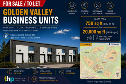
Golden Valley Business Units, Hatherley Lane, Cheltenham, Cheltenham, Gloucestershire GL51 England
Added on 25/05/2026Industrial Land
- Price
- Guide Price£250,000
Hailes Street, Winchcombe, Winchcombe, Gloucestershire GL54 England
Added on 25/05/2026Commercial Land
- Price
- Guide Price£300,000
- Floor area
- 1,025 sq ft
Added on 22/06/2026Industrial LandLeasehold
- Price
- Guide Price£275,000
- Floor area
- 3,298 sq ft
Added on 17/07/2026Warehouse
- Price
- £190,000
Added on 29/01/2026PubLeasehold
- Price
- Offers in Excess of£195,000
- Size
- 0.38 acres
Westbury-on-Severn, Gloucestershire, GL14, Westbury-on-Severn, Gloucestershire GL14 England
Added on 25/05/2026Warehouse
- Price
- Offers in Region of£200,000
- Size
- 4.81 acres
Nupdown Lane, Nupdown, BS35, Hill, South Gloucestershire BS35 England
Added on 27/05/2026Farmland