Bletchingley, Surrey
- Land size
- 5 acres
- Bedrooms
- 4
- Bathrooms
- 4
Key Features
- Galleried Entrance Hall
- Cloakroom
- Double Aspect Living Room
- Excellent Kitchen/Dining Room for modern living
- Utility Room
- 4 Bedrooms including Annex
- 4 Bath/Shower Rooms
- Double Garage
- Breathtaking Views
- About 5 Acres
Description
Location
Situated towards the end of a meandering country lane, where the village of Bletchingley, on the south side, transitions into beautiful open Surrey countryside, the property is approached by its own private, winding driveway. Enjoying a good measure of seclusion, the house enjoys stunning views over the adjoining landscape. The historic village of Bletchingley, which retains its traditional High Street, provides a sense of community, characterised by St Mary’s Church, local shops and choice of public houses. Central London is just 22 miles, whilst for the international traveller, Gatwick Airport is 10 miles (approximate distances). For those with leisure and outdoor interests, there is a local network of footpaths and bridleways connecting with the landscape and providing ideal opportunities for walking and riding.
Description
Originally forming part of a farmstead, The Bothy has been subject to a recent and comprehensive programme of refurbishment. The accommodation is extremely adaptable, including a large studio room over the double garage, which could easily be utilised as a self-contained annex. Stepping outside, there is a wide terrace to the rear which benefits from a south westerly aspect, ideal for alfresco dining. Beyond the terrace, the meadow and pasture, extending to some 5 acres, gently slopes from the house, where there are spectacular views. The property will particularly appeal to families with outdoor interest, such as equestrian use.
Summary of Accommodation
Ground Floor
Entrance Hall: Light Oak / glass staircase to open galleried landing
Hall Cloakroom
Double Aspect Sitting Room: Wood burning stove, two sets of double doors to gardens
Superb Kitchen-Dining Room: Extensive shaker style units. Fine quality quartz stone worktops providing ample work and prep areas, built in hob and appliances, cupboard housing recycling bins. Neff, oven, combination oven and microwave, larder fridge, under counter freezer, dishwasher and Wine cooler. Bora electric Hob with work top extractor. Double Belfast sink with Quooker hot tap
Utility Room: Floor tiling and electrical underfloor heating. Bosch laundry equipment consisting of 9kg washing machine and 9kg heat exchanger tumble dryer for improved efficiency. Microwave oven, fridge freezer and utility sink (This room could easily be utilised as a second kitchen serving the studio/annex)
Wet Room / Shower
First Floor (Main House)
Principle Bedroom: Dressing Area, En-suite shower/bathroom
Two Further bedrooms: Each served by own shower room
First Floor (Annex)
Fourth Bedroom/Studio room over garage, eaves storage, approached by rear oak staircase
Specification
Main building fitted with high quality double glazed doors and windows to give energy efficient light and airy openings, complete with high security multiple locking front door.
Heating: Wet underfloor heating to ground floor, zoned heating controls. All served with low energy LPG wall boiler.
TV and internet: provisions for connections to principle rooms
Security: Zoned security system is installed throughout the building.
Exterior
Double garage: Remote control door
Extensive sand-stone paving to rear and front, ideal for entertaining with spectacular views
Rear Courtyard garden: wood store and storage barn
EV car charging wired for future connection to terminal (connections not included as part of sale)
Field Shelter
Water supply to paddock areas
Freehold
Mains electricity & water
Private drainage plant drainage, shared with neighbouring properties
Council Tax to be assessed
Extensive, additional features. Full details available at viewings or on request
Map Location
Property details
- Tenure
- Freehold
- Council Tax Band
- Ask Agent
- Date Posted
- 2026-11-09
Market Value Analysis
Compared with 365 Homes with Land listings in South East England (5+ acres).
Energy Performance Certificate
Energy Efficiency Rating
Based on UK Energy Performance Certificate standards (EU Directive 2002/91/EC)
Running costs are one side. Planning activity, flood history and ground risks for this location are in the full report.
Utilities & Restrictions
Utilities
- Electricity
- Ask Agent
- Water
- Ask Agent
- Heating
- Ask Agent
- Broadband
- Ask Agent
- Sewerage
- Ask Agent
Rights & Restrictions
- Public Rights of Way
- Ask Agent
- Private Rights of Way
- Ask Agent
- Listed Property
- Ask Agent
- Restrictions
- Ask Agent
Listed status, conservation areas and planning constraints for this location are in the full report.
Property Features
- Accessibility
- Ask Agent
- Parking
- Parking Available
- Garden
- Garden
Beyond the particulars: planning activity, flood history, heritage and ground risks, checked for this exact spot.
Connectivity
Broadband
Fastest speed available at this postcode
48 Mbps
Superfast · available to 46% of premises
Suitable for
- HD streaming
- Video calls
- Web & social
Mobile signal
Predicted 4G and 5G signal; indoor signal depends on building materials.
Ofcom Connected Nations postcode-level predictions. Speeds and signal are modelled, not measured, and vary between addresses and providers.
Signal is the easy part. Planning activity, flood history and protected designations here are in the full report.
Nearest Schools
Primary
- Bletchingley Village Primary School829 metresOfsted: Requires improvement *
- Ages
- 2 to 11
- Pupils
- 230
- Type
- Academy converter
- Godstone Primary and Nursery School0.9 milesNo Ofsted rating
- Ages
- 2 to 11
- Pupils
- 226
- Type
- Foundation school
- St Stephen's CofE Primary School1.9 milesOfsted report card · May 2026
- Ages
- 2 to 11
- Pupils
- 248
- Type
- Academy converter
- Faith
- Church of England
- St Peter's CofE Infant School2.1 milesOfsted: Good
- Ages
- 4 to 7
- Pupils
- 85
- Type
- Voluntary aided school
- Faith
- Church of England
- Nutfield Church CofE Primary School2.1 milesNo Ofsted rating
- Ages
- 5 to 11
- Pupils
- 202
- Type
- Voluntary aided school
- Faith
- Church of England
Secondary
- Merstham Park School3 milesOfsted: Good
- Ages
- 11 to 16
- Pupils
- 711
- Type
- Free schools
- Carrington School3.4 milesOfsted: Good
- Ages
- 11 to 16
- Pupils
- 1,012
- Type
- Academy converter
- Oxted School3.9 milesOfsted report card · Mar 2026
- Ages
- 11 to 18
- Pupils
- 1,528
- Type
- Academy converter
- de Stafford School4 milesOfsted: Good
- Ages
- 11 to 16
- Pupils
- 811
- Type
- Academy converter
- St Bede's School4.1 milesNo Ofsted rating
- Ages
- 11 to 18
- Pupils
- 1,918
- Type
- Voluntary aided school
- Faith
- Church of England/Roman Catholic
* Latest graded judgement covers quality of education only; no overall grade was issued under the 2024-25 inspection framework.
Distances are straight-line from the advertised location. Source: the national school registers (DfE, Welsh Government, Scottish Government) and Ofsted.
Schools are just the start: sold prices nearby, planning activity and any flood history are in the full report.
Amenities
Supermarket
GP surgery
Pharmacy
Hospital
Green space
Straight-line distances from the advertised location. Sources: NHS records, Geolytix supermarket locations, OS Open Greenspace and the national trails registers.
The area stacks up? Now check the location itself: planning nearby, protected designations and past flooding.
Getting Around
Nearest station
Nearest bus stop
Typical drive times
Straight-line distances from the advertised location; drive times are typical free-flow times over OpenStreetMap road data, so allow more at peak. Public transport locations from DfT NaPTAN.
Easy to reach matters. So do planning activity, flood history and ground risks: all in the full report.
Flood Risk
Environment Agency open data, checked around the advertised map pin for the listed acreage. Long-term risk counts flood defences; the planning map's flood zones do not. Provided by LandSale, not the listing agent, and not part of the agent's particulars. Risk varies across a holding, so verify before committing.
Rivers and the sea
Planning map: Flood Zone 1.
Surface water
Not at the pin: mapped about 60 metres away.
These bandings are the summary. Where this location sits on the flood maps, plus planning activity, heritage and ground risks, is in the full report.
Important notice: Information, maps and tags on this page are drawn from the advertising agent's marketing materials or generated automatically. LandSale has not verified them. Relying on these details is at your own risk, always carry out independent checks before committing to a purchase.
LandSale full disclaimer
Marketing information only - not formal particulars. The details on this website are provided for general guidance and do not constitute an offer or contract. Neither LandSale nor the advertising estate/land agent accepts responsibility for any inaccuracy.
1. Source of information
- Listing content: Core description, asking price, tenure, measurements, photographs and planning history originate from the marketing materials of the advertising estate or land agent. LandSale does not author this content and cannot guarantee its accuracy.
- Automated tags & categorisation: Property type, land-use class, acreage bands and similar labels may be applied by machine-learning models. They are intended as a helpful guide only and may not reflect the property's legal status or permitted use.
- Third-party & enriched data layers: Maps, boundary outlines, planning designations, soil reports, broadband coverage and other environmental or location-based insights are licensed from external suppliers. Such data are supplied “as is", may be incomplete or out of date and are subject to change without notice.
2. Verification required
Prospective purchasers must verify critical matters, including but not limited to planning permission, title boundaries, public rights of way, environmental constraints, acreage, services, access and VAT status, through their own inspections, specialist surveys, legal advisers and the selling agent before relying on the information or entering into any contract.
3. No warranty or liability
LandSale gives no warranty, express or implied, as to the accuracy, completeness or fitness for any particular purpose of the information displayed. LandSale shall not be liable for any loss, damage, cost or expense arising directly or indirectly from any use of or reliance on such information, save where liability may not be excluded by law.
4. Updates & feedback
If you believe any detail on this listing is inaccurate, please let us know. We will investigate and, where appropriate, update the listing or notify the agent.
© LandSale | Version 1.3 - August 2026
Similar properties for sale
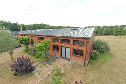
- Price
- Offers in Region of£1,650,000
- Size
- 6.1 acres
Added on 03/07/2026Barn Conversion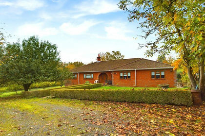
- Price
- £1,250,000
- Size
- 22 acres
Tandridge Hill Lane, Godstone, Tandridge, Surrey RH9 England
Added on 29/01/2026Smallholding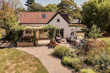
- Price
- Guide Price£1,200,000
- Size
- 3.75 acres
Added on 13/11/2026House with Land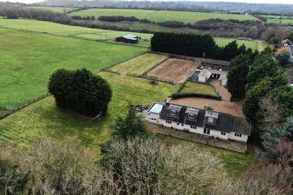
- Price
- £1,950,000
- Size
- 14 acres
Added on 16/09/2026Equestrian property
- Price
- Guide Price£1,495,000
- Size
- 3 acres
Wilmots Lane, Horne, Horley, Surrey, RH6, Horne, Surrey RH6 England
Added on 10/05/2026Cottage
- Price
- Guide Price£1,400,000
- Size
- 3 acres
Dwelly Lane, Edenbridge, Kent, TN8, Limpsfield, Surrey TN8 England
Added on 24/06/2026House with Land
- Price
- £1,250,000
- Size
- 3 acres
Broadbridge Lane, Smallfield, Horley, Surrey, RH6, Burstow, Surrey RH6 England
Added on 01/10/2026House with Land
- Price
- £1,875,000
- Size
- 2.3 acres
Added on 30/06/2026House with Land
- Price
- £1,500,000
- Size
- 8.5 acres
Dormans Park, West Sussex @ Private Estates, Dormansland, Surrey RH19 England
Added on 19/04/2026House with Land
- Price
- Guide Price£1,400,000
- Size
- 2.19 acres
Kingswood Way, South Croydon, CR2, Croydon East, Croydon CR2 England
Added on 18/09/2026House with Land