Woodhouse End Road, Gawsworth, Macclesfield, SK11
- Land size
- 7.29 acres
- Bedrooms
- 5
- Bathrooms
- 3
Description
Mount Farm is an impressive modern detached family home, occupying an attractive rural setting and enjoying the benefit of approximately 7.294 acres of gardens and paddocks. Offering spacious and versatile accommodation arranged over two floors, the property provides an excellent opportunity for those seeking a family home with the added benefit of a range of potential ancillary or equestrian facilities.
The ground floor accommodation briefly comprises an entrance hall, a spacious sitting room, separate dining room, open plan breakfast kitchen family room and utility room. To the first floor, there are five well-proportioned double bedrooms, two of which benefit from en-suite facilities, together with a family bathroom.
Externally, the property is approached through impressive wrought iron entrance gates, opening onto a driveway which provides extensive off-road parking for several vehicles.
A particularly attractive feature is the substantial detached brick-built barn extending to approximately 2,278 sq ft, which offers considerable potential for conversion to provide ancillary accommodation, subject to the necessary planning permissions and consents, or alternatively could be utilised for a variety of equestrian purposes.
The property stands within approximately 7.294 acres of gardens and surrounding grounds, offering an excellent degree of privacy, space and versatility, making Mount Farm an appealing proposition for families, those with equestrian interests or purchasers seeking a country lifestyle with additional potential.
Porch
Entrance Hall
4.27m x 2.35m (14' 0" x 7' 9"): A hardwood front door with an obscure glazed side panel, ceiling coving, thermostat heating control, radiator, chrome power points and telephone connection. Stairs rise to the first floor, with panelled doors leading to:
Cloakroom/WC
2.36m x 1.08m (7' 9" x 3' 7"): Double glazed timber window to the rear aspect. Fitted with a low-level WC and countertop wash hand basin with mixer tap, tiled splashback and mirror over, radiator, fuse box, electric meter and tiled flooring.
Sitting Room
6.62m x 5.02m (21' 9" x 16' 6"): Double glazed timber windows to three elevations and French doors opening onto the rear patio. A period cast iron fireplace with decorative surround and stone hearth, ceiling coving, oak flooring, radiators, chrome power points, TV aerial and telephone connection.
Kitchen Breakfast Room
7.97m x 5.34m narrowing to 4.13m (26' 2" x 17' 6" narrowing to 13' 7"): Full-height uPVC double glazed window to the rear aspect, together with double glazed timber windows and French doors opening onto the rear patio. Fitted with a Shaker-style kitchen comprising a range of units and a breakfast island, complemented by granite work surfaces with matching upstands. A one-and-a-half bowl stainless steel Franke sink is undermounted, with drainer grooves routed into the work surface. Freestanding Cuisinemaster range cooker with extractor fan over and tiled splashback, dishwasher, chrome power points and a cupboard housing the oil-fired combination boiler. Tiled flooring, recessed lighting and vertical radiators. Panelled doors to;
Dining Room
4.08m x 3.17m (13' 5" x 10' 5"): Double glazed timber windows to the front and side aspects. A period cast iron fireplace with stone hearth, ceiling coving, radiator, chrome power points and oak flooring.
Utility Room
2.41m x 1.82m (7' 11" x 6' 0"): Double glazed timber window to the side aspect and hardwood door providing access to the outside. Fitted with a range of kitchen units with rolled-edge work surfaces over and a stainless steel sink with inset drainer. Space for a washing machine and fridge freezer, chrome power points, recessed lighting, ceiling coving and tiled flooring.
Landing
3.97m x 2.35m (13' 0" x 7' 9"): Double glazed timber window to the front aspect, ceiling coving, loft access hatch and chrome power points. Panelled doors leading to:
Bedroom 1
4.36m x 4.15m (14' 4" x 13' 7"): Full-height uPVC double glazed window to the rear aspect and double glazed timber window to the side. Vertical radiator, chrome power points and ceiling coving. Door to:
En Suite 1
2.41m x 1.82m (7' 11" x 6' 0"): Double glazed timber window to the side aspect. White suite comprising a panelled bath with shower attachment over and glazed shower screen, low-level WC and pedestal wash hand basin with mirror over. Chrome ladder-style towel radiator, recessed lighting, extractor fan, tiled flooring and part-tiled walls.
Bedroom 2
5.04m x 3.66m (16' 6" x 12' 0"): Double glazed timber windows to the rear and side aspects, radiator, ceiling coving and chrome power points.
En Suite 2
2.5m x 1.1m (8' 2" x 3' 7"): Obscure double glazed timber window to the rear aspect. Fitted with a shower enclosure with sliding glazed door and shower attachment, low-level WC and pedestal wash hand basin with mirror over. Anthracite towel radiator, extractor fan, tiled flooring and part-tiled walls.
Bedroom 3
5.04m x 3m (16' 6" x 9' 10"): Double glazed timber windows to the front and side aspects, radiator, ceiling coving and chrome power points.
Bedroom 4
4.09m x 2.96m (13' 5" x 9' 9"): Double glazed timber windows to the front and side aspects, radiator, ceiling coving, chrome power points and TV aerial connection.
Bedroom 5
3.51m x 3.02m (11' 6" x 9' 11"): Double glazed timber window to the side aspect, radiator, ceiling coving and chrome power points.
Family Bathroom
Obscure double glazed timber window to the rear aspect. White suite comprising a panelled bath, separate shower enclosure with glazed door and handheld shower attachment, low-level WC and pedestal wash hand basin with mirror over. Recessed lighting, ceiling coving, anthracite towel radiator, tiled flooring and part-tiled walls.
Gardens & Grounds
The gardens immediately surrounding the property are predominantly laid to lawn, complemented by well-stocked flower and shrub borders. Beyond, the grounds extend into paddock land, which is enclosed by post and rail fencing and incorporates several ponds. The paddocks benefit from two separate gated access points directly from the road, in addition to access via the main driveway, providing excellent flexibility for equestrian or other rural uses. In all the grounds extend to 7.294acres (2.953ha)
Farm Building
The substantial farm building extends to 2278sqft to the front are brick built and have a concrete floor through out along with windows, stable doors and sliding doors to the paddocks, The building has the potential to provide ancillary accommodation to the main house, equestrian facilities or commercial use (Subject to the necessary planning permission being obtained).
Development Clawback
There is a development clawback on the property from 2016 for a period of 80 years that in the event of any residential planning permission being obtained for more than one residential dwelling on the site, Cheshire East Council will be entitled to a share of 50% in the uplift in value. Please note that this reservation does not include planning permission obtained which permits any commercial use, change of use to ancillary accommodation to the main property, other than a separate residential dwelling.
Council Tax & Local Authority
Cheshire East Council - Band G - 2026/27 - £4,045.32
Material Information Part A
Tenure: Freehold
Material Information Part B
Property type: See above
Property Construction: Brick built, tiled roof
Number and types of room: See above
Electricity Supply: Mains
Water Supply: Mains
Sewerage: Septic Tank
Heating: Boiler & radiators - oil fired combi boiler
Broadband: Standard.
Mobile Signal:
EE: Good outdoor and in-home
O2: Good outdoor, variable in-home
Three: Good outdoor, variable in-home
Vodafone: Good outdoor
Parking: Space for several cars
Material Information Part C
Building Safety: no known issues
Restrictions, rights and easements: Land registry available on request.
Flood Risk: River & Seas = Very Low Surface Water = Very Low.
Costal Erosion: No
Planning permissions: Sprift report available on request
Accessibility/adaptions: None
Coalfield or Mining Area: No
Map Location
Property details
- Tenure
- Freehold
- Council Tax Band
- G
- Date Posted
- 2026-11-09
Market Value Analysis
Compared with 209 Homes with Land listings in North West England (5+ acres).
Energy Performance Certificate
Energy Efficiency Rating
Based on UK Energy Performance Certificate standards (EU Directive 2002/91/EC)
Running costs are one side. Planning activity, flood history and ground risks for this location are in the full report.
Utilities & Restrictions
Utilities
- Electricity
- Mains
- Water
- Mains
- Heating
- Double Glazing, Oil Heating, Central Heating
- Broadband
- Fibre (FTTC)
- Sewerage
- Septic Tank / Private
Rights & Restrictions
- Public Rights of Way
- Ask Agent
- Private Rights of Way
- Ask Agent
- Listed Property
- Ask Agent
- Restrictions
- Ask Agent
Listed status, conservation areas and planning constraints for this location are in the full report.
Property Features
- Accessibility
- No Wheelchair Access
- Parking
- Driveway, Gated Parking
- Garden
- Garden
Beyond the particulars: planning activity, flood history, heritage and ground risks, checked for this exact spot.
Connectivity
Broadband
Fastest speed available at this postcode
10 Mbps
Under 10 Mbps here
Suitable for
- Web & social
- Music streaming
- Standard video calls
Mobile signal
Predicted 4G and 5G signal; indoor signal depends on building materials.
Ofcom Connected Nations postcode-level predictions. Speeds and signal are modelled, not measured, and vary between addresses and providers.
Signal is the easy part. Planning activity, flood history and protected designations here are in the full report.
Nearest Schools
Primary
- Gawsworth Primary School1 mileOfsted report card · Jan 2026
- Ages
- 4 to 11
- Pupils
- 198
- Type
- Academy converter
- Ash Grove Academy1.5 milesOfsted: Outstanding
- Ages
- 2 to 11
- Pupils
- 227
- Type
- Academy converter
- Hollinhey Primary School1.6 milesNo Ofsted rating
- Ages
- 2 to 11
- Pupils
- 248
- Type
- Academy converter
- Ivy Bank Primary School1.7 milesNo Ofsted rating
- Ages
- 2 to 11
- Pupils
- 387
- Type
- Academy converter
- Christ The King Catholic and Church of England Primary School1.7 milesOfsted: Good *
- Ages
- 3 to 11
- Pupils
- 84
- Type
- Academy sponsor led
- Faith
- Church of England/Roman Catholic
Secondary
- The Macclesfield Academy1.8 milesOfsted: Requires improvement
- Ages
- 11 to 16
- Pupils
- 614
- Type
- Academy sponsor led
- All Hallows Catholic College2.2 milesOfsted: Good *
- Ages
- 11 to 18
- Pupils
- 1,216
- Type
- Academy converter
- Faith
- Roman Catholic
- Tytherington School3.2 milesOfsted report card · Jun 2026
- Ages
- 11 to 18
- Pupils
- 1,421
- Type
- Academy converter
- The Fallibroome Academy3.2 milesOfsted: Good
- Ages
- 11 to 18
- Pupils
- 1,532
- Type
- Academy converter
- Eaton Bank Academy4.2 milesOfsted: Good *
- Ages
- 11 to 18
- Pupils
- 1,062
- Type
- Academy converter
* Latest graded judgement covers quality of education only; no overall grade was issued under the 2024-25 inspection framework.
Distances are straight-line from the advertised location. Source: the national school registers (DfE, Welsh Government, Scottish Government) and Ofsted.
Schools are just the start: sold prices nearby, planning activity and any flood history are in the full report.
Amenities
Supermarket
GP surgery
Pharmacy
Hospital
Straight-line distances from the advertised location. Sources: NHS records, Geolytix supermarket locations, OS Open Greenspace and the national trails registers.
The area stacks up? Now check the location itself: planning nearby, protected designations and past flooding.
Getting Around
Nearest station
Nearest bus stop
Typical drive times
Straight-line distances from the advertised location; drive times are typical free-flow times over OpenStreetMap road data, so allow more at peak. Public transport locations from DfT NaPTAN.
Easy to reach matters. So do planning activity, flood history and ground risks: all in the full report.
Flood Risk
Environment Agency open data, checked around the advertised map pin for the listed acreage. Long-term risk counts flood defences; the planning map's flood zones do not. Provided by LandSale, not the listing agent, and not part of the agent's particulars. Risk varies across a holding, so verify before committing.
Rivers and the sea
Planning map: Flood Zone 1.
Surface water
Not at the pin: mapped about 50 metres away.
These bandings are the summary. Where this location sits on the flood maps, plus planning activity, heritage and ground risks, is in the full report.
Important notice: Information, maps and tags on this page are drawn from the advertising agent's marketing materials or generated automatically. LandSale has not verified them. Relying on these details is at your own risk, always carry out independent checks before committing to a purchase.
LandSale full disclaimer
Marketing information only - not formal particulars. The details on this website are provided for general guidance and do not constitute an offer or contract. Neither LandSale nor the advertising estate/land agent accepts responsibility for any inaccuracy.
1. Source of information
- Listing content: Core description, asking price, tenure, measurements, photographs and planning history originate from the marketing materials of the advertising estate or land agent. LandSale does not author this content and cannot guarantee its accuracy.
- Automated tags & categorisation: Property type, land-use class, acreage bands and similar labels may be applied by machine-learning models. They are intended as a helpful guide only and may not reflect the property's legal status or permitted use.
- Third-party & enriched data layers: Maps, boundary outlines, planning designations, soil reports, broadband coverage and other environmental or location-based insights are licensed from external suppliers. Such data are supplied “as is", may be incomplete or out of date and are subject to change without notice.
2. Verification required
Prospective purchasers must verify critical matters, including but not limited to planning permission, title boundaries, public rights of way, environmental constraints, acreage, services, access and VAT status, through their own inspections, specialist surveys, legal advisers and the selling agent before relying on the information or entering into any contract.
3. No warranty or liability
LandSale gives no warranty, express or implied, as to the accuracy, completeness or fitness for any particular purpose of the information displayed. LandSale shall not be liable for any loss, damage, cost or expense arising directly or indirectly from any use of or reliance on such information, save where liability may not be excluded by law.
4. Updates & feedback
If you believe any detail on this listing is inaccurate, please let us know. We will investigate and, where appropriate, update the listing or notify the agent.
© LandSale | Version 1.3 - August 2026
Contact Michael J Chapman, Alderley Edge
79 London Road Alderley Edge Cheshire SK9 7DY
View agent profileSimilar properties for sale
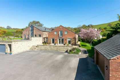
- Price
- Guide Price£1,150,000
- Size
- 3.29 acres
Leek Road, Gawsworth, Macclesfield, Cheshire, SK11, Gawsworth, Cheshire East SK11 England
Added on 18/04/2026Barn Conversion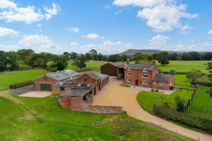
- Price
- Guide Price£1,250,000
- Size
- 8.9 acres
Added on 23/09/2026Farmhouse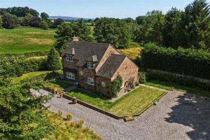
- Price
- Guide Price£1,250,000
- Size
- 3.9 acres
Fanshawe Lane, Henbury, Macclesfield, Henbury, Cheshire East SK11 England
Added on 24/07/2026House with Land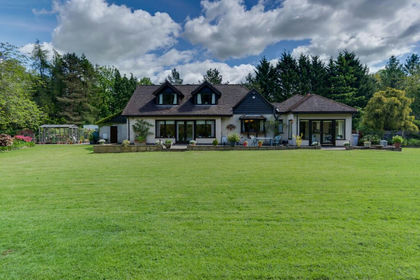
- Price
- Offers in Region of£1,250,000
- Size
- 3.75 acres
Smithy Lane, Hulme Walfield, CW12, Eaton, Cheshire East CW12 England
Added on 16/09/2026Country Home
- Price
- Guide Price£1,250,000
- Size
- 7.5 acres
Pines Lane, Staffs, ST8, Biddulph, Staffordshire ST8 England
Added on 10/05/2026Farmhouse
- Price
- Guide Price£1,075,000
- Size
- 8 acres
Bakestonedale Road, Pott Shrigley, Macclesfield, Pott Shrigley, Cheshire East SK10 England
Added on 14/08/2026House with Land
- Price
- £1,295,000
- Size
- 10 acres
Added on 27/05/2026Farmhouse
- Price
- Guide Price£1,300,000
- Size
- 3.49 acres
Added on 29/01/2026House with Land
- Price
- Offers in Region of£1,500,000
- Size
- 13 acres
South Hillswood, Meerbrook, Leek, Leekfrith, Staffordshire ST13 England
Added on 28/01/2026House with Land
- Price
- £1,500,000
- Size
- 6.49 acres
School Lane, Ollerton, Knutsford, Cheshire, WA16, Ollerton, Cheshire East WA16 England
Added on 11/09/2026House with Land