Beckside, Staindrop, Darlington, DL2
- Bedrooms
- 2
- Bathrooms
- 1
Key Features
- Stone Built Cottage
- Currently two Bedrooms - Could be changed to three
- Pleasant outlook to front over stream and wood
- Gas Central heating & Double Glazing
- Designated parking
- Rear Garden with artificial grass - easy to look after
Description
Langley Cottage is a lovely property which is offered to the market with no onward chain. It is a stone built cottage, situated down a quiet track with a pleasant outlook over the beck, hence the name of the street. It’s well presented and decorated in neutral colours with woodwork, and solid doors.
The accommodation comprises of an entrance porch with Cloakroom/wc which opens into the main living area - with patio doors opening onto the garden, an under stairs store cupboard and a log burning stove. The kitchen is located to the front of the property and features a selection of units for storage presented in pastel green, with worktops, tiled splash backs and some integrated appliances along with space for others. On the first floor there are two double bedrooms which are accessed off a wide and light landing - the master bedroom features two windows so could potentially be split to change the property to have three bedrooms. The shower room completes the layout.
Externally the property has parking for two cars to the front, whilst the rear of the house features a walled garden that has artificial grass.
Staindrop is a beautiful village located between Bishop Auckland in one direction and Barnard castle in the other. The village offers a few local shops and amenities but perhaps most importantly, a Primary and secondary School (Academy), both rated as "Good" by Ofsted.
MATERIAL INFORMATION
The information below is provided in accordance with the consumer protection requirements of the Digital Markets, Competition and Consumers Act 2024 and is intended to highlight matters which may be material to a prospective purchaser when deciding whether to view, offer on or proceed with this property.
Local Authority – Durham County Council
Council Tax Band – C
Tenure – Freehold
Property Type – Stone built cottage
Property Construction – Standard
Number & Types of Rooms – Please refer to the details and floorplan, all measurements taken being the maximum dimensions available between internal walls
Gas Supply- Mains
Electricity supply – Mains
Water Supply – Mains (metered)
Sewerage – Mains
Heating – Gas fired central heating via radiators & Log burner in living room.
Estimated Mobile phone coverage – Please refer to the Ofcom Website -
Estimated Broadband Download speeds – please refer to the Ofcom Website –
Parking- off street
Building Safety – (The Vendor is not aware of any Building Safety issues. However, we would recommend that the purchaser engages the services of a chartered surveyor to confirm)
Restrictions – Covenants which affect the property are contained within the Land Registry Title Register, dated 2004, which is available for inspection.
Selective licencing area – no
Article 4 Planning Restricted area – the property is subject to Article 4 Direction
Conservation Area – The property is in Staindrop Village conservation area.
Probate- NA
Rights & Easements- The land is subject to the rights granted by a Transfer of adjoining land dated 20 September 2004
Flood risk – Rivers and seas: very low Surface water: very low
Coastal Erosion – N/A
Protected Trees - NA
Planning Permission – There are no current planning applications in the locality that we are aware of. Or planning details that are known
Accessibility/Adaptations – The property has not been altered for accessibility
Mining Area – Coal Mining Reporting Area, further searches may be required.
The information has been obtained from the seller and, where appropriate, from publicly available or other relevant sources, and has been compiled in good faith. Information supplied by third parties or external sources may be subject to change.
J W Wood is not qualified to provide legal, surveying, structural or other specialist advice. Where any information requires legal or technical interpretation, or where any matter is of particular importance to your decision to purchase, you should seek appropriate verification from your conveyancer, surveyor or other suitably qualified professional before committing to significant expenditure.
Buyer Identity & AML Checks
Estate agents are subject to legal obligations under anti-money laundering legislation and, where applicable, are supervised by HM Revenue & Customs (HMRC) for compliance with those requirements. A £35 including VAT fee per purchaser applies for these checks.
Map Location
Property details
- Tenure
- Freehold
- Council Tax Band
- C
- Date Posted
- 2026-11-06
Utilities & Restrictions
Utilities
- Electricity
- Ask Agent
- Water
- Ask Agent
- Heating
- Ask Agent
- Broadband
- Ask Agent
- Sewerage
- Ask Agent
Rights & Restrictions
- Public Rights of Way
- Ask Agent
- Private Rights of Way
- Ask Agent
- Listed Property
- Ask Agent
- Restrictions
- Ask Agent
Listed status, conservation areas and planning constraints for this location are in the full report.
Property Features
- Accessibility
- Ask Agent
- Parking
- Parking Available
- Garden
- Garden
Beyond the particulars: planning activity, flood history, heritage and ground risks, checked for this exact spot.
Connectivity
Broadband
Fastest speed available at this postcode
76 Mbps
Superfast
Suitable for
- HD streaming
- Video calls
- Web & social
Mobile signal
Predicted 4G and 5G signal; indoor signal depends on building materials.
Ofcom Connected Nations postcode-level predictions. Speeds and signal are modelled, not measured, and vary between addresses and providers.
Signal is the easy part. Planning activity, flood history and protected designations here are in the full report.
Nearest Schools
Primary
- Staindrop CofE (Controlled) Primary School626 metresOfsted: Good
- Ages
- 3 to 11
- Pupils
- 179
- Type
- Voluntary controlled school
- Faith
- Church of England
- Cockfield Primary School2.2 milesOfsted: Good
- Ages
- 2 to 11
- Pupils
- 115
- Type
- Community school
- Ingleton CofE Primary School2.8 milesNo Ofsted rating
- Ages
- 3 to 11
- Pupils
- 48
- Type
- Academy converter
- Faith
- Church of England
- Evenwood Church of England Primary School3.2 milesNo Ofsted rating
- Ages
- 2 to 11
- Pupils
- 97
- Type
- Academy converter
- Faith
- Church of England
- Butterknowle Primary School3.3 milesOfsted report card · Feb 2026
- Ages
- 3 to 11
- Pupils
- 54
- Type
- Community school
Secondary
- Staindrop Academy538 metresOfsted: Good
- Ages
- 11 to 16
- Pupils
- 504
- Type
- Academy sponsor led
- Teesdale School and Sixth Form4.8 milesNo Ofsted rating
- Ages
- 11 to 18
- Pupils
- 684
- Type
- Academy sponsor led
- St John's Catholic School & Sixth Form College6.7 milesNo Ofsted rating
- Ages
- 11 to 18
- Pupils
- 1,229
- Type
- Academy converter
- Faith
- Roman Catholic
- Bishop Barrington Academy6.8 milesOfsted: Good
- Ages
- 11 to 16
- Pupils
- 599
- Type
- Academy converter
- King James I Academy Bishop Auckland7.8 milesOfsted report card · Mar 2026
- Ages
- 11 to 18
- Pupils
- 936
- Type
- Academy converter
Distances are straight-line from the advertised location. Source: the national school registers (DfE, Welsh Government, Scottish Government) and Ofsted.
Schools are just the start: sold prices nearby, planning activity and any flood history are in the full report.
Amenities
Supermarket
GP surgery
Pharmacy
Hospital
Green space
Straight-line distances from the advertised location. Sources: NHS records, Geolytix supermarket locations, OS Open Greenspace and the national trails registers.
The area stacks up? Now check the location itself: planning nearby, protected designations and past flooding.
Getting Around
Nearest station
Nearest bus stop
Typical drive times
Straight-line distances from the advertised location; drive times are typical free-flow times over OpenStreetMap road data, so allow more at peak. Public transport locations from DfT NaPTAN.
Easy to reach matters. So do planning activity, flood history and ground risks: all in the full report.
Flood Risk
Environment Agency open data, checked around the advertised map pin for the listed acreage. Long-term risk counts flood defences; the planning map's flood zones do not. Provided by LandSale, not the listing agent, and not part of the agent's particulars. Risk varies across a holding, so verify before committing.
Rivers and the sea
Not at the pin: mapped about 20 metres away.
Planning map: Flood Zone 3, about 20 metres away.
Surface water
These bandings are the summary. Where this location sits on the flood maps, plus planning activity, heritage and ground risks, is in the full report.
Important notice: Information, maps and tags on this page are drawn from the advertising agent's marketing materials or generated automatically. LandSale has not verified them. Relying on these details is at your own risk, always carry out independent checks before committing to a purchase.
LandSale full disclaimer
Marketing information only - not formal particulars. The details on this website are provided for general guidance and do not constitute an offer or contract. Neither LandSale nor the advertising estate/land agent accepts responsibility for any inaccuracy.
1. Source of information
- Listing content: Core description, asking price, tenure, measurements, photographs and planning history originate from the marketing materials of the advertising estate or land agent. LandSale does not author this content and cannot guarantee its accuracy.
- Automated tags & categorisation: Property type, land-use class, acreage bands and similar labels may be applied by machine-learning models. They are intended as a helpful guide only and may not reflect the property's legal status or permitted use.
- Third-party & enriched data layers: Maps, boundary outlines, planning designations, soil reports, broadband coverage and other environmental or location-based insights are licensed from external suppliers. Such data are supplied “as is", may be incomplete or out of date and are subject to change without notice.
2. Verification required
Prospective purchasers must verify critical matters, including but not limited to planning permission, title boundaries, public rights of way, environmental constraints, acreage, services, access and VAT status, through their own inspections, specialist surveys, legal advisers and the selling agent before relying on the information or entering into any contract.
3. No warranty or liability
LandSale gives no warranty, express or implied, as to the accuracy, completeness or fitness for any particular purpose of the information displayed. LandSale shall not be liable for any loss, damage, cost or expense arising directly or indirectly from any use of or reliance on such information, save where liability may not be excluded by law.
4. Updates & feedback
If you believe any detail on this listing is inaccurate, please let us know. We will investigate and, where appropriate, update the listing or notify the agent.
© LandSale | Version 1.3 - August 2026
Similar properties for sale
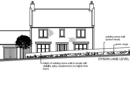
- Price
- Guide Price£185,000
Building Plot, Dyson Lane, Newsham, Richmond, Newsham, North Yorkshire DL11 England
Added on 31/07/2026Building Plot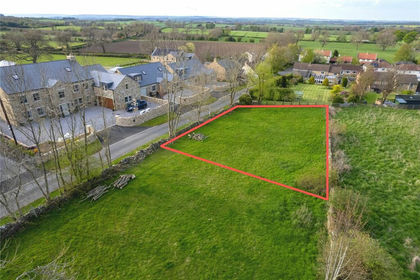
- Price
- Guide Price£175,000
- Size
- 0.16 acres
Moor Lane, Newsham, Richmond, DL11, Newsham, North Yorkshire DL11 England
Added on 29/01/2026Building Plot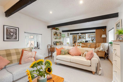
- Price
- Offers in Region of£225,000
East Layton, Richmond, North Yorkshire, DL11, Ravensworth, North Yorkshire DL11 England
Added on 11/09/2026Barn Conversion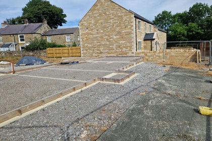
- Price
- Guide Price£195,000
Cobblers Gate Lane, Mickleton, DL12, Mickleton, County Durham DL12 England
Added on 14/09/2026Building PlotLeasehold- Price
- Guide Price£195,000
Cobblers Gate Lane, Mickleton, DL12, Mickleton, County Durham DL12 England
Added on 17/09/2026Building PlotLeasehold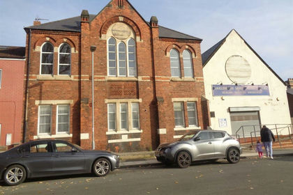
- Price
- Offers in Region of£195,000
Denmark Street, Darlington, Darlington, Darlington DL3 England
Added on 16/04/2026Development Land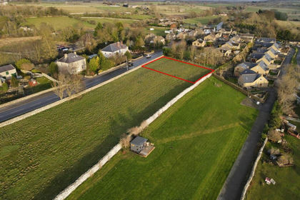
- Price
- £269,950
- Size
- 0.22 acres
Building Plot at Main Road, Harmby, DL8, Harmby, North Yorkshire DL8 England
Added on 17/07/2026Building Plot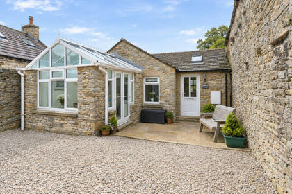
- Price
- Guide Price£180,000
Jasmine Cottage, Black Bull Yard, Middleham, Middleham, North Yorkshire DL8 England
Added on 12/09/2026Barn Conversion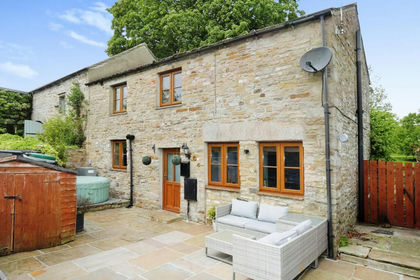
- Price
- Guide Price£275,000
Walden Barn, Carperby, Carperby-cum-Thoresby, North Yorkshire DL8 England
Added on 22/04/2026Barn Conversion
- Price
- Guide Price£250,000
Added on 25/09/2026Building Plot