
Stockleigh Pomeroy, Crediton, EX17
- Land size
- 131.38 acres
- Bedrooms
- 8
- Bathrooms
- 2
Key Features
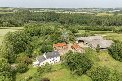
- • Grade II listed farmhouse, currently arranged as a five-bedroom main house and a three-bedroom annexe
- • Adjoining barn and stores, together with a large garage
- • Impressive range of traditional and modern farm buildings
- • Sought after, Mid Devon location within easy access to Crediton and Exeter
- • Freehold with vacant possession available
- • In all about 131.38 acres
Description
Situation
Lower North Coombe Farm is situated in the parish of Stockleigh Pomeroy, close to the village of Cheriton Fitzpaine, in the heart of Mid Devon. Approximately 4 miles from Crediton and 7 miles from Exeter, the holding is well placed for access to local amenities. The nearby market town of Crediton provides a good range of everyday shops including supermarkets and further services supporting the farming community, while Exeter offers a more comprehensive range of retail and commercial facilities.
Communications are good, with access to the M5 motorway at Exeter and Junction 27near Tiverton, providing connections to the wider motorway network. Exeter St Davids and Tiverton Parkway railway stations offer direct services to London Paddington, while Exeter Airport provides a range of domestic and international flights.
Overview
Lower North Coombe Farm is a mixed agricultural holding extending to approximately 131 acres in all, having remained in the same family ownership for some 50 years. The farm comprises an attractive, Grade II listed farmhouse, a collection of versatile farm buildings and a highly productive run of arable and pasture land. The holding has been farmed in recent years as a mixed livestock and arable unit, with beef cattle and sheep enterprises complemented by an arable rotation.
Lower North Coombe Farmhouse
The Grade II listed farmhouse is believed to date from the 16th century, with subsequent alterations including remodelling in the mid-19th century. Constructed of rendered cob beneath a slate roof, the house retains a distinctive character including traditional multi-pane windows and a moulded plaster eaves cornice. The accommodation is arranged over two floors and has been occupied in recent years as a five-bedroom farmhouse with an adjoining three-bedroom annexe, although the interconnecting layout lends itself to reinstatement as a single eight-bedroom farmhouse. The ground floor comprises an entrance hall, two sitting rooms, two kitchen/dining rooms, an office, utility room, porch and two bathrooms, together with a side lobby and ancillary storage. Two staircases lead to the first floor, which provides eight bedrooms and a study, with connecting landings serving the two parts of the house. Adjoining barns and stores provide further space ancillary to the farmhouse. To the front of the farmhouse is a lawned garden interspersed with established shrubs and planted borders. The garden extends down to a brook which provides an attractive natural feature.
Farm Buildings
The farm buildings comprise a range of traditional barns and later agricultural buildings, grouped around yards adjoining the farmhouse. Used throughout their history for agricultural purposes, they provide a combination of livestock accommodation and storage for crops, fodder and machinery, supporting the holding’s mixed farming operations. Of particular interest is the old waterwheel house, which forms a distinctive feature of the farmstead and reflects its agricultural heritage. The buildings comprise the following;
1) Former silage pit. Steel framed with sheeted roof.
2) Livestock housing/general purpose store. Block built with steel frame. Sheeted roof.
3) Former piggery. Block built with rendered elevations and sheeted roof.
4) General purpose store. Block built with rendered elevations and sheeted roof.
5) General purpose store. Block built with rendered elevations and sheeted roof.
6) Traditionally built two storey building of part cob, block and timber frame. General purpose store.
7) ‘Waterwheel House’. Traditional, two storey building. General purpose storage.
8) General purpose, two storey store. Block built with rendered elevations and sheeted roof.
9) Livestock housing. Steel frame with block and timber elevations. Sheeted roof.
10) Lean to stores.
11) Farmhouse.
12) Single storey, general purpose store.
Land
The land extends to approximately 131.38 acres in all, comprising good quality grade 2 and 3 arable and pasture land. The majority of which benefits from Devons sought after red soils, described as freely draining and slightly acidic which have supported the successful production of a wide range of cereal and fodder crops. Part of the land has been managed within an arable rotation, with the remaining grassland used for grazing and forage production. The quality and versatility of the land offers capability to support a broad range of farming systems. One field adjoins the A3072 providing a useful means of access to the holding and facilitating access for larger agricultural machinery.
Important information
Method of sale
The property will be offered for sale by private treaty.
Tenure
The farm is freehold with vacant possession upon completion.
Services
Mains water
Mains electricity, including a three phase supply. Private drainage. Oil fired central heating
Boundaries
Any purchaser shall be deemed to have full knowledge of all boundaries and neither vendor nor the vendor’s agents will be responsible for defining the boundaries or the ownership thereof. Should any dispute arise as to the boundaries or any points on the particulars or plans or the interpretation of them, the question shall be referred to the vendors agent whose decision acting as experts shall be final.
Rights of Way, Wayleaves & Easements
The property is sold subject to and with the benefit of all existing rights of way, easements, wayleaves, covenants and other rights and obligations, whether public or private, including rights relating to light, support, drainage, water, electricity and other services, whether or not specifically referred to in these particulars. There is a public right of way crossing the farm.
EPC Rating - E
Local Authority
Mid Devon District Council
Council Tax Band - E
Directions
Postcode = EX17 4BH
What3Words = ///tripped.eyeliner.mostly
Viewings
Strictly by appointment only. Full details of all our properties are available on our website
Brochure Oct 2026. Photographs Oct 2026.
EPC Rating: F
Disclaimer
Kivells, their clients and any joint agents give notice that they are not authorised to make or give representations or warranties in relation to the property. No responsibility is accepted for any statement within these particulars, which do not form part of any offer or contract. Areas, measurements and boundaries are approximate. Text, photographs, CGI’s and plans are for guidance only. It should not be assumed the property has all necessary planning or building consents, and Kivells have not tested any services or equipment. The property is sold subject to all matters in the Property and Charges Register, including rights of way and easements. Purchasers are deemed to know all boundaries. Nothing herein constitutes financial advice; seek your own. Use of Mortgage Genies SW Ltd. will result in a £250 + VAT referral fee to Kivells. Kivells retains copyright to all particulars and media.
Map Location
Property details
- Tenure
- Freehold
- Council Tax Band
- E
- Date Posted
- 2026-11-02
Market Value Analysis
Compared with 22 Farms & Smallholdings listings in South West England (100+ acres).
Energy Performance Certificate
Energy Efficiency Rating
Based on UK Energy Performance Certificate standards (EU Directive 2002/91/EC)
Running costs are one side. Planning activity, flood history and ground risks for this location are in the full report.
Utilities & Restrictions
Utilities
- Electricity
- Ask Agent
- Water
- Mains
- Heating
- Oil Heating
- Broadband
- Ask Agent
- Sewerage
- Ask Agent
Rights & Restrictions
- Public Rights of Way
- Ask Agent
- Private Rights of Way
- Ask Agent
- Listed Property
- Yes
- Restrictions
- Ask Agent
Listed status, conservation areas and planning constraints for this location are in the full report.
Property Features
- Accessibility
- Ask Agent
- Parking
- Parking Available
- Garden
- Garden
Beyond the particulars: planning activity, flood history, heritage and ground risks, checked for this exact spot.
Connectivity
Broadband
Fastest speed available at this postcode
1.8 Gbps
Gigabit full fibre
Suitable for
- 4K streaming on every screen
- Full-time home working
- Online gaming & big downloads
Fixed wireless access may also be an option here.
Mobile signal
Predicted 4G and 5G signal; indoor signal depends on building materials.
Ofcom Connected Nations postcode-level predictions. Speeds and signal are modelled, not measured, and vary between addresses and providers.
Signal is the easy part. Planning activity, flood history and protected designations here are in the full report.
Nearest Schools
Primary
- Cheriton Fitzpaine Primary School1.3 milesNo Ofsted rating
- Ages
- 4 to 11
- Pupils
- 91
- Type
- Community school
- Sandford School3.2 milesOfsted: Good
- Ages
- 3 to 11
- Pupils
- 74
- Type
- Community school
- Thorverton Church of England Primary School3.3 milesNo Ofsted rating
- Ages
- 4 to 11
- Pupils
- 110
- Type
- Voluntary controlled school
- Faith
- Church of England
- Hayward's Primary School3.6 milesOfsted report card · Mar 2026
- Ages
- 4 to 11
- Pupils
- 403
- Type
- Community school
- Newton St Cyres Primary School3.8 milesOfsted: Good
- Ages
- 2 to 11
- Pupils
- 133
- Type
- Community school
Secondary
- Queen Elizabeth's3.9 milesOfsted report card · May 2026
- Ages
- 11 to 18
- Pupils
- 1,096
- Type
- Academy converter
- Thomas Hall School6.3 milesOfsted: Requires improvement
- Ages
- 4 to 16
- Pupils
- 438
- Type
- Free schools
- Tiverton High School7.3 milesOfsted: Inadequate *
- Ages
- 11 to 16
- Type
- Academy sponsor led
- St James School7.6 milesNo Ofsted rating
- Ages
- 11 to 16
- Pupils
- 985
- Type
- Academy converter
- Clyst Vale Community College8.4 milesOfsted: Good
- Ages
- 11 to 18
- Pupils
- 944
- Type
- Academy converter
* Latest graded judgement covers quality of education only; no overall grade was issued under the 2024-25 inspection framework.
Distances are straight-line from the advertised location. Source: the national school registers (DfE, Welsh Government, Scottish Government) and Ofsted.
Schools are just the start: sold prices nearby, planning activity and any flood history are in the full report.
Amenities
Supermarket
GP surgery
Pharmacy
Hospital
Straight-line distances from the advertised location. Sources: NHS records, Geolytix supermarket locations, OS Open Greenspace and the national trails registers.
The area stacks up? Now check the location itself: planning nearby, protected designations and past flooding.
Getting Around
Nearest station
Nearest bus stop
Typical drive times
Straight-line distances from the advertised location; drive times are typical free-flow times over OpenStreetMap road data, so allow more at peak. Public transport locations from DfT NaPTAN.
Easy to reach matters. So do planning activity, flood history and ground risks: all in the full report.
Flood Risk
Environment Agency open data, checked around the advertised map pin for the listed acreage. Long-term risk counts flood defences; the planning map's flood zones do not. Provided by LandSale, not the listing agent, and not part of the agent's particulars. Risk varies across a holding, so verify before committing.
Rivers and the sea
Not at the pin: mapped about 10 metres away.
Planning map: Flood Zone 3, about 10 metres away.
Surface water
Not at the pin: mapped about 180 metres away.
These bandings are the summary. Where this location sits on the flood maps, plus planning activity, heritage and ground risks, is in the full report.
Important notice: Information, maps and tags on this page are drawn from the advertising agent's marketing materials or generated automatically. LandSale has not verified them. Relying on these details is at your own risk, always carry out independent checks before committing to a purchase.
LandSale full disclaimer
Marketing information only - not formal particulars. The details on this website are provided for general guidance and do not constitute an offer or contract. Neither LandSale nor the advertising estate/land agent accepts responsibility for any inaccuracy.
1. Source of information
- Listing content: Core description, asking price, tenure, measurements, photographs and planning history originate from the marketing materials of the advertising estate or land agent. LandSale does not author this content and cannot guarantee its accuracy.
- Automated tags & categorisation: Property type, land-use class, acreage bands and similar labels may be applied by machine-learning models. They are intended as a helpful guide only and may not reflect the property's legal status or permitted use.
- Third-party & enriched data layers: Maps, boundary outlines, planning designations, soil reports, broadband coverage and other environmental or location-based insights are licensed from external suppliers. Such data are supplied “as is", may be incomplete or out of date and are subject to change without notice.
2. Verification required
Prospective purchasers must verify critical matters, including but not limited to planning permission, title boundaries, public rights of way, environmental constraints, acreage, services, access and VAT status, through their own inspections, specialist surveys, legal advisers and the selling agent before relying on the information or entering into any contract.
3. No warranty or liability
LandSale gives no warranty, express or implied, as to the accuracy, completeness or fitness for any particular purpose of the information displayed. LandSale shall not be liable for any loss, damage, cost or expense arising directly or indirectly from any use of or reliance on such information, save where liability may not be excluded by law.
4. Updates & feedback
If you believe any detail on this listing is inaccurate, please let us know. We will investigate and, where appropriate, update the listing or notify the agent.
© LandSale | Version 1.3 - August 2026
Listing agent
Kivells, Exeter Land & Farm SalesThe Matford Centre, Matford Park Road, Exeter, Devon, EX2 8FD
Contact Kivells, Exeter Land & Farm Sales
The Matford Centre, Matford Park Road, Exeter, Devon, EX2 8FD
View agent profileSimilar properties for sale
- Price
- Guide Price£1,795,000
- Size
- 85.79 acres
Added on 03/07/2026Farm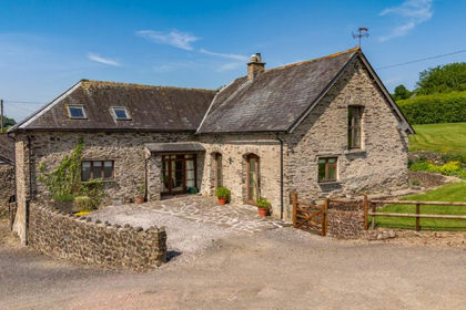
- Price
- Guide Price£1,700,000
- Size
- 95.63 acres
Lot 1: Perry Farm, Dulverton, Somerset, TA22, Dulverton, Somerset TA22 England
Added on 17/09/2026Farm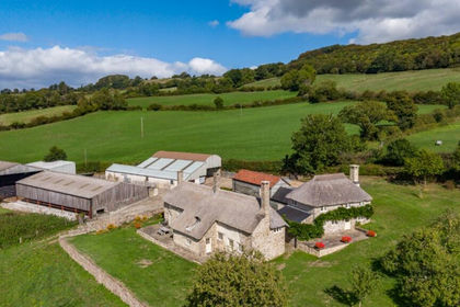
- Price
- Guide Price£1,800,000
- Size
- 68.36 acres
Lot 1 Stockers Farm, Northleigh, Colyton, Devon, EX24, Widworthy, Devon EX24 England
Added on 25/09/2026House with Land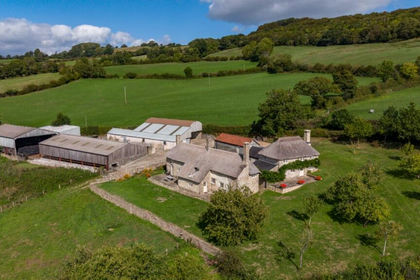
- Price
- Guide Price£2,350,000
- Size
- 127.45 acres
Northleigh, Colyton, Devon, EX24, Widworthy, Devon EX24 England
Added on 25/09/2026Farm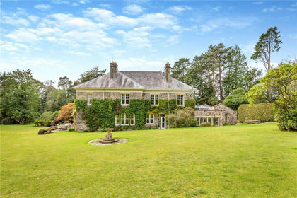
- Price
- Offers in Excess of£2,500,000
- Size
- 78 acres
Shirwell, Barnstaple, Devon, EX31, Shirwell, Devon EX31 England
Added on 09/09/2026Country Estate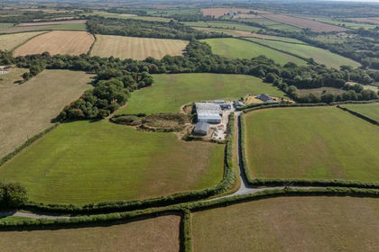
- Price
- Offers Over£2,000,000
- Size
- 118.39 acres
East Putford, Holsworthy, EX22, Bulkworthy, Devon EX22 England
Added on 01/10/2026Farm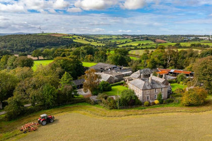
- Price
- Guide Price£2,425,000
- Size
- 137.2 acres
Hurdon Farm, Launceston, Cornwall, PL15, Launceston, Cornwall PL15 England
Added on 26/10/2026Farm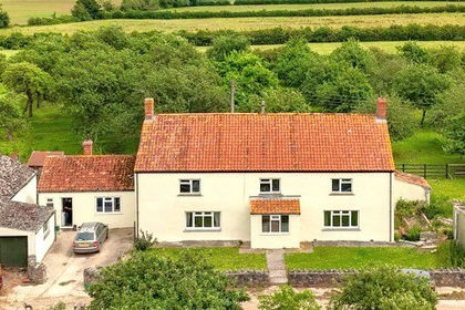
- Price
- Guide Price£1,750,000
- Size
- 220.63 acres
Nythe, Ashcott, Bridgwater, TA7, Bridgwater, Somerset TA7 England
Added on 22/06/2026Farm