Land Adjacent Regis House, Lyme Road, Uplyme, Dorset, DT7
- Bedrooms
- 7
Description
LOT 8 FREEHOLD DEVELOPMENT SITE WITH PLANNING PERMISSION
AN EXCITING RESIDENTIAL DEVELOPMENT OPPORTUNITY IN THE LYME REGIS AREA
Landmark Auctions is pleased to offer this freehold development site, situated on Lyme Road in Uplyme, near the highly desirable coastal town of Lyme Regis, Dorset.
The property benefits from full planning permission for the development of seven residential flats, presenting an attractive opportunity for builders, developers and investors seeking a residential development project in an established South West location.
The approved scheme comprises a mix of one- and two-bedroom apartments, offering the potential to appeal to a broad range of prospective purchasers and occupiers, subject to the final specification and market conditions.
PROPOSED DEVELOPMENT
The approved scheme provides for seven residential units arranged as follows:
Ground Floor: Two x two-bedroom flats.
First Floor: Two x two-bedroom flats.
Second Floor: Two x one-bedroom flats.
Separate Dwelling: One x one-bedroom flat.
The proposed accommodation offers a mix of unit sizes designed to cater for different buyer and tenant requirements.
The site may appeal to developers looking to deliver a residential scheme for individual resale, private investment or a potential buy-to-let portfolio, subject to detailed appraisal and the relevant planning and legal considerations.
PLANNING
Full planning permission is stated to have been granted under reference 23/1004/FUL.
Prospective purchasers are advised to undertake their own due diligence, including verification of the planning authority, decision notice, approved drawings, planning conditions, commencement requirements and any associated obligations, before proceeding.
Planning enquiries should be directed to the relevant local planning authority.
Accommodation
KEY INVESTMENT HIGHLIGHTS
Freehold development opportunity.
Full planning permission stated for seven residential flats.
Proposed mix of four two-bedroom flats and three one-bedroom flats.
Located in Uplyme, close to Lyme Regis.
Potential for development, individual unit sales or investment retention, subject to viability.
Location
LOCATION
The site is situated in Uplyme, close to Lyme Regis, one of the South West's most recognised coastal destinations on the DorsetDevon border.
Lyme Regis is renowned for its picturesque seafront, beaches, historic harbour, independent shops, restaurants, cafs and visitor attractions. The town attracts both permanent residents and visitors throughout the year, providing an established coastal setting for residential property.
The location offers access to the amenities of Lyme Regis while benefiting from its position within the surrounding Uplyme area.
Axminster railway station is approximately an 11-minute drive away, subject to traffic, providing rail connections towards London Waterloo and Exeter. The A35 and A3052 provide road links across Dorset and Devon and towards the wider South West.
Tenure
Freehold
Planning
Full planning permission stated for seven residential flats.
Proposed mix of four two-bedroom flats and three one-bedroom flats.
Located in Uplyme, close to Lyme Regis.
Potential for development, individual unit sales or investment retention, subject to viability.
Map Location
Property details
- Tenure
- Freehold
- Council Tax Band
- Ask Agent
- Date Posted
- 2026-10-30
Utilities & Restrictions
Utilities
- Electricity
- Ask Agent
- Water
- Ask Agent
- Heating
- Ask Agent
- Broadband
- Ask Agent
- Sewerage
- Ask Agent
Rights & Restrictions
- Public Rights of Way
- Ask Agent
- Private Rights of Way
- Ask Agent
- Listed Property
- Ask Agent
- Restrictions
- Ask Agent
Listed status, conservation areas and planning constraints for this location are in the full report.
Property Features
- Accessibility
- Ask Agent
- Parking
- Ask Agent
- Garden
- Ask Agent
Beyond the particulars: planning activity, flood history, heritage and ground risks, checked for this exact spot.
Connectivity
Broadband
Fastest speed available at this postcode
80 Mbps
Superfast
Suitable for
- HD streaming
- Video calls
- Web & social
Mobile signal
Predicted 4G and 5G signal; indoor signal depends on building materials.
Ofcom Connected Nations postcode-level predictions. Speeds and signal are modelled, not measured, and vary between addresses and providers.
Signal is the easy part. Planning activity, flood history and protected designations here are in the full report.
Nearest Schools
Primary
- Mrs Ethelston's CofE Primary Academy794 metresOfsted: Good
- Ages
- 5 to 11
- Pupils
- 197
- Type
- Academy converter
- Faith
- Church of England
- St Michael's CofE Primary School, Lyme Regis0.8 milesOfsted: Requires improvement
- Ages
- 3 to 11
- Pupils
- 59
- Type
- Academy sponsor led
- Faith
- Church of England
- Charmouth Primary School2.1 milesOfsted: Requires improvement
- Ages
- 3 to 11
- Pupils
- 71
- Type
- Academy sponsor led
- Musbury Primary School3.6 milesNo Ofsted rating
- Ages
- 2 to 11
- Pupils
- 53
- Type
- Academy converter
- St Mary's Catholic Primary School, Axminster3.8 milesNo Ofsted rating
- Ages
- 4 to 11
- Pupils
- 136
- Type
- Academy converter
- Faith
- Roman Catholic
Secondary
- The Woodroffe School297 metresOfsted: Good
- Ages
- 11 to 18
- Pupils
- 886
- Type
- Foundation school
- Axe Valley Academy4 milesOfsted: Good
- Ages
- 11 to 16
- Pupils
- 741
- Type
- Academy sponsor led
- Colyton Grammar School5.4 milesOfsted: Outstanding
- Ages
- 11 to 18
- Pupils
- 1,083
- Type
- Academy converter
- The Sir John Colfox Academy8.9 milesNo Ofsted rating
- Ages
- 11 to 18
- Pupils
- 756
- Type
- Academy converter
- Holyrood Academy9.9 milesOfsted: Good
- Ages
- 11 to 18
- Pupils
- 1,282
- Type
- Academy converter
Distances are straight-line from the advertised location. Source: the national school registers (DfE, Welsh Government, Scottish Government) and Ofsted.
Schools are just the start: sold prices nearby, planning activity and any flood history are in the full report.
Amenities
Supermarket
GP surgery
Pharmacy
Hospital
Green space
Walking trail
Straight-line distances from the advertised location. Sources: NHS records, Geolytix supermarket locations, OS Open Greenspace and the national trails registers.
The area stacks up? Now check the location itself: planning nearby, protected designations and past flooding.
Getting Around
Nearest station
Nearest bus stop
Typical drive times
Straight-line distances from the advertised location; drive times are typical free-flow times over OpenStreetMap road data, so allow more at peak. Public transport locations from DfT NaPTAN.
Easy to reach matters. So do planning activity, flood history and ground risks: all in the full report.
Flood Risk
Environment Agency open data, checked around the advertised map pin for the listed acreage. Long-term risk counts flood defences; the planning map's flood zones do not. Provided by LandSale, not the listing agent, and not part of the agent's particulars. Risk varies across a holding, so verify before committing.
Rivers and the sea
Planning map: Flood Zone 1.
Surface water
These bandings are the summary. Where this location sits on the flood maps, plus planning activity, heritage and ground risks, is in the full report.
Important notice: Information, maps and tags on this page are drawn from the advertising agent's marketing materials or generated automatically. LandSale has not verified them. Relying on these details is at your own risk, always carry out independent checks before committing to a purchase.
LandSale full disclaimer
Marketing information only - not formal particulars. The details on this website are provided for general guidance and do not constitute an offer or contract. Neither LandSale nor the advertising estate/land agent accepts responsibility for any inaccuracy.
1. Source of information
- Listing content: Core description, asking price, tenure, measurements, photographs and planning history originate from the marketing materials of the advertising estate or land agent. LandSale does not author this content and cannot guarantee its accuracy.
- Automated tags & categorisation: Property type, land-use class, acreage bands and similar labels may be applied by machine-learning models. They are intended as a helpful guide only and may not reflect the property's legal status or permitted use.
- Third-party & enriched data layers: Maps, boundary outlines, planning designations, soil reports, broadband coverage and other environmental or location-based insights are licensed from external suppliers. Such data are supplied “as is", may be incomplete or out of date and are subject to change without notice.
2. Verification required
Prospective purchasers must verify critical matters, including but not limited to planning permission, title boundaries, public rights of way, environmental constraints, acreage, services, access and VAT status, through their own inspections, specialist surveys, legal advisers and the selling agent before relying on the information or entering into any contract.
3. No warranty or liability
LandSale gives no warranty, express or implied, as to the accuracy, completeness or fitness for any particular purpose of the information displayed. LandSale shall not be liable for any loss, damage, cost or expense arising directly or indirectly from any use of or reliance on such information, save where liability may not be excluded by law.
4. Updates & feedback
If you believe any detail on this listing is inaccurate, please let us know. We will investigate and, where appropriate, update the listing or notify the agent.
© LandSale | Version 1.3 - August 2026
Similar properties for sale
- Price
- Guide Price£125,000
- Size
- 0.08 acres
Channells Lane, Horton, Ilminster, Horton, Somerset TA19 England
Added on 22/04/2026Building Plot- Price
- Guide Price£125,000
Channells Lane, Horton, Ilminster, Horton, Somerset TA19 England
Added on 22/04/2026Building Plot
- Price
- Guide Price£110,000
Bluett Road, Wellington, Somerset, TA21, Wellington, Somerset TA21 England
Added on 29/01/2026Building Plot
- Price
- Offers in Region of£98,000
Building Plot, Clyst Honiton, Exeter, EX5, Clyst Honiton, Devon EX5 England
Added on 22/05/2026Building Plot
- Price
- Guide Price£115,000
Podimore, Yeovil, BA22, Yeovilton and District, Somerset BA22 England
Added on 11/03/2026Building Plot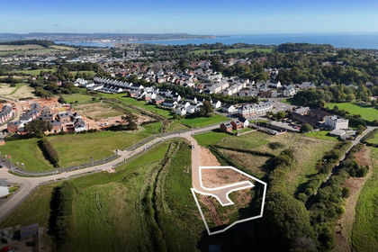
- Price
- From£140,000
SELF BUILD PLOTS, Dawlish, Devon, EX7, Dawlish, Devon EX7 England
Added on 29/01/2026Self Build Plot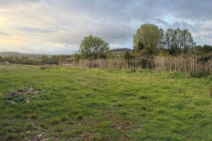
- Price
- Guide Price£150,000
- Size
- 0.27 acres
Building Plot, Peak Lane, Compton Dundon, TA11, Compton Dundon, Somerset TA11 England
Added on 20/10/2026Building Plot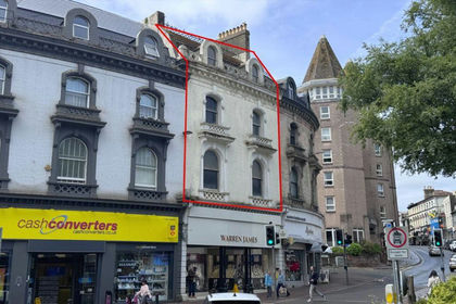
- Price
- £150,000
Added on 04/07/2026Development LandLeasehold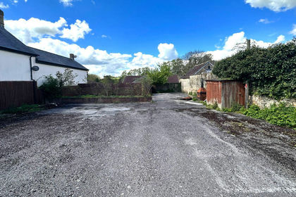
- Price
- £125,000
Land at Rear of Bear Inn, 12 Market Place, Wincanton, Somerset, BA9, Wincanton, Somerset BA9 England
Added on 17/07/2026Development Land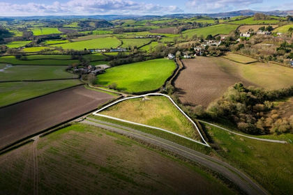 Added on 29/01/2026Self Build Plot