Malt Shovel, Oakerthorpe Road, Wirksworth, DE4
- Land size
- 0.11 acres
Key Features
- Charming country inn located next to Wirksworth Moor on the edge of the vibrant Derbyshire town of Wirksworth
- Traditional two room operation with good sized commercial kitchen
- Well-presented enclosed courtyard and car parking for c. 12 vehicle
- Good sized living accommodation on first floor
- The property will appeal to local and regional licensed operators and investors
- Alternate use potential, subject to obtaining the necessary consents
Description
Location
Wirksworth is a historic market town in the Derbyshire Dales, located on the southern edge of the Peak District National Park. Historically, a key industrial town in the region, Wirksworth is now known for its independent shops and cafes, annual arts festival and bustling music scene. Wirksworth is well-connected to other key settlements, being 4 miles south of Matlock, 10 miles east of Ashbourne and 12 miles north of Derby.
The Malt Shovel is located on a prominent corner on Oakerthorpe Road, high above Wirksworth, next to Wirksworth Moor. The property is surrounded by an extensive network of trails, public footpaths and historic rights of way.
Property Description
A two-storey detached property of stone construction with part-rendered elevations beneath a pitched roof, with later additions to the side and rear.
Accommodation
The trading accommodation comprises a small, cosy front bar with seating for approximately 20 customers and a more formal dining area providing around 30 covers, arranged around an L-shaped bar servery. Ancillary facilities include ladies' and gentlemen's WCs, a commercial kitchen, a small preparation area, dry store, basement cellar and additional storage rooms to the rear of the kitchen. Externally, the property benefits from a good-sized enclosed courtyard.
Private living accommodation is situated on the first floor and comprises; three double bedrooms, lounge, domestic kitchen and bathroom.
Externally, the property benefits from a good-sized car park for c. 12 vehicles.
The property's ground floor gross enternal area extends to c. 1,350 sq ft and sits on a site of circa 0.11 acres.
Tenure Comments
Freehold. The property is held under Title Number DY398514 and the Title Plan is included on page 5.
The car park does not form part of the registered title. Further information regarding this part of the site is available on request.
Planning and Development
We have made enquiries with the local authority and can confirm the property is not listed but is within the Wirksworth conservation area. For further information please contact the local authority.
Services
We are advised that the property is served by a septic tank for foul drainage and Calor Gas for heating.
Premises Licence
It is understood that the property currently possesses a Premises Licence. A copy is available upon request.
Fixtures and Fittings
The sale of the property will include any trade fixtures and fittings which are in the absolute ownership of the Seller and in situ on completion. No fixtures and fittings will be warranted and no inventory can be provided. Any branded or leased items and any items owned by third parties will be excluded from the sale.
VAT
VAT is applicable on the sale of the property.
EPC
The property has an EPC rating of Band D. A copy is available upon request.
Viewings
All viewings are strictly by appointment only.
Map Location
Property details
- Tenure
- Freehold
- Council Tax Band
- Ask Agent
- Date Posted
- 2026-10-29
Utilities & Restrictions
Utilities
- Electricity
- Ask Agent
- Water
- Ask Agent
- Heating
- Ask Agent
- Broadband
- Ask Agent
- Sewerage
- Ask Agent
Rights & Restrictions
- Public Rights of Way
- Ask Agent
- Private Rights of Way
- Ask Agent
- Listed Property
- Ask Agent
- Restrictions
- Ask Agent
Listed status, conservation areas and planning constraints for this location are in the full report.
Property Features
- Accessibility
- Ask Agent
- Parking
- Ask Agent
- Garden
- Ask Agent
Beyond the particulars: planning activity, flood history, heritage and ground risks, checked for this exact spot.
Connectivity
Broadband
Fastest speed available at this postcode
15 Mbps
Standard (10-30 Mbps)
Suitable for
- Web & social
- Music streaming
- Standard video calls
Mobile signal
Predicted 4G and 5G signal; indoor signal depends on building materials.
Ofcom Connected Nations postcode-level predictions. Speeds and signal are modelled, not measured, and vary between addresses and providers.
Signal is the easy part. Planning activity, flood history and protected designations here are in the full report.
Nearest Schools
Primary
- Wirksworth Junior School912 metresOfsted: Good
- Ages
- 7 to 11
- Pupils
- 76
- Type
- Community school
- Wirksworth CofE Infant School0.7 milesOfsted: Good
- Ages
- 5 to 7
- Pupils
- 47
- Type
- Voluntary controlled school
- Faith
- Church of England
- Cromford Church of England Primary School1.6 milesOfsted: Good
- Ages
- 4 to 11
- Pupils
- 75
- Type
- Voluntary controlled school
- Faith
- Church of England
- Middleton Community Primary School1.6 milesOfsted report card · Feb 2026
- Ages
- 4 to 11
- Pupils
- 93
- Type
- Community school
- Crich Carr CofE Primary School2.1 milesOfsted: Good *
- Ages
- 3 to 11
- Pupils
- 42
- Type
- Voluntary controlled school
- Faith
- Church of England
Secondary
- Anthony Gell School0.8 milesNo Ofsted rating
- Ages
- 11 to 18
- Pupils
- 776
- Type
- Academy converter
- Highfields School4.4 milesNo Ofsted rating
- Ages
- 11 to 18
- Pupils
- 1,298
- Type
- Academy converter
- Belper School and Sixth Form Centre5.7 milesOfsted: Good *
- Ages
- 11 to 18
- Pupils
- 1,212
- Type
- Foundation school
- Swanwick Hall School6.6 milesOfsted: Good
- Ages
- 11 to 18
- Pupils
- 1,025
- Type
- Academy converter
- John Flamsteed Community School7 milesOfsted: Good *
- Ages
- 11 to 16
- Pupils
- 850
- Type
- Academy converter
* Latest graded judgement covers quality of education only; no overall grade was issued under the 2024-25 inspection framework.
Distances are straight-line from the advertised location. Source: the national school registers (DfE, Welsh Government, Scottish Government) and Ofsted.
Schools are just the start: sold prices nearby, planning activity and any flood history are in the full report.
Amenities
Supermarket
GP surgery
Pharmacy
Hospital
Green space
Straight-line distances from the advertised location. Sources: NHS records, Geolytix supermarket locations, OS Open Greenspace and the national trails registers.
The area stacks up? Now check the location itself: planning nearby, protected designations and past flooding.
Getting Around
Nearest station
Nearest bus stop
Typical drive times
Straight-line distances from the advertised location; drive times are typical free-flow times over OpenStreetMap road data, so allow more at peak. Public transport locations from DfT NaPTAN.
Easy to reach matters. So do planning activity, flood history and ground risks: all in the full report.
Flood Risk
Environment Agency open data, checked around the advertised map pin for the listed acreage. Long-term risk counts flood defences; the planning map's flood zones do not. Provided by LandSale, not the listing agent, and not part of the agent's particulars. Risk varies across a holding, so verify before committing.
Rivers and the sea
Planning map: Flood Zone 1.
Surface water
Not at the pin: mapped about 10 metres away.
These bandings are the summary. Where this location sits on the flood maps, plus planning activity, heritage and ground risks, is in the full report.
Important notice: Information, maps and tags on this page are drawn from the advertising agent's marketing materials or generated automatically. LandSale has not verified them. Relying on these details is at your own risk, always carry out independent checks before committing to a purchase.
LandSale full disclaimer
Marketing information only - not formal particulars. The details on this website are provided for general guidance and do not constitute an offer or contract. Neither LandSale nor the advertising estate/land agent accepts responsibility for any inaccuracy.
1. Source of information
- Listing content: Core description, asking price, tenure, measurements, photographs and planning history originate from the marketing materials of the advertising estate or land agent. LandSale does not author this content and cannot guarantee its accuracy.
- Automated tags & categorisation: Property type, land-use class, acreage bands and similar labels may be applied by machine-learning models. They are intended as a helpful guide only and may not reflect the property's legal status or permitted use.
- Third-party & enriched data layers: Maps, boundary outlines, planning designations, soil reports, broadband coverage and other environmental or location-based insights are licensed from external suppliers. Such data are supplied “as is", may be incomplete or out of date and are subject to change without notice.
2. Verification required
Prospective purchasers must verify critical matters, including but not limited to planning permission, title boundaries, public rights of way, environmental constraints, acreage, services, access and VAT status, through their own inspections, specialist surveys, legal advisers and the selling agent before relying on the information or entering into any contract.
3. No warranty or liability
LandSale gives no warranty, express or implied, as to the accuracy, completeness or fitness for any particular purpose of the information displayed. LandSale shall not be liable for any loss, damage, cost or expense arising directly or indirectly from any use of or reliance on such information, save where liability may not be excluded by law.
4. Updates & feedback
If you believe any detail on this listing is inaccurate, please let us know. We will investigate and, where appropriate, update the listing or notify the agent.
© LandSale | Version 1.3 - August 2026
Similar properties for sale
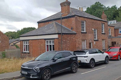
- Price
- £185,000
M-629432 - Devonshire Arms, Chatsworth Close, Alfreton DE55, Alfreton, Derbyshire DE55 England
Added on 10/09/2026Pub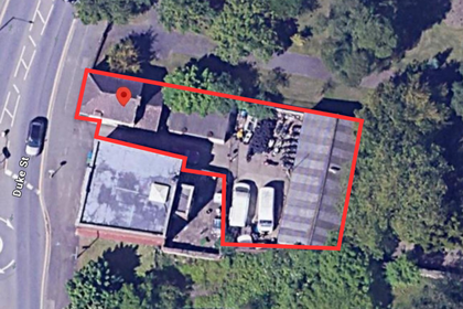
- Price
- Guide Price£200,000
- Size
- 0.11 acres
Added on 29/01/2026Industrial Land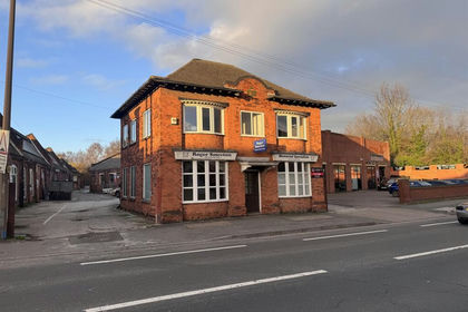
- Price
- Offers in Region of£175,000
Phoenix House, Nottingham Road, Long Eaton NG10, Erewash, Derbyshire NG10 England
Added on 03/09/2026Commercial Land
- Price
- £175,000
- Size
- 0.02 acres
Unit B1, Old Station Drive, Millhouses, Sheffield, S7, Sheffield Hallam, Sheffield S7 England
Added on 02/06/2026Industrial Land
- Price
- £149,995
Added on 26/10/2026PubLeasehold
- Price
- £175,000
- Size
- 0.13 acres
66 Effingham Road, Sheffield, S4, Sheffield South East, Sheffield S4 England
Added on 23/10/2026WarehouseLeasehold
- Price
- Guide Price£198,000
Potter Hill, Rotherham, South Yorkshire, S61, Rotherham, Rotherham S61 England
Added on 23/10/2026Pub Added on 17/07/2026Industrial Land
 Added on 18/07/2026Development Land
 Added on 25/09/2026Commercial LandLeasehold