Chain Bridge Road, Boston
- Land size
- 9 acres
Key Features
- Approx. 32 Acres (STS)
- Part of the SOU006 allocation,
- Scheduled for both residential and commercial development
- Popular Location
- Convenient road network
Description
This substantial and highly sustainable development site comprises approximately 9 acres of premium greenfield land, originally forming part of a successful local farm and currently utilised for high-quality grazing. The site sits in a pivotal strategic position right on the immediate edge of the established Boston settlement boundary, making it an exceptionally logical node for immediate and phased urban integration. The land features prominent road frontage, with Chain Bridge Road tracing smoothly across the full entirety of its northern boundary, while the western perimeter opens into expansive, tranquil countryside views. The site is located close to the A16 and A52 regional arterial networks, with the benefit of the Swineshead Road / Wyberton Chain Bridge retail hub, Boston’s premier destination for out of town shopping nearby.
Location - Chain Bridge, Boston, PE21 7LE (Approx. 2.8 miles south west of town centre)
Site Area - Approximately 9 Acres (Current use: Grazing Land / Former Farm)
Tenure - Freehold with Vacant Possession
Local Plan Status - Part of Housing & Employment Allocation SOU006 (South West Quadrant Sustainable Urban Extension)
Taxation / Vat - We understand that VAT will not be charged in addition to the purchase price
Method Of Sale & Lotting Flexibility - The property is offered for sale as a 9 acre block under Freehold tenure.
However, if a purchaser wishes to buy additional land, there is an opportunity to purchase further sections of or all of the remaining 23 acre block, freehold, in order to accommodate diverse developer requirements, structural joint ventures, or phased delivery timelines. This flexible lotting framework offers an exceptional opportunity for builders and consortia to secure tailored configurations optimized for targeted project goals.
Strategic Regional Masterplan Allocation (Sou006) - The land is situated within the blueprint of a much broader strategic housing and employment allocation, identified in the regional framework as Allocation SOU006 (The South West Quadrant Sustainable Urban Extension). In accordance with the extensive Masterplan framework agreed with Boston Borough Council, this ambitious local development vector is zoned to deliver the following regional assets:
•1. Residential Allocation: Approximately 1,515 new high-quality homes (with 1,276 explicitly scheduled to be completely constructed within the active plan period).
•2. Employment Infrastructure: Approximately 2.5 hectares of premium commercial employment land, specifically designated to host versatile Class B1, A2, A3, and A4 operational uses.
•3. Public Open Space & Ecology: Expansive, professionally designed community green space incorporating equipped play areas, informal recreational lawns, and highly rich ecological protection zones seamlessly blended with modern Sustainable Urban Drainage Systems (SUDS) and extensive integrated footpath/cycleway corridors.
•4. Gateway Marina Hub: A flagship inland marina hub directly connected to the South Forty Foot Drainage channel and regional inland waterways, incorporating extensive permanent moorings, dedicated marina support facilities, alongside a vibrant blend of waterfront residential, commercial, and leisure/tourism operations.
March 2026 Local Plan Submission - Significantly, the landowners have formally submitted the entirety of the 32 acres into the recent March 2026 Local Plan Review. This submission actively proposes the site for comprehensive standalone development on its own independent merit. The landowners are currently awaiting the final statutory consultation response and feedback from the Council's Forward Planning Officer regarding its future integration into the district's long-term growth policy framework.
The neighbouring land to the eastern boundary has already been successfully approved for High End Executive Home development (planning applications B/19/0430 and B/23/0176).
Location & Local Infrastructure Connectivity - The site benefits from an incredibly convenient commercial and residential posture. It lies just 2.8 miles south west of Boston town centre, providing swift, effortless access to key regional arterial networks including the A16 southbound corridor and westbound express links (A52 Grantham and the A1121/A17 Sleaford road networks).
Crucially, the site is positioned under a single mile from a dominant, fast-expanding retail park complex. This major commercial hub currently features premium anchors including a Tesco Superstore (including petrol filling station), B&Q, Lidl, Starbucks, Downtown Superstore, Pure Gym, Dunelm, and a B&M retail store. Further enhancing the micro-location's long-term commercial value, blue-chip retail leaders Aldi and Marks & Spencer are currently actively progressing planning pathways to construct flagship stores in the premier retail park site directly opposite Tesco.
For families and community planning, the site falls within comfortable driving and walking distance to top-tier local primary schools including St. Thomas's, Boston West, and Wyberton primary schools. Outstanding recreational amenities are also immediately close by, including the highly popular Westgate Wood, Jenny's Wood, and the expansive Sir Joseph Banks Country Park.
Further Planning Enquiries - Comprehensive planning files, allocation maps, and technical structural datasets can be sourced directly via the South East Lincolnshire Local Plan documentation or by communicating directly with the Boston Borough Council Planning Department at their local offices or via their direct-dial public planning enquiry channel:
Viewings - Strictly by appointment only with the selling agent Bruce Mather Ltd, 6 Pump Square, Boston, Lincolnshire, PE21 6QW
Tel:
Email:
MISREPRESENTATION ACT 1967 & PROPERTY MISDESCRIPTIONS ACT NOTICE
Bruce Mather Ltd, for themselves and for the vendors or lessors of this property whose agents they are, give notice that: (i) The particulars are set out as a general outline only for the guidance of intending purchasers or lessees, and do not constitute, nor constitute part of, an offer or contract; (ii) All descriptions, dimensions, reference to condition and necessary permissions for use and occupation, and other details are given without responsibility and any intending purchasers or tenants should not rely on them as statements or representations of fact but must satisfy themselves by inspection or otherwise as to the correctness of each of them; (iii) No person in the employment of Bruce Mather Ltd has any authority to make or give any representation or warranty whatever in relation to this property. All measurements are approximate and maps are for illustrative spatial identification context only.
Map Location
Property details
- Tenure
- Freehold
- Council Tax Band
- Ask Agent
- Date Posted
- 2026-10-29
Market Value Analysis
Compared with 30 Development Land listings in East Midlands (5+ acres).
Utilities & Restrictions
Utilities
- Electricity
- Ask Agent
- Water
- Ask Agent
- Heating
- Ask Agent
- Broadband
- Ask Agent
- Sewerage
- Ask Agent
Rights & Restrictions
- Public Rights of Way
- Ask Agent
- Private Rights of Way
- Ask Agent
- Listed Property
- Ask Agent
- Restrictions
- Ask Agent
Listed status, conservation areas and planning constraints for this location are in the full report.
Property Features
- Accessibility
- Ask Agent
- Parking
- Ask Agent
- Garden
- Garden
Beyond the particulars: planning activity, flood history, heritage and ground risks, checked for this exact spot.
Connectivity
Broadband
Fastest speed available at this postcode
10 Gbps
Gigabit full fibre
Suitable for
- 4K streaming on every screen
- Full-time home working
- Online gaming & big downloads
Mobile signal
Predicted 4G and 5G signal; indoor signal depends on building materials.
Ofcom Connected Nations postcode-level predictions. Speeds and signal are modelled, not measured, and vary between addresses and providers.
Signal is the easy part. Planning activity, flood history and protected designations here are in the full report.
Nearest Schools
Primary
- Boston West Academy839 metresOfsted: Good
- Ages
- 4 to 11
- Pupils
- 412
- Type
- Academy converter
- Staniland Academy0.6 milesOfsted: Good *
- Ages
- 3 to 11
- Pupils
- 461
- Type
- Academy converter
- Carlton Road Academy0.9 milesOfsted: Good *
- Ages
- 3 to 11
- Pupils
- 458
- Type
- Academy converter
- Boston Pioneers Free School Academy1.1 milesOfsted: Good *
- Ages
- 4 to 11
- Pupils
- 411
- Type
- Free schools
- St Thomas CofE Primary Academy1.4 milesOfsted: Outstanding *
- Ages
- 4 to 11
- Pupils
- 400
- Type
- Academy converter
- Faith
- Church of England
Secondary
- The Boston Grammar School1.3 milesOfsted report card · Apr 2026
- Ages
- 11 to 18
- Pupils
- 924
- Type
- Academy converter
- Gender
- Boys
- Haven High Academy1.6 milesOfsted: Inadequate
- Ages
- 11 to 16
- Pupils
- 1,229
- Type
- Academy converter
- Boston High School2.1 milesNo Ofsted rating
- Ages
- 11 to 18
- Pupils
- 837
- Type
- Academy converter
- Gender
- Girls
- Thomas Middlecott Academy3.2 milesOfsted: Requires improvement *
- Ages
- 11 to 16
- Pupils
- 612
- Type
- Academy sponsor led
- Giles Academy7.5 milesOfsted: Good
- Ages
- 11 to 18
- Pupils
- 793
- Type
- Academy sponsor led
* Latest graded judgement covers quality of education only; no overall grade was issued under the 2024-25 inspection framework.
Distances are straight-line from the advertised location. Source: the national school registers (DfE, Welsh Government, Scottish Government) and Ofsted.
Schools are just the start: sold prices nearby, planning activity and any flood history are in the full report.
Amenities
Supermarket
GP surgery
Pharmacy
Hospital
Green space
Straight-line distances from the advertised location. Sources: NHS records, Geolytix supermarket locations, OS Open Greenspace and the national trails registers.
The area stacks up? Now check the location itself: planning nearby, protected designations and past flooding.
Getting Around
Nearest station
Nearest bus stop
Typical drive times
Straight-line distances from the advertised location; drive times are typical free-flow times over OpenStreetMap road data, so allow more at peak. Public transport locations from DfT NaPTAN.
Easy to reach matters. So do planning activity, flood history and ground risks: all in the full report.
Flood Risk
Environment Agency open data, checked around the advertised map pin for the listed acreage. Long-term risk counts flood defences; the planning map's flood zones do not. Provided by LandSale, not the listing agent, and not part of the agent's particulars. Risk varies across a holding, so verify before committing.
Rivers and the sea
Not at the pin: mapped about 40 metres away.
Planning map: Flood Zone 3.
Surface water
Not at the pin: mapped about 50 metres away.
These bandings are the summary. Where this location sits on the flood maps, plus planning activity, heritage and ground risks, is in the full report.
Important notice: Information, maps and tags on this page are drawn from the advertising agent's marketing materials or generated automatically. LandSale has not verified them. Relying on these details is at your own risk, always carry out independent checks before committing to a purchase.
LandSale full disclaimer
Marketing information only - not formal particulars. The details on this website are provided for general guidance and do not constitute an offer or contract. Neither LandSale nor the advertising estate/land agent accepts responsibility for any inaccuracy.
1. Source of information
- Listing content: Core description, asking price, tenure, measurements, photographs and planning history originate from the marketing materials of the advertising estate or land agent. LandSale does not author this content and cannot guarantee its accuracy.
- Automated tags & categorisation: Property type, land-use class, acreage bands and similar labels may be applied by machine-learning models. They are intended as a helpful guide only and may not reflect the property's legal status or permitted use.
- Third-party & enriched data layers: Maps, boundary outlines, planning designations, soil reports, broadband coverage and other environmental or location-based insights are licensed from external suppliers. Such data are supplied “as is", may be incomplete or out of date and are subject to change without notice.
2. Verification required
Prospective purchasers must verify critical matters, including but not limited to planning permission, title boundaries, public rights of way, environmental constraints, acreage, services, access and VAT status, through their own inspections, specialist surveys, legal advisers and the selling agent before relying on the information or entering into any contract.
3. No warranty or liability
LandSale gives no warranty, express or implied, as to the accuracy, completeness or fitness for any particular purpose of the information displayed. LandSale shall not be liable for any loss, damage, cost or expense arising directly or indirectly from any use of or reliance on such information, save where liability may not be excluded by law.
4. Updates & feedback
If you believe any detail on this listing is inaccurate, please let us know. We will investigate and, where appropriate, update the listing or notify the agent.
© LandSale | Version 1.3 - August 2026
Similar properties for sale
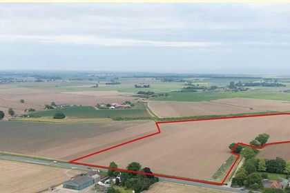
- Price
- Guide Price£1,370,000
- Size
- 85.57 acres
Lot 1 34.63 Hectares (85.57 Acres) or Thereabouts, Leverton, Lincolnshire PE22 England
Added on 18/08/2026Arable Land
- Price
- Guide Price£930,000
- Size
- 124.44 acres
Added on 13/06/2026Farmland
- Price
- Guide Price£1,350,000
- Size
- 143.46 acres
Added on 04/09/2026Farmland
- Price
- Guide Price£1,500,000
- Size
- 135.76 acres
Added on 29/01/2026Farmland