Newtown, Witchampton, Wimborne, Dorset, BH21
- Land size
- 4 acres
- Bedrooms
- 6
- Bathrooms
- 3
Key Features
- Imposing Victorian country house
- Substantial six-bedroom accommodation extending to approx. 5,145 sq ft
- Mature, parkland style grounds approaching 4 acres
- Marvellous reception hall and 3 further reception rooms
- Peaceful and secluded setting on the edge of quiet village of Witchampton
Description
An imposing late Victorian country house of approximately 5,145 sq ft, in park-like grounds approaching 4 acres with chalk stream frontage, on the edge of the village of Witchampton.
Little Mead is a handsome late Victorian residence, built in 1898 of mainly red brick with yellow brick detailing beneath a tiled roof, and set in glorious park-like grounds approaching 4 acres. In the same ownership for the last 23 years, the house has been the subject of a sympathetic programme of renovation and modernisation and retains a wealth of period features, including tall sash windows, high ceilings with cornicing, fine period fireplaces and two staircases with decorative turned balustrading, aided by the fact that the house is not listed. The accommodation extends to approximately 5,145 sq. ft and is centred on an impressive reception hall and a superb open plane kitchen/breakfast room with a sitting area overlooking the river. There are three further reception rooms, six bedrooms, including a main bedroom with dressing room and bathroom, two family bathrooms and an attic room on the second floor. The grounds are a particular feature, with mature specimen trees, a former tennis lawn and a terrace beside a chalk stream.
Little Mead is approached along a private no-through lane. A sweeping shingle driveway lined by clipped hedges opens out into a turning circle with central pond and parking in front of the house.
The gardens and grounds are a particular feature, offering seclusion provided by hedging and a wide variety of mature specimen trees. Laid mainly to lawn, the gardens are arranged in several 'rooms' including a former tennis lawn with a GARDEN STORE. To the rear of the house a TERRACE sits immediately beside a chalk stream, a tributary of the River Allen. The grounds extend to approaching 4 acres.
AGENT'S NOTE
There is a separate area of meadow on the opposite side of the lane, which the owners would consider selling by separate negotiation. Please contact the agent for further details.
Dorset Council. Band H.
Mains water and electricity. Private drainage via a treatment plant. Calor gas fired central heating.
From Wimborne take to B3078 Cranborne Road north. After about four miles pass the turning signposted to Witchampton on the left and, about 500m further on, turn left into the next small lane. Little Mead is the last driveway on the right.
Please note that satnav will direct you through Witchampton village to Witchampton Mill, from where it is not possible to reach Little Mead.
What3Words:pioneered.powering.hissing
Little Mead occupies an idyllic and secluded position along a quiet no-through lane on the edge of Witchampton, one of the area's most sought after villages. The village lies within the Cranborne Chase National Landscape, a designated Area of Outstanding Natural Beauty covering some 380 square miles of rolling countryside, and has a church, church hall, first school and the Crichel social club and shop. The surrounding countryside offers excellent walking, rising and cycling, with the New Forest National Park, the Isle of Purbeck and the Jurassic Coast all within easy reach.
The Minster town of Wimborne (approx. 4.5 miles) provides a comprehensive range of shops and services, including a Waitrose, cafes, restaurants and the Tivoli theatre. Poole Harbour is about 13 miles and Bournemouth and the beaches at Sandbanks about 15 miles. Independent schools within around 30 minutes include Canford, Dumpton, Bryanston, Castle Court and Clayesmore. The A31 at Ashley Heath gives access to the M27 and M3, and there are mainline rail services to London Waterloo from Poole, Salisbury and Southampton Airport Parkway.
Entrance Porch
Oak front door opening into the reception hall.
Reception Hall
Spacious reception hall, perfect for entertaining on a grand scale. Opens through to hallways on either side, each with a staircase to the first floor, one giving access to the guest cloakroom.
Drawing Room
Elegant dual aspect room with a wide bay window to the front and French doors to the side. Imposing marble fireplace with open grate.
Dining Room
Painted wood fire surroun with marble inset and hearth. Views over the garden. Door to the utility room, which can serve as a preparation kitchen.
Sitting Room/Study
Bay window to the front and double doors opening onto the main lawn.
Kitchen/Breakfast Room
Magnificent open plan room with a seating area featuring full height dual aspect windows, glazed rooflights and a sliding patio door onto the terrace overlooking the river. Extensive range of hand painted units with quartz worktops. Central island with sink and breakfast bar. Electric Aga set into a recess with display mantel over. Integrated Miele appliances including oven, microwave oven, warming drawer, dishwasher, tall freezer and larder fridge. Concealed coffee/breakfast station.
Utility Room
Formerly a kitchen. Good range of floor and wall units. Second dishwasher. Wall mounted central heating boiler. Linen cupboard housing the hot water cylinder. Serving door to the dining room.
Boot Room & Gardener's WC
Together with the study and secondary staircase, offering potential for a guest or family annexe, subject to any necessary consents.
Landing
Fine staircase with hardwood handrail rising from the main hall. Linen cupboards.
Main Bedroom
Generous room with two large windows to the front.
Dressing Room
Fully fitted.
Bathroom
Spa-like bathroom with freestanding bath, glazed shower, twin basins set into a range of custom cabinets and WC.
Bedrooms 2 - 6
Five further bedrooms.
Family Bathrooms
Two family bathrooms, each with a bath and separate shower.
Attic Room
Stairs rise to a second floor playroom/studio with a large roof window.
Map Location
Property details
- Tenure
- Freehold
- Council Tax Band
- H
- Date Posted
- 2026-10-28
Market Value Analysis
Compared with 1,543 Homes with Land listings in South West England (1+ acres).
Energy Performance Certificate
Energy Efficiency Rating
Based on UK Energy Performance Certificate standards (EU Directive 2002/91/EC)
Running costs are one side. Planning activity, flood history and ground risks for this location are in the full report.
Utilities & Restrictions
Utilities
- Electricity
- Ask Agent
- Water
- Ask Agent
- Heating
- Ask Agent
- Broadband
- Ask Agent
- Sewerage
- Ask Agent
Rights & Restrictions
- Public Rights of Way
- Ask Agent
- Private Rights of Way
- Ask Agent
- Listed Property
- Ask Agent
- Restrictions
- Ask Agent
Listed status, conservation areas and planning constraints for this location are in the full report.
Property Features
- Accessibility
- Ask Agent
- Parking
- Driveway
- Garden
- Garden
Beyond the particulars: planning activity, flood history, heritage and ground risks, checked for this exact spot.
Connectivity
Broadband
Fastest speed available at this postcode
1.8 Gbps
Gigabit full fibre
Suitable for
- 4K streaming on every screen
- Full-time home working
- Online gaming & big downloads
Mobile signal
Predicted 4G and 5G signal; indoor signal depends on building materials.
Ofcom Connected Nations postcode-level predictions. Speeds and signal are modelled, not measured, and vary between addresses and providers.
Signal is the easy part. Planning activity, flood history and protected designations here are in the full report.
Nearest Schools
Primary
- Witchampton Church of England First School0.6 milesOfsted: Good
- Ages
- 5 to 9
- Pupils
- 45
- Type
- Academy converter
- Faith
- Church of England
- St James Church of England First School1.8 milesOfsted: Good *
- Ages
- 2 to 9
- Pupils
- 134
- Type
- Academy converter
- Faith
- Church of England
- Wimborne St Giles Church of England First School and Nursery3.8 milesNo Ofsted rating
- Ages
- 2 to 9
- Pupils
- 70
- Type
- Academy converter
- Faith
- Church of England
- Pamphill Church of England First School3.9 milesOfsted: Good
- Ages
- 5 to 9
- Pupils
- 67
- Type
- Academy sponsor led
- Faith
- Church of England
- Wimborne First School and Nursery4 milesOfsted: Good
- Ages
- 2 to 9
- Pupils
- 400
- Type
- Academy converter
Secondary
- Queen Elizabeth's School3.7 milesOfsted: Requires improvement
- Ages
- 13 to 18
- Pupils
- 1,375
- Type
- Academy converter
- Faith
- Church of England
- St Michael's Church of England Middle School, Colehill3.9 milesNo Ofsted rating
- Ages
- 9 to 13
- Pupils
- 563
- Type
- Academy converter
- Faith
- Church of England
- Allenbourn Middle School4 milesOfsted: Good *
- Ages
- 9 to 13
- Pupils
- 499
- Type
- Academy converter
- Emmanuel Church of England Middle School5.4 milesOfsted: Good
- Ages
- 9 to 13
- Pupils
- 434
- Type
- Academy sponsor led
- Faith
- Church of England
- Cranborne Middle School5.6 milesNo Ofsted rating
- Ages
- 9 to 13
- Pupils
- 265
- Type
- Community school
* Latest graded judgement covers quality of education only; no overall grade was issued under the 2024-25 inspection framework.
Distances are straight-line from the advertised location. Source: the national school registers (DfE, Welsh Government, Scottish Government) and Ofsted.
Schools are just the start: sold prices nearby, planning activity and any flood history are in the full report.
Amenities
Supermarket
GP surgery
Pharmacy
Hospital
Green space
Straight-line distances from the advertised location. Sources: NHS records, Geolytix supermarket locations, OS Open Greenspace and the national trails registers.
The area stacks up? Now check the location itself: planning nearby, protected designations and past flooding.
Getting Around
Nearest station
Nearest bus stop
Typical drive times
Straight-line distances from the advertised location; drive times are typical free-flow times over OpenStreetMap road data, so allow more at peak. Public transport locations from DfT NaPTAN.
Easy to reach matters. So do planning activity, flood history and ground risks: all in the full report.
Flood Risk
Environment Agency open data, checked around the advertised map pin for the listed acreage. Long-term risk counts flood defences; the planning map's flood zones do not. Provided by LandSale, not the listing agent, and not part of the agent's particulars. Risk varies across a holding, so verify before committing.
Rivers and the sea
Not at the pin: mapped about 10 metres away.
Planning map: Flood Zone 3.
Surface water
Not at the pin: mapped about 30 metres away.
These bandings are the summary. Where this location sits on the flood maps, plus planning activity, heritage and ground risks, is in the full report.
Important notice: Information, maps and tags on this page are drawn from the advertising agent's marketing materials or generated automatically. LandSale has not verified them. Relying on these details is at your own risk, always carry out independent checks before committing to a purchase.
LandSale full disclaimer
Marketing information only - not formal particulars. The details on this website are provided for general guidance and do not constitute an offer or contract. Neither LandSale nor the advertising estate/land agent accepts responsibility for any inaccuracy.
1. Source of information
- Listing content: Core description, asking price, tenure, measurements, photographs and planning history originate from the marketing materials of the advertising estate or land agent. LandSale does not author this content and cannot guarantee its accuracy.
- Automated tags & categorisation: Property type, land-use class, acreage bands and similar labels may be applied by machine-learning models. They are intended as a helpful guide only and may not reflect the property's legal status or permitted use.
- Third-party & enriched data layers: Maps, boundary outlines, planning designations, soil reports, broadband coverage and other environmental or location-based insights are licensed from external suppliers. Such data are supplied “as is", may be incomplete or out of date and are subject to change without notice.
2. Verification required
Prospective purchasers must verify critical matters, including but not limited to planning permission, title boundaries, public rights of way, environmental constraints, acreage, services, access and VAT status, through their own inspections, specialist surveys, legal advisers and the selling agent before relying on the information or entering into any contract.
3. No warranty or liability
LandSale gives no warranty, express or implied, as to the accuracy, completeness or fitness for any particular purpose of the information displayed. LandSale shall not be liable for any loss, damage, cost or expense arising directly or indirectly from any use of or reliance on such information, save where liability may not be excluded by law.
4. Updates & feedback
If you believe any detail on this listing is inaccurate, please let us know. We will investigate and, where appropriate, update the listing or notify the agent.
© LandSale | Version 1.3 - August 2026
Contact Woolley & Wallis, Fordingbridge
33 Salisbury Street, Fordingbridge, SP6 1AB
View agent profileSimilar properties for sale
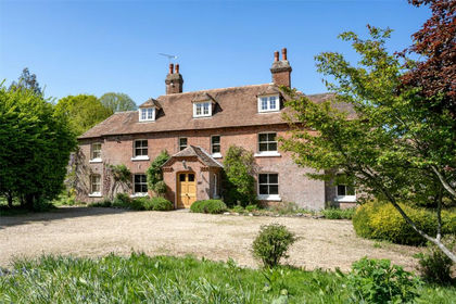
- Price
- Guide Price£2,250,000
- Size
- 11.7 acres
Dorchester Road, Sturminster Marshall, Wimborne, BH21, Sturminster Marshall, Dorset BH21 England
Added on 22/06/2026Country Home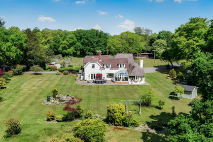
- Price
- Guide Price£3,000,000
- Size
- 24 acres
Highwood, Ringwood, Ellingham, Harbridge and Ibsley, Hampshire BH24 England
Added on 04/06/2026Country Home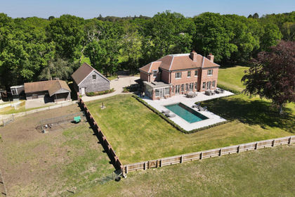
- Price
- Guide Price£2,950,000
- Size
- 6 acres
Holly Hill, Hangersley, BH24, Ringwood, Hampshire BH24 England
Added on 10/05/2026Country Home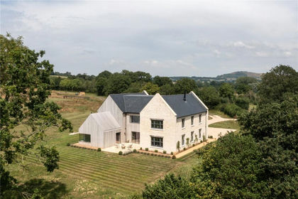
- Price
- Offers in Excess of£2,000,000
- Size
- 7.68 acres
Church Lane, East Orchard, Dorset, SP7, East Orchard, Dorset SP7 England
Added on 12/05/2026Country Home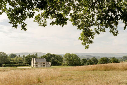
- Price
- Offers in Excess of£2,000,000
- Size
- 7.68 acres
Harefield Farmhouse, Church Lane, East Orchard, East Orchard, Dorset SP7 England
Added on 12/05/2026Farmhouse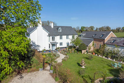
- Price
- Offers Over£2,500,000
- Size
- 3.75 acres
Added on 11/07/2026Country Home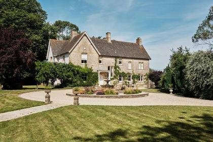
- Price
- Guide Price£1,995,000
- Size
- 2 acres
Mappowder, Sturminster Newton, Mappowder, Dorset DT10 England
Added on 20/07/2026Country Home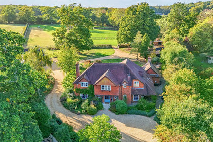
- Price
- £2,400,000
- Size
- 5 acres
Bramshaw, Lyndhurst, Hampshire, SO43, Bramshaw, Hampshire SO43 England
Added on 07/10/2026House with Land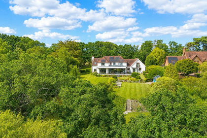
- Price
- £2,400,000
- Size
- 3.75 acres
Shirley Holms, Lymington, SO41, Sway, Hampshire SO41 England
Added on 14/08/2026Country Home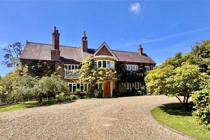
- Price
- Guide Price£1,895,000
- Size
- 2 acres
Sandy Down, Boldre, Lymington, Hampshire, SO41, Boldre, Hampshire SO41 England
Added on 02/07/2026Country Home