Auction: Wednesday 9 December 2026
1A Essex Street, Preston, Lancashire PR1
Key Features
- Substantial Modern Four Storey Building
- Offices, Warehouse & Residential Accommodation
- c47,000 sq.ft. (4,366 m2)
- Currently Producing c£20,000 pcm
Description
Online auction 8th-9th December 2026
Substantial Modern Four Storey Building – Offices, Warehouse & Residential Accommodation – c47,000 sq.ft. (4,366 m2) - Currently Producing approximately £20,000 pcm
Substantial modern four storey mixed use building, providing office, warehouse and residential accommodation.
Considered suitable for a wide variety of uses, subject to the required consents being obtained.
The building provides a GIA of circa 47,000 sq.ft.
Briefly comprising: -
Ground Floor – Rear full height warehouse (with 2x loading doors) – approx. 9,269 sqft., plant room, store, reception, offices, café and kitchen
First Floor – Offices (LHS), Former residential side - common room, kitchen, laundry room, office, (originally) 10 x en-suite rooms
Second Floor – Offices (LHS) plus (originally) 21 x en-suite rooms and ancillary
Third Floor - Offices (LHS) plus (originally) 17-18 x en-suite rooms and ancillary offices
Externally there is parking on site for 52-54 cars.
NB Many of the en-suite rooms have been re-purposed to offices with some knocked through to create larger offices.
Tenancies
The Vendor will enter into a short-term agreement ending on the 31st March 2027 paying £14,000 pcm, relating to their occupation of the ground floor warehouse, first, second and third floor offices.
Currently the Vendor sub-let parts of the building on short term all-inclusive agreements totalling approx. £6,000 pcm.
Please see legal pack for agreements and plans showing demises.
The vendor will absorb all gas, electricity and water rates incurred running the building from completion of the sale until they vacate on the 31st March 2027. All other costs of ownership will be for the buyer, including building insurance premium.
Tenure
The majority of the land is long leasehold from Preston City Council, 125 years from 2008 at £23,000 pa, next review 2028. Two other freehold parcels of land complete the site.
It is understood that VAT will be/is applicable, however the sale will be TOGC.
Tenure: long leasehold & freehold
Title number: LAN79445 (leasehold) LA215652 & LA740894 (freehold)
Length of Lease/Term: 125 years from 30 July 2008
Ground Rent : £23,000 pa
Service Charge: £
Council Tax Band :
Local Authority: Preston
Finance is available on this lot. For a decision-in-principle visit
IMPORTANT INFORMATION Buying at auction is a contractual commitment, you are legally obliged to buy the lot on the terms of the sale memorandum at the price you bid. If you are the successful bidder, you are required to pay the deposit and auction fees immediately. As agent for the seller, we treat any failure to satisfy your obligations as your repudiation of the contract and the seller may then have a claim against you for breach of contract. You must not bid unless you wish to be bound by the common conditions of auction.
ANTI-MONEY LAUNDERING REGULATIONS In accordance with Anti-Money Laundering Regulations, two forms of identification and confirmation of the source of funding will be required from the successful purchaser. Every effort has been made to confirm the accuracy of the lot details including any defect in the title both with the vendor and their solicitor. Auction House will not be held responsible for any failure to disclose any such defects.
Any purchasers choosing to buy without viewing in person are doing so at their own risk and acknowledge that the auctioneer will not be held responsible for any issues that may arise due to them being unintentionally missed from the video or sales particulars.
Please refer to legal pack for additional fees and the Auction Information document for guidance prior to bidding.
EPC RATING - UNITS GD + GA C
EPC RATING - 2nd + 3rd Floor B
EPC RATING - UNIT GE D
Tenure: See Legal Pack
Administration Fee: 2.75% inc VAT of the purchase price, subject to a minimum of £3600 inc VAT, payable on exchange of contracts.
Disbursements: Please see the legal pack for any disbursements listed that may become payable by the purchaser on completion.
Map Location
Property details
- Tenure
- Ask Agent
- Council Tax Band
- Ask Agent
- Date Posted
- 2026-10-28
Utilities & Restrictions
Utilities
- Electricity
- Ask Agent
- Water
- Ask Agent
- Heating
- Ask Agent
- Broadband
- Ask Agent
- Sewerage
- Ask Agent
Rights & Restrictions
- Public Rights of Way
- Ask Agent
- Private Rights of Way
- Ask Agent
- Listed Property
- Ask Agent
- Restrictions
- Ask Agent
Listed status, conservation areas and planning constraints for this location are in the full report.
Property Features
- Accessibility
- Ask Agent
- Parking
- Parking Available
- Garden
- Ask Agent
Beyond the particulars: planning activity, flood history, heritage and ground risks, checked for this exact spot.
Connectivity
Broadband
No premises records for this postcode, which is common for bare land and rural plots. A new connection would be quoted by the provider.
Mobile signal
No address-level signal records for this postcode, which is common for bare land.
Ofcom Connected Nations postcode-level predictions. Speeds and signal are modelled, not measured, and vary between addresses and providers.
Signal is the easy part. Planning activity, flood history and protected designations here are in the full report.
Nearest Schools
Primary
- St Ignatius' Catholic Primary School, Preston354 metresOfsted: Good
- Ages
- 4 to 11
- Pupils
- 193
- Type
- Academy converter
- Faith
- Roman Catholic
- English Martyrs Catholic Primary School, Preston564 metresNo Ofsted rating
- Ages
- 3 to 11
- Pupils
- 229
- Type
- Voluntary aided school
- Faith
- Roman Catholic
- Deepdale Community Primary School659 metresOfsted report card · Feb 2026
- Ages
- 3 to 11
- Pupils
- 696
- Type
- Community school
- St Gregory's Catholic Primary School, Preston0.7 milesOfsted: Good
- Ages
- 4 to 11
- Pupils
- 206
- Type
- Voluntary aided school
- Faith
- Roman Catholic
- St Augustine's Catholic Primary School, Preston0.8 milesOfsted report card · Mar 2026
- Ages
- 5 to 11
- Pupils
- 273
- Type
- Academy converter
- Faith
- Roman Catholic
Secondary
- Moor Park High School571 metresOfsted report card · Jan 2026
- Ages
- 11 to 16
- Pupils
- 599
- Type
- Foundation school
- Preston Muslim Girls High School784 metresNo Ofsted rating
- Ages
- 11 to 16
- Pupils
- 607
- Type
- Voluntary aided school
- Faith
- Muslim
- Gender
- Girls
- Eden Boys' School, Preston0.8 milesNo Ofsted rating
- Ages
- 11 to 18
- Pupils
- 615
- Type
- Free schools
- Faith
- Muslim
- Gender
- Boys
- Archbishop Temple Church of England High School1.1 milesOfsted: Good *
- Ages
- 11 to 16
- Pupils
- 891
- Type
- Voluntary aided school
- Faith
- Church of England
- Christ The King Catholic High School1.2 milesOfsted: Inadequate
- Ages
- 11 to 16
- Pupils
- 446
- Type
- Academy sponsor led
- Faith
- Roman Catholic
* Latest graded judgement covers quality of education only; no overall grade was issued under the 2024-25 inspection framework.
Distances are straight-line from the advertised location. Source: the national school registers (DfE, Welsh Government, Scottish Government) and Ofsted.
Schools are just the start: sold prices nearby, planning activity and any flood history are in the full report.
Amenities
Supermarket
GP surgery
Pharmacy
Hospital
Green space
Straight-line distances from the advertised location. Sources: NHS records, Geolytix supermarket locations, OS Open Greenspace and the national trails registers.
The area stacks up? Now check the location itself: planning nearby, protected designations and past flooding.
Getting Around
Nearest station
Nearest bus stop
Typical drive times
Straight-line distances from the advertised location; drive times are typical free-flow times over OpenStreetMap road data, so allow more at peak. Public transport locations from DfT NaPTAN.
Easy to reach matters. So do planning activity, flood history and ground risks: all in the full report.
Flood Risk
Environment Agency open data, checked around the advertised map pin for the listed acreage. Long-term risk counts flood defences; the planning map's flood zones do not. The map pin for this listing marks the postcode area rather than the exact location, so these readings describe the surrounding area. Provided by LandSale, not the listing agent, and not part of the agent's particulars. Risk varies across a holding, so verify before committing.
Rivers and the sea
Planning map: Flood Zone 1.
Surface water
These bandings are the summary. Where this location sits on the flood maps, plus planning activity, heritage and ground risks, is in the full report.
Important notice: Information, maps and tags on this page are drawn from the advertising agent's marketing materials or generated automatically. LandSale has not verified them. Relying on these details is at your own risk, always carry out independent checks before committing to a purchase.
LandSale full disclaimer
Marketing information only - not formal particulars. The details on this website are provided for general guidance and do not constitute an offer or contract. Neither LandSale nor the advertising estate/land agent accepts responsibility for any inaccuracy.
1. Source of information
- Listing content: Core description, asking price, tenure, measurements, photographs and planning history originate from the marketing materials of the advertising estate or land agent. LandSale does not author this content and cannot guarantee its accuracy.
- Automated tags & categorisation: Property type, land-use class, acreage bands and similar labels may be applied by machine-learning models. They are intended as a helpful guide only and may not reflect the property's legal status or permitted use.
- Third-party & enriched data layers: Maps, boundary outlines, planning designations, soil reports, broadband coverage and other environmental or location-based insights are licensed from external suppliers. Such data are supplied “as is", may be incomplete or out of date and are subject to change without notice.
2. Verification required
Prospective purchasers must verify critical matters, including but not limited to planning permission, title boundaries, public rights of way, environmental constraints, acreage, services, access and VAT status, through their own inspections, specialist surveys, legal advisers and the selling agent before relying on the information or entering into any contract.
3. No warranty or liability
LandSale gives no warranty, express or implied, as to the accuracy, completeness or fitness for any particular purpose of the information displayed. LandSale shall not be liable for any loss, damage, cost or expense arising directly or indirectly from any use of or reliance on such information, save where liability may not be excluded by law.
4. Updates & feedback
If you believe any detail on this listing is inaccurate, please let us know. We will investigate and, where appropriate, update the listing or notify the agent.
© LandSale | Version 1.3 - August 2026
Contact Auction House North West, Commercial
14 St Mary's Parsonage, Manchester, M3 2DF
View agent profileSimilar properties for sale
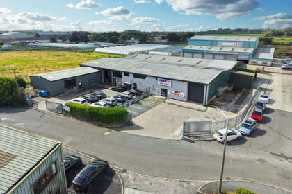
- Price
- Offers in Excess of£1,685,000
- Size
- 0.92 acres
Added on 09/10/2026Industrial Land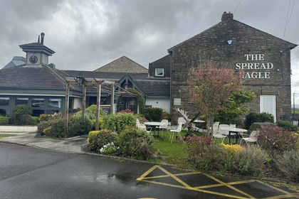
- Price
- £1,650,000
- Size
- 1.3 acres
NW-625401 - Spread Eagle, Mellor Lane, Blackburn BB2, Mellor, Lancashire BB2 England
Added on 30/05/2026Commercial Land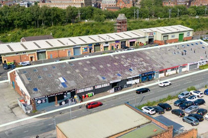
- Price
- £1,820,000
- Size
- 0.9 acres
Units 1-10 Clayton Place, Clayton Street, Wigan, Lancashire, WN3, Wigan, Wigan WN3 England
Added on 23/09/2026Industrial Land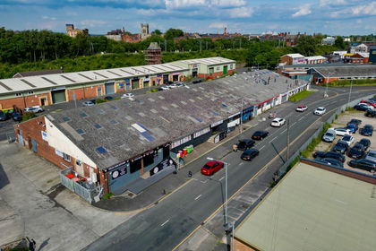
- Price
- Offers in Region of£1,820,000
- Size
- 0.66 acres
1-10 Clayton Court, Clayton Street, Wigan, Greater Manchester, WN3, Wigan, Wigan WN3 England
Added on 21/09/2026Industrial Land
- Price
- £1,200,000
- Size
- 0.25 acres
Added on 29/09/2026Industrial Land
- Price
- £1,800,000
Added on 29/01/2026Development Land
- Price
- £1,130,000
- Size
- 0.18 acres
Unit 6 Advance Point, Rossendale Road, Burnley, BB11, Burnley, Lancashire BB11 England
Added on 17/07/2026Warehouse
- Price
- From£1,300,000
- Size
- 0.24 acres
Unit 5 Advance Point, Rossendale Road, Burnley, BB11, Burnley, Lancashire BB11 England
Added on 12/10/2026Industrial Land
- Price
- £1,600,000
- Size
- 1.17 acres
Added on 18/09/2026Industrial Land
- Price
- Offers in Excess of£1,300,000
Trafalgar Street, Burnley, Lancashire, BB11, Burnley, Lancashire BB11 England
Added on 17/07/2026Industrial Land