
Station Road, Little Barrow, Nr Chester, CH3
- Land size
- 1.73 acres
- Dwelling size
- 5750 sqft
Description
A substantial traditional barn adjoining open countryside with consent to create a 5 bedroom family home with leisure facilities.
Proposed Accommodation (Circa 5,750 sq ft)
GROUND FLOOR
- Staircase Hall
- Cloakroom & Separate W.C.
- Study/Snug;
- Lounge
- Open plan Kitchen with Living & Dining areas
- Utility Room
- Plant Room
- Prep Kitchen
FIRST FLOOR
- Master Bedroom with en-suite Bathroom and
Dressing Room
- 3 further Bedrooms (all en-suite)
LEISURE SUITE
- Gym
- Indoor Swimming Pool
- Guest Wing/Annexe with Lounge, W.C., Guest
Bedroom with en-suite Bathroom
OUTSIDE
- Detached Triple Garage
- Tennis Court
- Gardens
- Paddock Land
- In all about 1.73 acres (0.7 ha)
DISTANCES
CHESTER - 6 MILES
M53/M56 - 5 MILES
LIVERPOOL - 22 MILES
MANCHESTER - 36 MILES
LIVERPOOL AIRPORT – 18 MILES
MANCHESTER AIRPORT – 28 MILES
(DISTANCES APPROXIMATE)
DESCRIPTION
On 26 October 2023, Planning Application No’s. 22/04318/FUL and 22/04311/FUL were approved permitting the conversion of Barn 1 and the adjoining Barn 2 into 2 detached dwellings. Barn 1 enjoys a rural aspect standing well back from the lane with independent drive providing great degrees of privacy. The approved plans provide for a very contemporary design with large windowsand open plan layout catering for modern day family living.
Barn 1, being the southerly barn, forms an ‘L’ shaped two storey range constructed of brick beneath a slate roof incorporating a single storey lean to against the return range. The accommodation within Barn 1 is both spacious and adaptable extending to circa 5,750 sq ft. It is accessed via a vaulted entrance hall off which is a cloakroom and separate w.c. To the side of the hall is a snug/study and beyond with access via independent double doors a well-proportioned lounge will sliding French windows. To the back of the house and enjoying a south west aspect is a 45ft open plan kitchen with living & dining areas and the drawings provide for sliding French windows opening into the garden.
Off the kitchen is a food preparation room together with separate utility room and plant room. Beyond the kitchen access is gained to a leisure suite with gym and indoor swimming pool, the latter having a full height vaulted ceiling to the roof. The plans provide for sliding French windows to the pool room which open to a sheltered south facing courtyard garden. At the far end of the leisure suite is a guest wing which could also serve as an independent annexe. Within the main part of the house the first floor accommodation is accessed via a galleried landing and the master suite comprises a double bedroom with en-suite bathroom and dressing room. On the opposite side of the stairs are three further double bedrooms which are all en-suite.
OUTSIDE
Externally the plans and landscape drawings provide for parking to the front and side with turning area against a 3 car garage/car port with the potential to create a home office above. Against the rear elevation the plans show hard landscaping including a wide terrace which extends to a lawned garden with plantings of trees & shrubs and provision for an all weather tennis court. Beyond the immediate garden there is an area of ground which could form a more natural ammenity area with pond, wild flower meadow, orchard or pony paddock for those with equestrian interests. The whole extends to 1.73 acres (0.7 ha) or thereabouts.
PROPERTY INFORMATION
Address: Barn 1 at Lodge Farm, Station Lane, Little Barrow, Nr Chester, Cheshire, CH3 7JW
Tenure: Freehold with vacant possession.
Services: Mains water and electricity available albeit to be connected. Private drainage to be installed.
Local Authority: Cheshire West & Chester Council.
Future Development Value: The contract will contain an overage provision stating that in the event there is a planning permission granted in the next 5 years for residential living accommodation extending beyond the footprint of the existing building, the vendors will be entitled to a payment on a prorata basis representing £50 per sq ft for any additional floor area.
Fixtures: Unless specifically mentioned in these particulars all contents, fixtures and fittings, garden ornaments, statues, carpets and curtains are excluded from the sale. Certain items may be available by separate negotiation.
Council Tax: Council Tax To Be Assessed post completion.
Town & Country Planning: The planning consent lapses on 26 October 2026 and a fresh application has been submitted so if necessary the purchase can be conditional on the planning being renewed/approved.
Community Infrastructure Levy (CIL): It is anticipated that there will be an obligation on the purchaser to pay Community Infrastructure Levy (CIL) and Biodiversity Net Gain (BNG) contributions of circa £30,888.72. This is likely to be payable in 2 instalments with 50% due 180 days after commencement of development and the remaining 50%, 365 days after commencement of development.
Viewing: Strictly by appointment via the Chester Office at Jackson-Stops.
Health & Safety: Please note that the loft floors to the building are not safe and interest parties should refrain from accessing the first floor areas.
Third Party Rights: The property is sold subject to all existing wayleaves, easements and rights of way, public or private, where specifically mentioned or not.
Map Location
Property details
- Tenure
- Freehold
- Council Tax Band
- Ask Agent
- Date Posted
- 2026-10-28
Market Value Analysis
Compared with 134 Development Land listings in North West England (1+ acres).
Property Brochure
Seen the details? The full report adds the independent checks: planning activity, flood history, heritage and ground.
Utilities & Restrictions
Utilities
- Electricity
- Ask Agent
- Water
- Ask Agent
- Heating
- Ask Agent
- Broadband
- Ask Agent
- Sewerage
- Ask Agent
Rights & Restrictions
- Public Rights of Way
- Ask Agent
- Private Rights of Way
- Ask Agent
- Listed Property
- Ask Agent
- Restrictions
- Ask Agent
Listed status, conservation areas and planning constraints for this location are in the full report.
Property Features
- Accessibility
- Ask Agent
- Parking
- Ask Agent
- Garden
- Ask Agent
Beyond the particulars: planning activity, flood history, heritage and ground risks, checked for this exact spot.
Connectivity
Broadband
Fastest speed available at this postcode
1.8 Gbps
Gigabit full fibre
Suitable for
- 4K streaming on every screen
- Full-time home working
- Online gaming & big downloads
Mobile signal
Predicted 4G and 5G signal; indoor signal depends on building materials.
Ofcom Connected Nations postcode-level predictions. Speeds and signal are modelled, not measured, and vary between addresses and providers.
Signal is the easy part. Planning activity, flood history and protected designations here are in the full report.
Nearest Schools
Primary
- Mickle Trafford Village School1.5 milesOfsted: Good
- Ages
- 4 to 11
- Pupils
- 169
- Type
- Community school
- Guilden Sutton CofE Primary School1.9 milesNo Ofsted rating
- Ages
- 4 to 11
- Pupils
- 207
- Type
- Voluntary controlled school
- Faith
- Church of England
- Ashton Hayes Primary School2.4 milesNo Ofsted rating
- Ages
- 4 to 11
- Pupils
- 134
- Type
- Community school
- Horn's Mill Primary School2.6 milesOfsted: Good
- Ages
- 4 to 11
- Pupils
- 199
- Type
- Community school
- Tarvin Primary School2.7 milesNo Ofsted rating
- Ages
- 4 to 11
- Pupils
- 230
- Type
- Academy converter
Secondary
- Upton-by-Chester High School3.1 milesNo Ofsted rating
- Ages
- 11 to 18
- Pupils
- 1,728
- Type
- Foundation school
- Christleton High School3.3 milesOfsted: Good
- Ages
- 11 to 18
- Pupils
- 1,382
- Type
- Academy converter
- The Bishops' Blue Coat Church of England High School4.1 milesOfsted: Good
- Ages
- 11 to 18
- Pupils
- 1,253
- Type
- Academy converter
- Faith
- Church of England
- Helsby High School4.1 milesNo Ofsted rating
- Ages
- 11 to 18
- Pupils
- 1,211
- Type
- Community school
- Chester International School4.6 milesOfsted: Good
- Ages
- 14 to 19
- Pupils
- 229
- Type
- Studio schools
Distances are straight-line from the advertised location. Source: the national school registers (DfE, Welsh Government, Scottish Government) and Ofsted.
Schools are just the start: sold prices nearby, planning activity and any flood history are in the full report.
Amenities
Supermarket
GP surgery
Pharmacy
Hospital
Straight-line distances from the advertised location. Sources: NHS records, Geolytix supermarket locations, OS Open Greenspace and the national trails registers.
The area stacks up? Now check the location itself: planning nearby, protected designations and past flooding.
Getting Around
Nearest station
Nearest bus stop
Typical drive times
Straight-line distances from the advertised location; drive times are typical free-flow times over OpenStreetMap road data, so allow more at peak. Public transport locations from DfT NaPTAN.
Easy to reach matters. So do planning activity, flood history and ground risks: all in the full report.
Flood Risk
Environment Agency open data, checked around the advertised map pin for the listed acreage. Long-term risk counts flood defences; the planning map's flood zones do not. Provided by LandSale, not the listing agent, and not part of the agent's particulars. Risk varies across a holding, so verify before committing.
Rivers and the sea
Planning map: Flood Zone 1.
Surface water
Not at the pin: mapped about 30 metres away.
These bandings are the summary. Where this location sits on the flood maps, plus planning activity, heritage and ground risks, is in the full report.
Important notice: Information, maps and tags on this page are drawn from the advertising agent's marketing materials or generated automatically. LandSale has not verified them. Relying on these details is at your own risk, always carry out independent checks before committing to a purchase.
LandSale full disclaimer
Marketing information only - not formal particulars. The details on this website are provided for general guidance and do not constitute an offer or contract. Neither LandSale nor the advertising estate/land agent accepts responsibility for any inaccuracy.
1. Source of information
- Listing content: Core description, asking price, tenure, measurements, photographs and planning history originate from the marketing materials of the advertising estate or land agent. LandSale does not author this content and cannot guarantee its accuracy.
- Automated tags & categorisation: Property type, land-use class, acreage bands and similar labels may be applied by machine-learning models. They are intended as a helpful guide only and may not reflect the property's legal status or permitted use.
- Third-party & enriched data layers: Maps, boundary outlines, planning designations, soil reports, broadband coverage and other environmental or location-based insights are licensed from external suppliers. Such data are supplied “as is", may be incomplete or out of date and are subject to change without notice.
2. Verification required
Prospective purchasers must verify critical matters, including but not limited to planning permission, title boundaries, public rights of way, environmental constraints, acreage, services, access and VAT status, through their own inspections, specialist surveys, legal advisers and the selling agent before relying on the information or entering into any contract.
3. No warranty or liability
LandSale gives no warranty, express or implied, as to the accuracy, completeness or fitness for any particular purpose of the information displayed. LandSale shall not be liable for any loss, damage, cost or expense arising directly or indirectly from any use of or reliance on such information, save where liability may not be excluded by law.
4. Updates & feedback
If you believe any detail on this listing is inaccurate, please let us know. We will investigate and, where appropriate, update the listing or notify the agent.
© LandSale | Version 1.3 - August 2026
Similar properties for sale
- Price
- Guide Price£425,000
Tarporley, Cheshire, Tarporley, Cheshire West and Chester CW6 England
Added on 22/09/2026Building Plot
- Price
- £399,900
- Size
- 0.19 acres
186 Chester Road, Warrington, Warrington South, Warrington WA4 England
Added on 29/01/2026Redevelopment Land
- Price
- £400,000
- Size
- 1.2 acres
Croxton Farm, Croxton, Whitchurch, SY13, Hanmer, Wrexham SY13 Wales
Added on 26/06/2026Development Land Added on 15/03/2026Building Plot
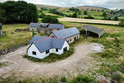
- Price
- Guide Price£405,000
- Size
- 1.58 acres
Plas Lane, Llanarmon-yn-Ial, Mold, Denbighshire, CH7, Llanarmon-yn-Ial, Denbighshire CH7 Wales
Added on 18/09/2026Development Land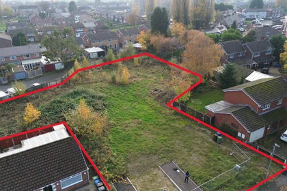
- Price
- £350,000
- Size
- 0.55 acres
Land At Sandy Lane Farm, Sandy Lane, Hindley, Wigan, Lancashire, WN2, Makerfield, Wigan WN2 England
Added on 29/01/2026Development Land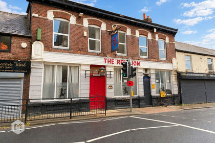
- Price
- Guide Price£380,000
Church Street, Atherton, M46, Leigh and Atherton, Wigan M46 England
Added on 30/10/2026Development Land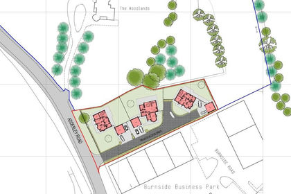
- Price
- Offers in Region of£420,000
Adderley Road, Market Drayton, Market Drayton, Shropshire TF9 England
Added on 20/02/2026Development Land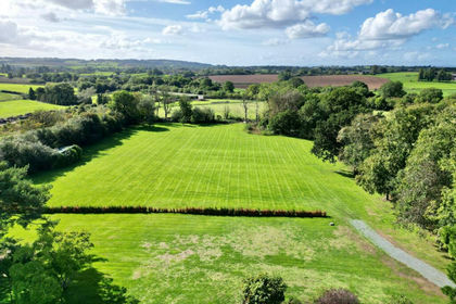 Added on 29/01/2026Self Build Plot
- Price
- Guide Price£325,000
- Size
- 0.49 acres
Added on 29/01/2026Building Plot