Auction: Wednesday 25 November 2026
Church Street, Higham, Rochester
- Land size
- 2.5 acres
- Bedrooms
- 2
- Bathrooms
- 1
Key Features
- FOR SALE BY ONLINE AUCTION ON 25TH NOV 2026
- AUCTION AT auctions.sealeys.co.uk
- GRADE II LISTED THATCHED ROOF COTTAGE IN RURAL CONSERVATION AREA
- APPROXIMATELY. 2.5 ACRE PLOT WITH ADDITIONAL LARGE TIMBER BARN IN GARDEN
- IN NEED OF COMPLETE UPDATING AND MODERNISATION
Description
FOR SALE BY AUCTION: Nestled in the charming village of Higham within a conservation area this delightful Grade II detached thatched roof cottage on Church Street offers a huge amount of character enhanced by many original features, which add to the of historical charm of the property. Situated in a substantial 2.5 Acre (Approx) plot extending to the side, rear and behind St Marys Church.
It is said that the property is the oldest dwelling house in the village dating back to the 14th century and is mentioned in the 1485 will of William Rolfe. We understand the property was listed on the 31st August 1976 by the National Heritage List for England ( List Entry Number 1373858).
The property is laid out over two floors with rendered front, weather boarded gable ends and original exposed beams inside. Now requiring complete updating and modernising the property offers huge potential and is available with immediate vacant possession.
Higham is known for its friendly community and beautiful surroundings, making it an excellent choice for those looking to enjoy a tranquil lifestyle while still being within reach of local amenities and transport links This property presents a wonderful opportunity to own a piece of history in a sought-after location. Whether you are looking to settle down or invest, this cottage is sure to impress.
FREEHOLD FOR SALE BY ONLINE AUCTION – Grade II Listed Timber Frame, Thatched Roof, Cottage in Substantial 2.5 Acre Plot in need of refurbishment.
Auction Guide £250,000 + Plus Fees
It is said that the property is the oldest dwelling house in the village dating back to the 14th Century and is mentioned in the 1485 will of William Rolfe. We understand the property was listed on 31st August 1976 by the National Heritage List for England (List Entry Number 1373858).
The property is laid out over two floors with rendered front, weather boarded gable ends and original exposed beams inside. Now requiring complete updating and modernisation the property offers huge potential and is available with immediate vacant possession. The accommodation comprises two reception rooms, kitchen area, ground floor washroom and an extended area to the side with vaulted ceiling, previously used as storage and there are two bedrooms which interlink with each other on the first floor.
There is a large timber barn within the plot and plenty of parking within the boundary.
LOCATION:
Situated in an idyllic hamlet of Church Street in Higham, which is a conservation area, and surrounded by open farmland and countryside. The cottage backs onto the historic Grade II Listed Medieval St Mary’s Church, which we understand is under the care of the Churches Conservation Trust and has a long history including being the parish church of author Charles Dickens whilst he lived at nearby Gads Hill Place.
The village itself offers a host of amenities, including convenience stores, pubs and a village social club. The area is served by the well regarded primary school and the famous Gads Hill School, an independent day school. Higham Station is within half a mile with rail services to St Pancras International and the Medway towns.
TENURE:
Freehold
Grade II Listed in Conservation Area.
LOCAL AUTHORITY:
Gravesham Borough Council Band: D £2,492.38 for 2026 – 2027
BIDDING
Bidding will take place on our website '' on 25th November 2026. Bidding opens at 12:00pm and ends at 1:00pm. In order for you to bid, you will be required to register your card for an 'auction entrance fee', this is made up of an 'administration fee' and a 'buyers security fee'. This will only be charged to the successful buyer. Please see the Buyers Guide and the Common Auction Conditions for more information. If you have any further questions please contact the agent, or seek legal advice. The required 'auction entrance fee' for this LOT is - £5,000
GUIDE PRICE*
Where a guide price (or range of prices) is published, that guide is the sellers minimum expectation at the date of publication. They are not necessarily figures at which a property will sell for and may change at any time prior to Auction. Unless stated otherwise, each Lot will be offered subject to a reserve (a figure below which the Auctioneer cannot sell the Lot during the Auction). We expect the reserve will be set within the guide range or no more than 10% above a single figure guide. Please register your interest or keep an eye on our website for any amendments to this.
FEES**
In addition to the bid price, you may be responsible for administration fees, other non-optional fees, and potentially the repayment of search and other costs. All lots are subject to the Common Auction Conditions and applicable Special Conditions of Sale.
Before bidding, carefully review all available legal documentation to understand your potential liabilities. This includes potential costs such as Stamp Duty, Land Registry fees, and VAT, which may be applicable upon completion.
If you have any doubts, please consult with your own professional advisors.
ADMINISTRATION FEE SCHEDULE***
The successful buyer is subject to an administration fee at the same time as the bidder security fee (auction entrance fee) for each LOT purchased. The administration fee is applied to the sale price in the following scaled increments
and includes VAT;
Up to £99,999 =£1,080
£100,000 - £349,999 =£2,160
£350,000 Plus =£3,600
Please see the 'General Conditions Of Sale' for detailed explanation of the terms.
Map Location
Property details
- Tenure
- Freehold
- Council Tax Band
- D
- Date Posted
- 2026-10-28
Market Value Analysis
Compared with 1,684 Homes with Land listings in South East England (1+ acres).
Energy Performance Certificate
Energy Efficiency Rating
Based on UK Energy Performance Certificate standards (EU Directive 2002/91/EC)
Running costs are one side. Planning activity, flood history and ground risks for this location are in the full report.
Utilities & Restrictions
Utilities
- Electricity
- Mains
- Water
- Mains
- Heating
- Ask Agent
- Broadband
- Ask Agent
- Sewerage
- Septic Tank / Private
Rights & Restrictions
- Public Rights of Way
- Ask Agent
- Private Rights of Way
- Yes
- Listed Property
- Yes
- Restrictions
- Yes
Listed status, conservation areas and planning constraints for this location are in the full report.
Property Features
- Accessibility
- Ask Agent
- Parking
- Off-Street Parking
- Garden
- Garden
Beyond the particulars: planning activity, flood history, heritage and ground risks, checked for this exact spot.
Connectivity
Broadband
Fastest speed available at this postcode
3 Mbps
Under 10 Mbps here
Suitable for
- Basic browsing & email
Mobile signal
Predicted 4G and 5G signal; indoor signal depends on building materials.
Ofcom Connected Nations postcode-level predictions. Speeds and signal are modelled, not measured, and vary between addresses and providers.
Signal is the easy part. Planning activity, flood history and protected designations here are in the full report.
Nearest Schools
Primary
- Higham Primary School1.2 milesOfsted: Good
- Ages
- 4 to 11
- Pupils
- 210
- Type
- Community school
- Cliffe Woods Primary School1.6 milesOfsted: Good *
- Ages
- 4 to 11
- Pupils
- 421
- Type
- Academy converter
- St Helen's Church of England Primary School, Cliffe1.8 milesNo Ofsted rating
- Ages
- 4 to 11
- Pupils
- 182
- Type
- Voluntary controlled school
- Faith
- Church of England
- Shorne Church of England Primary School2.3 milesNo Ofsted rating
- Ages
- 5 to 11
- Pupils
- 211
- Type
- Academy converter
- Faith
- Church of England
- Temple Mill Primary School2.6 milesNo Ofsted rating
- Ages
- 3 to 11
- Pupils
- 237
- Type
- Academy sponsor led
Secondary
- Maritime Academy3 milesOfsted: Good *
- Ages
- 11 to 19
- Pupils
- 736
- Type
- Free schools
- Leigh Academy Strood3 milesOfsted report card · Jun 2026
- Ages
- 11 to 19
- Pupils
- 1,311
- Type
- Academy sponsor led
- Thamesview School3.3 milesOfsted: Good
- Ages
- 11 to 18
- Pupils
- 978
- Type
- Foundation school
- St John's Catholic Comprehensive3.6 milesNo Ofsted rating
- Ages
- 11 to 18
- Pupils
- 1,335
- Type
- Voluntary aided school
- Faith
- Roman Catholic
- Gravesend Grammar School3.6 milesOfsted: Good *
- Ages
- 11 to 18
- Pupils
- 1,495
- Type
- Academy converter
- Gender
- Boys
* Latest graded judgement covers quality of education only; no overall grade was issued under the 2024-25 inspection framework.
Distances are straight-line from the advertised location. Source: the national school registers (DfE, Welsh Government, Scottish Government) and Ofsted.
Schools are just the start: sold prices nearby, planning activity and any flood history are in the full report.
Amenities
Supermarket
GP surgery
Pharmacy
Hospital
Straight-line distances from the advertised location. Sources: NHS records, Geolytix supermarket locations, OS Open Greenspace and the national trails registers.
The area stacks up? Now check the location itself: planning nearby, protected designations and past flooding.
Getting Around
Nearest station
Nearest bus stop
Typical drive times
Straight-line distances from the advertised location; drive times are typical free-flow times over OpenStreetMap road data, so allow more at peak. Public transport locations from DfT NaPTAN.
Easy to reach matters. So do planning activity, flood history and ground risks: all in the full report.
Flood Risk
Environment Agency open data, checked around the advertised map pin for the listed acreage. Long-term risk counts flood defences; the planning map's flood zones do not. Provided by LandSale, not the listing agent, and not part of the agent's particulars. Risk varies across a holding, so verify before committing.
Rivers and the sea
Planning map: Flood Zone 3.
Surface water
Not at the pin: mapped about 30 metres away.
These bandings are the summary. Where this location sits on the flood maps, plus planning activity, heritage and ground risks, is in the full report.
Important notice: Information, maps and tags on this page are drawn from the advertising agent's marketing materials or generated automatically. LandSale has not verified them. Relying on these details is at your own risk, always carry out independent checks before committing to a purchase.
LandSale full disclaimer
Marketing information only - not formal particulars. The details on this website are provided for general guidance and do not constitute an offer or contract. Neither LandSale nor the advertising estate/land agent accepts responsibility for any inaccuracy.
1. Source of information
- Listing content: Core description, asking price, tenure, measurements, photographs and planning history originate from the marketing materials of the advertising estate or land agent. LandSale does not author this content and cannot guarantee its accuracy.
- Automated tags & categorisation: Property type, land-use class, acreage bands and similar labels may be applied by machine-learning models. They are intended as a helpful guide only and may not reflect the property's legal status or permitted use.
- Third-party & enriched data layers: Maps, boundary outlines, planning designations, soil reports, broadband coverage and other environmental or location-based insights are licensed from external suppliers. Such data are supplied “as is", may be incomplete or out of date and are subject to change without notice.
2. Verification required
Prospective purchasers must verify critical matters, including but not limited to planning permission, title boundaries, public rights of way, environmental constraints, acreage, services, access and VAT status, through their own inspections, specialist surveys, legal advisers and the selling agent before relying on the information or entering into any contract.
3. No warranty or liability
LandSale gives no warranty, express or implied, as to the accuracy, completeness or fitness for any particular purpose of the information displayed. LandSale shall not be liable for any loss, damage, cost or expense arising directly or indirectly from any use of or reliance on such information, save where liability may not be excluded by law.
4. Updates & feedback
If you believe any detail on this listing is inaccurate, please let us know. We will investigate and, where appropriate, update the listing or notify the agent.
© LandSale | Version 1.3 - August 2026
Similar properties for sale
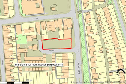
- Price
- Guide Price£185,000
- Size
- 0.2 acres
Land at Miles Place, Rochester, Kent, ME1, Rochester and Strood, Medway ME1 England
Added on 31/10/2026Development Land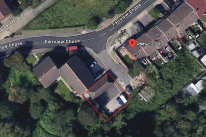
- Price
- Offers in Region of£350,000
Fairview Chase, Stanford-Le-Hope, SS17, South Basildon and East Thurrock, Thurrock SS17 England
Added on 29/01/2026Building Plot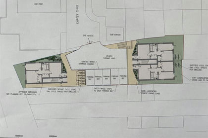
- Price
- Guide Price£300,000
Fairview Chase, Stanford-le-Hope, South Basildon and East Thurrock, Thurrock SS17 England
Added on 29/01/2026Building Plot Added on 29/01/2026Building Plot
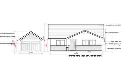
- Price
- Offers in Region of£275,000
- Size
- 0.2 acres
Studland Avenue, Wickford, Essex, SS12, Basildon and Billericay, Essex SS12 England
Added on 26/07/2026Self Build Plot
- Price
- Guide Price£250,000
- Size
- 0.12 acres
Canford Avenue, Wickford, Basildon and Billericay, Essex SS12 England
Added on 03/07/2026Self Build Plot Added on 26/06/2026Self Build Plot
- Price
- Offers in Region of£189,000
Land at troys Mead, Maidstone, ME17, Hollingbourne, Kent ME17 England
Added on 23/05/2026Building Plot
- Price
- Offers Over£250,000
Added on 11/04/2026Development Land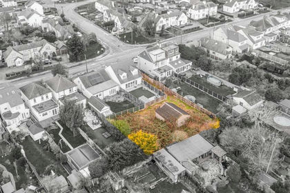
- Price
- Guide Price£225,000
Development Opportunity at Stambridge Road, Rochford, Rochford, Essex SS4 England
Added on 29/01/2026Self Build Plot