
Whittingham Lane, Goosnargh, Preston, PR3
- Land size
- 2.83 acres
- Dwelling size
- 1325 sqft
- Bedrooms
- 2
- Bathrooms
- 1
Key Features
- Subject to agricultural occupancy condition (see within the details)***
- Detached, single storey true bungalow
- Two good-sized double bedrooms
- In need of modernisation throughout
- Uninterrupted views of the open countryside
- Highly desirable rural location
- Set in a total plot of 2.83 acres (1.15 ha)
Description
****BEST & FINAL OFFERS BY 5PM TUES 5TH MAY***
Chingle Lodge is a detached bungalow set in around 2.83 acres (1.15 ha), thought to be subject to an agricultural occupancy condition. Boasting a secluded setting with incredible views, yet sat within a highly desirable area along Whittingham Lane, Goosnargh, this property provides a superb location.
Constructed in 1986 by its current owners, Chingle Lodge is being offered to the market for the very first time. Now requiring modernisation throughout, this charming and secluded property provides an excellent opportunity to create a bespoke family home.
Tucked away along a shared country lane off Whittingham Lane, the property is approached via a gated entrance that opens onto a stone driveway and an attached single garage. Beyond the house, a generous wraparound lawned garden enjoys uninterrupted views across open countryside to both the front and rear, and is complemented by several timber sheds and a greenhouse.
Location
Nestled in the rural parish of Goosnargh, just a short drive from Preston, this location offers an exceptional balance of countryside tranquillity and modern convenience. Renowned for its picturesque surroundings, welcoming community, and traditional village character, Goosnargh provides an idyllic setting for families. The location offers scenic walking routes, highly regarded local schools, and easy access to Preston’s wider amenities, including shopping, dining, and transport links.
Internally, the property can be entered via either the front or rear porch. To the front, the porch opens into a spacious hallway that provides access to all principal rooms.
The living room extends across the full width of the property, with sliding patio doors to the rear creating a seamless connection to the garden - ideal for relaxed indoor-outdoor living during the warmer months. An electric fire set in front of an open chimney with brick surround forms a central focal point, while an open archway leads through to the kitchen, allowing natural light to flow throughout.
The kitchen is fitted with a range of timber cabinets and features a characterful vintage Rayburn cooker alongside a standalone cooker. Adjoining the kitchen is a generous utility room, which offers access to the rear porch and the attached garage.
The property offers two well-proportioned double bedrooms, with the principal bedroom benefiting from built-in floor-to-ceiling wardrobes, providing ample storage.
Completing the accommodation is a three-piece family bathroom, finished with matching wooden features and comprising a bath with electric shower over, a pedestal wash basin, and a WC.
Chingle Lodge is set in a generous plot of 2.83 acres (1.15 ha) in total, making it ideal for those seeking a peaceful way of life, whilst also providing increased privacy and greater control over the surrounding environment. The plot also offers excellent versatility, whether for potential rental income or for those wishing to extend and enjoy the grounds as part of the residential property.
The land to the west benefits from a separate access down the access track, secured by a timber gate.
Classified as Grade 3, the land comprises good quality permanent pasture enclosed by a combination of mature hawthorn hedging and stock-proof netting. The garden boundary to the rear is defined by post and rail fencing.
The property is subject to an agricultural occupancy condition which limits the occupation of the property to those employed, or last employed within agriculture and/or Forestry.
‘The occupation of the dwelling shall be limited to a person solely or mainly employed, or last employed in agriculture as defined in Section 290 (i) of the Town and Country Planning Act 1971, or in forestry or a dependant of such a person residing with him (but including a widow or widower of such a person).’
Plan C-807-2 shows the site plan approved by Preston City Council under planning application 06-85-0402 for ‘Proposed Dwelling for Farm Worker, Chingle House Farm, Goosnargh’, with Chingle Lodge edged red.
Buyers will need to carry out their own research into the planning position, and will need to offer on the basis of the position as it is understood.
Map Location
Property details
- Tenure
- Freehold
- Council Tax Band
- Ask Agent
- Date Posted
- 2026-10-27
Market Value Analysis
Compared with 736 Homes with Land listings in North West England (1+ acres).
Energy Performance Certificate
Energy Efficiency Rating
Based on UK Energy Performance Certificate standards (EU Directive 2002/91/EC)
View official EPC certificate ↗
Running costs are one side. Planning activity, flood history and ground risks for this location are in the full report.
Property Brochure
Seen the details? The full report adds the independent checks: planning activity, flood history, heritage and ground.
Utilities & Restrictions
Utilities
- Electricity
- Ask Agent
- Water
- Ask Agent
- Heating
- Ask Agent
- Broadband
- Ask Agent
- Sewerage
- Ask Agent
Rights & Restrictions
- Public Rights of Way
- Ask Agent
- Private Rights of Way
- Ask Agent
- Listed Property
- Ask Agent
- Restrictions
- Ask Agent
Listed status, conservation areas and planning constraints for this location are in the full report.
Property Features
- Accessibility
- Ask Agent
- Parking
- Ask Agent
- Garden
- Ask Agent
Beyond the particulars: planning activity, flood history, heritage and ground risks, checked for this exact spot.
Connectivity
Broadband
Fastest speed available at this postcode
1.8 Gbps
Gigabit full fibre · available to 79% of premises
Suitable for
- 4K streaming on every screen
- Full-time home working
- Online gaming & big downloads
Mobile signal
Predicted 4G and 5G signal; indoor signal depends on building materials.
Ofcom Connected Nations postcode-level predictions. Speeds and signal are modelled, not measured, and vary between addresses and providers.
Signal is the easy part. Planning activity, flood history and protected designations here are in the full report.
Nearest Schools
Primary
- Goosnargh Oliverson's Church of England Primary School930 metresNo Ofsted rating
- Ages
- 4 to 11
- Pupils
- 199
- Type
- Voluntary aided school
- Faith
- Church of England
- St Francis Catholic Primary School, Goosnargh1.8 milesOfsted report card · Jan 2026
- Ages
- 4 to 11
- Pupils
- 104
- Type
- Voluntary aided school
- Faith
- Roman Catholic
- Sherwood Primary School1.9 milesOfsted: Outstanding *
- Ages
- 4 to 11
- Pupils
- 425
- Type
- Community school
- Fulwood, St Peter's Church of England Primary School and Nursery2 milesOfsted: Good
- Ages
- 4 to 11
- Pupils
- 227
- Type
- Voluntary aided school
- Faith
- Church of England
- Broughton-in-Amounderness Church of England Primary School2.1 milesOfsted: Good *
- Ages
- 3 to 11
- Pupils
- 378
- Type
- Voluntary aided school
- Faith
- Church of England
Secondary
- Broughton High School2.2 milesOfsted: Outstanding
- Ages
- 11 to 16
- Pupils
- 932
- Type
- Community school
- Corpus Christi Catholic High School2.6 milesOfsted: Outstanding *
- Ages
- 11 to 16
- Pupils
- 813
- Type
- Voluntary aided school
- Faith
- Roman Catholic
- Archbishop Temple Church of England High School2.7 milesOfsted: Good *
- Ages
- 11 to 16
- Pupils
- 891
- Type
- Voluntary aided school
- Faith
- Church of England
- Fulwood Academy2.8 milesOfsted: Good
- Ages
- 11 to 16
- Pupils
- 973
- Type
- Academy sponsor led
- Longridge High School2.8 milesOfsted: Requires improvement
- Ages
- 11 to 16
- Pupils
- 810
- Type
- Academy converter
* Latest graded judgement covers quality of education only; no overall grade was issued under the 2024-25 inspection framework.
Distances are straight-line from the advertised location. Source: the national school registers (DfE, Welsh Government, Scottish Government) and Ofsted.
Schools are just the start: sold prices nearby, planning activity and any flood history are in the full report.
Amenities
Supermarket
GP surgery
Pharmacy
Hospital
Green space
Straight-line distances from the advertised location. Sources: NHS records, Geolytix supermarket locations, OS Open Greenspace and the national trails registers.
The area stacks up? Now check the location itself: planning nearby, protected designations and past flooding.
Getting Around
Nearest station
Nearest bus stop
Typical drive times
Straight-line distances from the advertised location; drive times are typical free-flow times over OpenStreetMap road data, so allow more at peak. Public transport locations from DfT NaPTAN.
Easy to reach matters. So do planning activity, flood history and ground risks: all in the full report.
Flood Risk
Environment Agency open data, checked around the advertised map pin for the listed acreage. Long-term risk counts flood defences; the planning map's flood zones do not. Provided by LandSale, not the listing agent, and not part of the agent's particulars. Risk varies across a holding, so verify before committing.
Rivers and the sea
Planning map: Flood Zone 1.
Surface water
Not at the pin: mapped about 20 metres away.
These bandings are the summary. Where this location sits on the flood maps, plus planning activity, heritage and ground risks, is in the full report.
Important notice: Information, maps and tags on this page are drawn from the advertising agent's marketing materials or generated automatically. LandSale has not verified them. Relying on these details is at your own risk, always carry out independent checks before committing to a purchase.
LandSale full disclaimer
Marketing information only - not formal particulars. The details on this website are provided for general guidance and do not constitute an offer or contract. Neither LandSale nor the advertising estate/land agent accepts responsibility for any inaccuracy.
1. Source of information
- Listing content: Core description, asking price, tenure, measurements, photographs and planning history originate from the marketing materials of the advertising estate or land agent. LandSale does not author this content and cannot guarantee its accuracy.
- Automated tags & categorisation: Property type, land-use class, acreage bands and similar labels may be applied by machine-learning models. They are intended as a helpful guide only and may not reflect the property's legal status or permitted use.
- Third-party & enriched data layers: Maps, boundary outlines, planning designations, soil reports, broadband coverage and other environmental or location-based insights are licensed from external suppliers. Such data are supplied “as is", may be incomplete or out of date and are subject to change without notice.
2. Verification required
Prospective purchasers must verify critical matters, including but not limited to planning permission, title boundaries, public rights of way, environmental constraints, acreage, services, access and VAT status, through their own inspections, specialist surveys, legal advisers and the selling agent before relying on the information or entering into any contract.
3. No warranty or liability
LandSale gives no warranty, express or implied, as to the accuracy, completeness or fitness for any particular purpose of the information displayed. LandSale shall not be liable for any loss, damage, cost or expense arising directly or indirectly from any use of or reliance on such information, save where liability may not be excluded by law.
4. Updates & feedback
If you believe any detail on this listing is inaccurate, please let us know. We will investigate and, where appropriate, update the listing or notify the agent.
© LandSale | Version 1.3 - August 2026
Similar properties for sale
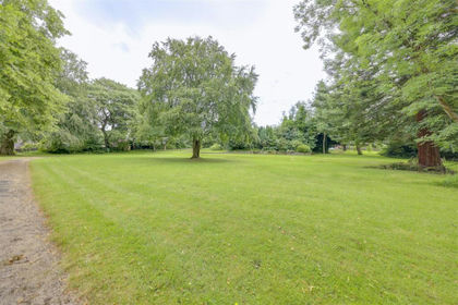
- Price
- £250,000
- Size
- 1.01 acres
Added on 11/07/2026Building Plot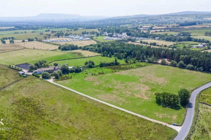
- Price
- £350,000
- Size
- 5.78 acres
Added on 20/07/2026Development Land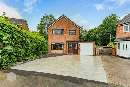
- Price
- Offers in Region of£270,000
- Size
- 1 acres
Harden Drive, Bolton, BL2, Bolton North East, Bolton BL2 England
Added on 07/06/2026Residential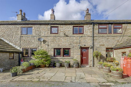
- Price
- £350,000
- Size
- 9.3 acres
Turn Hill, Dean Lane, Water, Rossendale, Rossendale and Darwen, Lancashire BB4 England
Added on 06/10/2026Cottage
- Price
- Guide Price£350,000
- Size
- 10.9 acres
Added on 02/07/2026Barn Conversion
- Price
- Offers Over£400,000
- Size
- 8.5 acres
Park Cottages, Hollin Hall, Colne, BB8, Trawden Forest, Lancashire BB8 England
Added on 08/09/2026House with Land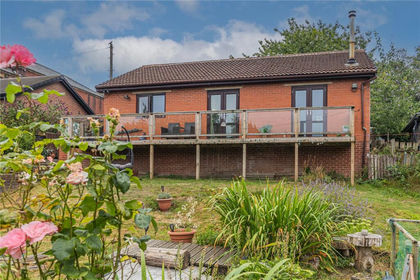
- Price
- £400,000
- Size
- 2 acres
Added on 17/08/2026House with Land