
Closing date for offers: Thursday 24 December 2026
Plot 164a Stellas Field Milchden Blackeness Lane Keston Bromley London BR26HL
- Land size
- 0.024 acres
Key Features
- Commercial Agricultural & Horticultural Potential
Description
"Freehold Sale — Flexible terms or Rent-to-Buy option considered if serious."
Plot 164a Stellas Field, Milchden, Blackness Lane, Keston, Bromley, London (BR2 6HL) Land Size: 0.024 Acres (Approx. 98m² / 1,054.86 sq. ft.) | Dimensions: 7m x 14m
Key Features: Commercial Agricultural & Horticultural Potential | Track Access
PRIME FREEHOLD PASTURE PLOT LONDON — PLOT 164A MILCHDEN, KESTON (BR2 6HL) Strategic Agricultural Parcel | Commercial Agricultural & Horticultural Potential ASKING PRICE: £7,500 BONUS: Service Rights, Soil Rights & Track Access
WHY PLOT 164A STANDS OUT FROM SURROUNDING PLOTS • Great Position: Quietly nestled in a peaceful corner area of the field to the rear of the site directly adjoining Plot 165 (listed at £25,000)—making it an outstanding target for plot assembly or strategic land holding in the London Borough of Bromley. • Prime Location & Aspect:
Well-maintained over the years (though currently slightly overgrown), this parcel enjoys a pleasant aspect with standard rights of access over the established track leading to Blackness Lane. • Natural Drainage & Hardstanding: Lime-rich loamy soil provides excellent natural free drainage, keeping ground firm underfoot year-round (no muddy wellies!).
Ideal for natural hardstanding to park a car/4x4, station a garden trailer, or store a freestanding water butt. • Low Maintenance: Rapid drainage naturally slows grass growth during dry summer periods, requiring significantly less upkeep and cost. • Rich, Undisturbed Soil: Fertile soil profile with neutral to slightly acidic pH. Ground along this Blackness Lane perimeter has remained largely undisturbed for over 30 years.
PERFECT FOR IMMEDIATE COMMERCIAL HORTICULTURE & NURSERY USE Under UK planning law (Town and Country Planning Act 1990, Section 336), horticulture and plant growing are classified as agricultural land use. Ideal for growing nursery stock, cut flowers, boutique plant production, raised beds, orchards, or apiary setup without requiring a change of land use.
Mobile & Temporary Use (Fully Permitted): A mobile garden trailer that is wheeled onto the site, used for work/harvest, and towed away (or kept parked temporarily while working) is classified as chattel / equipment rather than "development."garden car trailer is completely fine and legally sound, even under an Article 4 Direction.
PLANNING NOTE: ARTICLE 4 DIRECTION EXPLAINED There is an active Article 4 Direction on the site. This restricts physical development, fencing, and permanent structures—it does NOT alter the underlying agricultural classification of the land.
Under UK law, Commercial Agriculture and Horticulture are bare land uses, not "development." Therefore, an Article 4 Direction does NOT prevent an owner from utilizing the bare land for income-generating operations: • Open-Ground Commercial Horticulture:
Cultivating cut flowers, nursery stock, or specialty crops grown directly in the ground. • Commercial Beekeeping & Apiary: Positioning freestanding beehives for honey production. • Livestock Grazing & Agistment: Charging a fee to graze sheep, goats, or horses. • Orchards & Nursery Stock: Planting commercial fruit trees, Christmas trees, or saplings etc.
COMPETITIVELY PRICED Competitor sub-plots in Milchden (e.g., Plots 163D & 164C) are listed at £7,600+. At £7,500, you secure direct track frontage, premium corner positioning, and instant equity below surrounding guide prices. (Private 2-month licence to occupy available at £120/month upon request.)
LOCATION & COMMUTER HIGHLIGHTS Keston is a highly sought-after village offering scenic countryside charm alongside fast access into Central London and Orpington. Enjoy nearby open commons, local village pubs just a 5-minute walk away, and prime transport connections nearby (~1 mile from Biggin Hill Airport).
ACT FAST — HIGH DEMAND LOCATION! • Segmented corner parcel offering clear freehold title. • Free Conveyancing: Available via our partner solicitor (save up to £1,000).
•Planning & Environmental Support: Complimentary guidance notes included to help you navigate local borough land-use policies.
ENQUIRE/BUY TODAY A 10% deposit via PayPal/bank transfer will secure the plot
• Email: landinvestmentstd@gmail.com or Text Tim on 07386 601087
(Offered freehold with clear title. All planning and use inquiries to London Borough of Bromley.)
Map Location
Property details
- Tenure
- Freehold
- Council Tax Band
- Ask Agent
- Date Posted
- 2026-10-26
Utilities & Restrictions
Utilities
- Electricity
- Ask Agent
- Water
- Ask Agent
- Heating
- Ask Agent
- Broadband
- Ask Agent
- Sewerage
- Ask Agent
Rights & Restrictions
- Public Rights of Way
- Yes
- Private Rights of Way
- Yes
- Listed Property
- Ask Agent
- Restrictions
- Yes
Listed status, conservation areas and planning constraints for this location are in the full report.
Property Features
- Accessibility
- Level Access
- Parking
- Off-Street Parking
- Garden
- Private Garden
Beyond the particulars: planning activity, flood history, heritage and ground risks, checked for this exact spot.
Connectivity
Broadband
Fastest speed available at this postcode
1.8 Gbps
Gigabit full fibre
Suitable for
- 4K streaming on every screen
- Full-time home working
- Online gaming & big downloads
Mobile signal
Predicted 4G and 5G signal; indoor signal depends on building materials.
Ofcom Connected Nations postcode-level predictions. Speeds and signal are modelled, not measured, and vary between addresses and providers.
Signal is the easy part. Planning activity, flood history and protected designations here are in the full report.
Nearest Schools
Primary
- Keston Church of England Primary School1.1 milesOfsted: Good
- Ages
- 4 to 11
- Pupils
- 161
- Type
- Academy converter
- Faith
- Church of England
- Downe Primary School1.2 milesNo Ofsted rating
- Ages
- 4 to 11
- Pupils
- 85
- Type
- Academy converter
- Wickham Common Primary School1.6 milesOfsted: Good
- Ages
- 4 to 11
- Pupils
- 413
- Type
- Academy converter
- Fairchildes Primary School1.7 milesOfsted: Outstanding
- Ages
- 2 to 11
- Pupils
- 497
- Type
- Academy converter
- Rowdown Primary School1.8 milesOfsted: Good *
- Ages
- 3 to 11
- Pupils
- 316
- Type
- Academy sponsor led
Secondary
- Ravens Wood School1.7 milesNo Ofsted rating
- Ages
- 11 to 19
- Pupils
- 1,598
- Type
- Academy converter
- Gender
- Boys
- Meridian High School1.7 milesOfsted: Good
- Ages
- 11 to 18
- Pupils
- 535
- Type
- Academy sponsor led
- Darrick Wood School2 milesOfsted: Good
- Ages
- 11 to 18
- Pupils
- 1,698
- Type
- Academy converter
- Hayes School2 milesOfsted: Outstanding
- Ages
- 11 to 18
- Pupils
- 1,770
- Type
- Academy converter
- Charles Darwin School2.2 milesOfsted: Good
- Ages
- 11 to 18
- Pupils
- 1,305
- Type
- Academy converter
* Latest graded judgement covers quality of education only; no overall grade was issued under the 2024-25 inspection framework.
Distances are straight-line from the advertised location. Source: the national school registers (DfE, Welsh Government, Scottish Government) and Ofsted.
Schools are just the start: sold prices nearby, planning activity and any flood history are in the full report.
Amenities
Supermarket
GP surgery
Pharmacy
Hospital
Green space
Straight-line distances from the advertised location. Sources: NHS records, Geolytix supermarket locations, OS Open Greenspace and the national trails registers.
The area stacks up? Now check the location itself: planning nearby, protected designations and past flooding.
Getting Around
Nearest station
Nearest bus stop
Typical drive times
Straight-line distances from the advertised location; drive times are typical free-flow times over OpenStreetMap road data, so allow more at peak. Public transport locations from DfT NaPTAN.
Easy to reach matters. So do planning activity, flood history and ground risks: all in the full report.
Flood Risk
Environment Agency open data, checked around the advertised map pin for the listed acreage. Long-term risk counts flood defences; the planning map's flood zones do not. Provided by LandSale, not the listing agent, and not part of the agent's particulars. Risk varies across a holding, so verify before committing.
Rivers and the sea
Planning map: Flood Zone 1.
Surface water
These bandings are the summary. Where this location sits on the flood maps, plus planning activity, heritage and ground risks, is in the full report.
Important notice: Information, maps and tags on this page are drawn from the advertising agent's marketing materials or generated automatically. LandSale has not verified them. Relying on these details is at your own risk, always carry out independent checks before committing to a purchase.
LandSale full disclaimer
Marketing information only - not formal particulars. The details on this website are provided for general guidance and do not constitute an offer or contract. Neither LandSale nor the advertising estate/land agent accepts responsibility for any inaccuracy.
1. Source of information
- Listing content: Core description, asking price, tenure, measurements, photographs and planning history originate from the marketing materials of the advertising estate or land agent. LandSale does not author this content and cannot guarantee its accuracy.
- Automated tags & categorisation: Property type, land-use class, acreage bands and similar labels may be applied by machine-learning models. They are intended as a helpful guide only and may not reflect the property's legal status or permitted use.
- Third-party & enriched data layers: Maps, boundary outlines, planning designations, soil reports, broadband coverage and other environmental or location-based insights are licensed from external suppliers. Such data are supplied “as is", may be incomplete or out of date and are subject to change without notice.
2. Verification required
Prospective purchasers must verify critical matters, including but not limited to planning permission, title boundaries, public rights of way, environmental constraints, acreage, services, access and VAT status, through their own inspections, specialist surveys, legal advisers and the selling agent before relying on the information or entering into any contract.
3. No warranty or liability
LandSale gives no warranty, express or implied, as to the accuracy, completeness or fitness for any particular purpose of the information displayed. LandSale shall not be liable for any loss, damage, cost or expense arising directly or indirectly from any use of or reliance on such information, save where liability may not be excluded by law.
4. Updates & feedback
If you believe any detail on this listing is inaccurate, please let us know. We will investigate and, where appropriate, update the listing or notify the agent.
© LandSale | Version 1.3 - August 2026
Similar properties for sale
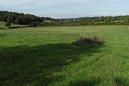
- Price
- Offers Over£5,000
- Size
- 0.02 acres
Added on 25/09/2026Small Plot of Land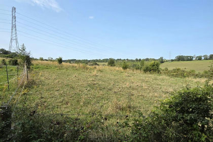
- Price
- Guide Price£13,000
- Size
- 1 acres
Blackness Lane, Milchden, Keston, BR2, Bromley and Biggin Hill, Bromley BR2 England
Added on 18/09/2026Cheap Land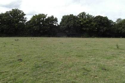
- Price
- £6,750
- Size
- 0.06 acres
Added on 26/09/2026Small Plot of Land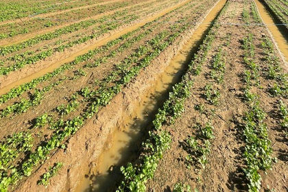
- Price
- Offers in Region of£12,000
Huntercombe Lane South, Slough, Berkshire, SL6, Burnham, Buckinghamshire SL6 England
Added on 16/06/2026Small Plot of Land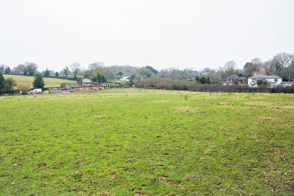
- Price
- £13,900
- Size
- 0.34 acres
Flaunden - Hertfordshire, Flaunden, Hertfordshire HP3 England
Added on 30/06/2026Vacant Land