High House, Holme, Carnforth, Cumbria
- Land size
- 18 acres
- Bedrooms
- 5
- Bathrooms
- 2
Key Features
- Impressive five-bedroom country house combining traditional farmhouse character with beautifully appointed modern accommodation.
- Exceptional open-plan kitchen, dining and sitting room.
- Attractive rural setting on the edge of Holme, with established gardens and far-reaching views towards Farleton Knott.
- Extensive range of ancillary buildings, including substantial garage with accommodation above, agricultural building, and workshop/storage facilities.
- Land with excellent potential for equestrian, grazing, recreational or smallholding interests.
- Highly accessible South Cumbria location, with the A6 and M6 readily accessible and convenient connections to Kendal, Lancaster, the Lake District and Yorkshire Dales
Description
A Located at the end of a no through country lane, in this popular area easily accessible to Kendal, Lancaster and the Lake District, a well-proportioned and presented detached family home,
with generous gardens and adjacent attached level land with modern barn and riding arena, in all circa 18 ac
Guide Price as a Whole: £1,350,000
Lot 1 – House and Gardens £850,000
Lot 2 – Land circa 18 acres £500,000
Description
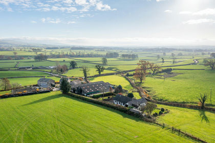
Occupying an attractive rural position on the edge of Holme, High House is an impressive and highly individual country property, combining the character and proportions of a traditional farmhouse with beautifully appointed contemporary accommodation, established gardens, useful ancillary buildings and land, in all circa 18 acres.
Approached by a quiet country lane and surrounded by open countryside, from the house and gardens there are far-reaching pastoral views towards Farleton Knott, while the mature gardens provide an attractive sense of privacy and seclusion.
High House has been thoughtfully transformed to create a comfortable and versatile home, retaining much of the character to be expected of a property of this nature whilst providing the scale and facilities required for modern family life. The accommodation is arranged over two floors and extends to a substantial five-bedroom house, with generous reception and working spaces.
At the heart of the house is an exceptional open-plan kitchen, dining and sitting area, with exposed beams, stone flooring and a wood-burning stove introducing warmth and character. This impressive room provides a natural focus for the house, combining a well-equipped kitchen with dining and informal sitting areas.
A more formal sitting room provides an alternative reception space, with a dual aspect and French doors opening onto the terrace. There is also a separate study, positioned to take advantage of the outlook and providing a quiet environment for working from home. A utility room, rear entrance and downstairs WC complete the ground floor.
The first floor provides five bedrooms, the principal bedroom incorporating fitted storage and an en-suite shower room, whilst the remaining bedrooms are served by a well-appointed, 4 piece family bathroom.
Externally, immediately surrounding the house, are established gardens combining broad areas of lawn, mature trees and planting, together with a substantial terrace positioned to enjoy the rural outlook. A charming garden room provides additional amenity, whilst a small stream and footbridge introduce a particularly attractive natural feature within the grounds. A substantial detached garage incorporates additional accommodation above, whilst a separate agricultural building provides extensive workshop and storage facilities.
Beyond the formal gardens, the property extends into its own land. The present arrangement lends itself particularly well to equestrian interests, grazing, recreation or smallholding use, although the land and associated buildings could readily accommodate a variety of requirements. The outbuildings are equally useful and are currently split into a workshop space and 4 stables with feed room.
There is an all-weather turnout pen which was once part of the arena. The drainage is still in place and could once again be an arena without too much effort.
Despite its rural surroundings, High House enjoys excellent communications. The A6 is readily accessible, with Junction 36 of the M6 within easy reach, providing convenient connections throughout Cumbria, Lancashire and beyond. Kendal, Lancaster and the Lune Valley are readily accessible, whilst the Lake District and Yorkshire Dales are both within comfortable travelling distance. Oxenholme railway station provides access to the West Coast Main Line, including direct services to London Euston.
High House represents a rare opportunity to acquire a substantial country home in an exceptionally attractive and accessible setting. Its combination of character, generous accommodation, established grounds, ancillary buildings and land creates a property of considerable flexibility and appeal, equally suited to family life, rural pursuits or simply enjoying the space and freedom of a private country setting.
Directions
From M6 Junction 36: Leave the M6 at Junction 36 and follow the A65 signposted Kirkby Lonsdale. At the roundabout take the third exit for Holme and Burton onto the A6070. Follow this for 1 mile and turn right towards Milnthorpe. Follwo this lane for 850 metrrs and turn right into the access lane towards Overthwaite Farm. High House is on the right hand side after 700 metres.
what3words dentistry.ambitions.sleeping
Services
Tenure
Freehold.
Vacant possession upon completion.
Key Information
• Standard construction.
• We understand that broadband and mobile telephone reception are available. For an indication of speeds and supply please see the OFCOM website:
• There is private off road vehicle parking.
• There is a foot path to the southern boundary.
Services
Oil powered central heating with mains electric and water being connected. Neither these services nor any boilers or radiators have been tested. Drainage is to a septic tank. Any alterations required to meet current regulations are to be the responsibility of the purchaser.
Energy Performance Certificate
High House – ‘E’.
Wayleaves and Easements
The properties are sold subject to and with the benefit of any existing easements, wayleaves and rights of way. The sale is subject to all the existing rights of way, drainage, light, air support and other easements and quasi-easements and outgoings whether mentioned in these particulars or not.
Boundaries
Where the boundary responsibilities are known they are marked with ‘T’. Where no marking, the boundary responsibilities are unknown.
Sale Plan
The sale plan has been prepared by the selling agent for the convenience of the prospective purchasers. It is deemed to be correct, but any error, omission or misstatement shall not affect the sale. Purchasers must satisfy themselves as to accuracy.
Viewings
Strictly by appointment only through our South Lakes office in Staveley. Tel No. .
Front Porch
Kitchen Living Dining Room
Living Room
Utility Room
Inner hall
Study
First Floor Landing
Bedroom 1
Ensuite Shower Room
Bedroom 2
Bedroom 3
Bedroom 4
Bedroom 5
Bathroom
Garage
Barn 1
Barn 2
Turnout Pen
Map Location
Property details
- Tenure
- Freehold
- Council Tax Band
- E
- Date Posted
- 2026-10-19
Market Value Analysis
Compared with 62 Farms & Smallholdings listings in North West England (10+ acres).
Energy Performance Certificate
Energy Efficiency Rating
Based on UK Energy Performance Certificate standards (EU Directive 2002/91/EC)
Running costs are one side. Planning activity, flood history and ground risks for this location are in the full report.
Utilities & Restrictions
Utilities
- Electricity
- Ask Agent
- Water
- Ask Agent
- Heating
- Ask Agent
- Broadband
- Ask Agent
- Sewerage
- Ask Agent
Rights & Restrictions
- Public Rights of Way
- Ask Agent
- Private Rights of Way
- Ask Agent
- Listed Property
- Ask Agent
- Restrictions
- Ask Agent
Listed status, conservation areas and planning constraints for this location are in the full report.
Property Features
- Accessibility
- Ask Agent
- Parking
- Parking Available
- Garden
- Garden
Beyond the particulars: planning activity, flood history, heritage and ground risks, checked for this exact spot.
Connectivity
Broadband
Fastest speed available at this postcode
10 Mbps
Standard (10-30 Mbps)
Suitable for
- Web & social
- Music streaming
- Standard video calls
Fixed wireless access may also be an option here.
Mobile signal
Predicted 4G and 5G signal; indoor signal depends on building materials.
Ofcom Connected Nations postcode-level predictions. Speeds and signal are modelled, not measured, and vary between addresses and providers.
Signal is the easy part. Planning activity, flood history and protected designations here are in the full report.
Nearest Schools
Primary
- Holme Primary School1.3 milesNo Ofsted rating
- Ages
- 3 to 11
- Pupils
- 122
- Type
- Community school
- Milnthorpe Primary School1.5 milesNo Ofsted rating
- Ages
- 3 to 11
- Pupils
- 176
- Type
- Community school
- Beetham CofE Primary School1.9 milesNo Ofsted rating
- Ages
- 2 to 11
- Pupils
- 51
- Type
- Voluntary aided school
- Faith
- Church of England
- Burton Morewood CofE Primary School2.8 milesOfsted: Good
- Ages
- 2 to 11
- Pupils
- 165
- Type
- Academy converter
- Faith
- Church of England
- St Patrick's CofE School2.9 milesNo Ofsted rating
- Ages
- 2 to 11
- Pupils
- 92
- Type
- Voluntary aided school
- Faith
- Church of England
Secondary
- Dallam School1.5 milesOfsted report card · Apr 2026
- Ages
- 11 to 18
- Pupils
- 761
- Type
- Academy converter
- Queen Elizabeth Studio School5.4 milesOfsted report card · Jun 2026
- Ages
- 14 to 19
- Pupils
- 329
- Type
- Studio schools
- Queen Elizabeth School5.4 milesOfsted: Good
- Ages
- 11 to 18
- Pupils
- 1,155
- Type
- Academy converter
- Kirkbie Kendal School6.6 milesNo Ofsted rating
- Ages
- 11 to 18
- Pupils
- 1,029
- Type
- Academy converter
- Carnforth High School6.8 milesOfsted report card · Apr 2026
- Ages
- 11 to 16
- Pupils
- 657
- Type
- Academy converter
Distances are straight-line from the advertised location. Source: the national school registers (DfE, Welsh Government, Scottish Government) and Ofsted.
Schools are just the start: sold prices nearby, planning activity and any flood history are in the full report.
Amenities
Supermarket
GP surgery
Pharmacy
Hospital
Straight-line distances from the advertised location. Sources: NHS records, Geolytix supermarket locations, OS Open Greenspace and the national trails registers.
The area stacks up? Now check the location itself: planning nearby, protected designations and past flooding.
Getting Around
Nearest station
Nearest bus stop
Typical drive times
Straight-line distances from the advertised location; drive times are typical free-flow times over OpenStreetMap road data, so allow more at peak. Public transport locations from DfT NaPTAN.
Easy to reach matters. So do planning activity, flood history and ground risks: all in the full report.
Flood Risk
Environment Agency open data, checked around the advertised map pin for the listed acreage. Long-term risk counts flood defences; the planning map's flood zones do not. Provided by LandSale, not the listing agent, and not part of the agent's particulars. Risk varies across a holding, so verify before committing.
Rivers and the sea
Planning map: Flood Zone 3.
Surface water
Not at the pin: mapped about 30 metres away.
These bandings are the summary. Where this location sits on the flood maps, plus planning activity, heritage and ground risks, is in the full report.
Important notice: Information, maps and tags on this page are drawn from the advertising agent's marketing materials or generated automatically. LandSale has not verified them. Relying on these details is at your own risk, always carry out independent checks before committing to a purchase.
LandSale full disclaimer
Marketing information only - not formal particulars. The details on this website are provided for general guidance and do not constitute an offer or contract. Neither LandSale nor the advertising estate/land agent accepts responsibility for any inaccuracy.
1. Source of information
- Listing content: Core description, asking price, tenure, measurements, photographs and planning history originate from the marketing materials of the advertising estate or land agent. LandSale does not author this content and cannot guarantee its accuracy.
- Automated tags & categorisation: Property type, land-use class, acreage bands and similar labels may be applied by machine-learning models. They are intended as a helpful guide only and may not reflect the property's legal status or permitted use.
- Third-party & enriched data layers: Maps, boundary outlines, planning designations, soil reports, broadband coverage and other environmental or location-based insights are licensed from external suppliers. Such data are supplied “as is", may be incomplete or out of date and are subject to change without notice.
2. Verification required
Prospective purchasers must verify critical matters, including but not limited to planning permission, title boundaries, public rights of way, environmental constraints, acreage, services, access and VAT status, through their own inspections, specialist surveys, legal advisers and the selling agent before relying on the information or entering into any contract.
3. No warranty or liability
LandSale gives no warranty, express or implied, as to the accuracy, completeness or fitness for any particular purpose of the information displayed. LandSale shall not be liable for any loss, damage, cost or expense arising directly or indirectly from any use of or reliance on such information, save where liability may not be excluded by law.
4. Updates & feedback
If you believe any detail on this listing is inaccurate, please let us know. We will investigate and, where appropriate, update the listing or notify the agent.
© LandSale | Version 1.3 - August 2026
Listing agent
H&H Land & Estates, Carlisle
Borderway Mart, Rosehill, Carlisle, Cumbria, CA1 2RS
Contact H&H Land & Estates, Carlisle
Borderway Mart, Rosehill, Carlisle, Cumbria, CA1 2RS
View agent profileSimilar properties for sale
- Price
- £1,400,000
- Size
- 14.83 acres
Mill Bank, Kirkby Lonsdale, Carnforth, LA6, Whittington, Lancashire LA6 England
Added on 29/01/2026Farmhouse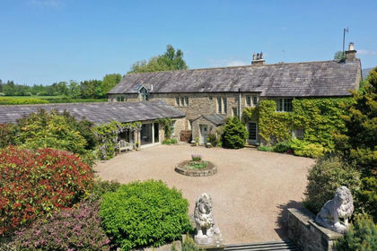
- Price
- Guide Price£1,500,000
- Size
- 10.55 acres
Low Gale Barn, Cowan Bridge, LA6, Burrow-with-Burrow, Lancashire LA6 England
Added on 29/01/2026Barn Conversion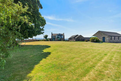
- Price
- £1,600,000
- Size
- 25 acres
Parkside Farm, Tatham, Tatham, LA2, Tatham, Lancashire LA2 England
Added on 21/08/2026House with Land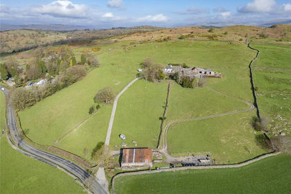
- Price
- Guide Price£1,550,000
- Size
- 53.92 acres
Sunny Brow Farm, Crook, Kendal, Cumbria, Crook, Westmorland and Furness LA8 England
Added on 03/10/2026Farm
- Price
- Guide Price£1,250,000
- Size
- 9.45 acres
Conder Mill Farm, Wyresdale Road, Quernmore, Lancashire, LA2, Scotforth, Lancashire LA2 England
Added on 02/07/2026Smallholding
- Price
- £1,395,000
- Size
- 13.88 acres
Coast Road, Roosebeck, Ulverston, Cumbria, Aldingham, Westmorland and Furness LA12 England
Added on 29/01/2026Barn Conversion
- Price
- Guide Price£1,250,000
- Size
- 43.08 acres
Soulby, Kirkby Stephen, CA17, Soulby, Westmorland and Furness CA16 England
Added on 26/06/2026Smallholding
- Price
- £1,495,000
- Size
- 77.11 acres
Syke Side Farm, Soulby, Kirkby Stephen, Cumbria, CA17, Soulby, Westmorland and Furness CA17 England
Added on 29/01/2026Farm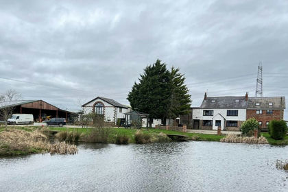
- Price
- £1,250,000
- Size
- 50 acres
Moor Hall Farm, School Lane, Out Rawcliffe, Lancashire, PR3, Out Rawcliffe, Lancashire PR3 England
Added on 17/03/2026Small Farm
- Price
- £1,200,000
- Size
- 23.23 acres
Eaves Lane, Woodplumpton, Preston, Lancashire, Woodplumpton, Lancashire PR4 England
Added on 25/08/2026Farmhouse