Land Off The B4084, Drakes Broughton, Worcestershire, WR10
- Land size
- 13.4 acres
Key Features
- LOT A - Land with outline permission for up to 45 no. dwellings
- LOT B - Land with an outline application submitted for up to 45 no. dwellings
Description
LOT A - Land with outline permission for up to 45 no. dwellings
LOT B - Land with an outline application submitted for up to 45 no. dwellings
The site is located off the B4084 on the southern edge of the village of Drakes Broughton. Drakes Broughton is a village in Worcestershire approximately 2 miles north west of the market town of Pershore and 7 miles south east of the cathedral city of Worcester. The site is conveniently located within close proximity of major road networks to include the A44 Evesham Road and the B4084, providing direct links to the nearby towns of Pershore and Evesham. Junction 7 of the M5 motorway is within easy distance of the site situated some 4.4 miles west connecting the site to Gloucester and Birmingham.
The village of Drakes Broughton offers a range of amenities to include a Public House, first & middle school, a convenience store, post office and village hall. Further amenities to include retail and leisure facilities, schools and restaurants can be found in Pershore and Evesham along with Worcestershire Parkway Train Station some 3 miles away from the site. The X50 bus route provides regular services connecting Evesham, Pershore, Drakes Broughton and Worcester.
Pershore Town Centre - 2.8 miles
Worcester City Centre - 7.2 miles
Evesham Town Centre- 9.7 miles
Worcestershire Parkway Train Station - 3.3 miles
LOT A extends to approximately 6.75 acres* and comprises a grass field with hedgerows and tree planting along the boundaries. In terms of topography, the site is relatively flat with a gradual decline from the north west corner to the south east corner. The site is bound to the north by residential dwellings, to the east by the remainder of the field within the same ownership. To the west of the site is the B4084, along which are a number of residential dwellings. The site currently has a field gate providing access to the site off the B4084.
LOT B extends to approximately 6.49 acres* (including the access road) and currently consists of an open parcel of grassland. The application site is characterised as grazing land situated on the southern edge of a large village. The site has road frontage to Brickyard Lane, but will be accessed via Phase 1 which is served off the B4084. Existing residential properties adjoin the site to the north and east with mature hedgerows bordering the majority of the site.
*the areas are based on each planning application boundary. The site ownership extends to c.13.40 acres (5.36 ha).
Parties are to make their own enquiries as to the availability of services and we have not made any investigations in this regard.
The developer is to provide an allowance for service connection points to the boundary of Phase 1, with sufficient capacity to serve a potential Phase 2 development.
The site falls within the administrative area of Wychavon District Council. The following application has been submitted and approved for Lot A:
W/24/01485/OUT - Outline planning application with all matters reserved, except for access, for up to 45 no. dwellings, including 18 no. affordable dwellings and associated works. - Planning approved on the 9th February 2026.
The following application has been submitted for Lot B as follows:
W/26/00171/OUT - Outline planning application with all matters reserved, except for access, for up to 45 no. dwellings, including 18 no. affordable dwellings and associated works. Application validated on the 12th February 2026.
The Proposed Scheme
LOT A
The proposed development comprises a scheme of up to 45 no. dwellings. The permission is in outline form, with appearance, scale, layout and landscaping to be reserved for future consideration. The access however, is detailed within the outline application and is proposed to be taken directly off the B4084 (Worcester Road) on the western boundary of the site, whereby a section of existing hedgerow is proposed to be removed to allow for the new site access.
Although in outline form, an accommodation schedule has been provided with the application. The proposed mix comprises 27 no. open market and 18 no. affordable dwellings (40%). The layout proposes a mix of semi-detached and detached, 2-storey dwellings with parking spaces meeting the parking requirements. All open market 3-bedroom dwellings have single garages and 4-bedroom dwellings have double garages.
There is a pedestrian link in the northern corner of the site to an existing PROW which runs parallel with the northern boundary.
LOT B
Lot B forms Phase 2 of a wider scheme, with the consented Phase 1 (W/24/01485/OUT) to the west. The application has recently been submitted (validation 12th February 2026). The proposed scheme provides for 27 no. open market and 18 no. affordable dwellings. The site access is located along the western boundary through the consented Phase 1 layout. The key spine road runs east across the site, curving south along the edge of the public open space and looping back on itself.
Section 106 Agreement
The S.106 has been signed as of 4th February 2026 for Lot A, with the following terms stated:
Education (Early Years) - £115,565
Education (First School) - £231,130
Affordable Housing - 40% (70% Social Rent and 30% Affordable Home Ownership)
Healthcare - £28,800
Built Sports Contribution - £32,105 towards Pershore Leisure Centre
Formal Sports Contribution - Between £41,742 and £104,490 towards enhancing the pitch facilities in Drakes Broughton
BNG Monitoring Contribution - £5,448 in relation to the monitoring of the implementation of the BNG plan.
BNG - off-site BNG provision
Community Infrastructure Levy
The proposed development may attract Community Infrastructure Levy. We note from Wychavon District Council's Charging Schedule that the CIL rate for 'Residential - all other areas' for 'Wychavon' is £40/sqm (plus indexation).
The landowner retains the ability to opt to tax.
The sites are offered for sale by way of informal tender. Offers are invited on the following basis:
- LOT A - unconditional offers
- LOT B - unconditional and conditional (STP) offers
Offers should be submitted in accordance with the 'Financial Proposal Form' contained within the Data Room and be received by Bruton Knowles prior to Noon on Tuesday 12th May 2026.
Offers should be sent via email to Harry Breakwell - [email protected].
The purchaser is to contribute £10,000 + VAT towards the vendor's abortive legal fees. An undertaking will be required upon agreement of Heads of Terms. The purchaser is to contribute £10,000 + VAT towards Bruton Knowles fee for Lot B only.
Viewing of the sites is by appointment only with Bruton Knowles.
Map Location
Property details
- Tenure
- Freehold
- Council Tax Band
- Ask Agent
- Date Posted
- 2026-10-19
Property Brochure
Seen the details? The full report adds the independent checks: planning activity, flood history, heritage and ground.
Utilities & Restrictions
Utilities
- Electricity
- Ask Agent
- Water
- Ask Agent
- Heating
- Ask Agent
- Broadband
- Ask Agent
- Sewerage
- Ask Agent
Rights & Restrictions
- Public Rights of Way
- Ask Agent
- Private Rights of Way
- Ask Agent
- Listed Property
- Ask Agent
- Restrictions
- Ask Agent
Listed status, conservation areas and planning constraints for this location are in the full report.
Property Features
- Accessibility
- Ask Agent
- Parking
- Ask Agent
- Garden
- Ask Agent
Beyond the particulars: planning activity, flood history, heritage and ground risks, checked for this exact spot.
Connectivity
Broadband
Fastest speed available at this postcode
1.8 Gbps
Gigabit full fibre · available to 78% of premises
Suitable for
- 4K streaming on every screen
- Full-time home working
- Online gaming & big downloads
Mobile signal
Predicted 4G and 5G signal; indoor signal depends on building materials.
Ofcom Connected Nations postcode-level predictions. Speeds and signal are modelled, not measured, and vary between addresses and providers.
Signal is the easy part. Planning activity, flood history and protected designations here are in the full report.
Nearest Schools
Primary
- St Barnabas CofE Primary School284 metresOfsted: Good
- Ages
- 2 to 12
- Pupils
- 190
- Type
- Academy converter
- Faith
- Church of England
- Pinvin CofE Academy1.7 milesOfsted: Good
- Ages
- 2 to 12
- Pupils
- 220
- Type
- Academy converter
- Faith
- Church of England
- Orchard Primary School1.8 milesOfsted report card · Feb 2026
- Ages
- 2 to 11
- Pupils
- 185
- Type
- Academy converter
- Abbey Park Primary School1.9 milesOfsted: Good
- Ages
- 2 to 12
- Pupils
- 289
- Type
- Community school
- Holy Redeemer Catholic Primary School1.9 milesOfsted: Good
- Ages
- 2 to 11
- Pupils
- 184
- Type
- Voluntary aided school
- Faith
- Roman Catholic
Secondary
- Pershore High School1.5 milesOfsted: Requires improvement
- Ages
- 11 to 18
- Pupils
- 1,055
- Type
- Academy converter
- Nunnery Wood High School5 milesOfsted: Good
- Ages
- 11 to 16
- Pupils
- 1,488
- Type
- Academy converter
- Blessed Edward Oldcorne Catholic College5.6 milesNo Ofsted rating
- Ages
- 11 to 16
- Pupils
- 1,036
- Type
- Voluntary aided school
- Faith
- Roman Catholic
- Christopher Whitehead Language College6.5 milesNo Ofsted rating
- Ages
- 11 to 18
- Pupils
- 1,580
- Type
- Academy converter
- Hanley Castle High School6.7 milesOfsted: Good
- Ages
- 11 to 18
- Pupils
- 1,142
- Type
- Academy converter
Distances are straight-line from the advertised location. Source: the national school registers (DfE, Welsh Government, Scottish Government) and Ofsted.
Schools are just the start: sold prices nearby, planning activity and any flood history are in the full report.
Amenities
Supermarket
GP surgery
Pharmacy
Hospital
Green space
Straight-line distances from the advertised location. Sources: NHS records, Geolytix supermarket locations, OS Open Greenspace and the national trails registers.
The area stacks up? Now check the location itself: planning nearby, protected designations and past flooding.
Getting Around
Nearest station
Nearest bus stop
Typical drive times
Straight-line distances from the advertised location; drive times are typical free-flow times over OpenStreetMap road data, so allow more at peak. Public transport locations from DfT NaPTAN.
Easy to reach matters. So do planning activity, flood history and ground risks: all in the full report.
Flood Risk
Environment Agency open data, checked around the advertised map pin for the listed acreage. Long-term risk counts flood defences; the planning map's flood zones do not. Provided by LandSale, not the listing agent, and not part of the agent's particulars. Risk varies across a holding, so verify before committing.
Rivers and the sea
Planning map: Flood Zone 1.
Surface water
Not at the pin: mapped about 10 metres away.
These bandings are the summary. Where this location sits on the flood maps, plus planning activity, heritage and ground risks, is in the full report.
Important notice: Information, maps and tags on this page are drawn from the advertising agent's marketing materials or generated automatically. LandSale has not verified them. Relying on these details is at your own risk, always carry out independent checks before committing to a purchase.
LandSale full disclaimer
Marketing information only - not formal particulars. The details on this website are provided for general guidance and do not constitute an offer or contract. Neither LandSale nor the advertising estate/land agent accepts responsibility for any inaccuracy.
1. Source of information
- Listing content: Core description, asking price, tenure, measurements, photographs and planning history originate from the marketing materials of the advertising estate or land agent. LandSale does not author this content and cannot guarantee its accuracy.
- Automated tags & categorisation: Property type, land-use class, acreage bands and similar labels may be applied by machine-learning models. They are intended as a helpful guide only and may not reflect the property's legal status or permitted use.
- Third-party & enriched data layers: Maps, boundary outlines, planning designations, soil reports, broadband coverage and other environmental or location-based insights are licensed from external suppliers. Such data are supplied “as is", may be incomplete or out of date and are subject to change without notice.
2. Verification required
Prospective purchasers must verify critical matters, including but not limited to planning permission, title boundaries, public rights of way, environmental constraints, acreage, services, access and VAT status, through their own inspections, specialist surveys, legal advisers and the selling agent before relying on the information or entering into any contract.
3. No warranty or liability
LandSale gives no warranty, express or implied, as to the accuracy, completeness or fitness for any particular purpose of the information displayed. LandSale shall not be liable for any loss, damage, cost or expense arising directly or indirectly from any use of or reliance on such information, save where liability may not be excluded by law.
4. Updates & feedback
If you believe any detail on this listing is inaccurate, please let us know. We will investigate and, where appropriate, update the listing or notify the agent.
© LandSale | Version 1.3 - August 2026

Listing agent
Bruton Knowles, Gloucester
Olympus House, Olympus Park, Gloucester, GL2 4NF
Contact Bruton Knowles, Gloucester
Olympus House, Olympus Park, Gloucester, GL2 4NF
View agent profileSimilar properties for sale
- Price
- Guide Price£395,000
- Size
- 33.03 acres
33.03 Acres Arable Land, Hatfield, Worcester, Norton Juxta Kempsey, Worcestershire WR5 England
Added on 17/08/2026Arable Land
- Price
- Offers in Region of£200,000
- Size
- 15.68 acres
Hill, Throckmorton Road, Pershore, Hill and Moor, Worcestershire WR10 England
Added on 03/08/2026Agricultural Land
- Price
- POA
- Size
- 16.62 acres
Land North Of B4082, Upton Snodsbury, Worcestershire, WR7, , Worcestershire WR7 England
Added on 08/09/2026Development Land
- Price
- POA
- Size
- 17.5 acres
Added on 06/05/2026Greenfield Land
- Price
- Guide Price£325,000
- Size
- 22.7 acres
Inkberrow, Worcestershire, Inkberrow, Worcestershire WR7 England
Added on 24/09/2026Agricultural Land
- Price
- Guide Price£500,000
- Size
- 28.55 acres
Inkberrow, Worcestershire, Inkberrow, Worcestershire WR7 England
Added on 24/09/2026Agricultural Land
- Price
- Guide Price£560,000
- Size
- 56.85 acres
Added on 09/10/2026Farmland
- Price
- Offers in Region of£980,000
- Size
- 97.65 acres
Added on 15/10/2026Farmland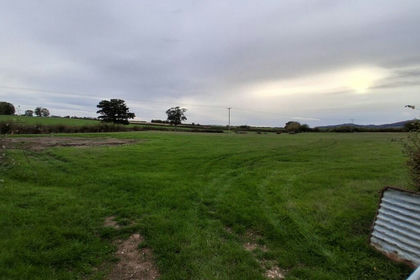
- Price
- Offers in Region of£150,000
- Size
- 14.62 acres
Added on 15/10/2026Grazing Land
- Price
- Guide Price£436,500
- Size
- 43.65 acres
Added on 09/10/2026Arable Land