Oldfield Meadow, Holsworthy, Devon
- Land size
- 2.66 acres
Description
Oldfield Meadow is ideal for anyone considering investing in a small piece of England with a vision of planting a substantial amount of new woodland.
It is located on the Cornwall / Devon border in a remarkably beautiful and privileged location and is a piece of land with an incredibly special presence, which captures the warmth of the sun's rays throughout those sunny days.
Access is gained through a padlocked gate just off the public highway, where after entering the gate you will turn right inside the field onto the track, for approx. 70 meters (alongside the public highway). You will then take a left turn down the track until you pass the wooden post and rail fence on your right, at which point you should notice some hard standing parking on the right. You will see a wooden ride stop along with a name plate printed with “Oldfield Meadow.”
You will be amazed by the magnificent views as you gaze northward over the valley towards Hollacombe and beyond; there are breath-taking views as far as the eye can see. This piece of land accommodates mature and established hedgerows along the north and east sides of the meadow, which not only act as splendid boundaries, but also provide a certain amount of shelter from the elements and promotes privacy screening between adjoining meadows. The south side of the meadow is demarcated by a post and rail fence which extends from the eastern boundary to the west side of the meadow where the access track runs.
The land itself has a moderate yet gentle downward slope from the south to the north, which has the advantage of aiding natural drainage in heavy rainfall. A generous amount of convenient hard standing has been laid for parking at the western edge of the meadow which can accommodate space for a couple of vehicles to park and manoeuvre.
This parcel of land has had an extensive agricultural history and has previously been used as pastureland for sheep and cattle as well as creating animal fodder from hay and silage. It has great potential for a new custodian with the opportunity to transform the landscape via the planting of new woodlands. This would compliment the network of established trees which already surround the meadow in the nearby landscape whilst also leaving a legacy for future generations to enjoy.
The land and local area is already an important sanctuary for wildlife, hosting a variety of species including deer, rabbits, and badgers to name but a few. The addition of new woodland into this open area can only serve to extend the diverse habitats that are already present.
Converting these meadows into woodland will bring more biodiversity to the land and local area and will act as an important corridor for wildlife to travel through. Standing trees in the vicinity will provide a source of seeds, aiding the process of woodland establishment through natural regeneration which would work synergistically with active tree planting. Grant funding is available for those who wish to make use of it.
This meadow would most definitely bring an abundance of enjoyment and a sense of achievement to anyone interested in pursuing woodland creation, not only for personal enjoyment and amenity purposes, but also for those interested in carbon offsetting.
Map Location
Property details
- Tenure
- Ask Agent
- Council Tax Band
- Ask Agent
- Date Posted
- 2026-10-17
Market Value Analysis
Compared with 22 Cheap Land listings in South West England (1+ acres).
Utilities & Restrictions
Utilities
- Electricity
- Ask Agent
- Water
- Ask Agent
- Heating
- Ask Agent
- Broadband
- Ask Agent
- Sewerage
- Ask Agent
Rights & Restrictions
- Public Rights of Way
- Ask Agent
- Private Rights of Way
- Ask Agent
- Listed Property
- Ask Agent
- Restrictions
- Ask Agent
Listed status, conservation areas and planning constraints for this location are in the full report.
Property Features
- Accessibility
- Ask Agent
- Parking
- Ask Agent
- Garden
- Ask Agent
Beyond the particulars: planning activity, flood history, heritage and ground risks, checked for this exact spot.
Connectivity
Broadband
Fastest speed available at this postcode
3 Mbps
Under 10 Mbps here
Suitable for
- Basic browsing & email
Fixed wireless access may also be an option here.
Mobile signal
Predicted 4G and 5G signal; indoor signal depends on building materials.
Ofcom Connected Nations postcode-level predictions. Speeds and signal are modelled, not measured, and vary between addresses and providers.
Signal is the easy part. Planning activity, flood history and protected designations here are in the full report.
Nearest Schools
Primary
- Clawton Academy2.1 milesOfsted: Requires improvement *
- Ages
- 2 to 11
- Pupils
- 82
- Type
- Academy converter
- Ashwater Primary School2.5 milesNo Ofsted rating
- Ages
- 2 to 11
- Pupils
- 42
- Type
- Community school
- Halwill Community Primary School3.7 milesOfsted: Good *
- Ages
- 4 to 11
- Pupils
- 77
- Type
- Community school
- Holsworthy Church of England Primary School3.8 milesNo Ofsted rating
- Ages
- 0 to 11
- Pupils
- 338
- Type
- Voluntary controlled school
- Faith
- Church of England
- Bradford Primary School4.2 milesOfsted: Good
- Ages
- 2 to 11
- Pupils
- 24
- Type
- Academy converter
Secondary
- Holsworthy Community College3.8 milesNo Ofsted rating
- Ages
- 11 to 16
- Pupils
- 551
- Type
- Academy converter
- Launceston College11 milesOfsted: Good
- Ages
- 11 to 18
- Pupils
- 1,205
- Type
- Academy converter
- Budehaven Community School11 milesOfsted: Good
- Ages
- 11 to 18
- Pupils
- 1,145
- Type
- Foundation school
- Okehampton College13 milesOfsted report card · Jan 2026
- Ages
- 11 to 18
- Pupils
- 1,066
- Type
- Academy converter
- Great Torrington School14 milesNo Ofsted rating
- Ages
- 11 to 16
- Pupils
- 863
- Type
- Academy converter
* Latest graded judgement covers quality of education only; no overall grade was issued under the 2024-25 inspection framework.
Distances are straight-line from the advertised location. Source: the national school registers (DfE, Welsh Government, Scottish Government) and Ofsted.
Schools are just the start: sold prices nearby, planning activity and any flood history are in the full report.
Amenities
Supermarket
GP surgery
Pharmacy
Hospital
Straight-line distances from the advertised location. Sources: NHS records, Geolytix supermarket locations, OS Open Greenspace and the national trails registers.
The area stacks up? Now check the location itself: planning nearby, protected designations and past flooding.
Getting Around
Nearest station
Nearest bus stop
Typical drive times
Straight-line distances from the advertised location; drive times are typical free-flow times over OpenStreetMap road data, so allow more at peak. Public transport locations from DfT NaPTAN.
Easy to reach matters. So do planning activity, flood history and ground risks: all in the full report.
Flood Risk
Environment Agency open data, checked around the advertised map pin for the listed acreage. Long-term risk counts flood defences; the planning map's flood zones do not. Provided by LandSale, not the listing agent, and not part of the agent's particulars. Risk varies across a holding, so verify before committing.
Rivers and the sea
Planning map: Flood Zone 1.
Surface water
Not at the pin: mapped about 10 metres away.
These bandings are the summary. Where this location sits on the flood maps, plus planning activity, heritage and ground risks, is in the full report.
Important notice: Information, maps and tags on this page are drawn from the advertising agent's marketing materials or generated automatically. LandSale has not verified them. Relying on these details is at your own risk, always carry out independent checks before committing to a purchase.
LandSale full disclaimer
Marketing information only - not formal particulars. The details on this website are provided for general guidance and do not constitute an offer or contract. Neither LandSale nor the advertising estate/land agent accepts responsibility for any inaccuracy.
1. Source of information
- Listing content: Core description, asking price, tenure, measurements, photographs and planning history originate from the marketing materials of the advertising estate or land agent. LandSale does not author this content and cannot guarantee its accuracy.
- Automated tags & categorisation: Property type, land-use class, acreage bands and similar labels may be applied by machine-learning models. They are intended as a helpful guide only and may not reflect the property's legal status or permitted use.
- Third-party & enriched data layers: Maps, boundary outlines, planning designations, soil reports, broadband coverage and other environmental or location-based insights are licensed from external suppliers. Such data are supplied “as is", may be incomplete or out of date and are subject to change without notice.
2. Verification required
Prospective purchasers must verify critical matters, including but not limited to planning permission, title boundaries, public rights of way, environmental constraints, acreage, services, access and VAT status, through their own inspections, specialist surveys, legal advisers and the selling agent before relying on the information or entering into any contract.
3. No warranty or liability
LandSale gives no warranty, express or implied, as to the accuracy, completeness or fitness for any particular purpose of the information displayed. LandSale shall not be liable for any loss, damage, cost or expense arising directly or indirectly from any use of or reliance on such information, save where liability may not be excluded by law.
4. Updates & feedback
If you believe any detail on this listing is inaccurate, please let us know. We will investigate and, where appropriate, update the listing or notify the agent.
© LandSale | Version 1.3 - August 2026
Contact Woodlands.co.uk

19 Half Moon Lane, London, SE24 9JU
Call agent
07952 694 652Similar properties for sale
- Price
- Offers in Region of£40,000
- Size
- 2.15 acres
Added on 02/09/2026Pasture
- Price
- Fixed Price£65,000
- Size
- 4 acres
Added on 17/10/2026Farmland
- Price
- Guide Price£65,000
- Size
- 7.8 acres
Tregreenwell, Bodmin, PL30, Camelford, Cornwall PL30 England
Added on 22/09/2026Pasture
- Price
- Offers in Excess of£55,000
- Size
- 2.2 acres
Added on 14/10/2026Farmland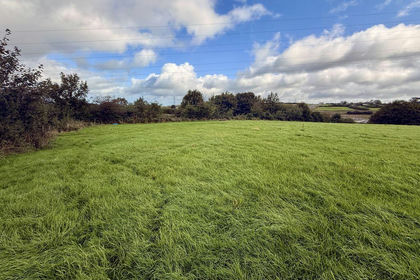
- Price
- Guide Price£25,000
- Size
- 1.92 acres
1.92 acres of land at Coldvreath, Roche, Roche, Cornwall PL26 England
Added on 21/09/2026Pasture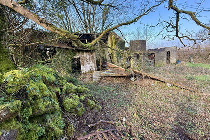
- Price
- Guide Price£60,000
- Size
- 4.92 acres
4.92 acres of land and Barn at Coldvreath, Roche, Roche, Cornwall PL26 England
Added on 21/09/2026Agricultural Land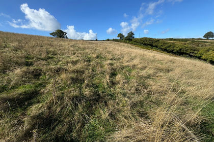
- Price
- Guide Price£65,000
- Size
- 10.09 acres
Combeinteignhead, Newton Abbot - Lot 2, TQ12, Newton Abbot, Devon TQ12 England
Added on 15/10/2026Agricultural Land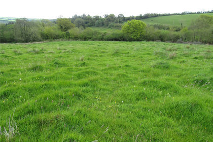
- Price
- Guide Price£50,000
- Size
- 5.38 acres
Lot 3: 5.38 Acres, Wigford Meadows, Loddiswell, Kingsbidge, TQ7, Kingsbidge, Devon TQ7 England
Added on 21/05/2026Pasture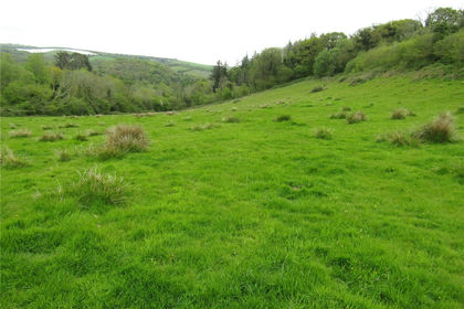
- Price
- Guide Price£60,000
- Size
- 7.6 acres
Lot 2: 7.60 Acres, Wigford Meadows, Loddiswell, Kingsbidge, TQ7, Kingsbidge, Devon TQ7 England
Added on 21/05/2026Pasture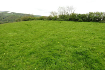
- Price
- Guide Price£50,000
- Size
- 6.64 acres
Lot 1: 6.64 acres, Wigford Meadows, Loddiswell, Kingsbidge, TQ7, Kingsbidge, Devon TQ7 England
Added on 20/05/2026Pasture