Watery Lane, Matching Green, Harlow, Essex, CM17
- Land size
- 1 acres
- Bedrooms
- 3
- Bathrooms
- 3
Description
Architecture and History
The Brewhouse is a sympathetically and wonderfully renovated home, forming part of the land for the adjacent Waterman’s End Farmhouse. Set in just over an acre, the maturity of the plot is its strength with established hedging and mature trees.
Built as a half-timbered building, the construction consists of a timber frame overlaid with a brick infill, meaning it is both an energy efficient and low maintenance home. Ceiling beams, a fireplace and a baking oven door have been preserved from the original dwelling, and long plank oak flooring is present throughout the home, curating a warm, classic aesthetic.
Travelling up the 50-metre private driveway, a subtle entrance leads into a utility space finished with marble quartz work tops. A dream kitchen slices through to the reception room, and features fully-integrated appliances, granite worktops and hardwood cabinetry.
The reception room really is the fulcrum of this home and at over ten metres in length it easily accommodates for distinct dining, entertaining and relaxation areas. Three sets of double doors lead out onto terraces and a lawn, cleverly positioned on a bright south easterly aspect ensuring tonnes of natural light throughout the day. This is the definition of inside/out living.
Three double bedrooms fan off from the reception room, adjoining one ensuite bathroom and two shower rooms. The principle bedroom retains the ceiling beams and fireplace and is a peaceful setting, that could also be used as an additional sitting room.
Outside the two terraces and garden are a wonderful place to relax. The longest terrace runs alongside the entire reception room, and the covered side terrace is the perfect al-fresco dining spot. The wide lawn has been elegantly maintained over the years featuring beautiful rose borders, a wide variety of shrubbery across the plot and marvellous far-reaching views over fields and woods.
There is plenty of storage and even a workshop onsite provided by a 10-metre-long shed, accessible from both the driveway and the garden.
Sustainability is key to all modern property conversions, particularly adapting to an ever-changing climate. The Brewhouse is no exception, with full air conditioning throughout the home powered by individual air source heat pumps. There is an active fire provided by an integrated wood burner, perfect for winter, which also heats the hot water & radiators, by an efficient inbuilt back burner system.
Local Area and Transport
The Brewhouse is part of Waterman’s End, a significant example of a late 16th century hamlet in the heart of rural Essex, close to the greatly respected village of Matching Green. Often cited amongst the most attractive villages in Essex, it is listed in the Domesday Book as ‘Matcinga’, which is derived from Old English.
The village green is a sumptuous affair set across 13-acres, with Matching Green Cricket Club playing cricket here since 1833. The green is framed by some remarkable properties all located within a beautifully maintained conservation area. The Chequers Inn is your local gastropub on the green either a 90 second drive or a 5-minute stroll.
Matching Green CofE Primary School is just down the road, rated ‘good’ by Ofted and is at the heart of the local community. There is a plethora of great independent & state secondary schools all within a 20-30-minute drive.
Enjoying a practical position for both Harlow town and Bishops Stortford, they both provide all the shopping, recreational and essential services required from thriving local towns.
Accessibility to both the M11 and M25 is quick and you can be in Cambridge within 50 minutes and North London in under an hour. Epping Underground Station, connecting with the Central Line, is a short 15 minutes drive away, and mainline rail services from Harlow Town station into London Liverpool Street take approx. 30 minutes.
Material Information
- Property construction: Timber Frame, Brick Infill
- ?Heating type: Air conditioning & cooling, electrically driven by individual air source heat pumps. Integrated wood burner, which also heats the hot water & radiators, via an inbuilt back burner system.
- ?Utilities: Electricity, Water, Sewerage
- ?Electricity supply: Independently supplied by Octopus Energy
- ?Water supply & Sewerage: Mains connected via Affinity Water
- ?Broadband: [Standard Download speed 5mbps; Upload Speed 0.7mbps. Superfast Download speed 72mbps; Upload Speed 18mbps). Ultrafast NOT available. Source: Ofcom
- ?Mobile signal/coverage: Good/Variable outdoor coverage on EE, Three & Vodafone. Poor outdoor coverage on O2. Source: Ofcom
- ?Restrictions: Grade 2 Curtilage Listed. Property located in the Metropolitan Green Belt Area.
- Flood risk: Very low risk of any type of flooding. Source: Gov.uk
- ?Planning permission: The property has all the required permissions. No further planning in the immediate area. Source: Gov.uk
- ?Accessibility/adaptations: Property is suitable for wheelchair users as all on ground level, apart from two front steps, which are easily adapted.
- ?Coalfield or mining area: No. Source: The Coal Authority
- ?Flight path: No. Source: Flightradar24?
Planning permission: The property has all the required permissions. No further planning in the immediate area. Mobile signal information: Mobile signal/coverage: Good/Variable outdoor coverage on EE, Three & Vodafone. Poor outdoor coverage on O2. Source: Ofcom
Map Location
Property details
- Tenure
- Freehold
- Council Tax Band
- A
- Date Posted
- 2026-10-09
Market Value Analysis
Compared with 1,142 Homes with Land listings in East Anglia (1+ acres).
Utilities & Restrictions
Utilities
- Electricity
- Mains
- Water
- Mains
- Heating
- Ask Agent
- Broadband
- Standard Copper (ADSL)
- Sewerage
- Mains
Rights & Restrictions
- Public Rights of Way
- Ask Agent
- Private Rights of Way
- Ask Agent
- Listed Property
- Ask Agent
- Restrictions
- Ask Agent
Listed status, conservation areas and planning constraints for this location are in the full report.
Property Features
- Accessibility
- Ask Agent
- Parking
- Driveway
- Garden
- Private Garden
Beyond the particulars: planning activity, flood history, heritage and ground risks, checked for this exact spot.
Connectivity
Broadband
Fastest speed available at this postcode
80 Mbps
Superfast
Suitable for
- HD streaming
- Video calls
- Web & social
Mobile signal
Predicted 4G and 5G signal; indoor signal depends on building materials.
Ofcom Connected Nations postcode-level predictions. Speeds and signal are modelled, not measured, and vary between addresses and providers.
Signal is the easy part. Planning activity, flood history and protected designations here are in the full report.
Nearest Schools
Primary
- Matching Green Church of England Voluntary Controlled Primary School305 metresOfsted: Good
- Ages
- 4 to 11
- Pupils
- 92
- Type
- Voluntary controlled school
- Faith
- Church of England
- Moreton Church of England Voluntary Aided Primary School2.2 milesOfsted: Good
- Ages
- 4 to 11
- Pupils
- 191
- Type
- Voluntary aided school
- Faith
- Church of England
- Sheering Church of England Voluntary Controlled Primary School2.9 milesOfsted: Requires improvement *
- Ages
- 4 to 11
- Pupils
- 62
- Type
- Voluntary controlled school
- Faith
- Church of England
- Hatfield Heath Primary School3 milesNo Ofsted rating
- Ages
- 4 to 11
- Pupils
- 210
- Type
- Academy converter
- Dr Walker's CofE Primary School3 milesOfsted: Requires improvement
- Ages
- 4 to 11
- Pupils
- 50
- Type
- Academy converter
- Faith
- Church of England
Secondary
- The Ongar Academy3.9 milesNo Ofsted rating
- Ages
- 11 to 18
- Pupils
- 467
- Type
- Free schools
- Mark Hall Academy4.2 milesOfsted: Requires improvement *
- Ages
- 11 to 16
- Pupils
- 867
- Type
- Academy sponsor led
- Passmores Academy4.6 milesNo Ofsted rating
- Ages
- 11 to 16
- Pupils
- 1,199
- Type
- Academy converter
- Leventhorpe4.8 milesOfsted: Good
- Ages
- 11 to 18
- Pupils
- 1,463
- Type
- Academy converter
- Burnt Mill Academy5.1 milesOfsted: Good
- Ages
- 11 to 16
- Pupils
- 959
- Type
- Academy converter
* Latest graded judgement covers quality of education only; no overall grade was issued under the 2024-25 inspection framework.
Distances are straight-line from the advertised location. Source: the national school registers (DfE, Welsh Government, Scottish Government) and Ofsted.
Schools are just the start: sold prices nearby, planning activity and any flood history are in the full report.
Amenities
Supermarket
GP surgery
Pharmacy
Hospital
Green space
Straight-line distances from the advertised location. Sources: NHS records, Geolytix supermarket locations, OS Open Greenspace and the national trails registers.
The area stacks up? Now check the location itself: planning nearby, protected designations and past flooding.
Getting Around
Nearest station
Nearest bus stop
Typical drive times
Straight-line distances from the advertised location; drive times are typical free-flow times over OpenStreetMap road data, so allow more at peak. Public transport locations from DfT NaPTAN.
Easy to reach matters. So do planning activity, flood history and ground risks: all in the full report.
Flood Risk
Environment Agency open data, checked around the advertised map pin for the listed acreage. Long-term risk counts flood defences; the planning map's flood zones do not. Provided by LandSale, not the listing agent, and not part of the agent's particulars. Risk varies across a holding, so verify before committing.
Rivers and the sea
Planning map: Flood Zone 1.
Surface water
Not at the pin: mapped about 30 metres away.
These bandings are the summary. Where this location sits on the flood maps, plus planning activity, heritage and ground risks, is in the full report.
Important notice: Information, maps and tags on this page are drawn from the advertising agent's marketing materials or generated automatically. LandSale has not verified them. Relying on these details is at your own risk, always carry out independent checks before committing to a purchase.
LandSale full disclaimer
Marketing information only - not formal particulars. The details on this website are provided for general guidance and do not constitute an offer or contract. Neither LandSale nor the advertising estate/land agent accepts responsibility for any inaccuracy.
1. Source of information
- Listing content: Core description, asking price, tenure, measurements, photographs and planning history originate from the marketing materials of the advertising estate or land agent. LandSale does not author this content and cannot guarantee its accuracy.
- Automated tags & categorisation: Property type, land-use class, acreage bands and similar labels may be applied by machine-learning models. They are intended as a helpful guide only and may not reflect the property's legal status or permitted use.
- Third-party & enriched data layers: Maps, boundary outlines, planning designations, soil reports, broadband coverage and other environmental or location-based insights are licensed from external suppliers. Such data are supplied “as is", may be incomplete or out of date and are subject to change without notice.
2. Verification required
Prospective purchasers must verify critical matters, including but not limited to planning permission, title boundaries, public rights of way, environmental constraints, acreage, services, access and VAT status, through their own inspections, specialist surveys, legal advisers and the selling agent before relying on the information or entering into any contract.
3. No warranty or liability
LandSale gives no warranty, express or implied, as to the accuracy, completeness or fitness for any particular purpose of the information displayed. LandSale shall not be liable for any loss, damage, cost or expense arising directly or indirectly from any use of or reliance on such information, save where liability may not be excluded by law.
4. Updates & feedback
If you believe any detail on this listing is inaccurate, please let us know. We will investigate and, where appropriate, update the listing or notify the agent.
© LandSale | Version 1.3 - August 2026
Listing agent
Unique Property Company, Unique Property Company
Unit 17 The Gransden, 39 Gransden Avenue, London E8 3QA
Contact Unique Property Company, Unique Property Company
Unit 17 The Gransden, 39 Gransden Avenue, London E8 3QA
View agent profileSimilar properties for sale
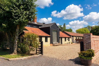
- Price
- £930,000
Anchor Lane, Abbess Roding, Ongar, CM5, Abbess Beauchamp and Berners Roding, Essex CM5 England
Added on 08/07/2026Barn Conversion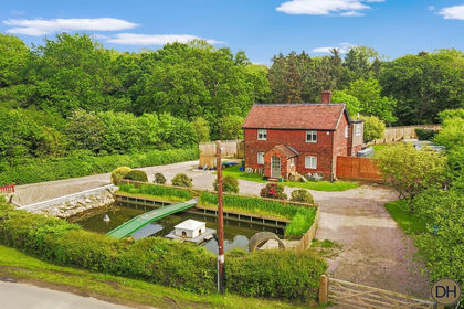
- Price
- Guide Price£800,000
- Size
- 1 acres
Ark Royal, Matching Tye, Essex CM17, Matching, Essex CM17 England
Added on 03/02/2026Development Land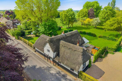
- Price
- Offers Over£1,000,000
- Size
- 2.5 acres
Church Lane, White Roding, Dunmow, Essex, White Roothing, Essex CM6 England
Added on 19/05/2026Cottage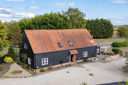
- Price
- Guide Price£975,000
- Size
- 0.8 acres
The Street, Sheering, Bishop's Stortford, CM22, Sheering, Essex CM22 England
Added on 01/10/2026Barn Conversion Added on 26/06/2026Barn Conversion
- Price
- Guide Price£725,000
- Size
- 2.62 acres
Proctor's, Beauchamp Roding, Ongar, Abbess Beauchamp and Berners Roding, Essex CM5 England
Added on 25/09/2026House with Land
- Price
- £1,099,995
- Size
- 2.2 acres
Added on 16/04/2026House with Land
- Price
- Guide Price£900,000
The Village, Willingale, Ongar, CM5, Willingale, Essex CM5 England
Added on 24/06/2026Barn Conversion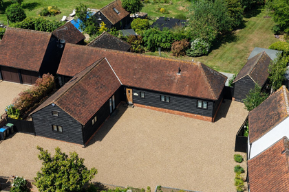
- Price
- £950,000
Added on 27/05/2026Barn Conversion
- Price
- Offers in Excess of£875,000
Spurriers Farm, Norton Heath, Ingatestone, High Ongar, Essex CM4 England
Added on 29/01/2026Barn Conversion