Lydart, Monmouth, NP25
- Land size
- 4.6 acres
- Bedrooms
- 3
- Bathrooms
- 2
Key Features
- Impressive Grounds of Circa 4.6 Acres With Detached Barns, Outbuildings, And A Coach House Ripe For Development (STPP)
- Architecturally Designed Open-Plan Living Space With Tri-Folding Doors And Charming Character Features
- Beautifully Restored Period Home In A Remarkable Setting
- State of The Art Energy Efficiency System - Reducing Costs To A Minimum
- Four Separate Paddocks Each With Their Own Private Water Supply
- Breathtaking Unspoilt Views Towards The Brecon Beacons
- Scope For Multi-Generational Living
- Formal Dining Room, Downstairs Shower Room and Additional WC
- Monmouthshire Council Tax Band G
Description
‘Highfield’ is a beautifully restored period property tucked away in a truly remarkable setting, offering breathtaking, uninterrupted views towards the Brecon Beacons. The property sits on a generous plot of approximately 4.6 acres, with four paddocks, each with its own private water supply, detached barns and outbuildings, and a further coach house ripe for conversion (subject to necessary consents). A sweeping driveway leads you to a generous parking area with an EV charging point set to the side of the property. The home opens into a spacious hallway, with coat storage and a convenient WC. Beyond lies the heart of the home – a substantial architecturally designed open-plan living space flooded with natural light, a homely inglenook fireplace and stone walls. Tri-folding doors offer a natural extension to the home, opening onto the raised sun terrace with the enchanting rolling countryside views, perfectly framing the setting. The kitchen enjoys equally impressive proportions with ample storage, granite work surfaces and a large breakfast bar. The home incorporates a state-of-the-art energy efficiency system designed to keep running costs to an absolute minimum, featuring an air source heat pump, zoned underfloor heating to the ground floor, high-performance wall, floor and roof insulation, triple glazing, and a whole-house mechanical ventilation with heat recovery (MVHR) system. The heat pump controls are housed within the plant room, located opposite the conservatory, while the MVHR system is operated via a dedicated control panel in the en-suite shower room. The formal entrance hall at the side leads to a shower room, store room and a particularly generous dining space – giving scope for multi-generational living. Upstairs are three genuine double bedrooms. The principal bedroom spans the width of the home, with an en-suite bathroom, allowing you to further appreciate the rural setting. The second bedroom has been set up with convenience in mind, with a door onto the family shower room. Highfield is perfect for equestrians, families, or those simply wanting a way of life uniquely their own.
Highfield is situated in Lydart, a peaceful hillside hamlet within the Wye Valley National Landscape, around an eight-minute drive from the market town of Monmouth. The town offers independent shops, cafés and restaurants, regular markets and a choice of supermarkets, including Waitrose, M&S Simply Food and Lidl. Families have access to Monmouth Comprehensive School and the independent Haberdashers’ Monmouth Schools. The surrounding countryside offers plenty to explore, with walking, cycling and horse-riding routes across the Wye Valley, while the River Wye provides further opportunities to enjoy the outdoors. Despite its rural setting, Lydart is well placed for the A40 and A449, with Cardiff and Bristol approximately 40 minutes away by car; direct trains to London Paddington are available from Newport and Bristol Parkway, with journeys taking around one hour and 45 minutes, depending on the service.
Map Location
Property details
- Tenure
- Freehold
- Council Tax Band
- G
- Date Posted
- 2026-10-08
Market Value Analysis
Compared with 1,043 Homes with Land listings in Wales (1+ acres).
Energy Performance Certificate
Energy Efficiency Rating
Based on UK Energy Performance Certificate standards (EU Directive 2002/91/EC)
Running costs are one side. Planning activity, flood history and ground risks for this location are in the full report.
Utilities & Restrictions
Utilities
- Electricity
- Mains
- Water
- Mains
- Heating
- Air Source Heat Pump, Underfloor Heating
- Broadband
- Ask Agent
- Sewerage
- Septic Tank / Private
Rights & Restrictions
- Public Rights of Way
- Ask Agent
- Private Rights of Way
- Ask Agent
- Listed Property
- Ask Agent
- Restrictions
- Ask Agent
Listed status, conservation areas and planning constraints for this location are in the full report.
Property Features
- Accessibility
- Ask Agent
- Parking
- Parking Available
- Garden
- Garden
Beyond the particulars: planning activity, flood history, heritage and ground risks, checked for this exact spot.
Connectivity
Broadband
Fastest speed available at this postcode
1.8 Gbps
Gigabit full fibre
Suitable for
- 4K streaming on every screen
- Full-time home working
- Online gaming & big downloads
Mobile signal
Predicted 4G and 5G signal; indoor signal depends on building materials.
Ofcom Connected Nations postcode-level predictions. Speeds and signal are modelled, not measured, and vary between addresses and providers.
Signal is the easy part. Planning activity, flood history and protected designations here are in the full report.
Nearest Schools
Primary
- Trellech Junior & Infants2.2 miles
- Pupils
- 169
- Type
- Infants & Juniors
- Language
- English medium school / provision
- Overmonnow Primary School2.2 miles
- Pupils
- 337
- Type
- Nursery, Infants & Juniors
- Language
- English medium school / provision
- Ysgol Gymraeg Trefynwy2.2 miles
- Pupils
- 21
- Type
- Nursery, Infants & Juniors
- Language
- Welsh medium school / provision (including transitional)
- Kymin View Primary School2.3 miles
- Pupils
- 145
- Type
- Nursery, Infants & Juniors
- Language
- English medium school / provision
- Osbaston Church in Wales School2.9 miles
- Pupils
- 197
- Type
- Infants & Juniors
- Language
- English medium school / provision
Secondary
- Monmouth Comprehensive School2.6 miles
- Pupils
- 1,696
- Type
- Secondary (ages 11-19)
- Language
- English medium school / provision
- Chepstow Comprehensive School9.3 miles
- Pupils
- 860
- Type
- Secondary (ages 11-19)
- Language
- English medium school / provision
- King Henry VIII 31913 miles
- Pupils
- 1,310
- Type
- Middle (ages 3-19)
- Language
- English medium school / provision
- Caldicot School13 miles
- Pupils
- 1,247
- Type
- Secondary (ages 11-19)
- Language
- English medium school / provision
- Ysgol Gymraeg Gwynllyw14 miles
- Pupils
- 808
- Type
- Middle (ages 3-19)
- Language
- Welsh medium school / provision (including transitional)
Distances are straight-line from the advertised location. Source: the national school registers (DfE, Welsh Government, Scottish Government) and Ofsted.
Schools are just the start: sold prices nearby, planning activity and any flood history are in the full report.
Amenities
Supermarket
GP surgery
Pharmacy
Straight-line distances from the advertised location. Sources: NHS records, Geolytix supermarket locations, OS Open Greenspace and the national trails registers.
The area stacks up? Now check the location itself: planning nearby, protected designations and past flooding.
Getting Around
Nearest station
Nearest bus stop
Typical drive times
Straight-line distances from the advertised location; drive times are typical free-flow times over OpenStreetMap road data, so allow more at peak. Public transport locations from DfT NaPTAN.
Easy to reach matters. So do planning activity, flood history and ground risks: all in the full report.
Flood Risk
Natural Resources Wales open data, checked around the advertised map pin for the listed acreage. Long-term risk counts flood defences; the planning map's flood zones do not. Provided by LandSale, not the listing agent, and not part of the agent's particulars. Risk varies across a holding, so verify before committing.
Rivers and the sea
Planning map: Flood Zone 1.
Surface water
These bandings are the summary. Where this location sits on the flood maps, plus planning activity, heritage and ground risks, is in the full report.
Important notice: Information, maps and tags on this page are drawn from the advertising agent's marketing materials or generated automatically. LandSale has not verified them. Relying on these details is at your own risk, always carry out independent checks before committing to a purchase.
LandSale full disclaimer
Marketing information only - not formal particulars. The details on this website are provided for general guidance and do not constitute an offer or contract. Neither LandSale nor the advertising estate/land agent accepts responsibility for any inaccuracy.
1. Source of information
- Listing content: Core description, asking price, tenure, measurements, photographs and planning history originate from the marketing materials of the advertising estate or land agent. LandSale does not author this content and cannot guarantee its accuracy.
- Automated tags & categorisation: Property type, land-use class, acreage bands and similar labels may be applied by machine-learning models. They are intended as a helpful guide only and may not reflect the property's legal status or permitted use.
- Third-party & enriched data layers: Maps, boundary outlines, planning designations, soil reports, broadband coverage and other environmental or location-based insights are licensed from external suppliers. Such data are supplied “as is", may be incomplete or out of date and are subject to change without notice.
2. Verification required
Prospective purchasers must verify critical matters, including but not limited to planning permission, title boundaries, public rights of way, environmental constraints, acreage, services, access and VAT status, through their own inspections, specialist surveys, legal advisers and the selling agent before relying on the information or entering into any contract.
3. No warranty or liability
LandSale gives no warranty, express or implied, as to the accuracy, completeness or fitness for any particular purpose of the information displayed. LandSale shall not be liable for any loss, damage, cost or expense arising directly or indirectly from any use of or reliance on such information, save where liability may not be excluded by law.
4. Updates & feedback
If you believe any detail on this listing is inaccurate, please let us know. We will investigate and, where appropriate, update the listing or notify the agent.
© LandSale | Version 1.3 - August 2026
Listing agent
Milburys, Wotton-Under-Edge
1 High Street, Wotton-Under-Edge, GL12 7DE
Similar properties for sale
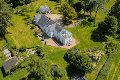
- Price
- Guide Price£1,250,000
- Size
- 5 acres
Monmouth Road, Monmouth, NP25, Trellech United, Monmouthshire NP25 Wales
Added on 17/07/2026Country Home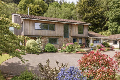
- Price
- £1,230,000
- Size
- 3 acres
Pinelands, The Narth, NP25, Trellech United, Monmouthshire NP25 Wales
Added on 22/06/2026House with Land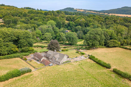
- Price
- Offers Over£1,000,000
- Size
- 5 acres
Added on 19/04/2026Barn Conversion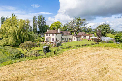
- Price
- Guide Price£1,250,000
- Size
- 10.77 acres
Wonastow, Monmouth, Monmouthshire, Mitchel Troy, Monmouthshire NP25 Wales
Added on 03/07/2026House with Land
- Price
- Guide Price£995,000
- Size
- 10 acres
Penallt, Monmouth, Monmouthshire, Trellech United, Monmouthshire NP25 Wales
Added on 29/01/2026Small Farm
- Price
- Guide Price£850,000
- Size
- 2.9 acres
Penallt, Monmouth, Monmouthshire, Trellech United, Monmouthshire NP25 Wales
Added on 09/10/2026House with Land
- Price
- £875,000
- Size
- 3 acres
Little Llanthomas, Penyclawdd, NP25, Mitchel Troy, Monmouthshire NP25 Wales
Added on 29/01/2026Cottage
- Price
- Guide Price£1,000,000
- Size
- 40 acres
Llangovan, Monmouth, Monmouthshire, NP25, Mitchel Troy, Monmouthshire NP25 Wales
Added on 24/05/2026Farm
- Price
- £990,000
- Size
- 11 acres
Parklands, Llandogo, NP25, Wye Valley, Monmouthshire NP25 Wales
Added on 18/05/2026House with Land
- Price
- £965,000
- Size
- 2.66 acres
Whitelye Road, Catbrook, NP16, Trellech United, Monmouthshire NP16 Wales
Added on 17/09/2026House with Land