Closing date for offers: Friday 4 December 2026 at 12 noon
Wilton Lane, Culcheth, Warrington
- Land size
- 1.1 acres
Key Features
- Rare development opportunity extending to approximately 1.1 acres
- Full planning consent for substantial five-bedroom Georgian-style farmhouse
- Planning consent allowed on appeal in January 2025
- Approved three-storey farmhouse designed to Building Regulations Standard M4(2)
- Four en-suite bedrooms, dressing room, first-floor laundry & loft study
- Separate full planning consent for an ancillary park home
- Genuine opportunity for consented multi-generational living
- Existing habitable two-bedroom bungalow – live on site whilst building
- Large yard with independent entrance approximately 21ft wide
- Excellent access to M6, M62, A580, Birchwood & Newton-le-Willows stations
Description
FOR SALE BY FORMAL TENDER - RARE DEVELOPMENT OPPORTUNITY – APPROX. 1.1 ACRES – FULL PLANNING CONSENT FOR FIVE-BEDROOM GEORGIAN-STYLE FARMHOUSE – SEPARATE CONSENT FOR ANCILLARY PARK HOME – EXISTING TWO-BEDROOM BUNGALOW – LARGE YARD & INDEPENDENT ACCESS
11 Wilton Lane is an exceptional consented development opportunity situated on the northern edge of Culcheth. The established, well-screened site extends to approximately 1.1 acres and benefits from two separate full planning consents, creating a genuinely unusual opportunity for substantial family and multi-generational living.
Full planning consent for a substantial five-bedroom Georgian-style farmhouse was allowed on appeal in January 2025.
The approved three-storey scheme is designed to Building Regulations Standard M4(2) – Accessible and Adaptable Dwellings and provides four en-suite bedrooms, dressing room, first-floor laundry and loft study.
There is also separate full planning consent for an ancillary park home, providing genuine, consented multi-generational accommodation, subject to the terms of the planning consent.
The site includes a substantial yard, well screened by mature trees, with its own independent entrance approximately 21ft wide, in addition to the house access. The existing habitable two-bedroom bungalow provides the valuable option of living on site whilst constructing the new farmhouse, subject to planning conditions.
The property is offered for sale as a whole, providing an exciting opportunity to create a substantial bespoke family home with additional consented accommodation and extensive land/yard space.
The land has been submitted through Warrington Borough Council's current Call for Sites process, with potential longer-term Grey Belt considerations given the Council's current housing land supply position. Purchasers should make their own enquiries regarding future planning potential. Viewing highly recommended.
Tenders to be received by 12 noon 4th December.
Multi-Generational Potential - The site lends itself particularly well to a family looking to live together but separately. The consented farmhouse and the park home
sit within the same ownership, on the same site, with the benefit of separate accommodation and the space to keep each household's
parking and privacy distinct. The residential caravan use is the subject of a Certificate of Lawfulness.
The approved farmhouse is required by condition to be constructed to Building Regulations Standard M4(2) 'Accessible and
Adaptable Dwellings'. In practical terms that means level access, wider circulation, and a layout that can be adapted over time for an
older or less mobile family member without structural alteration — exactly the flexibility a multi-generational household needs over
a twenty-year horizon.
Within the main house itself, the approved layout supports the same principle: a ground-floor study and office that could serve as a
ground-floor bedroom and sitting room, four en-suite bedrooms so that no one shares a bathroom, a first-floor laundry, and a self-
Full planning consent for a substantial detached five-bedroom Georgian-style farmhouse, allowed on appeal in January 2025
Certificate of Lawfulness for a residential caravan on the site — established separate accommodation alongside the new
house
A site of approximately 1.1 acres in all, including a large yard, well screened by mature trees
Separate independent entrance to the yard, approximately 21ft wide, in addition to the house access
Existing and habitable two-bedroom bungalow, suitable to live in whilst constructing the new house
Consented farmhouse to be built to Building Regulations Standard M4(2) 'Accessible and Adaptable Dwellings'
Approved scheme provides four en-suite bedrooms, a dressing room, a first-floor laundry and a loft study over three floors
(five bedrooms in total)
Grey belt potential, given the Council's current housing land supply position
Land submitted through Warrington Borough Council's current Call for Sites process
Excellent road and rail links — M6, M62, A580 East Lancs Road, Birchwood and Newton-le-Willows stations
contained loft floor with its own bedroom, dressing room, en-suite and study.
The Land And Yard - The principal attraction of the site is the land. The holding extends in all to approximately 1.1 acres, the greater part of it a yard laid
largely to hardstanding, well screened on its boundaries by mature trees which give the site a good degree of privacy and shelter
from the lane.
The registered extent is shown on the HM Land Registry title plan, hatched in red and fronting Wilton Lane, under title number
CH414614. Land shown beyond the hatching falls within separate titles and is reproduced for reference only.
Critically, the yard has its own separate entrance directly onto Wilton Lane, approximately 21ft wide and capable of taking large
vehicles. This is independent of the access serving the house, which means the yard can be used, let or developed without
compromising the privacy or security of the dwelling — a rare and valuable characteristic.
The scale and surfacing of the yard lend it to a wide range of uses subject to the necessary consents, and its separation from the
residential element gives a purchaser real optionality.
The Existing Buildings - The site is presently occupied by a habitable detached two-bedroom bungalow, together with a park home and a range of
outbuildings.
The bungalow extends to approximately 117.9 sq m (1,268 sq ft) and provides an entrance porch, lounge, conservatory, kitchen,
utility, store, two bedrooms, a bathroom, a separate shower room and a cloakroom WC. It is comfortable, well proportioned and
ready to be lived in from day one.
The kitchen has been refitted to a good standard, with shaker-style units, stone-effect worktops, a central island with breakfast
seating and fully fitted appliances including fridge/freezer, dishwasher and gas range with stainless steel extractor.
The consent for the new farmhouse is granted on the basis of the demolition of the existing dwelling and outbuildings and the
construction of the new house in their place. The existing bungalow is therefore best regarded as a holding position — somewhere to
live, or to let, while a scheme is brought forward — rather than as the substance of what is being sold.
The park home is an established building on the site, its residential caravan use being the subject of a Certificate of Lawfulness
granted by Warrington Borough Council in 1997.
Map Location
Property details
- Tenure
- Freehold
- Council Tax Band
- E
- Date Posted
- 2026-10-08
Market Value Analysis
Compared with 128 Development Land listings in North West England (1+ acres).
Energy Performance Certificate
Energy Efficiency Rating
Based on UK Energy Performance Certificate standards (EU Directive 2002/91/EC)
Running costs are one side. Planning activity, flood history and ground risks for this location are in the full report.
Utilities & Restrictions
Utilities
- Electricity
- Ask Agent
- Water
- Ask Agent
- Heating
- Ask Agent
- Broadband
- Ask Agent
- Sewerage
- Ask Agent
Rights & Restrictions
- Public Rights of Way
- Ask Agent
- Private Rights of Way
- Ask Agent
- Listed Property
- Ask Agent
- Restrictions
- Ask Agent
Listed status, conservation areas and planning constraints for this location are in the full report.
Property Features
- Accessibility
- Ask Agent
- Parking
- Parking Available
- Garden
- Garden
Beyond the particulars: planning activity, flood history, heritage and ground risks, checked for this exact spot.
Connectivity
Broadband
Fastest speed available at this postcode
1.8 Gbps
Gigabit full fibre · available to 67% of premises
Suitable for
- 4K streaming on every screen
- Full-time home working
- Online gaming & big downloads
Mobile signal
Predicted 4G and 5G signal; indoor signal depends on building materials.
Ofcom Connected Nations postcode-level predictions. Speeds and signal are modelled, not measured, and vary between addresses and providers.
Signal is the easy part. Planning activity, flood history and protected designations here are in the full report.
Nearest Schools
Primary
- Twiss Green Community Primary School0.8 milesOfsted: Good
- Ages
- 3 to 11
- Pupils
- 203
- Type
- Community school
- Lowton Junior and Infant School0.9 milesOfsted: Good *
- Ages
- 4 to 11
- Pupils
- 199
- Type
- Foundation school
- Lowton St Mary's CofE (Voluntary Aided) Primary School0.9 milesOfsted: Good *
- Ages
- 3 to 11
- Pupils
- 229
- Type
- Voluntary aided school
- Faith
- Church of England
- Gilded Hollins Community School0.9 milesNo Ofsted rating
- Ages
- 4 to 11
- Pupils
- 209
- Type
- Community school
- Newchurch Community Primary School1.3 milesOfsted: Good *
- Ages
- 4 to 11
- Pupils
- 204
- Type
- Community school
Secondary
- Lowton Church of England High School0.8 milesOfsted: Good
- Ages
- 11 to 16
- Pupils
- 814
- Type
- Foundation school
- Faith
- Church of England
- Culcheth High School1.4 milesNo Ofsted rating
- Ages
- 11 to 16
- Pupils
- 1,164
- Type
- Community school
- Golborne High School2.2 milesOfsted: Outstanding
- Ages
- 11 to 16
- Pupils
- 1,144
- Type
- Foundation school
- Bedford High School2.9 milesOfsted: Good
- Ages
- 11 to 16
- Pupils
- 1,111
- Type
- Community school
- Birchwood Community High School3.4 milesOfsted: Good *
- Ages
- 11 to 16
- Pupils
- 875
- Type
- Academy converter
* Latest graded judgement covers quality of education only; no overall grade was issued under the 2024-25 inspection framework.
Distances are straight-line from the advertised location. Source: the national school registers (DfE, Welsh Government, Scottish Government) and Ofsted.
Schools are just the start: sold prices nearby, planning activity and any flood history are in the full report.
Amenities
Supermarket
GP surgery
Pharmacy
Hospital
Straight-line distances from the advertised location. Sources: NHS records, Geolytix supermarket locations, OS Open Greenspace and the national trails registers.
The area stacks up? Now check the location itself: planning nearby, protected designations and past flooding.
Getting Around
Nearest station
Nearest bus stop
Typical drive times
Straight-line distances from the advertised location; drive times are typical free-flow times over OpenStreetMap road data, so allow more at peak. Public transport locations from DfT NaPTAN.
Easy to reach matters. So do planning activity, flood history and ground risks: all in the full report.
Flood Risk
Environment Agency open data, checked around the advertised map pin for the listed acreage. Long-term risk counts flood defences; the planning map's flood zones do not. Provided by LandSale, not the listing agent, and not part of the agent's particulars. Risk varies across a holding, so verify before committing.
Rivers and the sea
Planning map: Flood Zone 1.
Surface water
Not at the pin: mapped about 20 metres away.
These bandings are the summary. Where this location sits on the flood maps, plus planning activity, heritage and ground risks, is in the full report.
Important notice: Information, maps and tags on this page are drawn from the advertising agent's marketing materials or generated automatically. LandSale has not verified them. Relying on these details is at your own risk, always carry out independent checks before committing to a purchase.
LandSale full disclaimer
Marketing information only - not formal particulars. The details on this website are provided for general guidance and do not constitute an offer or contract. Neither LandSale nor the advertising estate/land agent accepts responsibility for any inaccuracy.
1. Source of information
- Listing content: Core description, asking price, tenure, measurements, photographs and planning history originate from the marketing materials of the advertising estate or land agent. LandSale does not author this content and cannot guarantee its accuracy.
- Automated tags & categorisation: Property type, land-use class, acreage bands and similar labels may be applied by machine-learning models. They are intended as a helpful guide only and may not reflect the property's legal status or permitted use.
- Third-party & enriched data layers: Maps, boundary outlines, planning designations, soil reports, broadband coverage and other environmental or location-based insights are licensed from external suppliers. Such data are supplied “as is", may be incomplete or out of date and are subject to change without notice.
2. Verification required
Prospective purchasers must verify critical matters, including but not limited to planning permission, title boundaries, public rights of way, environmental constraints, acreage, services, access and VAT status, through their own inspections, specialist surveys, legal advisers and the selling agent before relying on the information or entering into any contract.
3. No warranty or liability
LandSale gives no warranty, express or implied, as to the accuracy, completeness or fitness for any particular purpose of the information displayed. LandSale shall not be liable for any loss, damage, cost or expense arising directly or indirectly from any use of or reliance on such information, save where liability may not be excluded by law.
4. Updates & feedback
If you believe any detail on this listing is inaccurate, please let us know. We will investigate and, where appropriate, update the listing or notify the agent.
© LandSale | Version 1.3 - August 2026
Listing agent
Howell & Co, Warrington
759 Knutsford Road, Latchford, Warrington, WA4 1JY
Similar properties for sale
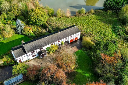
- Price
- Offers in Excess of£800,000
Added on 29/01/2026Barn Conversion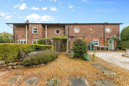
- Price
- Offers in Excess of£800,000
Added on 15/05/2026Barn Conversion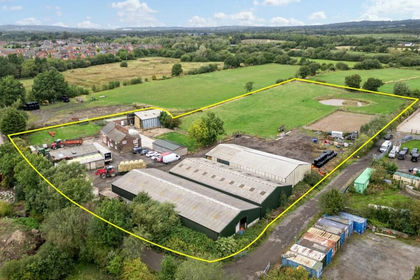
- Price
- Guide Price£1,100,000
- Size
- 4.37 acres
Added on 15/04/2026Farmhouse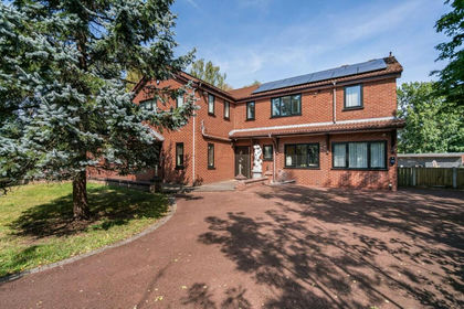
- Price
- Offers Over£875,000
- Size
- 2 acres
Smiths Lane, Hindley Green, Wigan, Leigh and Atherton, Wigan WN2 England
Added on 14/08/2026House with Land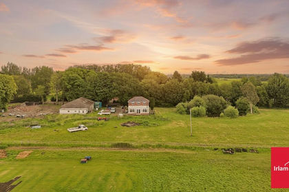
- Price
- Offers Over£850,000
- Size
- 2.9 acres
Astley Road, Irlam, M44, Worsley and Eccles, Salford M44 England
Added on 29/01/2026House with Land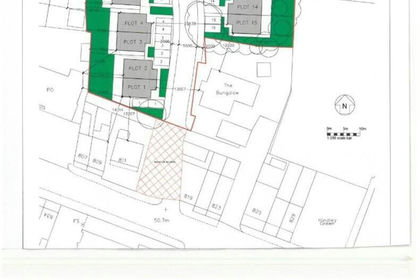
- Price
- Offers in Region of£1,025,000
- Size
- 1.1 acres
Atherton Road, Hindley Green, WN2, Makerfield, Wigan WN2 England
Added on 05/06/2026Development Land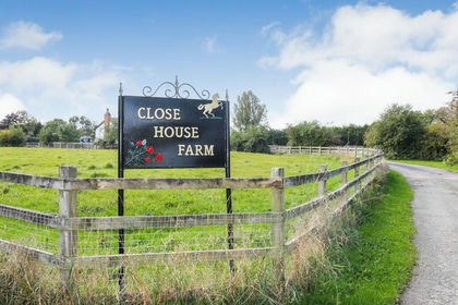
- Price
- Offers in Region of£1,050,000
- Size
- 4 acres
Added on 29/01/2026Equestrian property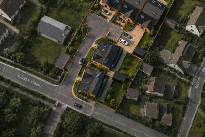
- Price
- £700,000
- Size
- 0.62 acres
Land At Turner Street, Westhoughton, BL5, Westhoughton, Bolton BL5 England
Added on 19/05/2026Development Land
- Price
- Offers Over£999,995
Stockport Road, Thelwall, WA4, Grappenhall and Thelwall, Warrington WA4 England
Added on 25/06/2026Barn Conversion
- Price
- £750,000
- Size
- 2 acres
Gorsey Lane, Bold, St. Helens, Merseyside, WA9, Bold, St. Helens WA9 England
Added on 14/08/2026Equestrian property