Tattenhall, Chester, Cheshire
- Land size
- 7.97 acres
- Bedrooms
- 4
- Bathrooms
- 1
Key Features
- A former dairy farm with alternative uses
- Equestrian and development potential
- 4-bedroom detached farmhouse requiring renovation
- Range of traditional brick buildings with development potential, STP
- Range of steel-framed agricultural buildings
- Approx. 7.97 acres (3.23 ha) with an additional 12.26 acres (4.96 ha) available by separate negotiation.
- Farmhouse EPC Rating F
Description
Lot 1 Only –A substantial farmhouse, requiring renovation, with a range of outbuildings and approximately 7.97 acres (3.23 hectares) of land. An additional 12.26 acres are available.
The Property
A former dairy farm offering a diverse range of alternative uses such as equestrian, a private residential property or development, subject to planning consent. The property extends to approximately 7.97 acres (3.23 ha), with an additional 12.26 acres (4.96 ha) by separate negotiation.
Lot 1
The Farmhouse
A substantial whitewashed brick-built farmhouse under natural slate roofing, requiring a general scheme of refurbishment throughout, with the possibilities of extending, STP.
The accommodation is arranged over two floors offering extensive living space, perfect for growing families. (See floorplan for accommodation layout).
Outbuildings
The property benefits from a substantial range of brick and steel-framed, clad buildings, comprising the following:
Detached building – 2-storey brick-built with corrugated fibre roof, with an adjoining corrugated covered yard to the rear, extending to approx. 1926 sq. ft (brick building only).
Brick Shippon – a single storey building with 30 stalls, and a steel-framed covered yard linking to a Dutch barn and a further covered yard to the rear. Approx 6187 sq. ft in total.
Detached building – 2-storey brick-built with profile metal sheet roofing, with an adjoining steel-framed pent-roof shed with partial Yorkshire boarding. Approx. 3751 sq. ft in total.
Sileage clamp – with pre-cast concrete walls and concrete flooring.
Farmland
The land within Lot 1, edged red on the sales plan, comprises of approximately 7.97 acres (3.23 ha) of Grade 3 grazing land (according to Provisional Agricultural Land Classification (ALC) (England)). Slowly permeable seasonally wet slightly acid but base-rich loamy and clayey soils. It has water troughs with over-land mains water. Access from the farm driveway, with road frontage.
There is an additional 12.26 acres (4.96 ha) of Grade 3 grazing land, as edged blue on the plan, available by separate negotiation.
Situation
Tattenhall is a picturesque Cheshire village about eight miles southeast of Chester, known for its medieval origins recorded in the Domesday Book, its historic centre around St Alban’s Church, and a landscape of redbrick cottages, Georgian farmhouses, and rolling countryside.
It is a thriving rural community with shops, pubs, cafés, strong local services, the well-known Cheshire Ice Cream Farm and access to the Sandstone Trail.
Tattenhall Park Primary School is a “good” state school and is a feeder to Bishop Heber High School, Malpas, an Ofsted “Outstanding” state secondary school.
Tattenhall is a charming blend of heritage, community life, and modern rural appeal.
Fixtures and fittings
All fixtures, fittings and furniture such as curtains, light fittings, garden ornaments and statuary are excluded from the sale. Some may be available by separate negotiation.
Additional Land Available
There is an additional area of land extending to approximately 12.26 acres (4.96 ha) that is available by separate negotiation. The land in question is edged blue on the plan.
Services
Mains water and electricity (3-phase to the detached brick barn). Private drainage and oil-fired central heating. None of the services or appliances, heating installations, plumbing or electrical systems have been tested by the selling agents.
If the private drainage system requires updating/replacement, it is assumed that prior to offers being made, associated costs have been considered and are the responsibility of the purchaser. Interested parties are advised to make their own investigations, no further information will be provided by the selling agents.
The estimated fastest download speed currently achievable for the property postcode area is around 1800 Mbps (data taken from checker.ofcom.org.uk on 30/01/2026). Actual service availability at the property or speeds received may be different.
We understand that the property is likely to have current mobile coverage (data taken from checker.ofcom.org.uk on 30/01/2026). Please note that actual services available may be different depending on the particular circumstances, precise location and network outages.
Tenure
Freehold with vacant possession on completion, subject to a grass crop agreement, in place until June 2026.
Development Overage
An uplift will be applied to the whole of the property in the event of approval for any additional residential dwellings, at 40% over 25 years, triggered by the implementation of planning or an onward sale with the enhanced benefit.
Rural, Environmental and Woodland Schemes
The land is not believed to be subject to any ongoing schemes.
Method of sale
The property is offered for sale by Private Treaty method. However the vendor reserves the right to conclude the sale by an alternative method if required.
Local Authority
Cheshire West & Chester Council
Council Tax Band: E
Public rights of way, wayleaves and easements
The property is sold subject to all rights of way, wayleaves and easements whether or not they are defined in this brochure.
Planning
The vendors do have recent ecology reports and surveys, which can be shared following discussions with the vendors.
The selling agents will not provide advice/guidance on the planning history for the property/land. Interested parties are advised to make their own investigations. It is assumed that enquiries have been satisfied, prior to an offer being made.
Anti Money Laundering Regulations (AML)
In accordance with Anti Money Laundering Regulations (AML), we are required to request forms of identification and carry out due diligence on any parties connected to a successful offer. Should an offer be made on behalf of a business/company, AML due diligence will also be necessary. Proof/source of funding must be supplied, prior to offer acceptance.
Plans and boundaries
The plans within these particulars are based on Ordnance Survey data and provided for reference only. They are believed to be correct but accuracy is not guaranteed. The purchaser shall be deemed to have full knowledge of all boundaries and the extent of ownership. Neither the vendor nor the vendor’s agents will be responsible for defining the boundaries or the ownership thereof.
In the event that the buyer of Lot 1 does not
purchase the additional land, edged blue, the
buyer will be responsible for erecting and
maintaining the new boundary splitting the
two parcels of land.
Viewings
Strictly by appointment through Fisher German LLP.
Directions
Postcode – CH3 9AY
what3words – ///thrashed.foster.spelling
Map Location
Property details
- Tenure
- Freehold
- Council Tax Band
- E
- Date Posted
- 2026-10-08
Market Value Analysis
Compared with 239 Homes with Land listings in North West England (5+ acres).
Energy Performance Certificate
Energy Efficiency Rating
Based on UK Energy Performance Certificate standards (EU Directive 2002/91/EC)
Running costs are one side. Planning activity, flood history and ground risks for this location are in the full report.
Utilities & Restrictions
Utilities
- Electricity
- Ask Agent
- Water
- Ask Agent
- Heating
- Ask Agent
- Broadband
- Ask Agent
- Sewerage
- Ask Agent
Rights & Restrictions
- Public Rights of Way
- Ask Agent
- Private Rights of Way
- Ask Agent
- Listed Property
- Ask Agent
- Restrictions
- Ask Agent
Listed status, conservation areas and planning constraints for this location are in the full report.
Property Features
- Accessibility
- Ask Agent
- Parking
- Parking Available
- Garden
- Garden
Beyond the particulars: planning activity, flood history, heritage and ground risks, checked for this exact spot.
Connectivity
Broadband
Fastest speed available at this postcode
1.8 Gbps
Gigabit full fibre
Suitable for
- 4K streaming on every screen
- Full-time home working
- Online gaming & big downloads
Mobile signal
Predicted 4G and 5G signal; indoor signal depends on building materials.
Ofcom Connected Nations postcode-level predictions. Speeds and signal are modelled, not measured, and vary between addresses and providers.
Signal is the easy part. Planning activity, flood history and protected designations here are in the full report.
Nearest Schools
Primary
- Tattenhall Park Primary School764 metresOfsted: Good
- Ages
- 3 to 11
- Pupils
- 199
- Type
- Community school
- Huxley CofE Primary School2 milesOfsted: Inadequate
- Ages
- 5 to 11
- Pupils
- 63
- Type
- Academy sponsor led
- Faith
- Church of England
- Saighton Church of England Primary School & Pre-School2.6 milesNo Ofsted rating
- Ages
- 3 to 11
- Pupils
- 112
- Type
- Voluntary aided school
- Faith
- Church of England
- Waverton Community Primary School2.9 milesOfsted report card · Mar 2026
- Ages
- 5 to 11
- Pupils
- 197
- Type
- Community school
- Duddon St Peter's CofE Primary School3.3 milesOfsted: Good *
- Ages
- 2 to 11
- Pupils
- 66
- Type
- Voluntary controlled school
- Faith
- Church of England
Secondary
- Christleton High School3.9 milesOfsted: Good
- Ages
- 11 to 18
- Pupils
- 1,382
- Type
- Academy converter
- Tarporley High School and Sixth Form College4.7 milesOfsted: Good
- Ages
- 11 to 18
- Pupils
- 1,219
- Type
- Academy converter
- The Bishops' Blue Coat Church of England High School4.9 milesOfsted: Good
- Ages
- 11 to 18
- Pupils
- 1,253
- Type
- Academy converter
- Faith
- Church of England
- The Catholic High School, Chester5.6 milesOfsted report card · May 2026
- Ages
- 11 to 18
- Pupils
- 797
- Type
- Academy converter
- Faith
- Roman Catholic
- Queen's Park High School5.6 milesOfsted: Good *
- Ages
- 11 to 18
- Pupils
- 792
- Type
- Academy sponsor led
* Latest graded judgement covers quality of education only; no overall grade was issued under the 2024-25 inspection framework.
Distances are straight-line from the advertised location. Source: the national school registers (DfE, Welsh Government, Scottish Government) and Ofsted.
Schools are just the start: sold prices nearby, planning activity and any flood history are in the full report.
Amenities
Supermarket
GP surgery
Pharmacy
Hospital
Green space
Straight-line distances from the advertised location. Sources: NHS records, Geolytix supermarket locations, OS Open Greenspace and the national trails registers.
The area stacks up? Now check the location itself: planning nearby, protected designations and past flooding.
Getting Around
Nearest station
Nearest bus stop
Typical drive times
Straight-line distances from the advertised location; drive times are typical free-flow times over OpenStreetMap road data, so allow more at peak. Public transport locations from DfT NaPTAN.
Easy to reach matters. So do planning activity, flood history and ground risks: all in the full report.
Flood Risk
Environment Agency open data, checked around the advertised map pin for the listed acreage. Long-term risk counts flood defences; the planning map's flood zones do not. Provided by LandSale, not the listing agent, and not part of the agent's particulars. Risk varies across a holding, so verify before committing.
Rivers and the sea
Planning map: Flood Zone 1.
Surface water
Not at the pin: mapped about 10 metres away.
These bandings are the summary. Where this location sits on the flood maps, plus planning activity, heritage and ground risks, is in the full report.
Important notice: Information, maps and tags on this page are drawn from the advertising agent's marketing materials or generated automatically. LandSale has not verified them. Relying on these details is at your own risk, always carry out independent checks before committing to a purchase.
LandSale full disclaimer
Marketing information only - not formal particulars. The details on this website are provided for general guidance and do not constitute an offer or contract. Neither LandSale nor the advertising estate/land agent accepts responsibility for any inaccuracy.
1. Source of information
- Listing content: Core description, asking price, tenure, measurements, photographs and planning history originate from the marketing materials of the advertising estate or land agent. LandSale does not author this content and cannot guarantee its accuracy.
- Automated tags & categorisation: Property type, land-use class, acreage bands and similar labels may be applied by machine-learning models. They are intended as a helpful guide only and may not reflect the property's legal status or permitted use.
- Third-party & enriched data layers: Maps, boundary outlines, planning designations, soil reports, broadband coverage and other environmental or location-based insights are licensed from external suppliers. Such data are supplied “as is", may be incomplete or out of date and are subject to change without notice.
2. Verification required
Prospective purchasers must verify critical matters, including but not limited to planning permission, title boundaries, public rights of way, environmental constraints, acreage, services, access and VAT status, through their own inspections, specialist surveys, legal advisers and the selling agent before relying on the information or entering into any contract.
3. No warranty or liability
LandSale gives no warranty, express or implied, as to the accuracy, completeness or fitness for any particular purpose of the information displayed. LandSale shall not be liable for any loss, damage, cost or expense arising directly or indirectly from any use of or reliance on such information, save where liability may not be excluded by law.
4. Updates & feedback
If you believe any detail on this listing is inaccurate, please let us know. We will investigate and, where appropriate, update the listing or notify the agent.
© LandSale | Version 1.3 - August 2026
Listing agent
Fisher German, Covering Cheshire and North Wales
Covering the North West
Similar properties for sale
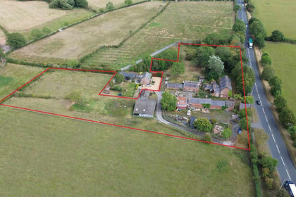
- Price
- Offers Over£850,000
- Size
- 4 acres
The Limes, Holme Street, Tarvin, Chester, Barrow, Cheshire West and Chester CH3 England
Added on 08/08/2026Development Land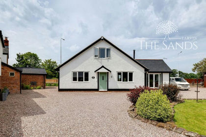
- Price
- Offers Over£800,000
- Size
- 5 acres
Shay Lane, Tarvin, CH3, Tarvin, Cheshire West and Chester CH3 England
Added on 11/07/2026House with Land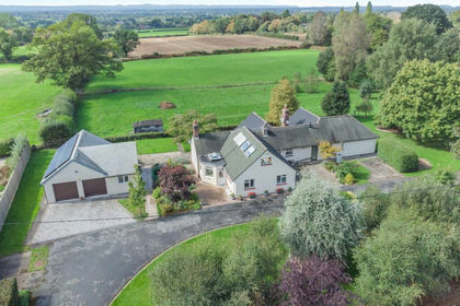
- Price
- £800,000
- Size
- 4 acres
Kelsall, Tarporley, Cheshire, Kelsall, Cheshire West and Chester CW6 England
Added on 07/10/2026House with Land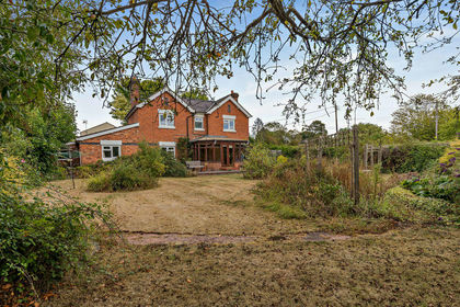
- Price
- £650,000
- Size
- 3.2 acres
Horton Green, Near Tilston, Shocklach Oviatt and District, Cheshire West and Chester SY14 England
Added on 17/08/2026House with Land
- Price
- Offers Over£850,000
- Size
- 7 acres
Added on 30/09/2026House with Land
- Price
- Offers Over£1,000,000
- Size
- 3 acres
Added on 30/07/2026House with Land
- Price
- Offers Over£1,000,000
- Size
- 6.46 acres
Added on 16/06/2026House with Land
- Price
- Guide Price£800,000
- Size
- 3.29 acres
Lower Lane, Bowling Bank, Wrexham, LL13, Isycoed, Wrexham LL13 Wales
Added on 02/08/2026House with Land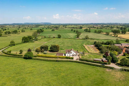
- Price
- Guide Price£800,000
- Size
- 3.9 acres
Deelands, Bowling Bank, Wrexham, Isycoed, Wrexham LL13 Wales
Added on 28/02/2026Equestrian property
- Price
- Guide Price£720,000
- Size
- 4.05 acres
Bowling Bank Farm, Bowling Bank, Isycoed, Wrexham, Isycoed, Wrexham LL13 Wales
Added on 04/08/2026House with Land