Blackhurst Farm, Rushlake Green, TN21
- Land size
- 124.19 acres
- Bedrooms
- 5
Key Features
- Four/Five-bedroom farmhouse
- Ring-fenced pasture fields with woodland shaws
- Range of modern and traditional outbuildings
- Extending in all to about 124.19 acres (50.26 ha)
Description
LOCATION
Blackhurst Farm is located on the outskirts of Rushlake Green, approximately one mile from the village centre with its general store and public house. Nearby towns include Heathfield (5 miles) and Hailsham (5.2 miles).
DESCRIPTION AND BRIEF HISTORY
The farm was purchased in the early 1990s and subsequently farmed by the vendor who reared livestock on the gently sloping grade 3 land which runs down to the Cuckmere River. A range of modern livestock barns are conveniently located around a yard to the north of the farmhouse. The yard also benefits from independent access from the public highway.
The property extends in all to approximately 124.19 acres, and briefly comprises:
THE FARMHOUSE
The original farmhouse was constructed in about 1938 and subsequently extended in 1948 and 1998.
The accommodation, which benefits from oil-fired central heating, briefly comprises:
GROUND FLOOR
Entrance Hall with tiled floor.
Inner Hall with Cloakroom off, stairs to First Floor, and door to rear porch.
Sitting Room (double aspect): Parquet floor and open fireplace with exposed brick surround.
Family/Games Room (triple aspect): Wooden spiral staircase leading to Library/Bedroom 5 on the first floor. Glazed double doors to outside.
Dining Room: Open fireplace with exposed stone surround.
Study/Farm Office with Boot Room off.
Kitchen/Breakfast Room: Worktops with storage cupboards below, inset ceramic sink and drainer, and electric hob with extractor hood above. Electric Rayburn set into alcove, wall-mounted storage units, space and plumbing for dishwasher, and integral fridge.
Rear Porch
FIRST FLOOR
Landing with Airing cupboard.
Bedroom 1: with En-Suite Bathroom, open fireplace and
Built-in wardrobe.
Bedroom 2: Wall-mounted wash basin, open fireplace, and built-in wardrobe.
Bedroom 3: Built- in cupboard with book shelving.
Bedroom 4
Library/Bedroom 5: Exposed wooden floorboards and fitted book shelving.
Family Shower Room.
Cloakroom.
THE GARDEN
The garden surrounding the farmhouse benefits from lawns interspersed with flowerbeds, a variety of trees and shrubs, paved and gravelled pathways, and paved terraces, together with a timber-framed Summer House and covered seating area.
Located to the south of the farmhouse, an enclosed parking area benefits from an adjacent fully enclosed four bay Garage building and a former Dairy Building which has been informally used for many years as auxiliary accommodation to the farmhouse.
THE LAND
The agricultural land is classified as Grade 3 and divided into a number of hedge/fence- enclosed pasture fields with blocks of Ancient and Semi-Natural Woodland, and four naturally fed ponds.
AGRICULTURAL OUTBUILDINGS
Arranged around a Yard to the north-east of the farmhouse, there is an eight-bay steel-framed Livestock Barn with a two-bay steel-framed Tractor Shed attached to the south-western corner, and a four-bay steel-framed lean to attached to the western elevation (extending in all to approximately 12,626 sq. ft.). In addition, there is a 15' Grain Silo.
LOCAL AUTHORITY
Wealden District Council.
COUNCIL TAX
The Farmhouse: Band G
The Old Dairy: Band A
TENURE
The property is to be sold freehold with vacant possession, subject to any necessary holdover for the harvesting of crops at the time of completion.
DIRECTIONS
From the village green in Rushlake Green, proceed south on Cowbeech Road for approximately one mile, whereafter there are two entrances to Blackhurst Farm on the right-hand side. Please use the second entrance for the farmhouse.,
What3Words: blogging.strange.bleaker
SERVICES
Mains electricity and water, private drainage.
EPC RATING
The Farmhouse: Band D
METHOD OF SALE
The property is offered for sale by private treaty.
EASEMENTS, WAYLEAVES AND RIGHTS OF WAY
The property is sold subject to and with the benefit of all existing rights whether public or private, including rights of way, supply, drainage, water and electricity supplies or other rights, covenants, restrictions and obligations, quasi-easements and all wayleaves whether referred to or not.
Public footpaths cross the property.
Further information available from the selling agent.
PLANS
The plans provided are for identification purposes only, and purchasers should satisfy themselves on the location of external or internal boundaries prior to offering.
BOUNDARIES
The purchaser must satisfy themselves on the location of all boundaries from the Land Registry plans available and from their site inspection on the ground.
ACREAGES
The acreages quoted are for guidance purposes only and are given without responsibility. Any intending purchasers should not rely upon these as statements or representations of fact and must satisfy themselves by inspection or otherwise as to the area being sold.
AGENT'S NOTE
We have prepared these sale particulars as a general guide and none of the statements contained within them should be relied upon as a statement of fact. All measurements are given as a guide, and no liability can be accepted for any errors arising therefrom. We have not carried out detailed or structural surveys, nor tested the services, appliances, or any fittings.
VIEWINGS
Strictly by appointment with the selling agent. The vendors and their agents do not accept any responsibility for accidents or personal injury as a result of viewings, whether accompanied or not.
PURCHASER IDENTIFICATION
In accordance with Anti- Money Laundering Regulations, we are required to obtain proof of identification for all purchasers. BTF employs the services of 'Thirdfort' to verify the identity and residence of purchasers.
Map Location
Property details
- Tenure
- Freehold
- Council Tax Band
- Ask Agent
- Date Posted
- 2026-10-02
Market Value Analysis
Compared with 18 Farms & Smallholdings listings in South East England (100+ acres).
Energy Performance Certificate
Energy Efficiency Rating
Based on UK Energy Performance Certificate standards (EU Directive 2002/91/EC)
Running costs are one side. Planning activity, flood history and ground risks for this location are in the full report.
Utilities & Restrictions
Utilities
- Electricity
- Ask Agent
- Water
- Ask Agent
- Heating
- Ask Agent
- Broadband
- Ask Agent
- Sewerage
- Ask Agent
Rights & Restrictions
- Public Rights of Way
- Ask Agent
- Private Rights of Way
- Ask Agent
- Listed Property
- Ask Agent
- Restrictions
- Ask Agent
Listed status, conservation areas and planning constraints for this location are in the full report.
Property Features
- Accessibility
- Ask Agent
- Parking
- Parking Available
- Garden
- Garden
Beyond the particulars: planning activity, flood history, heritage and ground risks, checked for this exact spot.
Connectivity
Broadband
Fastest speed available at this postcode
1.8 Gbps
Gigabit full fibre
Suitable for
- 4K streaming on every screen
- Full-time home working
- Online gaming & big downloads
Mobile signal
Predicted 4G and 5G signal; indoor signal depends on building materials.
Ofcom Connected Nations postcode-level predictions. Speeds and signal are modelled, not measured, and vary between addresses and providers.
Signal is the easy part. Planning activity, flood history and protected designations here are in the full report.
Nearest Schools
Primary
- Punnetts Town Community Primary School and Nursery2.3 milesOfsted: Good *
- Ages
- 4 to 11
- Pupils
- 121
- Type
- Community school
- Maynards Green Community Primary School2.7 milesOfsted: Good
- Ages
- 4 to 11
- Pupils
- 205
- Type
- Community school
- All Saints' and St Richard's Church of England Primary School2.7 milesOfsted report card · Apr 2026
- Ages
- 4 to 11
- Pupils
- 86
- Type
- Voluntary aided school
- Faith
- Church of England
- Herstmonceux Church of England Primary School2.8 milesNo Ofsted rating
- Ages
- 4 to 11
- Pupils
- 203
- Type
- Voluntary controlled school
- Faith
- Church of England
- Dallington Church of England Primary School2.8 milesNo Ofsted rating
- Ages
- 4 to 11
- Pupils
- 118
- Type
- Voluntary controlled school
- Faith
- Church of England
Secondary
- Heathfield Community College3 milesOfsted: Good
- Ages
- 11 to 18
- Pupils
- 1,416
- Type
- Community school
- Hailsham Academy4.7 milesOfsted: Inadequate
- Ages
- 2 to 16
- Pupils
- 1,577
- Type
- Academy converter
- Claverham Community College7.1 milesNo Ofsted rating
- Ages
- 11 to 16
- Pupils
- 1,147
- Type
- Community school
- Robertsbridge Community College8 milesOfsted: Inadequate
- Ages
- 11 to 16
- Pupils
- 644
- Type
- Academy sponsor led
- Bexhill High Academy8.3 milesOfsted: Good *
- Ages
- 11 to 16
- Pupils
- 1,441
- Type
- Academy converter
* Latest graded judgement covers quality of education only; no overall grade was issued under the 2024-25 inspection framework.
Distances are straight-line from the advertised location. Source: the national school registers (DfE, Welsh Government, Scottish Government) and Ofsted.
Schools are just the start: sold prices nearby, planning activity and any flood history are in the full report.
Amenities
Supermarket
GP surgery
Pharmacy
Hospital
Straight-line distances from the advertised location. Sources: NHS records, Geolytix supermarket locations, OS Open Greenspace and the national trails registers.
The area stacks up? Now check the location itself: planning nearby, protected designations and past flooding.
Getting Around
Nearest station
Nearest bus stop
Typical drive times
Straight-line distances from the advertised location; drive times are typical free-flow times over OpenStreetMap road data, so allow more at peak. Public transport locations from DfT NaPTAN.
Easy to reach matters. So do planning activity, flood history and ground risks: all in the full report.
Flood Risk
Environment Agency open data, checked around the advertised map pin for the listed acreage. Long-term risk counts flood defences; the planning map's flood zones do not. Provided by LandSale, not the listing agent, and not part of the agent's particulars. Risk varies across a holding, so verify before committing.
Rivers and the sea
Planning map: Flood Zone 1.
Surface water
Not at the pin: mapped about 130 metres away.
These bandings are the summary. Where this location sits on the flood maps, plus planning activity, heritage and ground risks, is in the full report.
Important notice: Information, maps and tags on this page are drawn from the advertising agent's marketing materials or generated automatically. LandSale has not verified them. Relying on these details is at your own risk, always carry out independent checks before committing to a purchase.
LandSale full disclaimer
Marketing information only - not formal particulars. The details on this website are provided for general guidance and do not constitute an offer or contract. Neither LandSale nor the advertising estate/land agent accepts responsibility for any inaccuracy.
1. Source of information
- Listing content: Core description, asking price, tenure, measurements, photographs and planning history originate from the marketing materials of the advertising estate or land agent. LandSale does not author this content and cannot guarantee its accuracy.
- Automated tags & categorisation: Property type, land-use class, acreage bands and similar labels may be applied by machine-learning models. They are intended as a helpful guide only and may not reflect the property's legal status or permitted use.
- Third-party & enriched data layers: Maps, boundary outlines, planning designations, soil reports, broadband coverage and other environmental or location-based insights are licensed from external suppliers. Such data are supplied “as is", may be incomplete or out of date and are subject to change without notice.
2. Verification required
Prospective purchasers must verify critical matters, including but not limited to planning permission, title boundaries, public rights of way, environmental constraints, acreage, services, access and VAT status, through their own inspections, specialist surveys, legal advisers and the selling agent before relying on the information or entering into any contract.
3. No warranty or liability
LandSale gives no warranty, express or implied, as to the accuracy, completeness or fitness for any particular purpose of the information displayed. LandSale shall not be liable for any loss, damage, cost or expense arising directly or indirectly from any use of or reliance on such information, save where liability may not be excluded by law.
4. Updates & feedback
If you believe any detail on this listing is inaccurate, please let us know. We will investigate and, where appropriate, update the listing or notify the agent.
© LandSale | Version 1.3 - August 2026
Listing agent
BTF Partnership, Heathfield
Euston House 82a High Street, Heathfield, TN21 8JD
Contact BTF Partnership, Heathfield
Euston House 82a High Street, Heathfield, TN21 8JD
View agent profileSimilar properties for sale
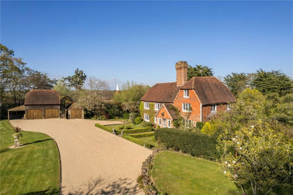
- Price
- Guide Price£1,895,000
- Size
- 2.5 acres
Bodle Street Green, Hailsham, BN27, Warbleton, East Sussex BN27 England
Added on 18/06/2026Country Home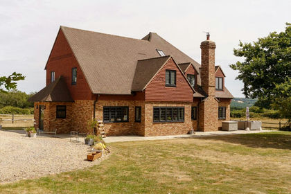
- Price
- Guide Price£1,500,000
- Size
- 3.5 acres
Three Cups, Heathfield, TN21, Warbleton, East Sussex TN21 England
Added on 11/09/2026Country Home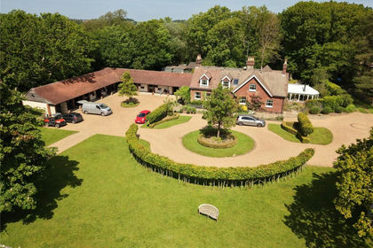
- Price
- Guide Price£2,400,000
- Size
- 21 acres
Greenwoods Lane, Punnetts Town, Heathfield, TN21, Heathfield and Waldron, East Sussex TN21 England
Added on 21/07/2026House with Land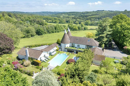
- Price
- Guide Price£1,800,000
- Size
- 13.23 acres
Tottingworth Park, Broad Oak, Heathfield and Waldron, East Sussex TN21 England
Added on 21/08/2026House with Land
- Price
- Guide Price£1,995,950
- Size
- 13.9 acres
Burwash Common, Etchingham, TN19, Heathfield and Waldron, East Sussex TN19 England
Added on 11/06/2026House with Land
- Price
- £1,750,000
- Size
- 6.6 acres
Burwash Road, Broad Oak, East Sussex, Heathfield and Waldron, East Sussex TN21 England
Added on 18/04/2026Country Home
- Price
- Guide Price£1,695,950
- Size
- 16 acres
Added on 17/06/2026House with Land
- Price
- Guide Price£1,550,000
- Size
- 26.5 acres
Coldharbour Road, Upper Dicker, Hailsham, East Sussex, BN27, Arlington, East Sussex BN27 England
Added on 29/01/2026Farm
- Price
- Guide Price£1,575,000
- Size
- 2.5 acres
Hempstead Lane, Hailsham, East Sussex, BN27, Arlington, East Sussex BN27 England
Added on 29/01/2026Country Home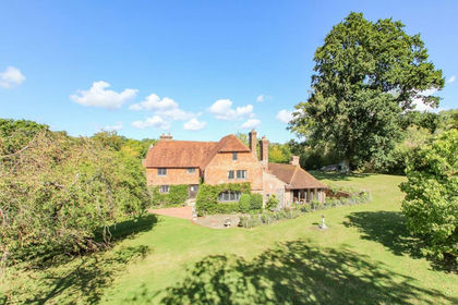
- Price
- Offers in Excess of£2,000,000
- Size
- 2 acres
Piccadilly Lane, Mayfield, TN20, Mayfield and Five Ashes, East Sussex TN20 England
Added on 13/05/2026Country Home